Sorin Dudui
CONEL-S.D.E.E. Brasov, 17A, 13 December
1918, Brasov-2200, tel:0040-68-410430 ext.250,
fax:0040-68-152186, E-mail: dudui@hotmail.comOvidiu Clotea
CONEL-S.D.E.E. Brasov, 17A, 13 December 1918,
Brasov-2200, tel:0040-68-410430 ext.250,
fax:0040-68-152186, E-mail: clotea@hotmail.com
Abstract
C.O.N.EL. -
S.D.E.E. Brasov, a subsidiary of Romanian National Power
Company wanted to develop its information system of
installation structure.
Because the system’s components are in connection
with the ground through their geographical position it
has been decided that a part of the application to be a
GIS.
We have developed a PC based LAN system to assist our
workers in creating, developing and managing the digital
maps of power network and also to design new
installations using the created spatial databases.
The application was written using VisualBasic 5, Visual
C++ and MapObjects 1.2 and it works in a Windows NT 4.0
LAN.
INTRODUCTION
The most important reasons of
developing a GIS at S.D.E.E. Brasov are:
- The geographical position of
F.D.E.E. Brasov installations is part of the
National Cadastral System. So, our company needs
to know its properties and the neighborhood of
them;
- for optimization of accidental
or programmed interventions and for improve our
relation with different kind of customers;
- there are a lot of "mind
information" known only by old workers who
will be retired and also there are a lot of
perishable information on paper support (fig.4);
METHODOLOGY AND IMPLEMENTATION
This project needed to solve
following aspects:
- Our regions maps are old (1970
- 1980) and very expensive too. They are only
raster images (fig.1);
- Our company is a distributed
one. So, we needed a lot of GIS licenses and it
doesn't have so much money. Also we didn't need
the whole functionality of a GIS because the most
part of the time we are working with lines;
- we needed a fast developing of
spatial database;
- we needed a very personalized
application because a small part of our people
knows English and they haven't knowledge of GIS
or computing;
- we haven't enough human
resources for digitizing the maps.
We solved these problems developing
an application using MapObjects, which is a strongly
customized COM, and it is also accessible as price for
our company.
We use as background raster georeferiencied raster images
at scale 1:1000,1:2000,1:5000 (fig.1, fig.2) and we made
A a digitizing (tracing) software. A big part of our
effort was to remake the raster images, which had a very
poor quality.
We made a partial tracing because we are interested only
in the neighborhood of our overhead lines or underground
cables. The software has the most part of functions of a
CAD (snapping, vertex editing etc.).
So, we obtained a combined raster-vector map (fig.3a,
fig.3b) on which, using special created utilities, we are
putting our objectives (networks and buildings) (fig.4,
fig.5). We also introduced a dimension utility, very
useful in printed maps (fig.6).
CONCLUSION
We succeeded in creating a cheap
professional geographic information system. Now we are
working in the acquisition of spatial data. We use medium
level personnel in teamwork in a LAN.
The work is fast because even if we have only raster maps
of a region we are able to put electric networks after
scanning them immediately.
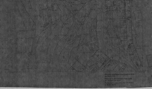
Fig.1 Raster image - Original Document
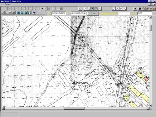
Fig.2 2 Georeferencied Customized Raster
image (you can see the demarcation zone)
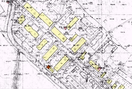
Fig. 3a Raster + Vector Map
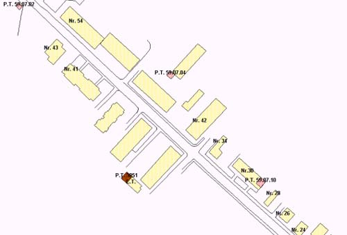
Fig. 3b Vector Map
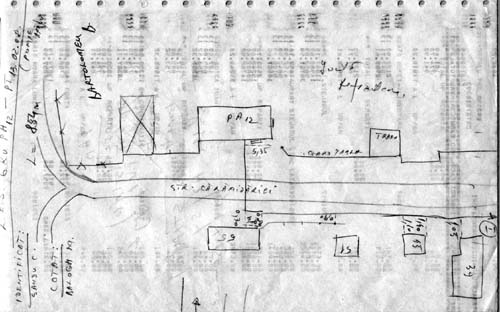
Fig.4 Sketch of a underground cable (primary
document)
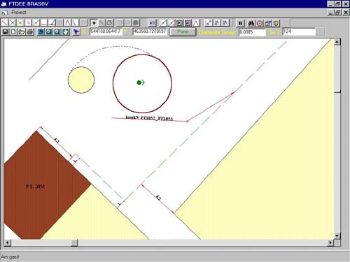
Fig.5 Underground Cable on the map. You can see the
dimensioning system
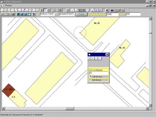
Fig.6 Special Utility for adding the position of
cable
Editing (points,
lines, polygons, curves) Snap tools


Editing Vertex Dimensioning


Fig7. Utilities
|


