|
| City GeoMAP – Internet Server |
| G. Beucan, V.
Craciunescu, N. Pristoleanu, D. Petre, F. Dinescu, M.
Razvan SC Geoter Proiect SRL , Pitesti , Romania , tel/fax : 0040 48 214999 email: cpstar@starnets.ro City GeoMAP – Internet Server is an application that helps to consult administrative and tourist maps of cities in an Internet browser. The application manage digital maps which should contain streets network, public transport network, public, administrative, commercial and tourist interest points. The client, running in an Internet browser can:
The application was developed using Esri MapObjects, C++ and Java. City GeoMAP – Internet Server is easy to set on the web Server and allow fast access for clients through an intuitive, friendly to use interface. This application is meant to be used on a Web Server (Windows NT or 95). Installing application:
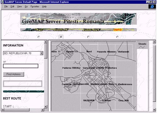
Facilities offered to a client using an Internet browser:
The first view is the street layer:
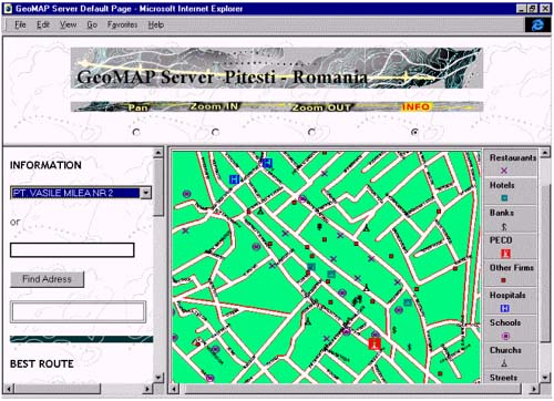
If more details are requested, select the ZOOM IN option and select by mouse click in the specific area.
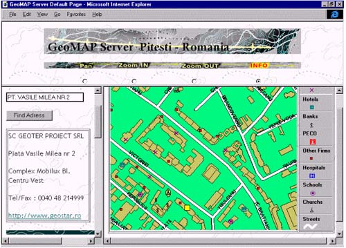
Example 1: finding an address: To find a specific address, fill in the fields for the street and number.
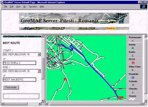
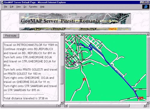
The selected element will be yellow highlighted and the user will get all the information from databases. Example 2: finding the optimal route: Fill in the addresses: start point and end point. Choose the appropriate layer: street layer or transport layer and select <Find route> button. As a result, a map corresponding to the desired route will be displayed highlighted in blue. (the time may vary depending on server performance and the complexity of the layer)
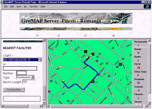
Example 3: finding the most approached points of interest within a range around a point: Input data:
A new map containing all the referred points will be displayed. The user can access the homepages (if there are) for the displayed objectives.
CityGeoMAP Internet Server is an project application flexible designed , which can be easy customize with the desire of users. |
     |
    |
 |
| [Introduction] [Conference programme] [Presentation by authors] [Presentation by category] [Poster session] [List of european Esri distributors] [List of exhibitor] [Esri products news] [Credits] |