Municipal budget (short-term operational budget and Capital budget),
includes direct investments in physical projects - infrastructure and surface development,
and non-physical projects, such as in education and welfare area.
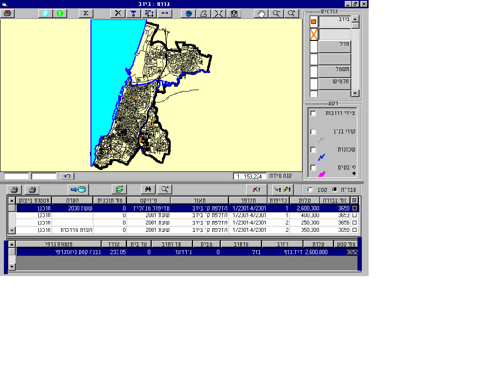
Distributing the budgeted working plan (with all its components) spatially, over the city map, pointing out timetables and costs, whilst displaying existing infrastructure as background, is a basis for visualizing the overall municipal investments.
Building the work plans as GIS layers, enables coordination and optimization
of projects and overhaul budget.
BENEFITS
À Enabling immediate and clear information, regarding overall municipal - planned and executed -
investments in any given area (neighborhood, street, statistical zone, any polygon).
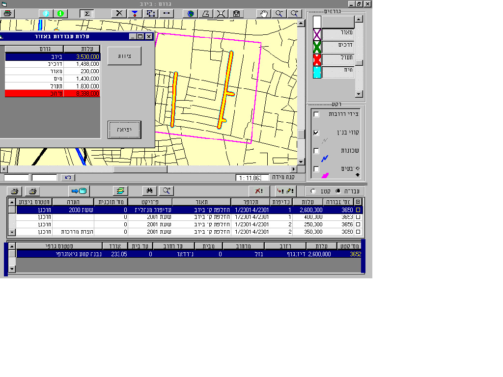
À Gathering all surface and infrastructure plans, related to a specific geographical location, assures full coordination among municipal and non-municipal entities.
À Optimal operative plans design results with efficient executable works, e.g. preventing the "zipper" phenomena - opening and reopening roads, and leading to a significant budgetary saving.
À Minimizing the interference in day to day life and economical activities caused by endless disturbance that was a consequence of a non-coordinated system, prior to the operation of the GIS system.
À Securing municipal property rights in order to enable optimal location for current and future infrastructure.
À Smooth production of coordinated work plans on periodically basis (quarterly, semi-annual etc.), for each relevant entity or group of entities.
Municipal budget (short-term operational budget and Capital budget),
includes direct investments in physical projects - infrastructure and surface development,
and non-physical projects, such as in education and welfare area.
À To exam the distribution of physical investments and budget versus municipal objectives.
À The optimal gathering and timing of various surface and infrastructure work.
À To enable an automatic quarterly selection of work plans.
À Enabling immediate and clear information, regarding overall municipal - planned and executed - investments in any given area
(neighborhood, street, statistical zone, any polygon).
À Gathering all surface and infrastructure plans, related to a specific geographical location, assures full coordination among
municipal and non-municipal entities.
À Optimal operative plans design results with efficient executable works, e.g. preventing the "zipper" phenomena - opening and reopening
roads, and leading to a significant budgetary saving.
À Minimizing the interference in day to day life and economical activities caused by endless disturbance that was a consequence of a non-coordinated system, prior to the operation of the GIS system.
À Securing municipal property rights in order to enable optimal location for current and future infrastructure.
À Smooth production of coordinated work plans on periodically basis (quarterly, semi-annual etc.), for each relevant entity or group of entities.
À Building an annual work plan for each organ (work plan including spatial representation of each project ) À Automatic spotting of candidates for gathering (projects in the same area) À Geographical presentation of all existing or planned infrastructure.
À Infrastructure layers : water, street lights ,sewage, drainage À Other relevant layers: schools, neighborhoods, welfare offices, museums À Planned infrastructure À Detailed department work-plans
À MapObjects
À VB6
À SYBASE/MS SQL-SERVER 7