
Rehoboth Bay Ulva Identification Project
Authors
Kimberly B. Cole, David B. Carter, Chuck Schonder
Abstract
Every year more boaters, fishers, and other recreational users place a larger strain on the limited space and natural resources of Rehoboth Bay. At the same time, regional development, agricultural, and industrial activities impact the Bay with increased runoff of chemicals and nutrients. A particular genus of macroalgae known as Ulva grows in these waters naturally, but has become an increasing problem with greater biomass due to changing water chemistry. Ulva management in Rehoboth Bay has challenged government agencies and local organizations for a number of years. Increases in Ulva biomass can lead to an increase in dead organic matter and to reduced dissolved oxygen levels in the Bay. Lower dissolved oxygen can have a significant impact on the local aquatic ecology. Increased dead organic loads can cause foul odors and create hazards for boats.
Government agencies have funded Ulva collection operations to reduce the impacts of the macroalgae on the ecosystem and recreational opportunities in Rehoboth Bay. Unfortunately, little data exists on the spatial extent of Ulva in Rehoboth Bay or the effectiveness of the collection operations. It seems imperative that the agencies funding the operations identify the present extent of Ulva in the Bay and periodically update that information to determine the effectiveness of their efforts.
This paper describes how the Delaware Coastal Programs (DCP) identified the spatial extent of macroalgae, including Ulva, in Rehoboth Bay in the late Spring of 1999. DCP used aerial photography, image processing software, a Geographical Information System (GIS) and a limited field survey to do this work which resulted in the identification of 1.88 square kilometers of macroalgae in all but the deepest parts of the Bay. The project results illustrate the large potential remotely sensed imagery has in resource management work.
Introduction
It has been well established that aerial photography can be used to identify submerged aquatic vegetation (SAV), given the proper environmental conditions. Regular color aerial photography has been used to penetrate water beyond the maximum depths of Rehoboth Bay in past projects along the US East Coast and in the Caribbean. The DCP referred to such projects to determine the feasibility of mapping the macroaglae, Ulva, in Rehoboth Bay.
Project Planning
Flight lines and Ground Control Points
The staff of DCP worked closely with an
aerial photography firm, Keystone Aerial Photos, to identify the
best manner to capture the images. Four North-South flight lines
were agreed upon at a scale of 1:12,000 with sixty percent
overlap on the ends and thirty percent overlap on the sides. To
relate the resulting images to other spatial data stored in
DCP’s and the Department of Natural Resources and
Environmental Control’s (DNREC) databases, the images
required registration to a coordinate system used by the other
spatial data. This operation required known ground control points
(GCP) in each image. Because some images covered only or
mostly water, they would not have easily identifiable GCPs. On
May 17, DCP staff anchored 8 white buoys each with a 16 square
foot surface area, in the Bay to act as GCPs. Division of Soil
and Water Conservation staff built and provided the buoys. While
deploying the buoys, DCP staff recorded their locations with a
differential Global Positioning System (GPS). DCP staff relocated
the buoys with the GPS after the flight, on May 26, to identify
possible movement of the GCPs for registration purposes. The
buoys were also removed from the Bay on May 26.
each image. Because some images covered only or
mostly water, they would not have easily identifiable GCPs. On
May 17, DCP staff anchored 8 white buoys each with a 16 square
foot surface area, in the Bay to act as GCPs. Division of Soil
and Water Conservation staff built and provided the buoys. While
deploying the buoys, DCP staff recorded their locations with a
differential Global Positioning System (GPS). DCP staff relocated
the buoys with the GPS after the flight, on May 26, to identify
possible movement of the GCPs for registration purposes. The
buoys were also removed from the Bay on May 26.
Environmental Considerations
The environmental conditions such as the tide, turbidity, sun angle, weather conditions, and platform altitude can all affect the penetration depth of an aerial photo. To allow the maximum penetration of water and best identification of the macroalgae by aerial photos, DCP set the following environmental requirements for this project:
Based on previous aerial photography studies, DCP chose to capture the images using a mid-morning flight +/- 2 hours from low tide, during a sunny day, with low wind speeds, prior to the opening of the tourism season (May 31). The low wind speed would decrease sun scatter from small waves. A morning flight before May 31 would decrease boat traffic and thus decrease turbidity. Low tide would allow the deepest absolute penetration with a given set of conditions. To meet these requirements, DCP staff and staff from an aerial photography firm, Keystone Aerial Photos, identified a number of possible days and times for the flight. The conditions on the first possible day, May 22, met DCP’s expectations and Keystone captured the images that day
Pre-Processing Products
 On
June 11 DCP received a packet of products from Keystone Aerial
Photos’ flight over Rehoboth Bay. The packet included 28, 9
in. by 9 in. black and white photos covering Rehoboth Bay, the
surrounding land, and the adjacent Atlantic Coastline. The photos
represent the Bay at a scale of 1:12,000 as DCP’s contract
specified. The packet also included 14 Compact Disks with real
color electronic images of the same area. The 1000 dpi scanning
process used to create the electronic files resulted in a
sub-meter resolution for the color images. Although the large
file sizes produced by the high-resolution images taxed the
processing power at DCP; the images will provide an excellent
base for later comparison studies or other detailed work in the
Rehoboth Bay area.
On
June 11 DCP received a packet of products from Keystone Aerial
Photos’ flight over Rehoboth Bay. The packet included 28, 9
in. by 9 in. black and white photos covering Rehoboth Bay, the
surrounding land, and the adjacent Atlantic Coastline. The photos
represent the Bay at a scale of 1:12,000 as DCP’s contract
specified. The packet also included 14 Compact Disks with real
color electronic images of the same area. The 1000 dpi scanning
process used to create the electronic files resulted in a
sub-meter resolution for the color images. Although the large
file sizes produced by the high-resolution images taxed the
processing power at DCP; the images will provide an excellent
base for later comparison studies or other detailed work in the
Rehoboth Bay area.
Digital and Spatial Processing
The first step in preparing aerial photos for analysis with other data involves registering the images to a known coordinate system. DCP staff used ERDAS Imagine image processing software to register the images to Delaware State Plane projection, NAD83 datum. The software used the GCPs mentioned earlier to stretch and rotate the images to fit the chosen coordinate system. Because each electronic file was so large, DCP’s fastest computer took more than two hours to process each image. Although the processing strained available computer power, the registration resulted in images matching well with DNREC’s base road files and other spatial data.
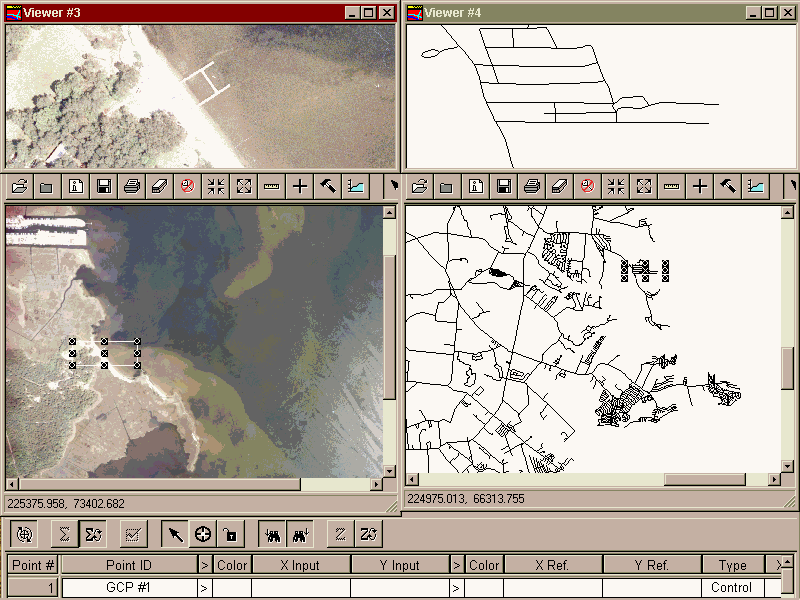
Registering images in ERDAS Imagine
After registering the images, DCP staff used Imagine to make image subsets, "clipping" the images, to remove residual photographic elements such as solar glare and edge effect shadows. This process also taxed the computing systems, but resulted in much cleaner images for classification purposes.
Once registered and clipped, the images were ready for classification. Image processing classification can be divided into supervised and unsupervised methods. In supervised methods, an analyst will "teach" the software to identify samples of each type as guides. In unsupervised methods, the computer classifies based solely on statistical variations in image data. Both methods have documented positive and negative aspects. DCP staff used variations of both methods and compared the results. In all cases the resulting classifications included more omission of visible macroalgae and commission of other land and water types than the analysts expected. Commission occurred when other land and water types were classified as macroalgae. In many cases, the classifications identified scattered parts of visible macroalgae, but the gunshot like results were deemed too inaccurate.


Supervised and Unsupervised
After the initial attempts at classification, the analysts tried some higher order image processing to improve the end results. Continuing to use Imagine, the analysts cut out the land portions of the images and ran unsupervised classification algorithms on the water. This allowed the computer to distinguish more subtle differences in the water, but still resulted in unacceptable amounts of omission and commission. The analysts then tried a number of "high-pass" filters to emphasize changes in land and water types prior to classification. That did not result in significant classification improvements either.


Land Mask and High Pass Filter
Although the image processing did create promising results given more time for refinement, the initial attempts produced only partially adequate macroalgae classification. As they did the various processes described above, DCP’s analysts communicated with staff from the federal Coastal Service Center (CSC) for expert advice and guidance. CSC staff had explained that in a similar project in North Carolina, the most useful SAV classification came from visual identification on a computer. DCP’s analysts chose to do the same.


Final Classification – Visual Interpretation
Using ArcView GIS, the analysts identified and classified the macroalgae based on visual interpretation of the registered, clipped images. This resulted in identification of 1.88 square kilometers of macroalgae in all but the deepest parts of Rehoboth Bay. Although anecdotal evidence from buoy retrieval suggests macroalgae in the center of the bay, the images could not penetrate the water deep enough in that area.
After classifying the images with visual interpretation, the individual electronic files were still extremely large and difficult to manage. The analysts used Imagine to resample the images from a sub-meter resolution to 5 and 10 meter resolution images. This reduced the file sizes by 250 and 1000 times, respectively. With smaller file sizes the analysts combined the individual images into a "mosaic" of the entire Bay.

Mosaic of Rehoboth Bay
Further Work and Possibilities
DCP and all interested parties now have access to high quality, high resolution electronic color images as a base layer for later studies, or for other Rehoboth area work. This project also provided DCP staff with significant image processing experience that will aid DNREC and other organizations in the future. Given additional time and support, DCP staff may refine the Imagine classification work well enough to further streamline the entire process.
As DCP and CSC staff worked through this project, they identified a number of areas for further research and possible ways of extending the study. CSC has a towed buoy sensor; known as RoxAnn, capable of measuring bathymetry and benthic surface types in depths like those found in Rehoboth Bay. CSC staff has offered to run RoxAnn through Rehoboth Bay at a minimal cost to DCP in the late Spring of 2000. If DCP chooses to capture aerial photos at the same time, that would allow for a change analysis study using the 1999 and 2000 data. RoxAnn’s input would help identify the depths to which the aerial photos can penetrate and any benthic surface effects in the photos. Without further photos, RoxAnn would at lease provide a finer resolution bathymetry than currently available for the Bay. Its bottom surface type results would also act as a useful substitute for a change analysis study with the 1999 aerial photos.
Conclusions
The work done with aerial photos of Rehoboth Bay resulted in the classification of 1.88 square kilometers of macroalgae in all but the deepest parts of the Bay. The project results illustrate the large potential remotely sensed imagery has in resource management work. The project also illustrated some of the challenges, like very large electronic files, and further work necessary, like refinement of classification methods, to make image processing a useful DNREC tool.
Hopefully this project will serve as a prototype for later resource management activities, as well as a base for later macroalgae biomass and location studies. With further refinement of the image processing work and integration of other advancing technologies, such as RoxAnn, this project may help integrate new and creative methods into the resource management field.
Acknowledgments
The following organizations provided technical and/or financial support for this project:
Author Information
Kimberly B. Cole*
Environmental Scientist II
Delaware Coastal Programs
Department of Natural Resources and Environmental Control
89 Kings Highway
Dover, DE 19901
302-739-3451
302-739-2048 fax
kcole@state.de.us
David B. Carter
Environmental Program Manager II
Delaware Coastal Programs
Department of Natural Resources and Environmental Control
89 Kings Highway
Dover, DE 19901
302-739-3451
302-739-2048 fax
dcarter@state.de.us
Chuck Schonder
Environmental Scientist II
Delaware Coastal Programs
Department of Natural Resources and Environmental Control
89 Kings Highway
Dover, DE 19901
302-739-3451
302-739-2048 fax
*Contact for further information