Ian Overton, Helli Kotasek and Ross Lloyd
Mapping and Beyond has released their new ArcView GIS extension called Smartclassify, which provides feature-rich classification and image processing power to ArcView GIS. Smartclassify provides supervised and unsupervised classification functionality, principal components analysis, change detection, raster to vector conversion, image filtering and image algorithms. It also features an image band calculator that allows the user to manipulate bands for custom algorithms. This paper will describe the features and applications of this new software capability.
Supervised Classification is an image processing function which creates thematic maps from remotely sensed images. Remote sensing is the acquisition of images of the earth taken from a distance. It refers to the science of acquiring images of the earth for natural resource management and planning, most commonly in the form of aerial photography and satellite imagery.
We can use images in GIS to:
The examples of the use of imagery in GIS are numerous and include areas such as planning, resource management, monitoring and change detection. Specific areas of use include:
One of the most useful image processing techniques available is classification. Image classification identifies the features within an image an assigns them to a class that then turns a continuous band image into a thematic map.
Remote sensing has developed from its beginnings in the late nineteenth century. One of the first platforms for remotely sensed images was the pigeon, which was used to take photographs by carrying a black and white camera during World War One. Remote sensing has developed from there to include:
Aerial photography is widely used, as it is a cost effective and readily available format. Infra-red photography can be used to indicate the relative health of vegetation. The introduction of multi-spectral scanners in aeroplanes and satellite platforms has given even more potential for classifying and analysing images. The large numbers of satellites operating today provide a good source of imagery in a variety of pixel sizes and image scene sizes.
Most remote sensing images are from passive scanners such as aerial photography and multi-spectral scanners that capture reflected light from the sun and therefore only operate during the day-time and in cloud free environments. Active scanners such as RADAR supply there own energy source that bounces off the target and is captured back by the instrument. RADAR is therefore used at night and in areas such as the tropics that are cloud covered for most of the year. RADAR provides a view of the topography of the area whereas multi-spectral scanners capture the reflected light in a number of bands covering the visible and infra-red spectrum.
Multi-spectral imagery has the ability to be quantified for the light reflected off the object so that comparisons can be made between image dates. There is an archive of Landsat MSS imagery for most of the world dating back to the 1980s. The multi-band data can also be queried to determine it there are relationships between the amount of reflected light occurring between different regions of the Electro-magnetic Spectrum. Objects on the earth’s surface reflect differently in different regions of the spectrum depending on their composition. For example healthy vegetation reflects highly in the near infra-red due to the water content in the leaves and absorbs light in the red region due to the chlorophyll pigments. The differences seen in light reflectance in different regions of the spectrum is the basis of classification of different land types.
ArcView GIS has limited functionality to manipulate and process remotely sensed imagery. Smartimage and Smartclassify are two products from Mapping and Beyond that provide this extra functionality to ArcView.
Smartimage is an ArcView extension that provides efficient and affordable image tools for every GIS desktop. It improves your visualisation and presentation of your GIS by allowing the use of aerial photography and remotely sensed imagery. Smartimage assists in the management of raster data by using functions to manipulate images for better performance in ArcView. It is a suit of tools that provide the following features.
Smartimage Functions:
Smartimage Provides:
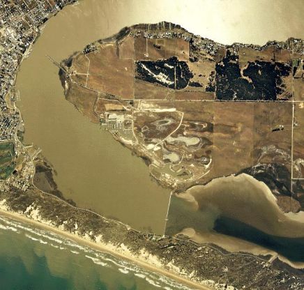
Figure 1. Aerial Photograph of Hindmarsh Island, Goolwa, South Australia

Figure 2. The registered airphoto of Hindmarsh Island

Figure 3. Premosaic image showing two registered aerial photographs

Figure 4. Mosaiced image from Smartimage with clip area marked

Figure 5. Clipped image from Smartimage showing roads in ArcView
Smartclassify is an ArcView extension that provides efficient and affordable image analysis tools. The software allows the user to improve their analysis and processing of aerial photography and remotely sensed imagery. It improves the management of raster data by using functions to manipulate images for better performance in ArcView. Smartclassify is a suit of tools that provide the following features.
Smartclassify Provides:
Unsupervised classification is the identification of natural groups, or structures, within multi-spectral data. Classification is based around the premise that remotely sensed images are usually composed of spectral classes that are reasonably uniform in respect to brightness in several different spectral bands.
Supervised classification is the process of using samples of known identity to classify samples of unknown identity. Samples that have known identity are located within training areas. Training areas are defined as regions on the image that can be clearly matched to areas of known identity on the ground. Training areas should therefore typify the spectral properties of the on-ground areas they represent. As a result they should not include any unusual areas, nor should they straddle boundaries between areas of known difference.
To simplify the classification process, Smartclassify can use a majority filter to smooth data by replacing pixel values in the active image with the majority (most frequent) value of neighbouring pixels. Filtering reduces the variability between adjacent pixels and makes the image easier to classify.
Smartclassify’s Raster to Vector function allows users to convert data from an image (raster) format to a polygon (vector) format whereby each pixel in the image is represented as a polygon in the vector file. This function is best performed on classified images where classified areas (training regions) can be depicted as polygons and attributed in the resulting shapefile. This enables the user to calculate areas and touse the dataset for further querying and analysis using standard ArcView functionality.

Figure 6. Aerial Photograph over a Forest

Figure 7. Classified Image of the Forest Area in Smartclassify

Figure 8. Classifed image converted to Vector using Smartclassify
For the first time in Arcview, Smartclassify provides supervised classification functionality. This tool allows users to create theme based images and then shapefiles from remotely sensed images such as aerial photographs, satellite images and scanned maps.
The product also incorporates a number of other image processing tools which when combined with the comapny's Smartimage product provide the user with the core image manipulation tools all within the ArcView interface. Using the tools Smartimage and Smartclassify within ArcView allows remotely sensed imagery to be manipulated and analysed and more effectively incorporated into a GIS.
Smartimage and Smartclassify extensions for ArcView GIS have been produced by Mapping and Beyond Pty. Ltd. Key staff members include Dr Jamie Sherrah, Graham Oborn and Steven Sunderland.
Lethbridge, M. (1999). 'Smartimage'. GIS User, November, 1999.
Overton, I.C. (2000). ‘Image Processing in GIS’. Proceedings of the Esri UK User Conference, Stoke-on-Trent, England, April, 2000.
Ian Overton
Managing Director
Mapping and Beyond Pty. Ltd.
Helli Kotasek
GIS Training and Support Officer
Mapping and Beyond Pty. Ltd.
Ross Lloyd
Business Development Manager
Mapping and Beyond Pty. Ltd.
33 Queen Street, Thebarton, South Australia, 5031
+61 8 8303 3841
+61 8 8303 5719
info@mappingandbeyond.com
http://www.mappinganbeyond.com