Abstract: The Wildlife Track at the Fairview Outdoor Education Center concentrated on cavity-nesting birds with special emphasis on the Eastern Bluebird. Fifteen 4th through 7th graders spent a week at the Clear Spring, Maryland facility through the State Department of Education's Summer Centers for Gifted and Talented Program. Participants were taught nestbox measuring and monitoring protocols based on the Cornell Laboratory of Ornithology nestbox network. GPS units were used to introduce the basics of navigation and mapping. A day of hands-on GIS work in the lab at Hagerstown Community College illustrated the link between maps and databases. Visit the web-site: www.wcboe.k12.md.us/mainfold/schoopag/otherins/fairview/giftedmain.htm
Author: Lisa Frances LaCivita
The vision
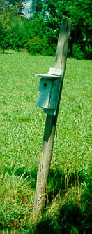
The Wildlife Track at the Fairview Outdoor Education Center concentrated on cavity nesting birds, with a special emphasis on the Eastern Bluebird. Fifteen 4th through 7th graders, spent a week at the Clear Spring, Maryland facility through the State Department of Education's Summer Centers for Gifted and Talented Program. Participants were taught nestbox measuring and monitoring protocols based on the Cornell Laboratory of Ornithology Nestbox Network (http://birdsource.cornell.edu/cnbn). Seven teams researched a local cavity-nesting songbird, which could be encountered when monitoring the nestboxes. Special attention was given to the different nests and nest materials for each species. Descriptions and graphic images, range, habitat, food sources, clutch size and characteristics were discovered. Each team shared their findings with the group via a PowerPoint presentation.

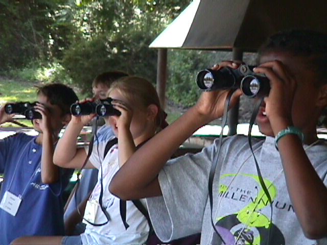
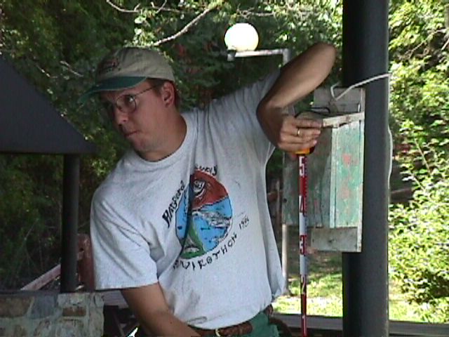
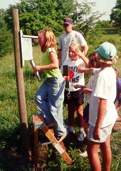
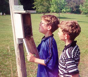
Students were taught how to properly approach and open the boxes, the use of binoculars and to measure the height and orientation of the nestbox opening. This information was placed in a database table. The bluebird trails at Fairview and nearby Fort Frederick State Park were monitored. The instructor (Eric Cromwell) engaged the participants in discussions of competition and predation in the context of wildlife. These discussions became very relevant when a black snake was found in one of the nestboxes.
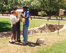
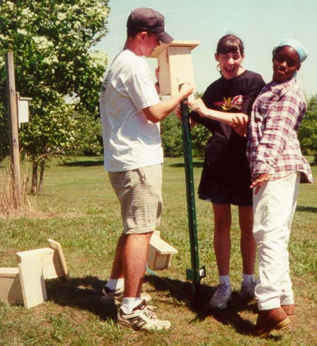
A recommendation from the students about whether to abandon the location for several boxes that had fallen into disrepair, and locations for additional boxes was also part of their mission. Each student built two bluebird boxes, one to install at the camp and the other to take home.
GPS units were used to introduce the basics of navigation and mapping. A day of hands-on GIS work in the lab at Hagerstown Community College introduced the link between maps and databases. An Arcview project file was created using a shapefile of nestbox locations overlaid on an image map of the Fairview complex. Data collected in the field by the students and entered into a table was joined to the point shapefile to create the GIS of the nestboxes. In addition to the nestbox data, the group enjoyed visiting a view with the Mid-Atlantic States and Maryland Counties. A shapefile file of fifteen points had been created using zipcodes, a field was added for the student's name and this theme was displayed in our view. Since participants attended the camp from across the state, everyone seemed interested in finding the hometowns of our group. Using these views and one with the 48 contiguous states, students quickly learned, display order, turning themes on and off, applying graduated color, selecting and inquiring features, zooming, making a theme active and traveling to and manipulating its table. We also visited a view of the world with volcanoes, tectonic plates, and the continents shaded by elevation. The students appeared to genuinely enjoy their explorations.
After lunch we introduced the concept of layouts. Pictures taken during the week with a digital camera and images from scanned photographs were placed on the network in an accessible directory. Having learned PowerPoint software earlier in the week, the students were quickly combining views, images, legends, north arrows and scales in a 24" x 36" layout, which was sent to the plotter. Each student printed their Arcview layout as a poster to take home and display at the presentation for parents.
Why bluebirds
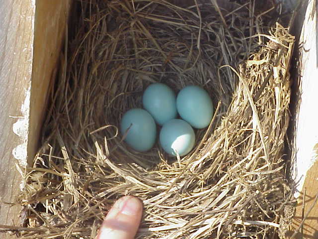
Bluebirds are cavity-nesting songbirds whose populations suffered measurable declines in the 1950's and 60's. Causes included loss of habitat, predation, invasion of exotic species and pesticide use in orchards. Bluebirds utilize abandoned woodpecker cavities but they prefer open grassland areas, orchards and parkland to dense woods. Competition for nest sites from the European Starling as well as other native birds was considered to have a major impact on bluebird populations.
This small, bright blue songbird (dubbed the "blue robin" by colonial settlers) can be seen in early spring and is considered by many as a harbinger for this welcome season. Easily recognizable, many people share affection for this species. Individuals, civic organizations and garden clubs constructed and erected thousands of nestboxes in an effort to help this species. By limiting the size of the opening in the nestboxes, Starlings can be excluded. Other small, native birds will use these nestboxes, but bluebird populations have rebounded through this effort.
A dilemma in environmental education is raising awareness of issues without leaving students overwhelmed and discouraged regarding solutions. It is important, as environmental concerns are studied, to provide opportunities for constructive actions. Success of bluebird trails, student participation in their construction and monitoring create this type of positive outlet.
Why GIS & GPS
The study of cavity-nesting birds does not require the use of GIS and GPS technologies. They were included to address comments on evaluations from previous Summer Center Programs. The most frequent criticism provided was that the programs needed to be more academically rigorous, and opportunities needed to be provided that students were not receiving at their schools or homes. The introduction and use of GIS and GPS helped to address these comments.
The abundance of bluebird trails and accompanying data provide opportunities for analysis and inquiry that mesh nicely with GIS technology. Why are some boxes used by bluebirds to successfully raise broods for many years while others are ignored? Just as in the real world of scientific inquiry, there are few absolute answers. The question of bluebird preferences allows for observation, speculation, and the development and testing of theories. Real research is on going, answers are rarely immediate.
The Evaluations
All eighteen of the Maryland Summer Centers are required to submit evaluations. The State Department of Education collects compiles and distributes this data. We were able to break out responses for the Potomac Valley Center. These include responses from all 75 campers in each of the five tracks – Wildlife, Aquatics, Natural and Environmental Arts, Creative Writing and Civil War History. Some pertinent responses are as follows:
I would rate this residential summer center:
Outstanding = 60% Good = 22% Average = 8% Poor = 0%
My overall rating of the course:
Outstanding = 60% Good = 33% Average = 6% Poor = 0%
I would say my studies at the Center were:
Always interesting = 50% Usually interesting = 40%
Sometimes Interesting = 10% Seldom Interesting = 0%
I would say that my studies at the center were:
Always Challenging = 18% Usually challenging = 37%
Sometimes Challenging = 36% Seldom challenging = 10%
Resources
http://birdsource.cornell.eduThis site is a features a variety of bird related opportunities. "Citizen scientists" are recruited and mentored. The Nestbox Network (which will become the Birdhouse Network), Classroom Feeder Watch, the Great Backyard Bird Count all provide opportunities for students or individuals to join these efforts. Information collected from "citizen scientists" is published on the web site, which allows participants to view the aggregated data. This includes the map gallery, which has winter range maps by species, created from submitted data. Ranges from different years can be compared, and inferences drawn from weather conditions. In addition, there are "bird of the week" profiles and recordings of birdsongs that can be listened to on-line or downloaded.
www.audubon.org & www.tnc.orgLocal Audubon chapters and state offices of The Nature Conservancy can often provide assistance contacting individuals or groups to assist with establishing or monitoring bluebird trails and other related projects.
Acknowledgements
The author is grateful for the efforts of:
Eric Cromwell
Matt Michael
Pearle Howell
Dave Howell
Carl Stark
Suzannah Moran
Angela Wyckoff
And the staff at Fairview Outdoor Education Center
Thanks to Hagerstown Community College for use of their GIS Lab
All photographs by Lisa Frances LaCivita
Appendixes: none
Endnote:
There are three species of bluebirds found in North America -- Eastern, Western and Mountain. Their breeding and year-round ranges cover the 48 contiguous states.
References:
The Audubon Society Baby Elephant Folio: Audubon's Birds of North America by Roger Tory Peterson and Virginia Marie Peterson, Abbeville Press (New York), 1981.
Complete Field Guide to American Wildlife, by Henry Hill Collins, Jr., Harper & Brothers (New York), 1959.
A Field Guide to Birds' Nests, Hal H. Harrison, Houghton Mifflin Company (Boston), 1975.
A Field Guide to the Birds, Roger Tory Peterson, Houghton Mifflin Company (Boston), 1947.
Field Guide to the Birds of North America, National Geographic Society, (Washington, D. C.), 1983.
Fieldbook of Natural History, E. Laurence Palmer, McGraw-Hill, (New York), 1949.
Author information:
Lisa LaCivita
CAD/GIS Coordinator
Hagerstown Community College
11400 Robinwood Drive
Hagerstown, Maryland 21742
Phone: 301 790 2800 x 387
Fax: 301 733 4229
LacivitaL@hcc.cc.md.us