Road density calculated for analysis of wildlife habitat effects and wildland identification is almost always determined with all roads contributing equally. This method ignores the fact that roads in reality have differing spheres of influence and offer different barriers ranging from busy Interstate Highways to Forest Service roads with closed access. These roads have different effects on wildlife based on width, amount of traffic, and engineering (e.g. fencing and concrete barriers). In this study road density is calculated based on a weighted road density measure. This measure is related and tuned for effects to focal wildlife species.
Develop a method to analyze road density in which roads are weighted according to their potential effects on species of interest
Traffic volume
Traffic type
Noise
Barriers
Width or extent of right-of-way
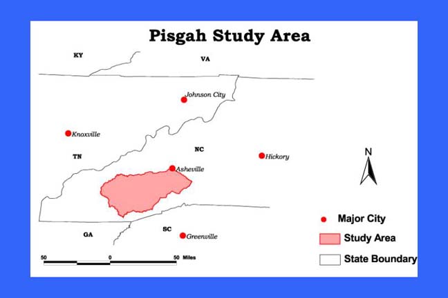
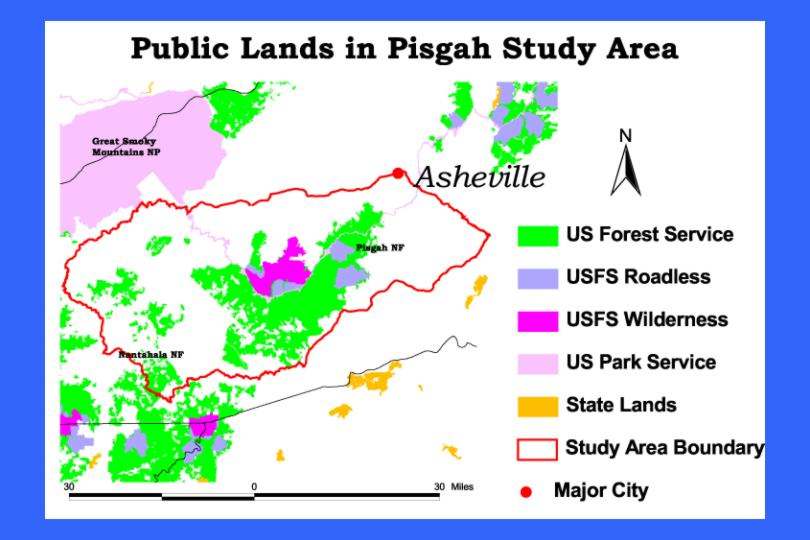
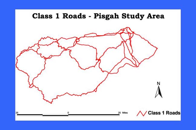
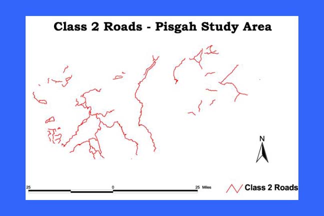
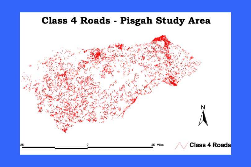
Located in Western North Carolina, the Pisgah Study Area covers 3,691 square kilometers (912,112 acres. Portions of Pisgah National Forest, including most of the Pisgah Ranger District, are included in the area. In addition, portions of Nantahala National Forest are included in the area. The Pisgah study area is located to the east of Great Smoky Mountains National Park.
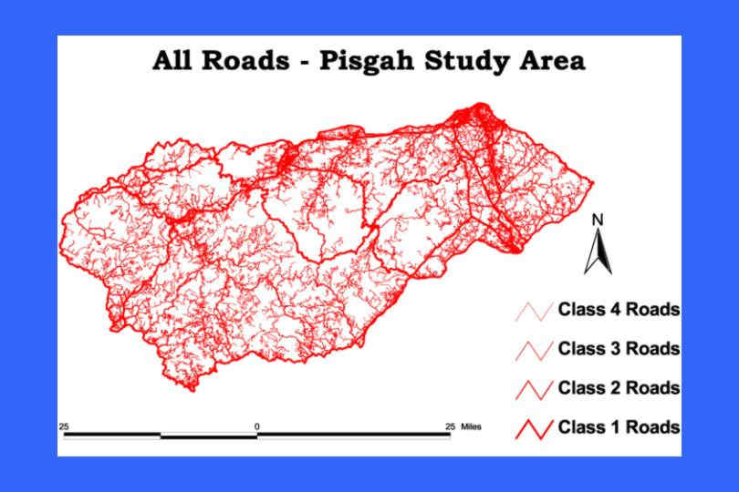
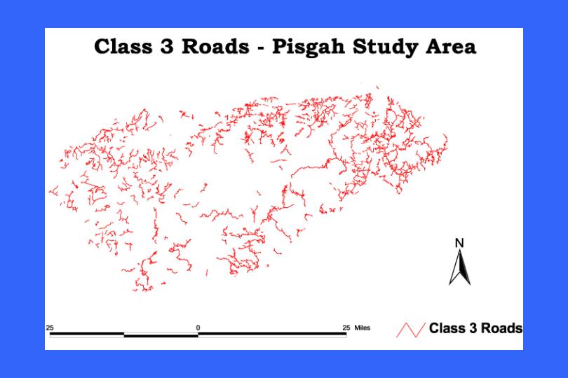
The study area contains a variety of different conditions across the landscape and includes urban as well as backcountry areas. Because of the presence of a wide range of road densities throughout the study area and the representation of all classes of roads, the Pisgah area offered a good test of weighted road density methodology.
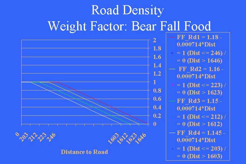
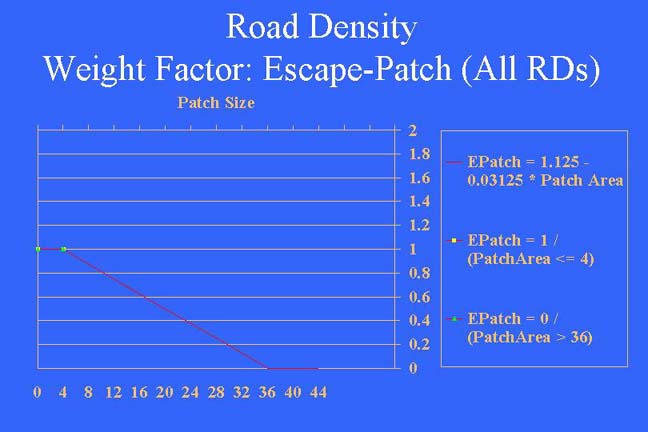
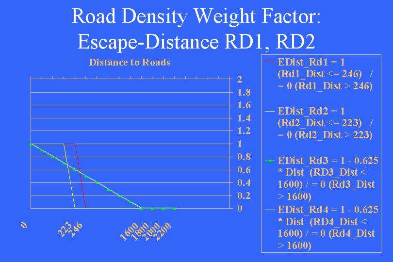
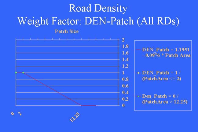
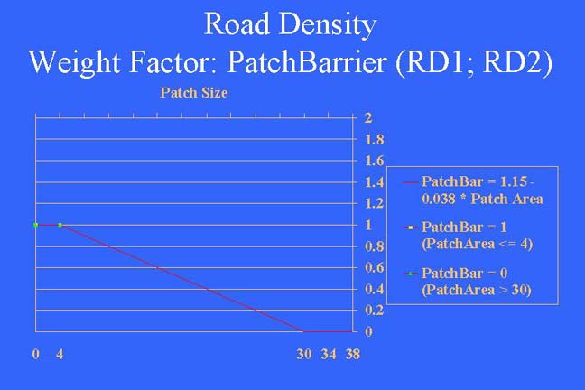
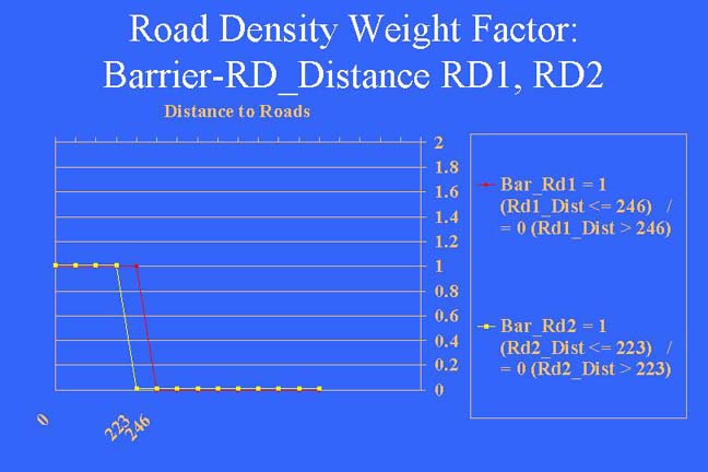
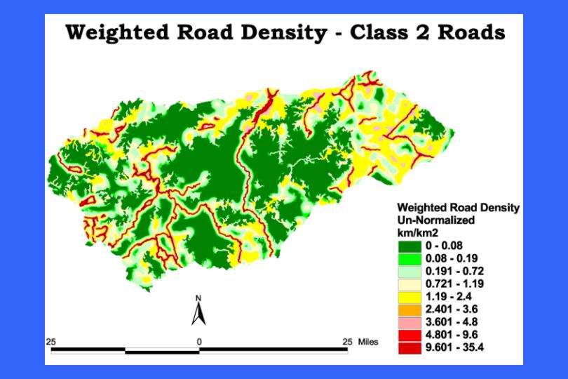
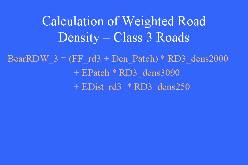
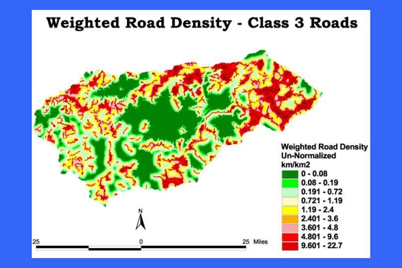
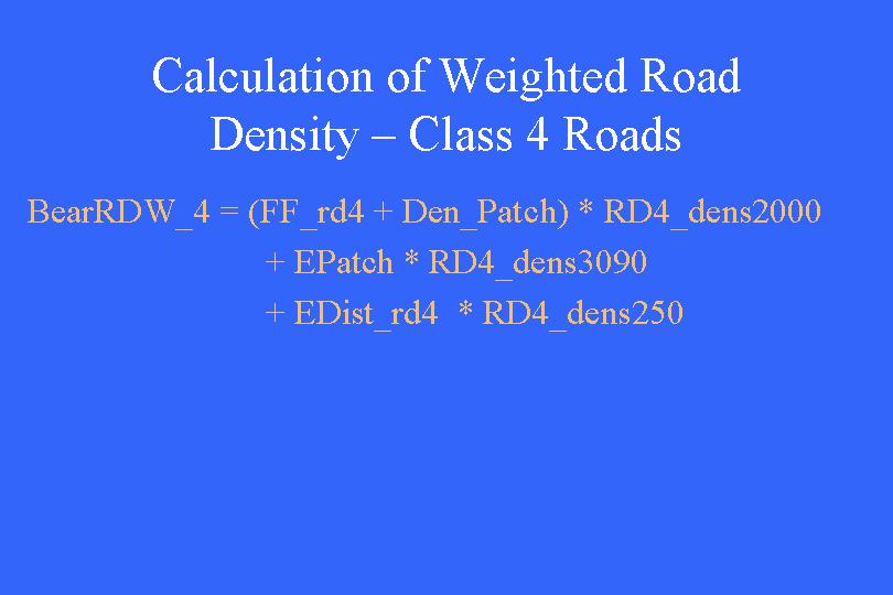
Black Bear have been a major focus of study in the area. R. A. Powell, et al have developed a Habitat Suitability Model that depends on road related factors. Their "Life Requisite Values": food availability, escape potential, and denning suitability depend on distance from roads and patch size (or conterminous forest). We have adopted these factors to use in weighting road density. The habitat values were not directly usable for our road density weightings. However a similar line of reasoning allowed us to set bounds on road effects ranging from maximal road effects (assigned a value of 1) and minimal effects (assigned a value of 0). Between these extremes we assume a linear line relationship. In addition, barrier effects of roads and patch size were derived from Powell's work and other bear researchers.
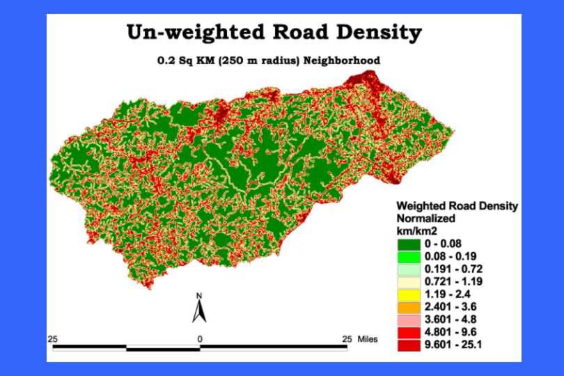
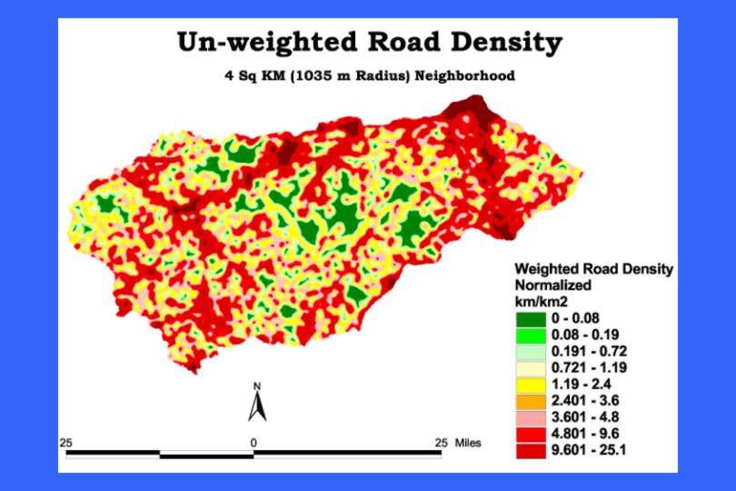
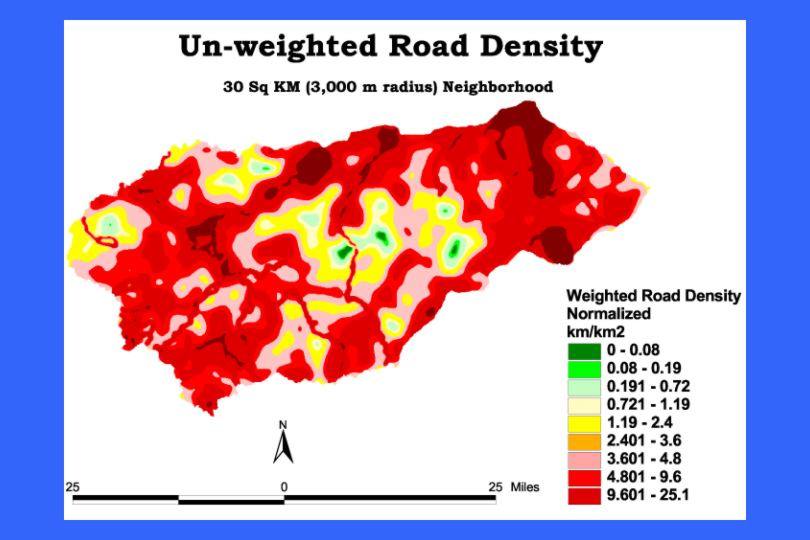
The radius of the neighborhood for road density calculation can either concentrate or spread out road density values. The radius used in road density calculation can have a profound effect on the values of road density. It must be chosen carefully to accurately reflect the biology of the species being examined and the nature of the weighting factors. A weighting factor that operates over a long distance will not be reflected if used with a road density calculated with a small radius. Additionally, weighting factors that are important over short distances will not be apparent when operating on road densities calculated with large radii. The neighborhood(s) chosen must be the appropriate size to match weighting factors.
Black Bear have been a major focus of study in the Pisgah study area. R. A. Powell, et al have developed a Habitat Suitability Model that depends on road related factors. Their "Life Requisite Values": food availability, escape potential, and denning suitability depend on distance from roads and patch size (or conterminous forest). We have adopted these factors to use in weighting road density. The habitat values were not directly usable for our road density weightings. However a similar line of reasoning allowed us to set bounds on road effects ranging from maximal road effects (assigned a value of 1) and minimal effects (assigned a value of 0). Between these extremes we assume a linear relationship. In addition, barrier effects of roads and patch size were derived from Powell's work and other bear researchers.

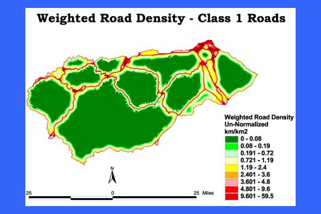
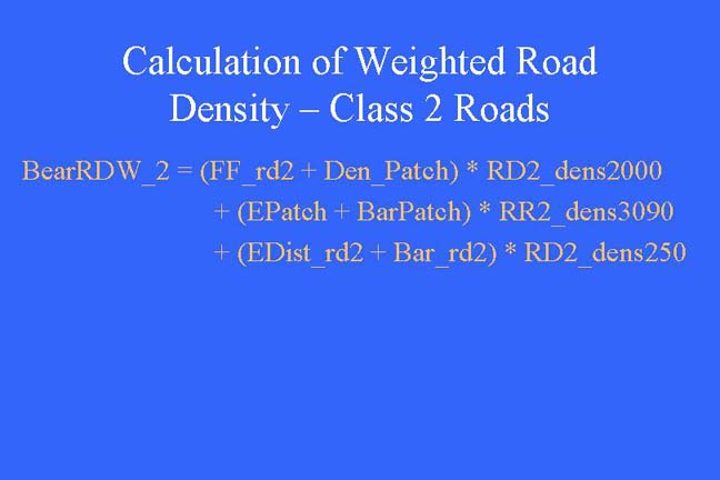
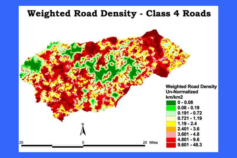
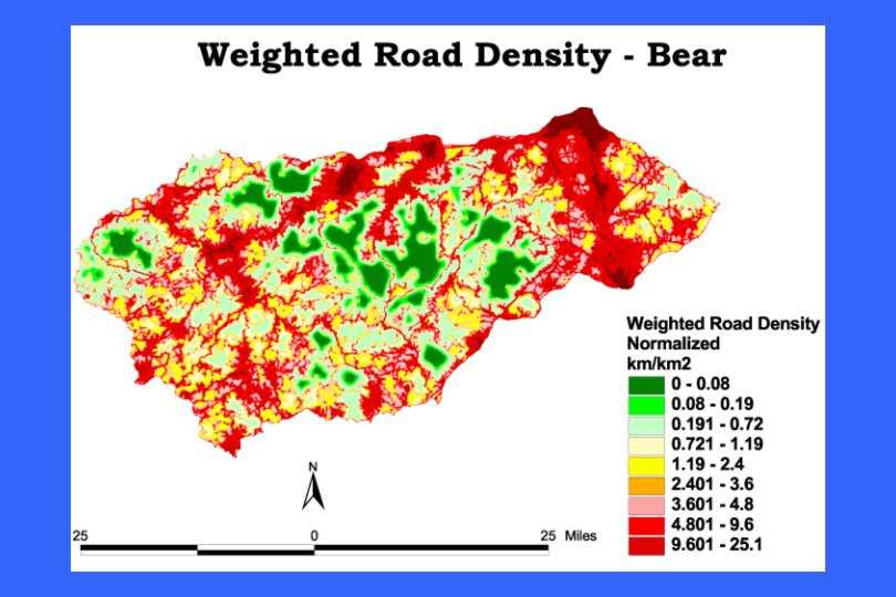
Weighted road density enables a more precise examination of the effects of roads on species than the traditional road density. Weightings allow characterization of the different effects of roads and a modeling of how these effects would be accumulated on the landscape.
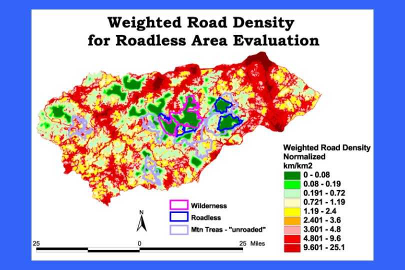
A specific application of weighted road density is in the evaluation of wildland areas. Various categories of roadless and un-roaded areas have been proposed for protection. Weighted road density could be a tool to evaluate the significance of various areas for low road density characteristics. Areas within the same categories (e.g. roadless or un-roaded) can have very different road density values. These values are traditionally evaluated using road density. Weighted road density offers a more precise tool for measuring this value.
Kerry Brooks
Planning Studies Dept., Clemson University
307 Lee Hall,
Box 340511
Clemson, SC 296340511
email:bkerry@CLEMSON.EDU
(864) 656-2048 FAX (864) 656-7519
Internet: http://hubcap.clemson.edu/~bkerry/
Susan Andrew
Ecologist
Southern Appalachian Forest Coalition
46 Haywood Street
Suite 323
Asheville, NC 28801
email:susan@safc.org
(828) 252-9223 FAX (828) 252-9074
Internet: www.safc.org