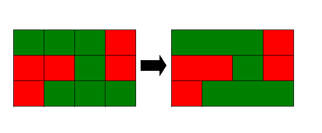
Figure 1: Satellites measure electro-magnetic radiation emitted or reflected from a discrete area
Weather data are an important aid to decision-making in many arenas. Choices that affect personal safety and property, business productivity, financial prosperity, and recreation are made everyday based on what is known about weather conditions. These data, by their nature are geographic information, allowing us to answer the "where," in addition to "what." It has been shown that Geographic Information System (GIS) software can serve as weather processing systems (Shipley and Graffman, 1998). However, the scarcity of real-time weather data in GIS format has been a barrier to the commercial utility of these software packages as a tool for processing and analyzing weather data.
The internet is an expanding source of weather information, but its limitations (specifically, inconsistent transmission speeds and absence of quality control) detract from its appeal as a weather data delivery vehicle. Furthermore, data is typically provided in standard meteorological formats (e.g., encoded METAR text messages):
KMSP 011258Z 06009KT 4SM R30L/6000VP6000FT -TSRA BR FEW009 BKN024 OVC030CB 14/13 A2992 RMK AO2 FRQ LTGICCG VC E-S TS VC E-S MOV E P0002
and these formats are not easily usable by most GIS software. In an effort to remove these barriers, DTN Weather Services is now producing real-time, GIS-ready weather data. In this paper, an overview of the following will be presented: (1) the relationship between weather data and GIS "feature classes," (2) the conversion of weather data to a GIS format, and (3) the use of DTN Weather Services weather data in ArcView®.
The Association for Geographic Information defines a feature as "A set of points, lines, and polygons, in a spatial database that represent a real-world entity." Many of these real-world entities have attributes that are static or unchanging (e.g., a city�s name and elevation.) The atmosphere, on the other hand, has attributes that are quite dynamic. Despite this, locations where atmospheric measurements are taken can still be represented as features in a GIS, and these measurements (weather data) become the ever-changing attributes of the features.
Perhaps the most familiar type of weather data are surface observations. Most everyone has seen the temperature reported for their own town or city, whether as a current or historical value. These observations have a value (e.g., 40 �C) and a location (e.g., San Diego, CA). An arbitrary frame of reference and coordinate system can be chosen to more precisely identify an observation�s location (e.g., latitude, longitude) Therefore, the point feature class in a GIS lends itself to the surface observation. Upper air observations, or rawinsonde data, can also be represented as point features, with each report representing point observations from many different altitudes.
Whereas weather stations and balloons measure data at one particular location, a large volume of weather data exists that represent measurements taken over an area. For example, remotely-sensed data (e.g., satellite and radar) represent the average electro-magnetic radiation (EMR), received by a sensor, which was emitted or reflected by some discrete area at a distance (see Figure 1).
Figure 1: Satellites measure electro-magnetic radiation emitted or reflected from a discrete area
In addition, data from numerical weather forecast models are usually interpreted as the average atmospheric properties over some area. In a GIS, there are two main format options for using this "areal" data, raster and vector. In ArcView®, raster data can be displayed as images or grids, while vector data that represent areas can be displayed as polygons.
It has been shown that there is a logical connection between the way objects are represented in a GIS and weather data. This section is intended to provide a general outline of the process used by the DTN Weather Services Metwork�-GIS fileserver to convert weather data into GIS format. The Metwork� fileserver is a weather file ingest and management system that runs on a Windows NT platform. All GIS conversion code was developed using Microsoft Visual C++.
The Metwork� file ingest process is summarized in Figure 2, and can be described as follows:
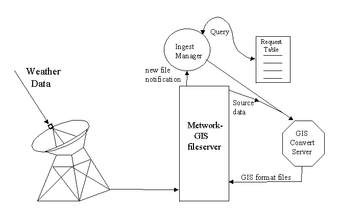
Figure 2: The file ingest process on a Metwork�-GIS fileserver
The process used by the GIS Convert Server for each of the GIS format types is outlined here:
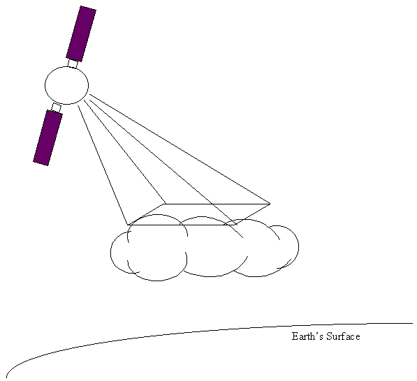
Figure 3: Polygon creation process. Similar values in the source data file are combined into a single polygon on a row-by-row basis.
When conversion is complete, Ingest Manager is notified for further action (such as FTP), if necessary.
To enhance ease-of-use of DTN Weather Services GIS weather data, an extension to ArcView has been developed. This extension provides the following benefits:
Shipley, S.T. & I. Graffman, ArcView GIS is a Weather Processing System, Esri '98 International User Conference, San Diego, CA, 27-31 July 1998.
Association for Geographic Information. GIS Dictionary. Retrieved May 31, 2000 from the World Wide Web: (http://www.geo.ed.ac.uk/agidict/welcome.html).