BEYOND ENTERPRISE GIS
William A. Lloyd
Vice
President
PlanGraphics, Inc.
Frankfort, Kentucky
Implementing core GIS technology and accessing it from viewers throughout an organization is only the first step in realizing the potential value of GIS to an enterprise. The return on an investment in GIS technology will be maximized when the following occur:
As a result, GIS technology must be intimately integrated with an organization’s business processes. It must be accessible by end users who know their jobs but who don’t necessarily know GIS. If GIS is not actually used on a daily basis by people who have no intimate knowledge of GIS, then the technology has little chance of making an impact on the organization’s success.
This presentation will illustrate successful achievement of the objectives for going “Beyond Enterprise GIS,” will describe the necessary components to assure that GIS technology will achieve its potential, and will discuss the use of Internet technology to achieve return on GIS investment.
The conventional definition of Enterprise GIS has included a core staff of highly trained GIS professionals maintaining an organization’s GIS data and the rest of the staff (theoretically) accessing this data using viewers (e.g., ArcView). However, organizations that implemented this model found that few staff members become proficient in ArcView, which requires a substantial amount of training (like any other software with high functionality and flexibility).
In one City government whose definition of Enterprise GIS included placing ArcView on every desktop PC and providing each user with four hours of ArcView training, the result at the end of one year was extremely disappointing—only two users in the entire City government (one in Engineering and one in Planning) were accessing GIS through ArcView. One year after all the training and deployment of viewing software, virtually all of the GIS analysis and map generation that were being done in this City were still performed by the core GIS staff.
The deficiencies of the conventional definition of Enterprise GIS are the following:
As a result, GIS is failing to achieve its potential for impacting the achievement of strategic objectives or producing the greatest payback for these organizations.
Successfully achieving the potential of GIS in a complex enterprise (such as a City or County government) involves agreeing upon some essential objectives. In a local government, the objectives include the following:
These objectives form the basis for going “Beyond Enterprise GIS.” The application of GIS technology to achieve these goals includes effectively addressing at least six implementation components, including technology, GIS software, data, applications, integration, and (most importantly) management.
This presentation will illustrate successful achievement of the objectives for going “Beyond Enterprise GIS,” will describe the necessary components to assure that GIS technology will achieve its potential, and will discuss the use of Internet technology to achieve return on GIS investment.
The objectives and results of going “Beyond Enterprise GIS” will be illustrated by examples, showing how specific organizations are applying these principles. These examples include the following:
Many potential users of GIS do not know anything about this technology, nor can they take time from their full-time jobs for the extensive training necessary for applying viewer technology to their business processes. This is the rationale for delivering browser-based GIS applications for general GIS access. MapObjects IMS, ArcIMS, Arc Explorer, and other Esri technologies are available to serve maps through the Internet, through organizational Intranets, and to a specific population through an Extranet.
By providing a familiar browser interface, non-GIS professionals can easily gain access to GIS data for map queries, mailing list generation, map generation, pin mapping, tagging locations, merging map layers, customizing maps, and other general GIS applications. These applications will address a large proportion of general GIS questions, and the technology minimizes the effort involved in supporting individual users.
Implementation of these applications for use on multi-thousands of desktops will force an organization to assure the integrity of its data on an ongoing basis. However, browser-based general use applications are an excellent way of showing many users (including policy-makers) that an organizational investment in GIS is providing a return.
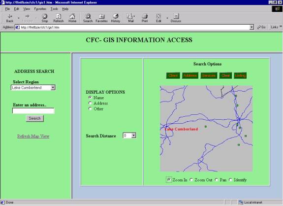
The State of Kentucky Cabinet for Families and Children (CFC) had developed an ArcView application for supporting the staff of the Independent Living Program (ILP). The ILP, operated by CFC, helps foster children (“clients”) between the ages of 12 and 21 develop skills that support independent living. The original ArcView application combined the ILP database with GDT’s DynaMap 2000 to create a searchable geocoded database of locations for clients, care providers, and community resources. The Program staff uses the application to locate services (e.g., schools, hospitals, and churches) that are in close proximity to a client. The application results can be displayed as a map of the area, a list of available services and their addresses, or imported into a document for use in form letters and mailing labels.
An updated version of the ILP application was developed using MapObjects IMS. The browser look and feel has simplified the staff’s training requirements, resulting in increased benefit from the application. In addition, serving maps and data over CFC’s Intranet has resulted in improved security, simplified application updates and upgrades, increased consistency, and reduced cost.
The City of Olathe, Kansas, presently operates a commercial solid waste service on a “for fee” basis. Each customer that subscribes to this service may choose the size of its container and which day(s) the container is emptied each week. The environment is very dynamic, as customers subscribe, unsubscribe, change container size, change weekly number of pickups and day of the week, order additional pickups, and request that pickups be made during certain time ranges. Additional complexity is created by seasonal variations (e.g., schools) and the need for drivers to carry keys to gain access to certain containers. An existing billing application on the City’s central AS/400 computer is employed to track customers and changes, send out invoices, and record payments. Each day, the routes of several trucks must be manually developed to reflect the updated parameters. Optimally, these routes are designed to end as close as possible to the City’s Transfer Station for disposal.
The City has specified its requirements for a routing application that uses GIS to develop daily routes for commercial solid waste trucks. The commercial solid waste billing application will generate the list of each day’s stops and constraints. The street network will come from the City’s GIS and associated Master Address File. The routing application will utilize data from these sources to develop each day’s routes.
The City intends to enable customers to update their account information over the Internet. Thus, a business will be able to access the City 24 hours daily to subscribe, unsubscribe, order a different sized container, change the weekly number of pickups and pickup day(s), and request additional pickups. The GIS’s Master Address File will be part of validating the customer’s transaction. The customer order will update the commercial solid waste billing application, and the updated information will be processed by the GIS-based routing application to develop routes for trucks.
What does it take to go beyond Enterprise GIS?
Successfully and efficiently going Beyond Enterprise GIS
requires orchestration of multiple components to create a result that will be
tailored to each organization’s unique requirements and circumstances. These six
components all must work in harmony, or the organization will (1) fail to
realize the potential benefits of this technology, and/or
(2) spend more
money and time than necessary to achieve the desired results.
Experience has shown that more GIS implementations fail to reach their potential because of management issues than because of all of the technology issues combined. Management issues for successful GIS include the following:
· Having the correct staffing and skills
· Providing GIS professionals and users with appropriate training
· Staff support for users
· Appropriate placement of GIS activities in the organizational structure
· Addressing institutional issues.
The core GIS staff will be able to focus on maintaining the organization’s base data, standards, and system enhancements, particularly when going Beyond Enterprise GIS reduces their time spent making maps for users.
Applications
Since most users are not GIS-literate, staff must be provided with user-friendly applications that empower staff to access the power of GIS technology as easily as they use a spreadsheet. The need for a high degree of user-friendliness is particularly addressed by using a browser interface, with which most users are familiar. Applications should be provided in at least the three following areas:
During the planning for Enterprise GIS, it is crucial that the priority applications determine the data requirements. This can potentially save hundreds of thousands of dollars in unnecessary data conversion and/or data maintenance expenditures.
Data
While data is admittedly a necessary (and frequently expensive) component of GIS, it provides the maximum return when its definition includes (1) support for specific priority applications, (2) an enterprise data architecture, (3) metadata, and (4) integration with transaction-based systems. Basing your data requirements on application requirements can greatly reduce the length of time before your GIS begins providing tangible results. A comprehensive enterprise data architecture designed for incremental implementation will facilitate integration with existing transaction-based applications, as well as reduce the scheduled time for achieving benefits from GIS. Centralization of data coordination, the enterprise data architecture, and standards (including metadata) can facilitate maintenance by departments who update information for which they are directly responsible.
Much of the tabular data necessary to make GIS highly useful is already stored and updated in the organization’s existing transaction-based applications (e.g., Utility Billing, Criminal Justice Information, and Permits applications in local governments). These applications can be “spatially enabled” to add GIS functionality to their current capabilities. Access to GIS from any staff desktop also offers the potential for integrating GIS into the organization’s business processes. This frequently involves writing a GIS application and/or reengineering a business process to take advantage of GIS’s potential. Integration with GIS is necessary for many business processes in which direct electronic transactions are being offered to deliver services. Note that the product produced by GIS in many of these processes may not be a map!
The introduction of Esri’s object-oriented GIS facilitates embedding Esri’s GIS functionality in any COM-compliant application, including Visual Basic and Microsoft Office. This lets users integrate functionality formerly provided by different Esri products, such as ArcView and MapObjects. Object-oriented GIS also supports using SDE and the Geodatabase to move beyond transaction-oriented databases into data warehousing. This enables the definition of the enterprise to extend beyond traditional organizational boundaries to encompass customers, citizens, and business partners.
Technology
This aspect of GIS implementation will address the organization’s hardware, system software, and communications network in order to provide staff with access to Enterprise GIS at every desktop (as well as vehicles, if justified).
Successful and efficient coordination of all six of these components to achieve an organization’s objectives for Enterprise GIS technology will require (1) a thorough understanding of the organization’s requirements and existing resources, and (2) a detailed implementation plan which addresses each of the six components. Improperly managing any of these components will result in spending more money than necessary and/or failure to achieve the potential benefits of this technology.
Going beyond the conventional definition of Enterprise GIS will generate broad support, results (productivity, effectiveness, and service improvements), and payback. Experience with local governments has proven that a well-planned, well-managed GIS implementation can result in cumulative payback exceeding cumulative expenditures by the end of the third year of implementation. Going Beyond Enterprise GIS is an effective approach to assure broad support for GIS from users, as well as policy-makers; to remain focused on improving the delivery of services; and to achieve the expected return on a GIS investment.
William A. Lloyd
Vice President
PlanGraphics, Inc.
112 East Main Street
Frankfort, Kentucky 40601
Phone: (502) 223-1501
Fax: (502) 223-1235
Email: blloyd@plangraphics.com