Combining and Intersecting Linear Data
Frank Winters
New York State DOT
fwinters@gw.dot.state.ny.us
Abstract
This presentation will take you through New York State DOT�s past, present and future techniques of intersecting linear data. NYSDOT uses two linear referencing methods. The first is a field-posted reference marker system. The second is called milepoint. Milepoint measures are based on an odometer reading form a county line. This presentation will provide a brief description of combining reference marker and milepoint data under ARC/INFO 7.x Next, a demonstration of a new ArcView extension allowing users to more easily perform line-on-line intersections will follow. Finally, some future direction for this functionality including enhancements to underlying software, and the resulting end-user benefits will be proposed.
Background
The New York State DOT (NYSDOT) highway system consists of 15,000 miles of
roadway. Two linear referencing methods are commonly used at NYSDOT. The first is
the field-posted reference marker system. The second is called the milepoint system.
The use of these two systems is fairly evenly split among different parts of the
Department.
Reference Marker

The reference marker system consists of a set of signs placed
every 10th of a mile along state highways. Each reference marker is
a permanent ID for a 1/10th mile segment. Department highway
data requiring a field reference, such as maintenance activities and
accidents records are based on these reference markers.
Milepoint
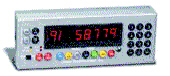 The milepoint measuring scheme denotes a precision odometer reading along a route.
Measures re-zero at county and city lines. An annual "windshield" highway inspection
is conducted following the milepoint scheme, which supports our
pavement management and capital program activities. Pictured
here is a precision odometer which is used to collect milepoint
measurements.
Example - Safety Screening
No tabular relationship, or lookup, exists to equate reference markers and milepoint
values. Yet, the department needs to combine and analyze data referenced to both of
these linear referencing methods. One example of the need to combine reference
markers and milepoint data is our safety screening application. Roads with a surface
score of six are candidates for a simple paving job (shown in red). We do not want to
pave highways with certain types of accident histories, without first performing a safety
analysis. (Roadway segments requiring accident analysis are shown in green.)
Speeds may increase on the new pavement, which could increase the accident rate.
The pavement scores are based on milepoint values while the accident data is based
on reference markers.

The Past
In the past we used ARC/INFO at the command line to transform and overlay the event
files. Below is an example of the commands required.
Eventsource ADD LINEAR safety accidents info LINEAR route route from to
Eventsource ADD LINEAR safety_mp safety_mp info LINEAR route route from_mile to_mile
Eventsource ADD LINEAR overlay overlay info LINEAR route route from_mile to_mile
EVENTTRANSFORM ny_route ref_mkr safety milepoint safety_mp
OVERLAYEVENTS overlay UNION # nyroute milepoint
The Present
In our current environment, we use an ArcView extension that we have written to
perform this type of overlay. The extension uses a pure geographic intersection. It
requires that the themes being intersected are based on identical line work. It works
equally well on events, shape files, route systems or arcs. The extension will also
intersect lines with polygons. The intersection produces a shapefile that includes just
the overlap of the two originals along with any attributes that the user selected. For a
copy of the line intersection script see:
http://www.Esri.com/news/arcuser/0100/files/trans.txt .
Stacking Events
Another way to perform a linear intersection is by stacking events. This is useful if you
need to find the intersection of two event files, and both event files are based on the
same measuring scheme. You can apply the first event table to a measured shape. A
measured shapefile, or PolyLineM, contains an "x", a "y", and an "m" (measure) on
each vertex. This results in a new PolyLineM. You can then apply the second event
file to the results of the first. This will produce an event theme, which is the intersection
of the two originals. The drawback to this method is that only the attributes from the
second event theme are retained.
The Future
Currently, the ArcView line intersection request (ReturnLineIntersection) produces a
polyline (with no measure values). Once ReturnLineIntersection carries the m values
(producing a PolyLineM), then we will have even greater flexibility. We will be able to
convert an event theme from one measuring scheme to another using geographic
intersection. To do this there needs to be a way to specify which m values to retain.
We would also be able to convert a line shapefile into an event table, by intersecting it
with a route theme. To do this we would capture the m value from the first and last
vertices, and store them in the attribute table, then drop the graphics.