On November 7th, Seminole County citizens approved a $25 million bond referendum that will fund the development of a network of urban and wilderness trails throughout the County and provide additional funds for the acquisition of Natural Lands. This bond will expand the scope of the twenty year 1990 Natural Lands referendum that has allowed the County to acquire 5,600 acres of environmentally sensitive lands for reservation. Through this referendum, Seminole County will create an interconnected system of urban trails that will be over 50 miles long as well as connections to schools, parks, shopping and neighborhoods.
Among other major projects, the bond money will be used to advance the construction of the Cross Seminole Trail, a 14-mile urban trail and complete the 3.7-mile connection from this trail to the Seminole Wekiva Trail, another 14-mile urban located west of I-4. The County intends to expand the $20 million set aside for trails by offering matching funds for federal grants, an important part in the prioritization process for these grants.
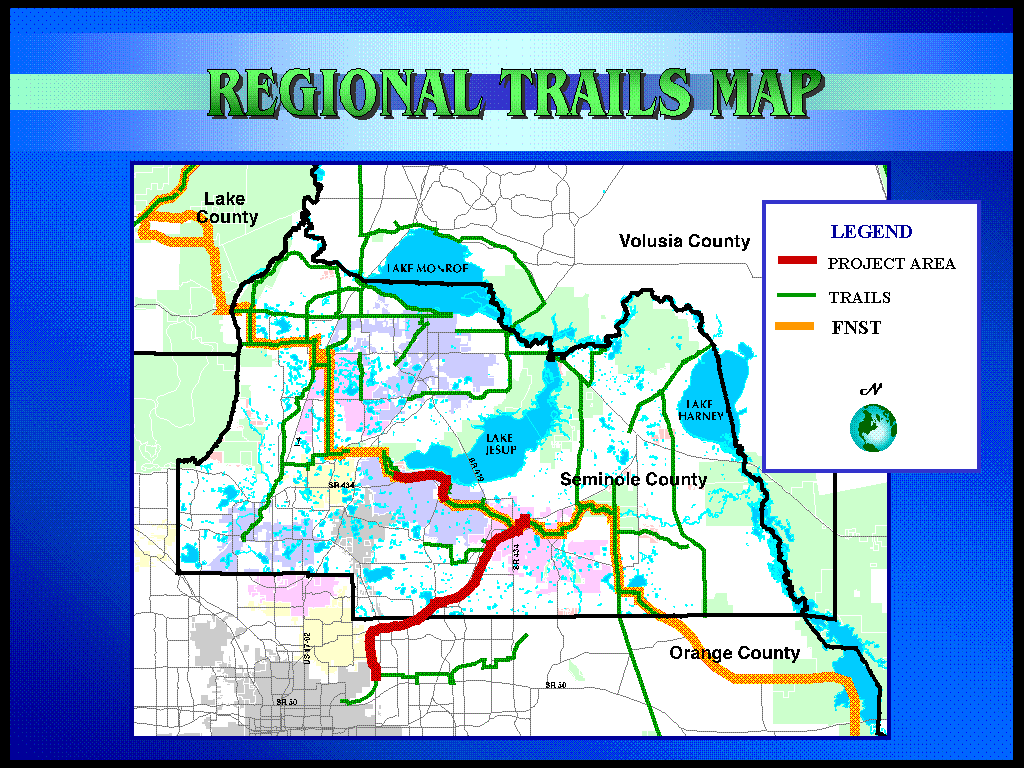
In addition, a 20-mile network of wilderness trails will be created including a section of the Florida National Scenic Trail, a 1,300-mile wilderness path, which runs from the panhandle to the Everglades.
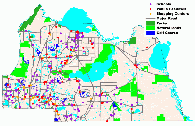
Safe connections to schools is one of the driving forces behind the creation of this system. Seminole County is working with the Seminole County School Board to create safe school access for school children to walk or bicycle to school. There will be trail connections to 23 different schools when this system is constructed and the building blocks will be in place to increase this number considerably.
A viable bicycle/pedestrian system needs to connect neighborhoods, schools, parks, shopping, workplaces, and transit stops. This idea was fundamental to the development and approval of the "Completing the Trails Connection" referendum.
The trails team is working with the School Board and city governments to ensure that all children who are required to walk to school have a safe route on which to walk. One of the main objectives of the trails program is to provide safe school connections to alleviate much of the parents’ safety concerns and to create safe school connections. Bike lanes and sidewalks are being planned to connect to the primary trails network.
Having recognized the correlation between trails and sidewalks, county management created a program called ‘Special Projects’ within the Public Works Department that includes, among other things, trails and sidewalks.

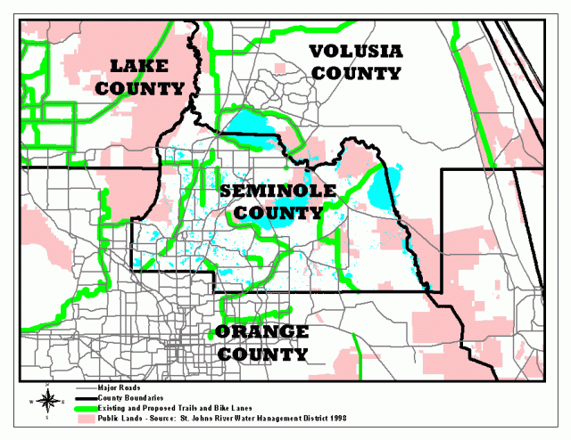
We are also working with our neighboring counties to connect to their trail systems. There are already plans and funding possibilities in place to connect the Cross Seminole Trail to the Cady Way Trail in Orange County. We are also exploring the possibility of connecting to the West Orange Trail and to trail systems being developed in Volusia and Lake Counties.
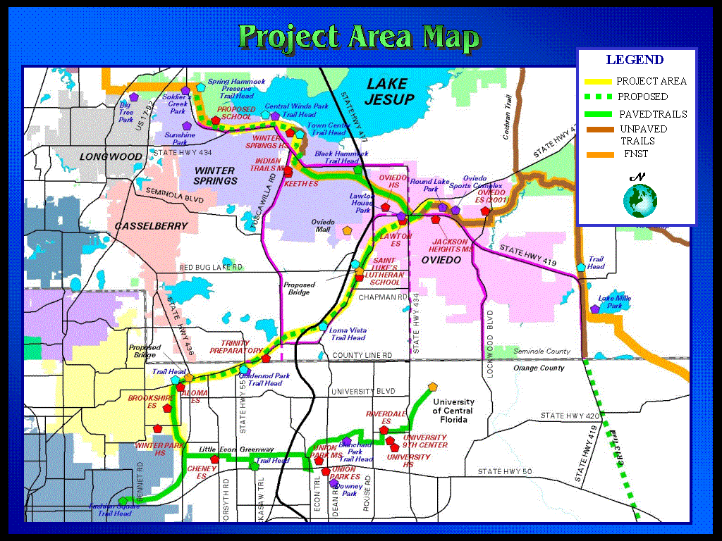
Cross Seminole Trail / Cady Way Trail
The project is related to surface transportation in function, proximity and impact in several ways. First, the trail will be a functional component of the overall alternative transportation system by providing safe, identifiable linkages for bicyclists and pedestrians.
When complete, the Cross Seminole Trail will link to an eventual 46 miles of paved trails and 20 to 30 miles of unpaved trails.
Secondly, the proximity of the Cross Seminole Trail to a densely developed and populated area will allow for greater local usage, which will directly impact the roadway system by reducing the total number of traffic trips in Seminole and Orange Counties.
The impact of this trail locally and regionally is immense. The built portion of the Cross Seminole Trail has acted as a catalyst for the trail program. The trail, in its entirety, acts as a central spine for many major and minor linkages that will create a non-vehicular network throughout the County.
The Cady Way and Cross Seminole Trails provide residential areas an alternative transportation route to various destination locations such as restaurants, office and commercial centers, parks, and schools.
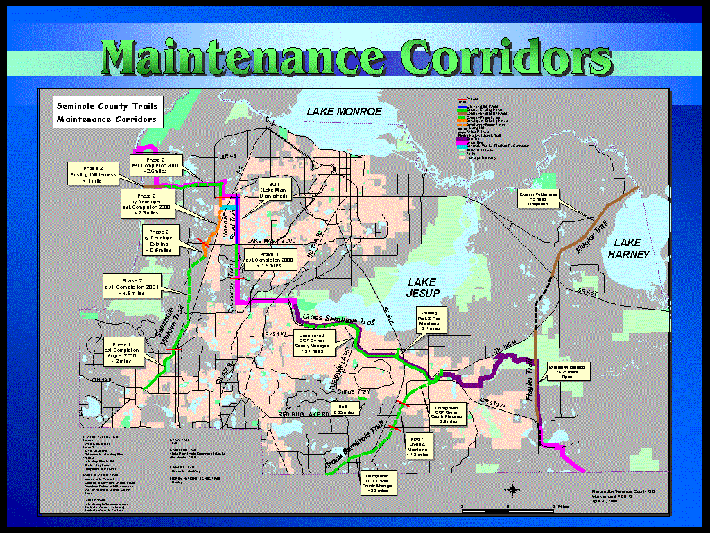
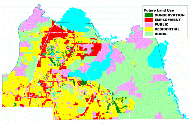
Software and Platform used for the Greenways and Trails Master Plan and the Proposed and Existing Trails maps were ArcInfo/ArcPlot for Unix on an IBM RISC6000. The Maintenance Corridors and Cady Way/Cross Seminole Trails maps were produced utilizing PC ArcView on an NT platform. The Spring Hammock Preserve Aerial was printed with MrSid compressed photos by means of PC ArcView. All maps were printed on a HP650C. The layers of information are stored in a Central Library in coverages and accessed via Unix Linx97 software across platforms.
For information regarding the creation of these products or other layers available please visit our web site at www.co.seminole.fl.us/gis or contact Nancy Church at nchurch@co.seminole.fl.us