Accuracy is a measure of quality of an engineering utility GIS database. Schematic representation may suffice for small-scale maps (1"=600� and smaller) and some system engineering modeling applications, but large-scale engineering mapping (1"=100� and larger) demands positional accuracy better than +2 feet. Stage-wise implementation gives precedence to layers of higher accuracy. GPS survey control, COGO cadastre input, aerial photography, analytical aerial triangulation, digital terrain modeling, rectified digital ortho photography, planimetry and topography is followed by precision digital input of utility layers. The final product is analyzed in terms of accuracy of different levels of base information utilized to reference it.
This paper summarizes efforts to develop Utility GIS to meet stringent engineering specifications, and the lessons learnt during the implementation of utility projects at the City of Downey, California.
Municipal GIS has, until recently, focused mainly on a macro level of spatial analysis, applicable to Planning and Development activities. Engineering and Utility Management departments have adopted these systems to some extent to monitor and track utility consumption in network modeling applications that do not require a high precision of facility location. Maps at this macro level are generally representative or schematic. A reason for the reluctance to move towards a micro-analytical capability has been the cost associated with attaining high precision data. Municipalities have invested minimally at initial stages of GIS development, until proof of concept has justified higher levels of spending.
Macro scales of GIS mapping start from 1:2400 with positional accuracy of 50 foot horizontally, and 25 foot vertically and up.
With the adoption of Global Positioning System (GPS) technology, the cost of obtaining survey control has reduced dramatically, making feasible the scope for attaining engineering accuracy within the GIS environment. Accuracy is fundamental to acceptance of GIS as a viable tool by Public Works and Engineering Departments within municipalities. These departments have, until recently, shown a preference for CAD-based systems tailored to meet their needs for graphic manipulation, a capability required for the creation of maps that meet engineering specification. Attribute information has been represented as annotation, with the analytical capability remaining largely un-harnessed. These systems have served the general purpose of replacing, to some extent, the maintenance of hardcopy maps by the departments concerned.
If Utility GIS is to replace current engineering systems, every piece of information available on hard copy engineering as-built records must be transferred into an attribute format within the GIS. It is imperative also for graphic representation within the GIS to reflect the same accuracy as the hardcopy record. The need to automate applications to support decision making, manage infrastructure and to administer asset inventory and maintenance of utility systems make it imperative for productivity to be increased through the use of spatial database management systems. GIS has to evolve as a centralized repository of all engineering information that can be easily accessed and manipulated to provide information to the user as needed.
Although the scanned source map can be made available digitally through a hot-link within the GIS environment, it�s reference will, hopefully, gradually recede once engineering staff become familiar with the much more "intelligent" information available within the GIS.
Engineering accuracy is generally related to three basic mapping scales: 1:240, 1:480 and 1:1200 (in the metric system, this would translate to 1:250, 1:500 and 1:1000 scale maps).
| Map Scale | Horizontal Accuracy | Vertical Accuracy | Function |
|---|---|---|---|
| 1:240 |
0.5'
|
0.25'
|
Site Specific Design |
| 1:480 |
1.0'
|
0.50'
|
Utility Engineering Design |
| 1:1200 |
2.5'
|
1.00'
|
Operations & Maintenance |
| 1:2400 |
5.0'
|
2.50'
|
Planning |
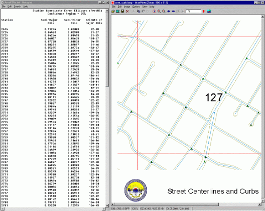
In implementing utility GIS conversion projects, precedence in the work process follows a path of degradation in accuracy. The highest order of accuracy, the ground survey, establishes control for the entire process to follow. Too often, GIS developers ignore this aspect of control, only to find out later that they are unable to relate their data to accurate positions in the real world. Fragmented control of GIS-related operations within a municipality, if performed by different departments in isolation, may not plan for different data layers to, some day, be brought together on a common datum. Control is the means of establishing a firm foundation for all data layers to subsequently be cross-referenced.
At the City of Loma Linda, the aerial contractor was instructed to use as much of the survey control established by the County of San Bernardino Surveyor. These points were earlier used to control the cadastral conversion of property information. As a result, the registration between the COGO-ed land base and the planimetry compiled by the aerial firm has remarkable coincidence. Where this simple means of registration is not exercised, the two data sources can seldom be brought together meaningfully.
At the City of Downey, the legacy land base showed major discrepancy when cross-referenced to the more recent aerial mapping project. The City established a tight control network of 850 GPS points located at street intersections throughout the jurisdiction. Based on this control, the accuracy of the original cadastre was determined to have a root mean square error (RMSE) of 139.300�, compared to an RMSE of 1.805� for the aerial planimetric data. Since the location of utilities is largely defined in relation to street centerlines and parcel boundaries, a major effort was involved in creation of street centerlines using coordinate geometry (COGO) and in correcting the parcel data based on right-of-way dimensions along the centerlines.
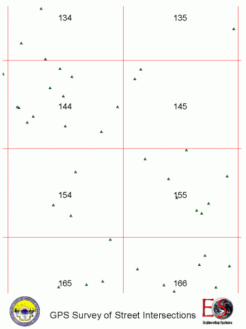
The GPS Intersection Index was utilized to register street centerlines during the COGO process, and to serve as an error detection system for quality control of the entire conversion process.
The City obtained digital ortho photography and curb and sidewalk planimetry at 1:480 scale. On cross-referencing curb faces with the street intersection GPS control, a relative accuracy of 1.805 foot was determined. This was much higher than the 0.5-foot accuracy specified for capture of planimetric features. . Photogrammetric standards for this map scale specify a "limiting rms-error" of 0.4 foot in either the X- or Y- direction for "well-defined" features (that is, 90% of "well-defined" features compiled should be within 0.4 foot of their correct position in either cardinal direction). Compared to the extrapolated GPS intersections, limiting rms errors of 1.370 foot in the X- and 1.175 foot in the Y-direction was observed for a 45 randomly selected points checked. These extrapolated values cannot be interpreted as "well-defined" in any sense of the term; so the above RMSE observation does not refer to a standard measure of photogrammetric accuracy. Instead, it was a measure of the accuracy of data extrapolated from the planimetric features for the purpose of locating utilities.
While no analysis of the accuracy of the digital ortho photography was conducted during this study, our expectation was that selection of features off the digital ortho map would be an order less reliable than the planimetric data. Digital ortho photographs are rectified by a digital terrain model (DTM). Unless the DTM is prepared to standards of photogrammetric map accuracy suitable for the creation of topographic data, utilization of the digital ortho photograph for registration of utility features is not recommended.
GPS street intersection coordinates were used as a starting point for COGO location of street centerlines. 118 parcel maps, 73 records of survey and 681 tract maps were sourced to produce the street centerline coverage. Star*net was used to COGO the centerlines.
An RMSE of 0.546 and 1.330 foot was observed in X- and Y-directions respectively for the COGO-ed centerlines when compared back to the GPS control.
The legacy parcel data registered to the California State Plane North American Datum (NAD) 1927 was projected onto the NAD83 Coordinate Datum, and rectified against GPS control as a single entity. Positional error was analyzed against the GPS control before any further correction of the legacy data was performed. An RMSE of 86.014 foot in the X- and 109.572 foot in the Y-direction was observed.
Figure 4 is a display of the parcel boundaries cross-referenced to GPS control, street curbing and final position of the parcel data after corrections were performed. Error conditions are seen to vary substantially throughout the area, a consistent finding throughout this operation. Each City block was individually registered utilizing GPS control, street centerlines, rights-of-way, curbs and sidewalks to produce the final parcel layout (shown as blue on the map). Care was taken not to distort parcel shapes.
Source attributes were then conflated back into the rectified coverage. This operation was repeated for each of several layers of information provided by the City. Accuracy of the final parcel base was determined to be 2.069 and 1.586 foot in the X- and Y-directions.
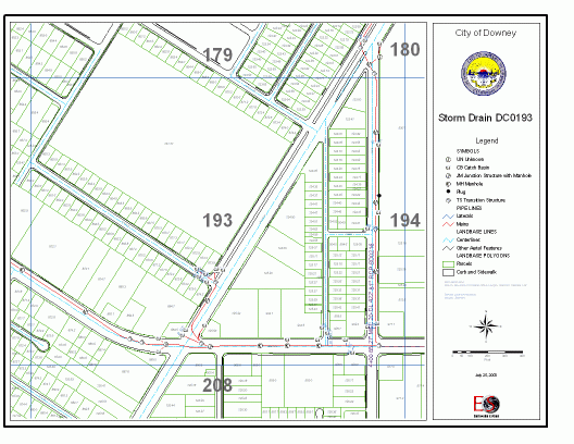
For the Storm system, mains and laterals were precision input using centerline offsets to locate the pipes. Graphic representation reflected exact lengths of facilities specified on the source. Where necessary, distances were measured off the source documents if annotation for offset distance or length were missing.
Direction of digitizing reflected upstream to downstream flow. This was validated against invert elevation attributes. Although the facilities were located too sparsely for statistical validity against randomly selected GPS locations for the project as a whole, the location is expected to be relatively accurate as large-scale source maps were available for the conversion.
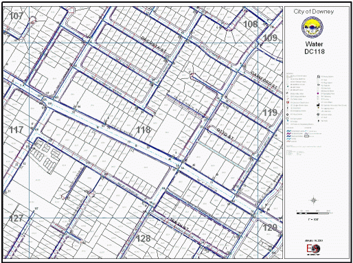
Water source maps were not as accurate. 1"=100� scale water base maps were provided. Pipes were precision input as were valves and fire hydrants (from offset locations provided by the Fire Department). Most offsets were measured off parcel boundaries, and the accuracy (or lack thereof) played a role in limiting positional accuracy of water facilities. The source maps, at best, were of 2-foot accuracy and the parcels 2.607-foot. Limiting RMSE for the finished water facilities was determined to be 1.548 foot in the X- and 2.064 foot in the Y-coordinate directions. The fact that the accuracy of the water facility slightly improved upon the parcel accuracy may be attributed to several large-scale as-built maps those were available for some newer development areas that were used. However, the error is approximately of the same order, as may be expected.
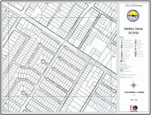
The sanitary sewer system posed the biggest challenge. Approximately 3,600 source as-built maps were converted (compared to 545 storm drain maps and 498 water base maps). An automated application in C++ was developed for data entry. The programs generated precision graphics of mains and laterals appropriately identified and associated with their attributes. The program used stationing to create the graphics. Redundancy in data entry was substantially reduced, as were errors. The automated process is validated by the high levels of accuracy attained: limiting RMSE values of 0.257 foot and 0.351 foot were determined when sewer facilities were statistically referenced against GPS control.
|
Layer
|
X-RMSE | Y-RMSE | Error Tolerance |
|---|---|---|---|
| Planimetry |
1.175
|
1.370
|
+1.805
|
| COGO-ed Street Centerlines |
1.330
|
0.546
|
+1.438
|
| Legacy Parcel Base |
86.014
|
109.572
|
+139.300
|
| Adjusted Parcel Base |
1.586
|
2.069
|
+2.607
|
| Water System |
1.548
|
2.064
|
+2.580
|
| Sanitary Sewer System |
0.257
|
0.351
|
+0.435
|
The data conversion product is, at best, as good as its source.
High order survey control must serve as a common foundation to every GIS layer added to the system.
Accuracy will degrade as you move downstream in the conversion process, so it is important to establish precedence in operational methodology.
Digital ortho will not serve to meet engineering specification. Even stereo-compiled data is suspect unless every manhole is targeted, which may prove to be an expensive option. Accuracy specifications provided by aerial contractors apply to "well-defined" features compiled by them.
Parcel land base must be COGO-ed to achieve engineering accuracy. The COGO process is often criticized for the cost incurred and the time it takes to convert parcel data. However, this method is the only technical option that will ultimately serve to meet engineering specification.
For accurate location of facilities, precision input is a must. Schematic representation will serve only macro analysis. Engineering demands accuracy at least to the extent that is presently available on hard copy.
Automated precision input is a trend of the future. The resulting accuracy meets the most stringent engineering specifications.