![]()
Mobile GIS
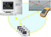
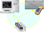
GPS is in the System
Mobile GIS is an extension of the enterprise. It�s part of a system, and in fact is dependant on a system for its success. It�s not an island unto itself.
The field device is an integral component of the mobile GIS system. It needs to be robust and based on sound standards.
Finally, location is central to the operation of mobile GIS � even more so than your office-based GIS � as location will ensure the efficient management and use of data on your field device and between the field and the office.
![]()
Mobile GIS
GPS is in the System
Mobile GIS is a term we�re hearing more within our profession.
We�re all familiar with GIS, and we understand the concept of mobility, but our understanding of what a mobile GIS is and how it will be used is still in its infancy. As we move ahead, though, we�re seeing more of the pieces required within a mobile GIS becoming apparent, and we�re gaining a better understanding of how mobile GIS will be used for everyday applications.
Let's look at the various
pieces within a mobile GIS and consider how they will interact from an
operational perspective which enables the use of your enterprise GIS
in the field.

Considerations
What is mobile GIS?
How useful is location?
What about field devices?
In bringing the pieces together, we�ll focus on three main areas:

Administrator
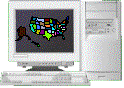
The primary focus of GIS, in the early days, was largely restricted to technically skilled operators. GIS professionals did everything from building database through to complex spatial analysis and cartegraphic design on behalf of others within an organisation. Operations were generally confined to powerful, stand-alone computers with the GIS database operated and maintained as a totally separate component within the organisational context.
GIS Accessibility - Present
![]()


Administrator
Decision maker
The administrative role still exists. However, rather than restricting operations to a specialised few on behalf of the organisation, the spatial analysis and cartegraphic aspects of GIS are now being carried out by the decision makers themselves.
Data is now widely distributed throughout the organisation over its network and, of course, across the Internet to the wider community.
GIS reaches the same people that the broader enterprise business systems reach, but the management and operation of the GIS is still generally restricted to those within an office environment. Field workers are usually still required to return to the office environment to utilise or modify data associated with their GIS.
GIS Accessibility - Future
![]()
Administrator
Decision maker
Knowledge-enabled workforce
The operations and data that decision makers use today will be made accessible to the entire workforce of an organisation � both office bound staff and mobile staff.
The workforce will be �knowledge-enabled� to the extent that they will no longer be dependant on others to assign tasks or to carry out queries on their behalf. They will have access to the same information everyone else in the organisation has.
The expansion of the enterprise will take many different forms and will be utilised by a wide and varied audience.
Underlying Technology
Data management
Location awareness
Spatial analysis
Viewed from a technological perspective then, we can easily connect the mobile field application into the existing structure of the enterprise GIS. We still have the GIS engine, that resides on a powerful, centralised server, carrying out the main data management role and providing the underlying application development software for spatial analysis and query operational.Data access
The GIS engine feeds data into the organisational network for all with access to the enterprise and the mobile field application simply connects to the enterprise to access the same data as and when needed. This connection is usually a physical connection either directly to an office based computer, or via an Internet connection.
The Internet, of course, is used by the entire GIS for the distribution of data throughout the entire organisation and, ultimately, from business to business. At this point, however, the mobile field application is not interacting seamlessly within the context of the network, but must take a copy only of the data that everyone else sees and operate it�s own resident application to process or use the data.
Moving forward, the seamless interaction of the mobile field device as part of the enterprise network itself will eventuate through the utilisation of wireless technology. Ultimately, we could see the field application operate as a web-browser, where it�s interface and analysis is carried out on the GIS engine, being served up to the field application in its entirity. But that�s a long way off.
What we�re likely to see is a small operational application and some resident base data on the field device. The field device will only interact with enterprise when data is updated or when new data is required to be viewed or queried. Wireless technology, however, isn�t quite there yet, and in fact seems to have slowed down with the associated economic slowdown, so we�ll take it out of the picture for now.
Whether wireless or not though the ability for the field application and device to be aware of its location is a significant factor in the ultimate success and acceptance of mobile GIS for operational efficiency. We�ll investigate this in more detail later and look at the main functions of personalisation, data management communication, and spatial analysis that location provides to mobile GIS.
The Mobile GIS System
![]()
Mobile GIS can be considered an extension of the enterprise GIS. Largely due to technological restrictions however, it currently uses only a subset of the entire GIS to carry out tasks focused on specific field based operations.
The mobile GIS user interface is therefore relatively simple up-front, being very task-oriented and specific, but (and especially as wireless technology becomes more robust) relies on the powerful back-end processing of a GIS engine to carry out more complex queries and analysis.
Field devices are restricted in terms of processing power and storage capacity, which restricts the field application to a relatively lightweight, thin-ish application or client, but again the completeness of operation for a mobile GIS comes about through the interaction of the fully-functional GIS host to provide robust data management and analytical operations.
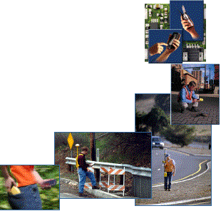
Field Device Considerations
![]()

I�d like to shift the focus now to the field and consider two important pieces that will be used by the ultimate operator of the mobile GIS: the field device and location.
The field device is the mobile workforce�s personal computer. But whereas an office based PC operates in a clean, stable environment, the mobile environment that the field device must be used in is significantly different, and must be considered. It must operate in environmental conditions that are harsher than an office environment. For each individual user, these conditions will vary in levels of harshness, but there are definite risks involved with equipment failure in any situation where equipment is being moved. When considering which device is best for the environment it�s going to be used in, think in particular about the ability to view graphics and text on the screen and what will happen if the device is dropped on the ground? Concrete surfaces are hard.
When thinking about the environment think also about the value of the data you are gathering or updating. If you drop your device and it breaks, can you retrieve the data you�ve been working with? Also, how much data can you store without having to return to the office? GIS is very graphically intensive � so will be mobile GIS. How well will your device be able to cope with large quantities of graphical data?
Finally, as with office based PC�s field devices are settling onto a standard operating system � predominantly Windows CE. A standard operating system provides stability that encourages the development of commercial applications, in turn encouraging growth. When considering the underlying technology for your device ensure it adhere�s to the standard of the day, otherwise your choice of applications will be very small or, if you�re a developer, your market will be small.
While few devices offer the complete solution, try to use devices that have integrated componentry � especially hardware components housed in the same unit. Consider the fundamental components important for your task and look towards devices that best meet your ergonomic and operational needs. If scanning barcodes is central to your application�s success, consider a Windows CE device that has an integrated scanner. If location is important, consider an integrated GPS receiver within your Windows CE device. The easier the device is to use for your field personnel, the greater the level of acceptance. Also, the more integrated the main components are within your handheld device, the less chance there is of damage due to the likes of cables gettings caught on branches, for example.
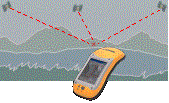
Location Awareness
![]()
There are three main areas where reliable, real-time definition of location is important: Personalization, Spatial Analysis and Data Management. As wireless operations become more robust and prevelent, communication of the data as part of the management requirement will also rely on location.
Location is used to uniquely identify � or personalize � both the device and the operator of the device. Where you are helps determine which application you should be running and what you should be seeing on your application. Location can be used to automate a lot of the operations that are associated with both analysis of the region in space you are concerned with and the manage access to data that is needed to make the analysis meaningful. Eventually, as wireless becomes a reality, the ability for your device to know it�s location allows for efficient, automated data transfer as and when needed without clogging up bandwidths.
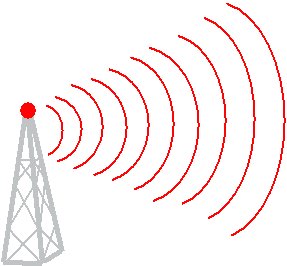
Location Definition
![]()
GPS along with cell-tower based location definition, and a combination of these technologies, are seen as the major location definition technologies for integration into handheld devices, such as mobile telephones and Pocket PC devices. You�ll see location aware devices become more prevelent in the not too distant future, especially with the need to provide reliable location for emergency purposes from mobile devices.
Why Mobile GIS?
![]()
Is mobile GIS being thrust upon us simply because the technology is available and cool? Or are there other business related reasons for encouraging mobile GIS?
While the technology is becoming increasing robust, there are sound business reasons to encourage the expansion of the enterprise to a mobile workforce.
This expansion allows the entire workforce of an organisation to access data and analytical tools to allow decisions to be made by those who need to make them, when they need to make them. It�s important to remember that not all decisions makers are confined to an office environment.
Mobile GIS provides these people with the resources that make them just as knowledge-enabled as their collegues in the office. Knowledge-enabling the entire workforce speeds up the dissemination and distribution of information, resulting in faster more efficient decisions and solutions.
Especially with wireless, but also with simple Internet connectivity today, data about the real world is much more current. With wireless it will become instantaneous. This means that all people within an organisation � both field workers and office workers � will have access to up-to-date and relevant data. Mobile GIS removes the need for intermediary paper-based recording. It�s not unknown for modifications made on paper maps to never make it into a digital format, which means the changes never get into the enterprise. With mobile GIS, data is always digital, making it easy and efficient to transfer from the field to the office without introducing interpretive errors.
There will be less delays in decision making resulting again in faster solutions that will also be less prone to error. Your customer with a power outage will hopefully be happier also, although the expectation benchmark will have just been raised again.
Mobile GIS
![]()
Dave Goughnour
Major Accounts Business Partners
Trimble Corporation
![]()