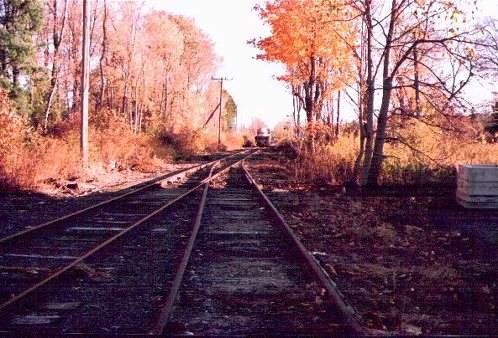
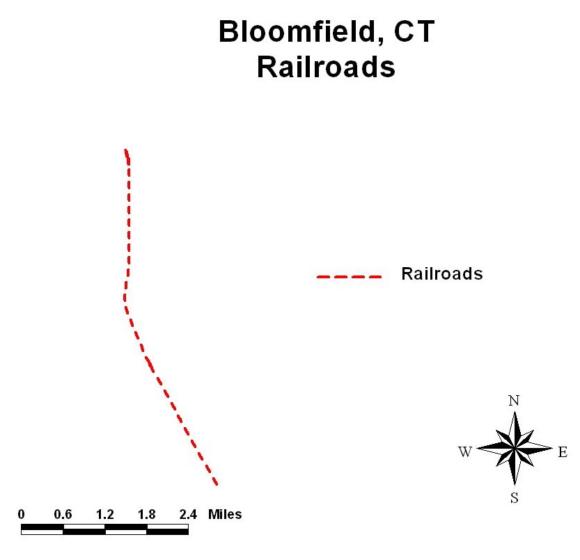
There is an abandoned railroad track between Hartford, CT and Griffin Park in the Town of Bloomfield. The Griffin Line supported active rail and freight service between Union Station in Downtown Hartford and its northwest neighborhoods, and suburban communities from the late 1800's until the last freight service ended in 1982. Recent plans call for the use of the Griffin Line as a light rail commuter transporter. Based on site defining criteria and data available from the State of Connecticut, students are asked to select candidate sites within the Town of Bloomfield for a commuter station, using ArcView GIS.
In 1997, under grants from NSF and The Connecticut Space Grant Consortium, the Center for Geospatial Analysis, Technology and Education (GATE) was established at the University of Hartford (http://uhaweb.hartford.edu/GATE). Several on line courses were developed, including "Introduction to Geographic Information Systems", a required course for all Civil Engineering sophomores. The course involves lab assignments from the text "Getting to Know ArcView" and culminates with a final project (Lab 11) involving a local, timely problem - the problem of locating a light rail commuter station in a neighboring town. What follows is a description of the process the students go through to solved the posed problem.
Problem Formulation:
There is an abandoned railroad track between Union Station in Hartford, and the Griffin park in the Town of Bloomfield. This track runs in close proximity to the University of Hartford, (it actually forms the eastern boundary of the campus) and is called the Griffin Line. The Griffin Line supported active rail and freight service between Downtown Hartford and it's northwest neighborhoods, and suburban communities from the late 1800's until the last freight service ended in 1982. The State of Connecticut provided the initial financial and policy commitment toward the Griffin line in 1981, acquiring the 8.5 mile segment of the rail right-of-way under the Rail Banking Program, thereby reserving the Griffin Line for future use as mass transit facility.
The use of the Griffin Line as a light rail commuter alternative to the highway has been discussed for several years as a commuter transporter and then extending the line to serve as a connector between Bradley International Airport and Downtown Hartford. Of the leading contending technologies, light rail has emerged as the leading candidate for the type of system to be used. Light rail in this sense means something similar to an electrified trolley. A major question has emerged in the planning studies: where to place the access stations - in particular, where to place the access station for the Town of Bloomfield, CT
Students, who will work on this problem of finding a site for a commuter access station, are sophomore civil engineering students who have recently completed an "Introduction to Surveying" class, and have completed the exercises in Getting to Know ArcView GIS. The problem is presented as follows: You have been hired by the Town of Bloomfield to find a suitable site for a Griffin Line station, within the boundaries of the town. In order to screen candidate sites, the following selection criteria have been formulated. The site should:
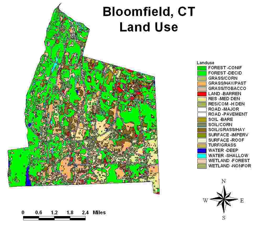
The criteria are realistic but somewhat contrived. Barren land parcels were specified because, not having to be cleared, they would appear to be cheaper and easier to build on. There are, of course, other categories of land use that could also meet this condition. We plan to modify this problem by introducing multiple candidate land use categories. The last criteria of being located near the center of town is purposely ambiguous since the cent of town is not defined.
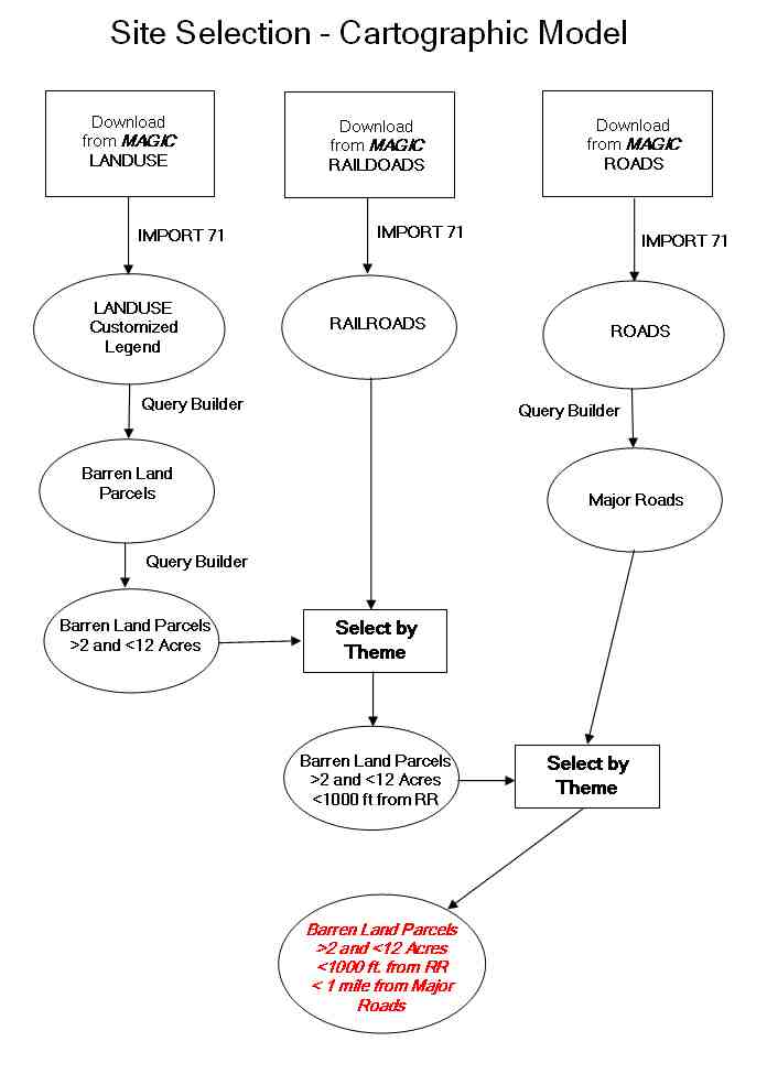
Data for the project is obtained from MAGIC (Map And Geographic Information Center) at the University of Connecticut, Homer Babbidge Library www.magic.lib.uconn.edu . The data include a LandSat derived 30m grid land use raster map, and vector maps of roads and railroads. The students are required to formulate a cartographic model (shown below) to complete the exercise.
Data from MAGIC needs to be manipulated and prepared before being able to be used by ArcView. The data needs to be downloaded, unzipped, and "imported" into ArcView using ArcView's Import71 subroutine. The MAGIC site also supplies metadata files so that the students can ascertain the genesis of the map, it's date, coordinate system and other information. This downloading and preparation process, imperfect at times, is sometimes in contrast to the well programmed exercises in "Getting to Know ArcView". Lost files, incomplete downloads, etc. introduce the student to the possible frustrations, and the trial and error nature of geospatial analysis.
The three beginning files are:
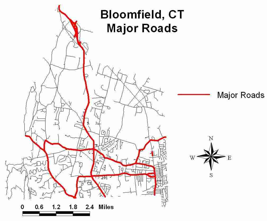
As can be seen in the cartographic model, the barren land parcels >2 but <12 acres can be obtained by successive use of the Query Builder. Then, using the Select by Theme option with the Railroad theme, barren land parcels >2 but <12 acres but < 1000 ft from the tracks are chosen. Using the query builder on the Roads theme extracts the Major Roads. Again using Select by Theme, barren land parcels >2 but <12 acres, <1000 ft from the tracks, and < 1 mile from a major road are defined. These parcels meet all the criteria except the last - being near the center of town. A map of the candidate parcels is shown below.
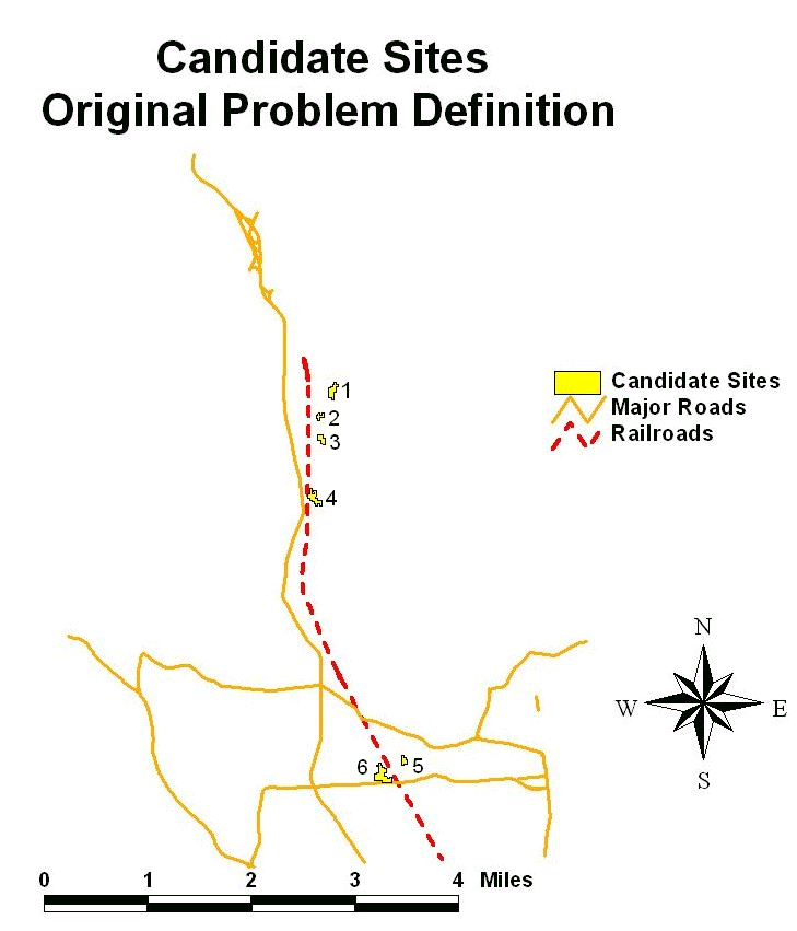
The final selection from the six candidate parcels is made base on the last criteria of being "closest to the center of town". Students may use their own definition of the center of town, such as the geometric center, the population center, or the downtown commercial area. The geometric center can be approximated using the measure tool. Population densities can be obtained from MAGIC and additional analysis done to locate a population center. The downtown commercial area can be located from a field trip to Bloomfield (approximated 4 miles from the campus). All definitions have been used, although the easiest to locate is the geometric center and it is used most often. Under these criteria, parcel 4 is closest to the geometric center, while parcels 5 and 6 are closest to the population and downtown center.
The last part of the exercise relates to a changing of the siting criteria:
The procedure is the same, but with the basic data remaining the same, the students can appreciate the power of the GIS to quickly handle the "what if" questions that always arise.