
|

Wayde York
Emergency Services Coordinator
Riverside County Fire Department
William Mumbleau
GIS Supervising Manager
County of Riverside - TLMA
Underway well before the emergencies of September 11, 2001 the County of Riverside's Transportation and Land Management Agency (TLMA) GIS developed a County-wide GIS data distribution system for the Emergency Operation Center (EOC) and Field Incident Command (FIC). The program was to deploy basic County geography combined with specific limited disaster management databases. As the disaster unfolded in New Your and Washington D.C. the County learned from the GIS experts firsthand "lessons learned". In addition, under direction from NIMA and the USGS, the County was tasked with inventorying all spatial data for the Homeland Security Administration. This paper discusses the impacts and modifications to the initial and the revised approach that the County used in the effort.
"Where Uncomfortable Officials
Meet in Unaccustomed Surroundings
To Play Unfamiliar Roles
Making Unpopular Decisions
Based on Inadequate Information
In Much Too Little Time!"
The term EOC is an outgrowth of usage by the military to describe "fixed operations centers". Its use was continued with civilian civil defense organizations adopting the term when emergency management's primary threat was considered nuclear war. Emergency Coordination Center (ECC) is usually more descriptive of the coordination functions carried out by these facilities.
 The Emergency Services Section of the Riverside County Fire Department is responsible for coordinating the emergency planning and preparation for response to and recovery from disasters. Riverside County is the seventh largest county (7,200 square miles) in the United States with over 1.5 million addresses. The focus of these efforts is the county's considerable threat from earthquakes. However, weather related disasters are far more common. There have been nine Presidential Declarations of Disaster in Riverside County from 1990 through the winter of 1998. Seven of the nine were either the direct result of weather conditions or were greatly exasperated by weather, primarily windstorms and wind-driven fires. The employees of Emergency Services also manage the County/Operational Area Emergency Operations Center (EOC) during major emergencies. The primary EOC is located in the County Administrative Center in downtown Riverside with the Alternate EOC located in the County Administration Center in Indio.
Background
 Discussions between the County of Riverside Transportation and Land Management Agency (TLMA) GIS and the Fire Department Emergency Operations Center staff occurred over an extended period of time to react to difference emergencies in the County. Various projects were undertaken over the years to develop maps to support and account for damaged structures during wildfire/brush fires events. Maps were also developed in preparation for El Nino in the late 1990's. Over the years, various project proposals and or data layers were developed to create specialized maps for the EOC. Over a ten-year period, the importance and capabilities of using GIS to respond to emergencies became clear. In February of 1999, the GIS Mapping/Analysis Section was designated as part of the Planning & Intelligence Section of the EOC. The Transportation & Land Management Unit Leader, a designated EOC position to be activated under a Level Three Activation, is staffed by the TLMA Deputy Director (ITO III), an EOC Responder, to represent GIS and the Agency. The core GIS staff would support the EOC as the incident escalates.
These efforts over the years developed into a recognition that we needed to develop plans and methodologies to deal with potential problems and emergencies in the County. In February 2001, a proposal was developed concerning the creation of a "special needs population" database on GIS. The proposal focused on the creation of three specific ArcInfo Coverages - Childcare/Healthcare Facilities, Hazmat Sites and Shelter Sites. This proposal focused on developing data layers loaded on CD's that could be utilized with both ArcExplorer(tm) and ArcView(tm) in a variety of situations. As we envisioned it these three layers would be combined with other data sets maintained by County GIS as part of the released product. After reviewing the proposal County Fire/EOC authorized GIS to start the project and develop the databases and layers. It was recognized by all that it would take a considerable amount of time to correct, modify and develop the data sets based on the limited amount of funding that could be dedicated to this project. However, September 11 changed those limitations.
The first rule of business is to "understand the business needs of the client". This being said, a series of meetings with EOC and the GIS staff were conducted to assess the hundreds of GIS data layers that the County maintained. Based on First Responders primary needs with the first-time GIS technology usage, the GIS staff sized the project accordingly.
Data that was customary only available within Fire Protection and Law Enforcement was acquired by County GIS staff to integrate into the County GIS data. Field information about the data was checked and verified by CDF and Riverside County Fire personnel. As normal, the information was in various formats, so the development process was automated with ArcGIS(tm) tools to scrub the data.
Then September 11 happened, under direction from NIMA and the USGS, the County was tasked with inventorying all spatial data for the Homeland Security Administration in November. We were will on our way with the task by then. However, we learned from that day; we needed to think the unthinkable. Information once gathered by the FBI and CIA was now critical for the safety of our homes and families. If Riverside County experienced anything close to September 11, the First Responders would need timely GIS data beyond the standard fires and floods information.
The data consisted of thirty-three mission critical layers that the EOC and participating agencies said were necessary for First Responders. Appendix 'A' of this paper contained the Database Table of Contents.
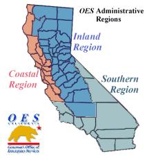
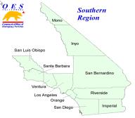
The first release was rolled out in a countywide meeting held in Palm Spring, California, December 2001 for EOC staff, various government agencies and cities within the County. In addition to the EOC distribution, all senior County GIS staff was issued a complete Riverside County GIS database for 7/24 response capability. The California Office of Emergency Services (OES) and representatives from Orange and San Bernardino counties attended as well. They have since incorporated similar programs.
The product consisted of a single CD that was configured with an auto installation using InstallShield�. Adobe Reader� and Microsoft Internet Explorer� were included for the supporting documentation. From Esri, ArcExplorer(tm) 2.0/3.1 was installed with the GIS Data and the Project Files. Several of the organizations either had ArcView(tm) or ArcInfo(tm) in-house for direct data analysis.
The Emergency Response Database was used in a SWAT and Chemical Weapons Exercise on March 27, 2002 within the EOC Planning and Intelligence Unit to respond to different elements of the exercise. It was successful operated from a laptop using ArcView 3.2aand ArcGIS generating several maps as part of the exercise. In addition to this GIS setup, the TLMA GIS Mapping & Analysis Section was activated with three HP1055CM with six GIS with ArcGIS 8.1.2 to assist. Because this exercise involved chemical release, the NOAA Aloha� and CAMEO� GIS software was integrated into the exercise. The chemical profile was analyzed, modeled and mapped.

Figure 1 - EOC Incident Briefing (EOC)
It became apparent during the exercise that additional GIS resources and capabilities would be necessary in a real incident. Through the prototyping efforts in this exercise, additional discussions and applications were identified for the EOC to utilize during any incident. Key GIS tasks and roles were documented.
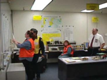
Figure 2 - EOC Planning and Intelligence Unit (EOC)
On the heels of this whiteboard exercise, a "real-time" event of a natural gas line break in Moreno Valley, California occurred. The EOC utilized the GIS databases to identify Census information for proximity analysis for necessary population evacuation. Since then, the EOC CD has been used extensively for creating tabletop exercises of fires, flooding, earthquakes, and snowstorms.
The second Emergency GIS Response CD release is scheduled for the EOC and Emergency Planners of the County in Summer 2002. The CD will include ArcExplorer(tm) 4.0 with the previous versions. The data is essentially the same delivered in December 2001 with updated information of the previous thirty-three (33) layers with addition of:
� History Fire Burn Areas
� Regional Vegetation Types
� Chemical/HazMAT Generators
� Latitude/Longitude Reference Points
� Aeronautical Reference Points
� Mass Transport Facilities
� Utilities
� Flood Inundation Areas
� Military Facilities
� Radiation Medical Facilities
The success of this project has created challenges in updating information as the usage increases. Not only is the EOC utilizing this information, but also we are working closely with CDF Fire and Riverside County Sheriffs with their E911 modernization programs.
Discovery of missing and/or new information is the happy problem that all GIS professionals face day-to-day. Firefighters rolling down the streets collecting data with their notebooks. Officers in their patrol cars seeing the same changes are creating data redundancy.
Because of the volume of GIS data being transmitted, we have started the business and systems requirements phase of several ArcIMS applications. These applications will provide bidirectional data management with the TLMA Geospatial Warehouse. This interface, with the SDEOracle(r) RDBMS, will integrate into the ArcGIS Geodatabases(tm). As the public safety officers compile field information, they will be able to upload via ArcIMS(tm).
We are also implementing the field deployment of ArcPAD(tm) 6.0. Preliminary testing with Compaq iPAQ 3800 PDAs is underway. These units will assist Battalion Chiefs and Incident Commanders. Wireless communication integration with these handheld devices is being tested as well. Streaming GIS data packets is challenging us.
The use of the Imagery is planned within the EOC and field units. Both ArcIMS and ArcPAD will serve up this aerial data.
This partnership of Public Safety is based on a GIS foundation. The simple need for spatially rich information to protect the public was critical before September 11. Were we successful? Yes; we were. We succeed in bridging one more element of the human condition with GIS. Is there room for improvements? Sure! We are talking about GIS - The Fastest Change Agent in the World!
After the events of that September day, First Responders in Riverside County embraced GIS with both hands saying, "let's roll!"
The Riverside County EOC would like to acknowledge the following contributors to this paper presentation and the continued support of this project -
Pat Egetter Information Technology Officer III
William Mumbleau, GIS Managing Supervisor
Jeff Letterman, Senior GIS Specialist
Janice Nollar, Senior GIS Specialist
Mickey Zolezio, GIS Specialist III
Tim Darden, GIS Specialist II
Adriana Soares, GIS Specialist I
Esri, Corporate Product Information, 2002.
Riverside County EOC, Internal Documents, 2002.
California Office of Emergency Services, OES History, 2002.
National Oceanic & Atmospheric Administration (NOAA), Aloha & CAMEO, 2001.
Wayde York
Emergency Services Coordinator
Riverside County Fire Department
4080 Lemon Street, Room 8
P.O. Box 1412 Phone (909) 955-4700
Riverside, CA 92502-1412 Fax (909) 955-8940
Wayde_York@fire.ca.gov
William Mumbleau
GIS Supervising Manager
County of Riverside
Transportation & Land Management Agency - GIS
4080 Lemon Street, B11
P.O. Box 1545 Phone (909) 955-1844
Riverside, CA 92502-1545 Fax (909) 955-1879
wmumblea@co.riverside.ca.us
APPENDIX 'A'

Data Dictionary
for the
EMERGENCY RESPONSE DATABASE
ADDITIONAL_INSTITUTIONS
ADULT_SCHOOLS
AIRPORTS
CENSUS_BLOCKS
CITIES
COMM_ COLLEGE
COUNTY_BOUNDARY
CSA
DAMS
ELEMENTARY_SCHOOLS
FAULTS
FIRESTATIONS
FLOOD
GOLF_COURSES
GOV_BLDGS
HAZMAT_SITES
HIGH_SCHOOLS
HIGHWAYS
HOSPITALS
HWY_SHIELDS
JAILS
MIDDLE_SCHOOLS
PARKS
PRESCHOOLS
RED_CROSS_SHELTERS
SCHOOL_DISTRICTS
SCHOOLS
SHERIFF
SPECIAL_NEEDS
STREETS
SUPERVISOR_1991
SUPERVISOR_2001
WATER