Title: Partnerships for GIS Implementation: The Wyoming NRCS Experience
Authors: Shandy Bittle and Jennifer Hayward
Organization: USDA-NRCS
Abstract
Natural Resources Conservation Service (NRCS) has developed two shared GIS positions in Wyoming. The first partnership located in Pinedale, Wyoming, is between the NRCS, Forest Service, and the BLM. The second partnership has been developed in Wheatland, Wyoming, between the NRCS, Platte County Resource District, and Platte County. Topics will include an explanation of the partnerships, their origin, function and benefits partners receive from the positions, and how future shared-GIS positions could be created to benefit entities that otherwise could not afford to have a full-time GIS position.
Introduction
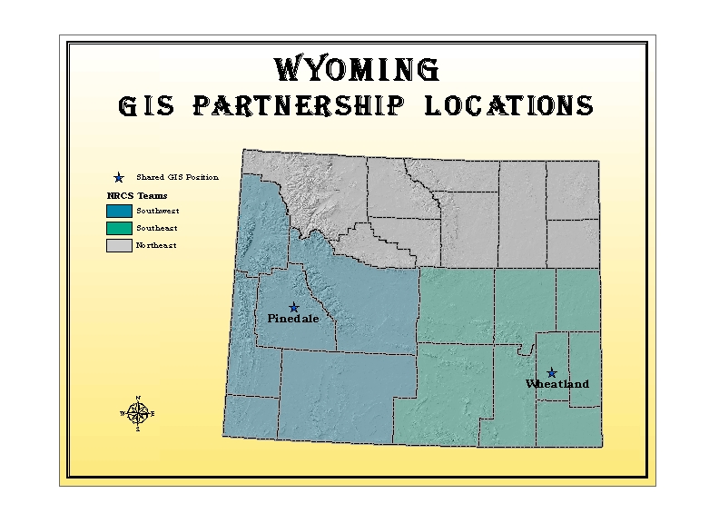
Implementing GIS in an agency or community can be challenging, especially during times of limited budgets. The Natural Resources Conservation Service (NRCS) in Wyoming has been involved with creating two partnerships that implement GIS throughout the state. It has been a time-intensive endeavor making these partnerships a reality. The first partnership, located in Pinedale, 70 miles south of Jackson Hole, is comprised of three federal agencies: the Natural Resources Conservation Service (NRCS), the United States Forest Service- Pinedale Ranger District, and the Bureau of Land Management (BLM)- Pinedale Field Office. This position was established in August 2000. The second partnership, located in Wheatland, 70 miles north of Cheyenne, was developed between the NRCS, Platte County Resource District, and Platte County. This partnership hired a GIS Coordinator in July 2001. These positions have enabled GIS users to utilize and apply technology in the field, and have provided local on-site advanced GIS analysis.
Pinedale
The timeline from partnership conception to implementation: A local Game and Fish employee invited potentially interested parties to meet and discuss the need for local GIS support. The agencies met and defined goals and ideals for the position and developed objectives to convince their leadership that the need warranted funding. The idea was simple: GIS help in the field at a rate that all partners could afford. Agencies accepted the idea and the proper paperwork followed. Unfortunately, the Game and Fish Department was not able to become a partner even though they initiated the process. In August 2000, nine months after the idea began, the partnership was created and Jennifer Hayward was hired.
What made it work? The committee developed the position because of the need for local GIS assistance, the ability to enable employees to apply GIS themselves, advanced analysis and creation of seamless datasets. Local support and direction were crucial in creating the position. Local leaders were able to define and clarify with each other how the position would be managed, housed and directed.
How it works. The Oversight Committee (a single representative from each agency) meets biannually to discuss accomplished tasks, goals, roadblocks, successes and appraisal of GIS implementation. In this situation, the committee allows the employee to budget her time accordingly. If conflicts arise, the agency that has the conflict determines the priority of projects without involving the others. At times, one agency may get more time in a particular month, but will receive less time later. A training budget was established to provide professional development in which all agencies share the cost.
Wheatland
The timeline from partnership conception to implementation. In February of 1998 efforts to form a partnership in SE Wyoming was initiated by the NRCS. In 1999 the Platte County Resource District (PCRD) started to drive the process and the establishment of a GIS position. The PCRD invested in GIS equipment totaling $16,000 in January of 2000. The final partners were solidified during the winter of 2000. By March of 2001 the GIS Coordinator position was advertised in newspapers and the internet. In May of 2001, Shandy Bittle was hired as the GIS Coordinator for the Platte County Natural Resources Partnership and began work that July.
What made it work? A combination of progressive and willing partners aided in making the GIS position a reality. The PCRD has a strong county board interested in technology and program delivery, and a desire to fund the equipment for the position. The Platte County GIS Users Group provided community support. The NRCS State Conservationist, Ed Burton, was in full support of establishing GIS in the field. Platte County recognized GIS benefits, advances and how they could benefit from a shared position.
How it works. Each partner contributes 1/3 of the salary and benefits of the employee. The business aspect is the responsibility of the PCRD. Projects are designed to benefit all partners when possible. For all partners, the return on the investment is the ability to acquire more data through the partnership than they would as independent agencies. When serving NRCS, the majority of time is dedicated to field office technical support and training. The PCRD projects include watershed planning, water quality sampling, and prescribed burns in cooperation with the Wyoming Department of Game and Fish. The county has several initiatives that are GIS related such as GASB 34, Ownership, Emergency Management and E-911.
Accomplishments/benefits
Enabling field employees to produce their own GIS-derived products is one of the biggest advantages to using GIS at the field office level. Providing professional products is important to our agencies as well as our customers. The ability to perform advanced analysis without waiting to be scheduled at higher administrative levels is also beneficial. Transfer of technology between partners is also advantageous to all involved. A short list of accomplishments of the positions include: development of an ArcGIS NRCS symbol set, 25 new GIS Users, modeling cattle use on public lands, fire support, coordination of data between agencies, professional products and maps, location of potential roads in oil and gas fields, watershed planning, customization of ArcPad for specific applications, assistance in developing regional GIS User Groups and an avenue for field user access to the latest methodology in GIS.
Setting up a Partnership
The most important factor in creating a shared GIS position is local interest and control of the position. If local partners are in agreement and support of the position, then the partnership will succeed once the financing is established. This process is time-consuming. Final agreement between all the partners takes time, from determining the salary, to procuring the equipment to the hiring of qualified staff. GIS support at one-third the rate of a full time employee allows all partners an expertise that they might not be able to afford.
Suggestions for creating a successful partnership include: