While DHNs are not new concepts, the advent and proliferation of broad-band technology in public school and private residences have engendered substantial growth. With the capabilities of networked technologies, DHNs are poised for the collection, display, and analysis of data in real-time. These new technologies support collaborations between classrooms, citizen-scientists and expert-researchers across city, state, and national boundaries. Projects such as TERC's Global Lab, The Monarch Watch, GLOBE, PathFinder Science (http://pathfinderscience.net), and others offer collaborations between thousands of students, teachers, and mentors in dozens of countries. These projects use the Internet and advanced telecommunications as a communication medium for the exchange of issues and data embedded within a Project-Based Learning environment. In most cases, the geographic spread of the classrooms participating in the network is an advantage to the research or problem the students are investigating. Bridging great distances is therefore not a luxury of the technology, but a demand of the inquiry.
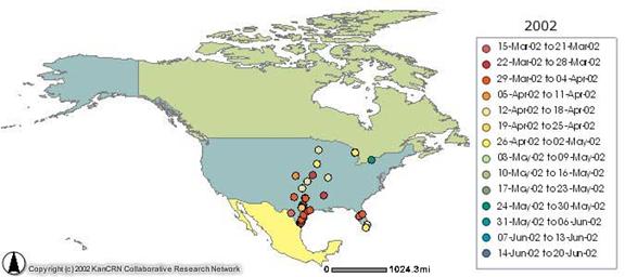
For example, PathFinder Science and The Monarch Watch are collaborating to bring information related to the identification and migration of Monarch Butterflies to thousands of participating students in the U.S., Canada, and Mexico. Before Internet and digital mapping technologies were used in data collection and display, students and teachers were not able to see the results of their work and how it correlated with data from other classrooms for several months. Students, citizen-scientists and researchers can now see real-time maps of monarch migrations and will be able to recall information about the identification of a particular Monarch in the database. In this way, technology allows for timely communication supporting on-going research into the natural world.
There are some 46 million school-aged children in the United States. Each one lives somewhere, plays somewhere, and attends school somewhere. The students, along with teachers and citizen-scientists, potentially represent the largest environmental sampling team ever amassed. Similarly, hundreds of thousands of Americans regularly engage in citizen-science, from bird watching to weather spotting. Each of these people can be tapped, calling on their senses of curiosity, activism, and preservation. Distributed Human Networks, in the form of collaborative learning environments are very powerful educational models for supporting student learning, particularly when units of study can be organized around a central theme or research question.
The 1990's witnessed an onset of national education standards for content and process skills in nearly every subject area in public schools. In most cases, the standards were intended to guide basic concepts and skills to be learned in each grade of US K-12 Education. The National Science Education Standards (NRC, 1996) and the Benchmarks for Scientific Literacy (AAAS, 1993) call for systemic changes throughout science education, providing for environments that allow students to construct their knowledge through personal and social interactions with meaningful scientific experiences. These experiences are intended to be composed of inquiry-driven events wherein students investigate questions of personal significance, using scientific methodologies as a framework and technology to augment and extend discovery. A chief outcome of science education in public schools is ultimately the development of students who are scientifically literate. Furthermore, the intention of the standards is to directly support and encourage the development of the teaching and learning environments required to allow for the emergence of students as scientists. Project Based Learning models, when aligned with the more specific instructional model of scientific inquiry, ideally suits the intentions and goals of the vision of the standards by providing for the most basic element of science teaching and learning in the classroom, "science as inquiry" (NRC, 1996). This shift to inquiry-driven science classrooms represents the pinnacle of current reform efforts in science education nationwide.
The National Geography Standards (GESP, 1994) call for the education of geographically informed students, able to ask and answer authentic questions with geographic components. Geographic inquiry is intended to be the primary method for developing students who are able to proceed through the five stages of asking and answering geographic questions. Asking geographic questions, followed by acquiring, organizing, and analyzing the information, allows a student to answer the geographic inquiry, usually resulting in a new set of questions and subsequent inquiries (GESP, 1994). Information technologies, more specifically Geographic Information Systems, are mentioned in one appendix of the standards. While the discussion is minimal, "the standards were written with geographic information systems in mind but not in sight" (p.257). The standards note the expense and gradual adoption of GIS technology in schools.
The National Educational Technology Standards for Students (NETS) provides a general description of linkages between curriculum and technology for K-12 education (ISTE, 2000). NETS profiles what a technology literate student is able to accomplish at particular grade ranges and includes performance indicators and curriculum examples in English, math, science, and social studies. NETS articulates a vision where classroom technology is used to augment traditional teaching models while simultaneously supporting new student-centered, authentic learning environments, rich in multi-sensory collaborative Problem Based Learning experiences.
Time is also a critical obstacle for extensive field work, especially in the case where great distances must be spanned to visit multiple field study locations. Researchers and environmental managers seldom have the opportunity to fully commit themselves to a particular field study. Time requirements for a project can be dramatically cut when the data collection can be shared among hundreds or thousands of interested citizen researchers.
Integral to both time and financial constraints is the issue of data quantity. Using DHNs, not only are geographically and spatially diverse study regions more likely to be included, but the number of sampling events is also likely to increase. Given an average high school biology teacher has about 130-150 students, a one-day data collection could produce 300 or more data points, depending largely on the collection procedure. The sheer volume of data collected moves the data set toward the mean, tending to mitigate any "noise" in the data.
Finally, the use of DHNs to promote public awareness, and in turn, political support is not unfounded. Ten thousand elementary school children studying Monarch butterflies generates an incredible public, emotional regard for the organism - essentially labeling it as a "charismatic micro-fauna". Al Gore's political support for the GLOBE program attempted to generate similar public sentiment and a public recognition of global warming issues. DHNs have the potential to leverage political and financial support, when properly managed.
Geographic Information Systems offer the potential to support classroom learning in student driven inquiries in many aspects of the natural and social domains. A GIS allows for the collection, storage, analysis, and display of location-based data (Burrough, 1986; Burrough & McDonnell 1998). The typical display of a GIS is a map-based image where layers represent distinct attributes or types of information. These layers can be added in any sequence the user prefers, allowing for student exploration or analyses.
The use of inquiry or Project Based Learning in the classroom requires a rich suite of tools for fostering and driving understanding and assimilation. These tools include media and technical applications for information access, analysis, and reporting. Researchers have concluded that technical tools, when used appropriately as instructional supports, have the potential to enhance student achievement and teacher learning (Cognition and Technology Group at Vanderbuilt, 1996; Dede, 1998). Furthermore, GIS has been shown to extend student self-efficacy in science, technology attitudes, and achievement in science (Baker, 2002). GIS holds the potential to assist with many of the necessary elements for supporting classroom scientific inquiry and PBL, encouraging the collection and display of dispersed environmental data. After data are mapped, classroom scientific inquiries could consider areas of further research from the data presented during pattern seeking and analysis activities. In this way, GIS can facilitate question formation and hypothesis refinement for further scientific inquiries for students.
PathFinder Science uses GIS technologies to aid in three distinct components of the research process, varying greatly depending on the exact project in question. As a wealth of free, readily attainable GIS data already exists, many teachers and students opt to use Internet-based GIS maps in the exploration of background research. Maps provide an intuitive interface for rapidly introducing students to large, complex, or interactive data sets. By using Internet-based maps, students immediately engage in the content and avoid the complexities of traditional desktop GIS applications.
As GIS technologies have rapidly expanded over the past decade, many new and exciting features are becoming available to GIS users. Desktop GIS can be a powerful ally in the collection of data on several PathFinder Science projects. Image analysis tools are no longer strictly reserved for the examination of aerial or satellite data, such GIS tools are also well suited for the mapping and analysis of leaf stomata and lichen growth.
Most notably, GIS is used to examine and analyze data collected by students involved in a collaborative project. As PathFinder Science schools provide a unique geographic distribution, mapping student-collected data is critical to the basic understanding of the data. Using both Internet-based and desktop GIS, students using GIS are able to compare and contrast their findings within the context of other collaborative data. Students are able to begin and extend fundamental pattern seeking processes and as time and expertise allow, students may begin to spatially analyze data, create new data from multiple pre-existing layers, and construct three dimension maps, time-sensitive map animations, or other visualizations.
The development and use of Distributed Human Networks creates a very deep and meaningful environment for citizen-scientists and students. This is an environment where many people each contribute a small piece to a large puzzle. While there are many organizations that provide DHN type environments, few provide the technical, pedagogical, and human resources needed to successfully implement these types of research and education efforts. PathFinder Science is one such organization capable of providing support for the three tiers that can support scientific and/or environment areas of research.
PathFinder Science provides online utilities, such as the Project Builder, which affords interested scientists or mentors the capability to create online DHN. The Project Builder (http://builder.pathfinderscience.net) tools include a simple application that allows for the design and development of web-based forms, back-end databases, and a variety of multimedia and imagery uploads. When a scientist-mentor uses this system they are able to build the necessary collaborative tools for supporting a DHN closely related to their interests. In addition, PathFinder Science provides some online pedagogical instruction, assisting new DHN creators with the basic instructional skills necessary to design an effective unit for citizen-scientists, students, and teachers. Finally, as a new project is tested and approved for public consumption, the existing human network (schools>1000, citizen-scientists>5000) of PathFinder Science can be coaxed into assisting with new and exciting research.
The development and use of DHNs can be an exciting and rewarding effort for any interested researcher. While there are a number of current efforts to monitor and assess air, water, and biotic factors, limitless possibilities exist for new areas of citizen and student scientific research. Leveraging the technical, pedagogical, and human resources of existing DHNs, students, citizens, researchers, and science all win.
708 JR Pearson Hall School of Education The University of Kansas Lawrence, KS 66045