Paper # 0953
Methods and Tools for Planning Community and Public Safety StrategiesSabine Huynen
Melissa Brenneman
Abstract
COMPASS — Community Mapping, Planning and Analysis for Safety Strategies — is a data-driven, collaborative initiative to support integrated, multi-agency community public safety interventions. The University of Redlands, Redlands Institute, is currently assisting the City of Redlands Police Department in the planning, design, and implementation of a spatial data infrastructure for the East Valley area (selected cities in San Bernardino County, California). This paper explores the key methods and concepts applied in the initial project phase, including: gathering background information from key stakeholders, organizing GIS awareness seminars, performing a stakeholder assessment and compiling the results. The paper also outlines the framework for future collaboration among the agencies and organizations involved.
1. Background
In recent years, a shift has occurred in local juvenile and criminal justice policy development toward more integrated and collaborative approaches. The East Valley COMPASS project demonstrates the efforts to link diverse stakeholders and their data systems as a regional collaboration for developing coordinated responses to community safety problems. Key to this approach is to analyze the nature of public safety problems in order to develop pro-active interventions to help solve them. The approach is data driven; that is, it relies on timely, accurate, electronically based data, keyed to geographic references and drawn from multidisciplinary sources. Jurisdictions that have developed such data systems, analytic capability, and collaborative partnerships have had a great success in reducing crime and addressing public safety problems. The four main components of COMPASS include:
Ø A collaborative policy group spanning a broad array of city agencies and community interests to guide the initiative and develop public safety strategies.
Ø A comprehensive data infrastructure consisting of a broad array of data (crime incident, public safety, demographic, social, environmental and school data) from a variety of sources.
Ø Strategic analysis of data both spatially and temporally through application of a user-friendly information system.
Ø A research partner (or consortium of partners) to assist in data analysis, support the development of interventions, and provide continuous feedback on the outcomes and impacts of interventions. The Police Foundation was selected to provide support for the East Valley COMPASS project.
Collaboration is integral to COMPASS. COMPASS partners include criminal justice system agencies, local governments, healthcare providers, public housing officials, social service providers, schools, community-based organizations, institutions of higher education, the private sector, and the National Institute of Justice (NIJ). This variety of information sources represents the framework for the creation of a multi-disciplinary data infrastructure. Information collected includes existing social indicator data (e.g. statistics or other data on employment, housing, land use, schools, hospital admissions, community assets/resources) and a host of crime/safety information and other public safety indicators (e.g. data on crime incidents, arrests, court and corrections events, victimization surveys, etc.).
The analytic strength of COMPASS lies in the wealth of data collected and identification of relationships among key indicators in the data. An essential tool used for this type of data analysis is GIS technology through which the data can be spatially visualized to facilitate data-driven problem-solving strategies in a targeted fashion. GIS can also be used to assess the impact of interventions over time, and to analyze unanticipated outcomes (e.g. crime displacement). It is within this context that the Redlands Institute, in cooperation with the City of Redlands Police Department and Research Partner, is planning, designing, and implementing a spatial data infrastructure to support the East Valley COMPASS Initiative.
2. Role of the Redlands Institute
Coordination across many organizations, institutions, and agencies typically requires an independent support and facilitation function. As expected, administrative mandates, topical and geographic jurisdictions, studies and monitoring interests, purposes, and priorities vary from one organization to another. The Redlands Institute, as an independent and unbiased participant, is helping to collect and synthesize information to help the participants of COMPASS focus on common interests and benefits while minimizing constraints and conflicts.
The following provides an overview of the tasks to be carried out by the Redlands Institute, in collaboration with the City of Redlands Police Department and the Research Partner.
Ø Task 1 – Gather Background Information
Ø Task 2 – Co-organize Orientation Seminar
Ø Task 3 - Prepare and Disseminate Questionnaire
Ø Task 4 – Co-organize Issues Workshop
Ø Task 5 - Prepare Requirements Analysis
Ø Task 6 - Prepare Data Inventory and Evaluation
Ø Task 7 - Prepare Data Infrastructure Design and Implementation Strategy
Ø Task 8 - Support Implementation Process
This paper explores the key methods and concepts applied in the initial project phase, including tasks 1 - 3: gathering background information from key stakeholders, organizing GIS awareness seminars, preparing and disseminating a questionnaire, and compiling the initial findings.
3. COMPASS Stakeholder Assessment
An initial data and information assessment was conducted as the first step for exploring potential collaboration and data sharing within the East Valley COMPASS community. This assessment was designed to identify the range of stakeholder datasets and information products, locate and characterize the major programs and activities, identify security and confidentiality constraints, identify interactions among agencies and programs, and review the assessment with the COMPASS stakeholders in a workshop format. The assessment included 40 organizations, representing state government, county government, city government, law enforcement, community service, education, health and private sector organizations within the East Valley of San Bernardino County, California.
Information collected during the assessment was ultimately entered into Excel spreadsheets that were used to analyze and display information as matrices and summary charts, and were converted into spatial formats. A map was produced illustrating the spatial distribution of all the stakeholders participating in COMPASS (geocoded by address matching to street files), their attendance at the orientation seminar, their completion of questionnaires. The map also includes a summary chart showing the organizations by type.
The following sections summarize the methods used to conduct the stakeholder assessment.
3.1 Gather Background Information
The Redlands Institute Information System team (IS team) participated in a series of initial meetings and interviews with key stakeholder representatives and collected and reviewed existing documents about each participating group. This background information helped the COMPASS team develop an understanding of the range of mandates and interests that comprised the stakeholder community and began establishing a dialog with each department, group or institution. The types of materials that were collected included:
Ø Organizational charts and descriptions of departmental mandates and duties;
Ø Annual reports;
Ø Newsletters;
Ø Related reports or other background material.
Background information was collected for the following 14 stakeholder organizations:
Ø San Bernardino County Sheriff
Ø Colton Police Department
Ø San Bernardino Police Department
Ø Fontana Police Department
Ø City of Redlands Police Department
Ø Redlands Drug Court
Ø City of Highland
Ø Loma Linda Medical Center
Ø Boys and Girls Club Redlands
Ø Family Service Association
Ø Trinity Church
Ø Redlands Unified School District
Ø Building a Generation
Ø Redlands Chamber of Commerce
The information collected was summarized by the IS team in a short abstract describing each organization and their interests as they relate to the proposed spatial data infrastructure.
3.2 Co-Organize Orientation Seminar
In cooperation with the City of Redlands Police Department, the IS team participated in an orientation seminar for the stakeholders. The seminar included an overview of GIS technology, its application to criminal justice, the processes and steps required for this project, and a discussion of stakeholder involvement. Thirty-eight attendees from twenty-two organizations participated in the three-hour workshop in early February 2002. The workshop consisted of two parts: the first part focused on GIS concepts and technology and how spatial analysis and data management capabilities of a GIS can be used for a variety of applications, including crime analysis, geocoding of social indicator information, data query, spatial analysis and visualization. The second part of the seminar focused on explaining the data collection and information systems design steps to be followed in this project, including the overall process, purpose and objectives of each task, and what would be expected of the stakeholders in subsequent activities. The questionnaire (described under section 3.3) was also explained and disseminated to participants. A seminar workbook was provided to each participant for reference during and following the presentation. Stakeholders who could not make the meeting were provided with a workshop book and questionnaire by mail.
3.3 Prepare and Disseminate Questionnaire
In order to gather more detailed information about the stakeholder organizations, a questionnaire was developed. Typically, this type of information is best gathered by interviewing stakeholders, but due to the large amount of stakeholders and limited resources, a questionnaire was used instead. The IS team developed the questionnaire and distributed it to the stakeholders at the orientation seminar to gather more detailed information concerning each organization's interests and information as it relates to the proposed spatial data infrastructure. The questionnaire included information about the specific programs and activities of each organization that might benefit from a data infrastructure, and the specific information sources that are used now to support those activities. Participants were also asked to include samples of their source data with their questionnaire, including:
Ø Existing social and criminal justice-related activities conducted now or in the future;
Ø Existing data used and/or generated;
Ø Existing maps and/or reports and other products used or generated;
Ø List of other organizations that each group coordinates with at present;
Ø Issues concerning data access, privacy, and security;
Ø Existing computing infrastructure and staff technical capacities;
Ø Other challenges or opportunities concerning data distribution, coordinated intervention and other areas of concern.
As part of the questionnaire creation process, the IS team explored several spatial data infrastructure related resources as follows (see bibliography for a more detailed description of references):
Ø Planning for a GIS. Dr. Roger Tomlinson. 2001 Esri & Tomlinson Associates Ltd.
Ø Strategic Approaches to Community Safety Initiative (SACSI): Enhancing the Analytic Capacity of Local Problem-Solving Efforts. Elizabeth Groff with Jill K. Fleury and Debra Stoe. National Institute of Justice.
Ø Justice National Information Architecture: Toward National Sharing of Governmental Information. Representing Chief Information Officers of the States. NASIRE.
Ø Integration in the Context of Justice Information Systems: A Common Understanding. A SEARCH Special Report. David J. Roberts. The National Consortium for Justice Information and Statistics. April 2000.
Ø Integrated Justice Information Systems. The Department of Justice Initiative. Office of Justice Programs. Office of the General Counsel. April 2000.
Based on this research, the IS team developed a questionnaire composed of the following three sections:
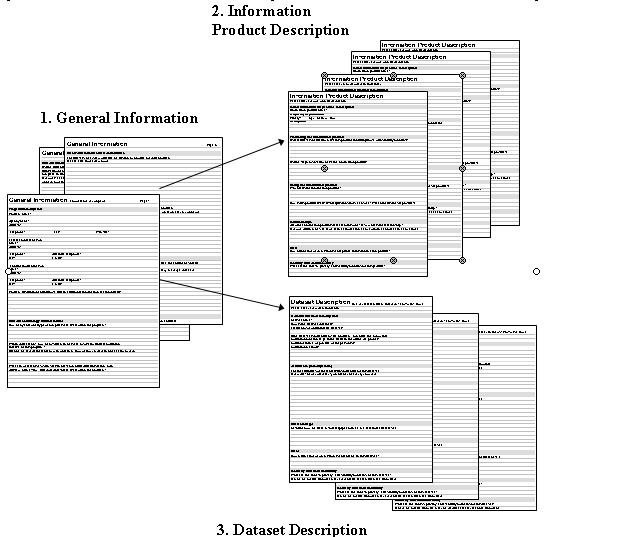
1) General Information
2) Information Product Descriptions
3) Dataset Descriptions
This structure addressed the various agency programs, the information products developed and used within those programs, and the datasets required to create those information products (Figure 1). Each completed general information section could be accompanied by many information product descriptions and dataset descriptions, since each program might need a number of information products and use a number of datasets to produce those information products.
3. Dataset Description
Figure 1. Questionnaire structured into three sections: General Information, Information Product Descriptions, and Dataset Descriptions.
The content of each component is described in more detail as follows:
1. General Information
- Program description
· General contact information
· Program description and purpose
- Current technology infrastructure
· How many and what type of computers are used within the program?
· Within the agency, how many staff members are involved with data collection and use within the program?
· What GIS or database systems (examples: Computer Aided Dispatch – CAD, ArcView, CrimeView, Microsoft Access) are used within the program?
- Current information produced
· List of current information products (lists, reports, maps, documents) created within the program
- Current datasets
· List of the datasets collected or used within the program
- COMPASS benefits and constraints
· List of datasets that the agency would like COMPASS to provide for their program
· List of information products that COMPASS could produce for the program
- Security and confidentiality
· What security or confidentiality concerns exist regarding data that might be shared with the COMPASS project? How might these be overcome?
- Interactions with other agencies
· List of organizations that the organization interacts with to share information and data
2. Dataset Description
- General dataset description
- Attributes (descriptions)
· List of all descriptive fields included in the dataset
- Data storage
· Description of how the data is stored (hardcopy forms, digital spreadsheet file, etc.)
- Error
· How much error or omission is acceptable in this dataset?
- Security and confidentiality
· What are the access, privacy, and security concerns for this dataset?
3. Information Product Description
- General information product description
- Producing the information product
· List of all datasets needed to make the product
· List of steps involved to make the information product
- Using the information product
· Who needs the information product?
· How is the product used? (What questions does it answer? What benefits does it provide?)
- Relationships
· What information products are related to this one? What is the relationship?
- Error
· How much error or omission is acceptable in this information product?
- Security and confidentiality
· What are the access, privacy, and security concerns for this product?
The IS team is currently still in the process of compiling results as the questionnaires are returned. The following questionnaires have been received:
Complete
Department of Corrections, Parole and Services Division
San Bernardino County Probation
Loma Linda University Medical Center
Building a Generation
Incomplete
Fontana PD
Redlands PD
United Way East Valley, Redlands
Expected/On Hold
Redlands Community Hospital
San Bernardino Human Services Network
Family Services Association
Boys and Girls Club Redlands
Redlands Unified School District
Discussion
As with any project, the team was confronted with unexpected challenges and constraints.
Due to the large number of stakeholders and limited resources, the IS team developed a very detailed questionnaire, with a rather heavy technical emphasis. Two issues resulted from this approach:
1. Participants attending the orientation seminar often represented managers and decision makers of the various organizations. Typically, they passed the questionnaire to their technical staff to complete. The technical staff had difficulties with the questionnaires since they hadn’t attended the orientation meetings. In many cases, they lacked the knowledge and motivation to fill out the questionnaires.
2. Another constraint was the level of detail of the questionnaire. In retrospect, the IS team might have been more successful in collecting information by providing a simplified questionnaire and following up with interviews, targeting a limited number of key stakeholders. In this context, the IS team also overestimated the technical skill levels of various community organizations. The latter were often simply overwhelmed or unfamiliar with the technical terms and concepts presented.
A further constraint to the project involved project staff from the City of Redlands Police Department. Their grant included a number of dedicated staff positions for the project. Although the positions were approved, filling the positions with qualified individuals took time. The IS team began work on the project before the positions were filled. Had the positions been filled, those individuals could have played larger roles in mobilizing and motivating the stakeholder community, which may have resulted in a better questionnaire response rate and more time to follow up with detailed interviews.
Conclusion
The next stage for the East Valley COMPASS project is to identify the key problem areas for the project to focus on over the coming year. Once the problem areas are identified, the IS team, in cooperation with the City of Redlands Police Department and Research Partner, will move forward with a data infrastructure design focusing on the needs specific to those problem areas.
Currently, the key problem areas being evaluated have a strong police emphasis. Therefore, it is expected that in the short run the law enforcement agencies will drive the project, rather than the community-based organizations. The law enforcement agencies typically have a high level of technical abilities with GIS, which improves the chances of initial success. Later, after the initial focus on law enforcement problems, the East Valley COMPASS project will be extended to include more community-based organizations.
Bibliography
Strategic Approaches to Community Safety Initiative (SACSI). Enhancing the Analytic Capacity of a Local Problem-Solving Effort. [paper]. National Institute of Justice. Available: http://www.ojp.usdoj.gov/nij/sacsi [2001, 10/31].
The National Association of State Information Resource Executives (NASIRE), (2000). Justice National Information Architecture - Toward National Sharing of Governmental Information. Lexington, Kentucky. NASIRE.
Roger Tomlinson, Ph.D. Planning for a GIS, [Virtual Campus Course, Esri].
Available: http://campus.Esri.com [2001, November].
Office of Justice Programs, (2000). Integrated Justice Information Systems. [paper]. Department of Justice.
Available: http://www.ojp.usdoj.gov/archive/topics/integratedjustice/ag-draft.htm [2000, 04/12].
Bischoff Kenneth E. and Gary R. Cooper, (2000). Integration in the Context of Justice Information Systems: A Common Understanding. Sacramento, California. SEARCH, The National Consortium for Justice Information and Statistics.