The basic process involved with finding restoration sites includes the following steps:
- determine criteria for a suitable site
- find sites meeting criteria
- field verify sites
- approach land owners to determine interest
- conduct feasibility study on sites with siteowner interest
- negotiate price of purchase or easement
- develop restoration plan/construction
Step 1 - Criteria
STREAMS |
must be shown as perennial stream on a USGS Topographic Map |
longer than 1000' |
sinuosity (the amount that a river meanders within its valley, calculated by dividing total stream length by valley length) should be less than 1.2 |
slope of the ground less than 4% |
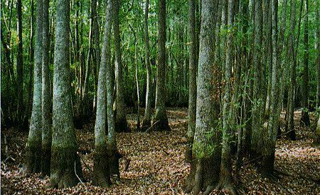
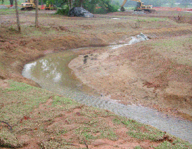
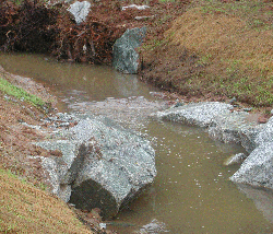
current landuse indicates degradation of stream (streams that have been straightened or dredged, are deeply incised, have erosion and undercutting of the channel banks, and have little natural bedform) |
preferably only one owner on both sides of stream |
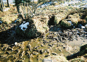
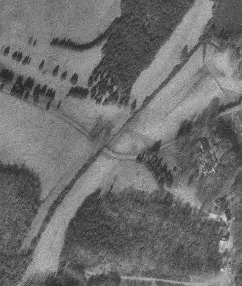
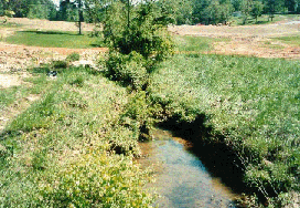
Figure 3. Degraded Stream |
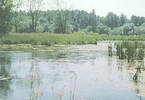
WETLANDS |
hydric soil |
current landuse indicating degradation |
5 acres or larger |
not already identified as a wetland on a National Wetlands Inventory map |
preferably only one owner |
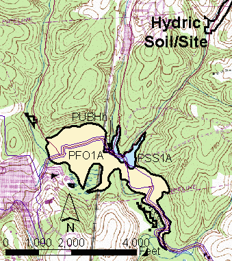
Figure 4. NWI Mapping and Hydric Soils |
Steps 2, 3 and 4 - Find Sites, Field Verify Sites, Contact Landowners
Now we come to the actual search methodology. This depends on the data available, and whether we are looking for stream or wetland restoration site searches.
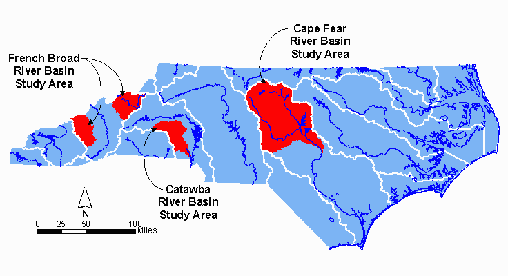
PROJECT 1 - PIEDMONT REGION OF THE CAPE FEAR RIVER BASIN
For this project, the NCDOT needed to identify potential wetland restoration sites. The digital data available varied by county. NCDOT was able to provide us with land cover data for the whole study area, and soil data for Guilford, Durham, Alamance, and Harnett Counties.
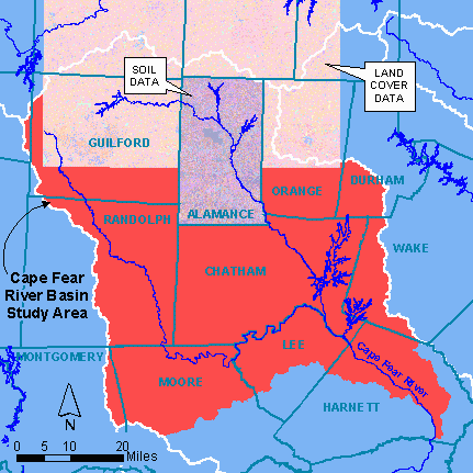
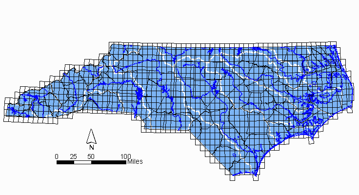
Figure 5. Cape Fear River Basin Study Area |
The polygonal land cover data was developed using raw satellite image data from the Landsat Thematic Mapper (TM), which was then classified into 23 land cover categories, based on human uses of land, vegetation, water, natural surface, and construction. Land cover with a classification of "managed herbaceous" or "cultivated" was selected from the shapefiles. This data is available in areas coinciding with the 1:100,000 USGS Map Series, therefore six shapefiles were used, each about 66Mb in size.
With the large sizes of the files, it became necessary to clip the data to reduce computer processing time. The USGS Quadrangle Maps were used for this. A check off sheet was developed to track which procedures had been performed on each quadrangle. A combination of ArcView and ARC/INFO was used for the reselection and clipping, and an AML developed to convert polygonal shapefiles to coverages.
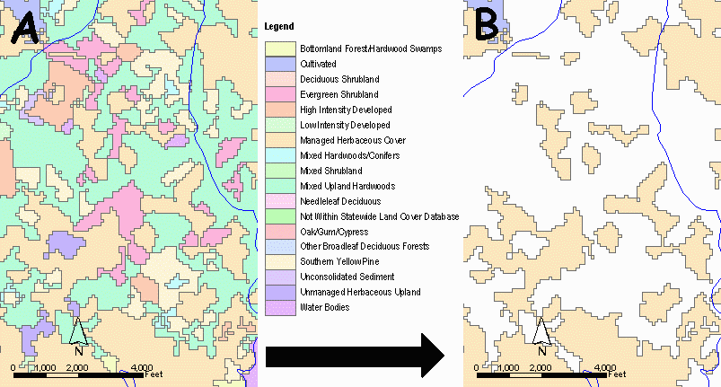
Figure 7. Land Cover Reselection |
Soil data that was available digitally had been digitized by NCCGIA, from County soil maps, developed by the United States Department of Agriculture (USDA) Natural Resource Conservation Service. Attributes were added according to the soil survey, and two categories of hydric soil identified: map units that are all hydric soils or have hydric soils as a major component; and map units with inclusions of hydric soils or which have wet spots. The soil shapefiles ranged in size from 14 Mb to 77 Mb.
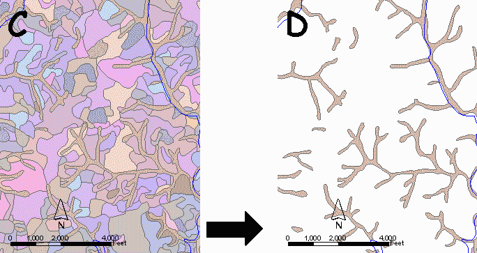
Figure 8. Hydric Soil Reselection |
The selected soil and land cover polygons were intersected, and then reselected to obtain only those of five acres or larger. Eighty-two areas met these criteria. Those that were not on or near perennial streams or that were in areas of steep relief were generally excluded from further investigation. Other significant features such as wildlife preserves, known game lands, significant natural areas, and known locations of species on the federal threatened and endangered species list were noted as well.
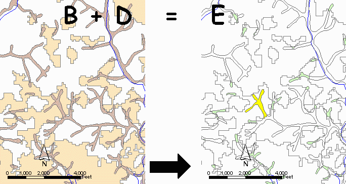
Figure 9. Intersection of Soil and Land Cover and Reselect Greater Than Five Acres |
National Wetlands Inventory (NWI) maps were downloaded from the Department of the Interior website, and overlain on the site maps. NWI maps are good for general location of wetlands, and were used to give a rough indication of whether or not a wetland had already been identified at the site identified using GIS.
Once preliminary site identification was complete, Earth Tech biologists conducted "windshield" surveys of the sites. Access to the properties was not included in the scope of work. Fifty nine sites were dropped from further evaluation because of various reasons including steepness of slopes, inaccessibility of site, high land values, excessive grading and excavation requirements to make the site physically feasible, or no evidence of saturation or flooding. For sites that looked promising in the initial survey, plat/tax maps showing property boundaries and ownership were obtained from County tax offices.
Twenty-three landowners were contacted by letter and/or telephone to determine their interest in participating in the NCDOT Wetland Mitigation Program and to request permission to enter the property for a closer look. As a result of these visits, ten potential wetland mitigation sites were presented to NCDOT for further studies. Earth Tech is currently doing a feasibility study on one of these.
PROJECT 2 - CATAWBA RIVER BASIN
For this project, the goals were to find 75 acres of potential wetland restoration (non-riverine or riverine) and 20,000 linear feet of stream restoration, with landowners willing to work with the NCDOT.
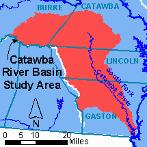
Figure 10. Catawba River Basin Study Area |
The initial goal was to identify large, contiguous areas of hydric soils where feasible. As the project progressed, it became evident that an adequate number of large contiguous potential wetland restoration acreage or liner feet of stream were not available. Therefore, 5 acres (rather than 10 acres) of wetland restoration, or 1,000 linear feet (rather than 1,500 linear feet) were identified. Additionally, sites with more than a single landowner were also evaluated.
Potential sites were identified utilizing GIS analysis as well as an evaluation of existing maps, driving the basin and through agency/organization referrals and personal contacts. Each site search method had strengths and weakness. The use of more than one method increased the chance of locating potential sites.
Wetlands
The GIS analysis for wetlands was similar to that in the Cape Fear River Basin, however, more land cover types were included: 'Deciduous Shrubland', 'Mixed Shrubland', 'Unmanaged Herbaceous Upland' and 'Unmanaged Herbaceous Wetland', in addition to 'Cultivated' and 'Managed Herbaceous Cover'. This resulted in more potential restoration sites, which were then visited in the field by Earth Tech biologists.
Streams
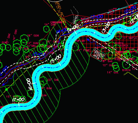
The GIS stream analysis addressed three of the criteria mentioned above in Step 1. Streams mapped on the USGS Maps were intersected with land use. Land use categories included were 'Cultivated', 'Managed Herbaceous Cover', 'Unmanaged Herbaceous Upland' and 'Unmanaged Herbaceous Wetland'. A reselection was then done to identify sites with more than 1,500 linear feet of channel. These were then overlain on the relevant USGS Map to determine the sinuosity manually. After screening for previously identified sites and multiple landowners this criteria only identified 12 potential sites in the entire 675 square mile study area. It was determined a second analysis was needed. A criterion of greater than 1,000 linear feet of channel was used to identify additional sites.
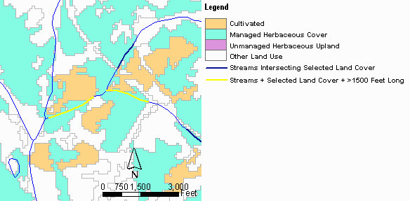
Figure 11. Stream Reselection |
Additional methods used to identify further sites included studying aerial maps at county tax offices, and contacting individuals within federal, state and local government agencies and private organizations. Agencies and organizations included, amongst others, Natural Resource Conservation Service (NRCS), North Carolina Forest Service (NCFS), the Nature Conservancy and NC Farm Bureau Federation, Inc.. These contacts identified landowners that have expressed interest in preservation or similar programs or may have an interest in the restoration program.
Twenty-four sites were evaluated in the field. Many of the potential wetland sites were eliminated because soils mapped as Chewacla were not hydric. Several sites were dropped after field evaluations when the landowner changed their mind about participating in the NCDOT mitigation program.
A total of 92 potential restoration sites were identified (Table 1) after the initial screening process. The initial GIS searches yielded the majority of the sites after screening. This produced a total of 24 site evaluations. Over these 24 sites it is estimated that 101 acres of potential hydric soils and 24,725 linear feet of stream were identified. The potential hydric soils is an overestimate of the acreage of actual hydric soils. The site search resulted in 5 prospectuses with signed entry agreement letters (1 wetland restoration site and 4 stream restoration sites).
Table 1. Result of Search by Method |
Search Method |
Number of Sites Identified |
Number of Sites after Screening |
Number of Mailings Sent |
Number of Sites Evaluated |
Wetland Acres Evaluated |
Stream Evaluated Linear Feet |
GIS Wetlands |
39 |
33 |
59 |
7 |
76.5 |
3000 |
GIS Streams >1500" |
30 |
12 |
16 |
0 |
NA |
NA |
GIS Streams >1000" |
65 |
18 |
23 |
2 |
2 |
2200 |
Expansion of Site |
NA |
NA |
3 |
0 |
NA |
NA |
Drive Basin |
21 |
17 |
23 |
5 |
17.5 |
7290 |
Referral/Direct Contact |
14 |
12 |
NA |
10 |
23 |
12235 |
Total All Methods |
169 |
92 |
124 |
24 |
119 |
24725 |
Difficulties and Challenges
The most common hydric soil unit (Chewacla) is considered hydric but only when frequently flooded. Even though categorized as a hydric soil by the NRCS, there are large areas mapped by the NRCS that do not contain the hydric characteristics within the upper 12 inches required to be a wetland. Site visits were the best way to confirm the presence of hydric soils that would support wetlands.
Many sites that initially appeared good were found to have multiple landowners.
Multiple landowners can only be identified by looking at tax owner mapping. Three counties had this information on-line, and the other one had it in GIS format, but only accessible at the tax map office. Multiple landowners make property ownership negotiation more complicated.
Contacting landowners was also challenging. Without a response to the mailing, there was often no practical or efficient way to attempt landowner contact, as many landowners did not have listed phone number or did not answer their phones or return messages.
Lack of landowner knowledge about the restoration processes and permanent easements were also large factors in determining landowner interest in the program. Time was spent educating landowners about these details. Through interaction with the landowner, and site evaluations, the owner gained a better understanding of the program and what it could offer him.
PROJECT 3 - FRENCH BROAD RIVER BASIN
The French Broad River Basin Study Area encompassed Avery, Mitchell, Yadkin and Haywood Counties. For all of these counties, digital vector topographic, landuse and stream data was available. For Avery and Haywood Counties, parcel and aerial data was also available digitally. For Mitchell and Yancey Counties, aerials were obtained from the Microsoft Terraserver, and parcel information in hardcopy from the county tax offices.
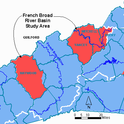
Figure 12. French Broad River Basin Study Area |
The land use analysis stream restoration site search steps used in the French Broad Study, were similar to the Catawba Study, but two additional steps were included. These were using the GIS to determine the slope of the valleys and sinuosity of the streams.
Slope
Calculation of slope used the hydrology (streams) and topography coverages. A fall of 20 feet over 1000 feet equals a 2% slope. Essentially, the streams were cut with the topography, to give lengths of stream equivalent to a 20-foot change in elevation. Any segments longer than or equal to 1000' were kept.
This procedure was done in ArcEdit, with the following commands:
- the streams coverage was 'generalized' by 10, meaning some vertices were removed, to make the arcs slightly straighter;
- 'intersectarcs' was turned on, and then the contours intersected with the hydrology, using the 'get' command;
- the contours were then immediately deleted.
The result was stream segments whose length indicated the slope of the valley.
Sinuosity
Sinuosity is a measure of the amount a stream meanders within its valley, or winds from side to side. Natural streams typically have a certain amount of sinuosity. A straight stream is often an indication that it has been channelized or moved, and therefore could be a candidate for restoration. The sinuosity is calculated by the amount that a river meanders within its valley, calculated by dividing total stream length by valley length. A sinuosity of 1 indicates a straight stream, 2 would be a very windy stream.
The stream coverage was copied and then 'generalized' in ArcEdit, until there were no vertices left between intersections of the stream. This coverage was then 'built' and related back to the original coverage using the stream-id number. The coverage was converted to a shapefile, and the associated table converted to Microsoft Excel format. In Excel, the original stream length was divided by the 'straight' stream length, to give a measure of the sinuosity. Those streams with a sinuosity of 1.2 or less were included in the list for potential stream restoration sites, after reselecting for appropriate surrounding landuse and a gentle slope of the valley.
Steps 5, 6 and 7 - Negotiate Property Ownership, Feasibility Study, Purchase/Construction
Once suitable stream and wetland restoration site searches have been identified, NCDOT Right-of-Way agents negotiate property ownership. This can either be through outright purchase of the land, or through a permanent easement on the property.
Once a site is determined to be feasible, Feasibility Studies are carried out to determine the best engineering approach to the stream or wetland restoration. Earth Tech stream engineers are trained in the 'Rosgen' method, or 'natural channel design', which takes into account many aspects of stream dynamics, including slope, water budget, meander length and sinuosity. Earth Tech is currently doing feasibility studies on one of the stream sites identified from the Cape Fear River Basin search, and three stream sites in the Catawba River Basin search.
Following successful negotiations with the property owner a detailed mitigation/restoration plan is developed for approval by the regulatory agencies. Upon approval of the plan detailed design/construction plans are developed. Once the stream or wetland has been designed, it is constructed, dependent on budget, of course. Contractors are put under contract to perform different parts of the design, such as grading, and tree planting.
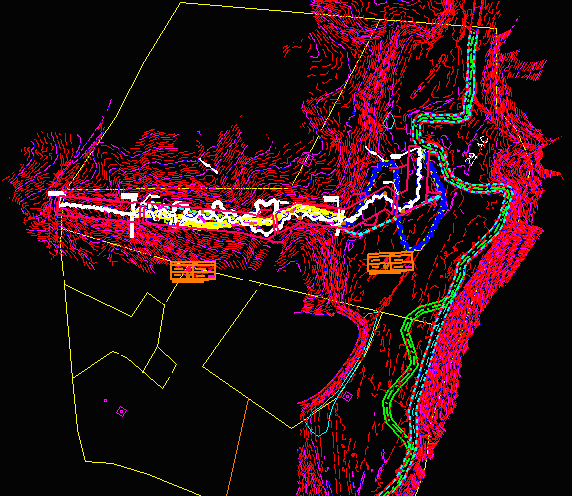
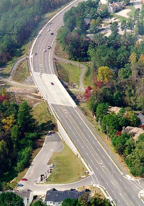
Figure 13. Stream Design in Microstation |
Conclusion
Earth Tech has developed some automated GIS procedures to search for potential stream and wetland restoration sites. Potential restoration sites are hard to locate as there are many factors involved in a viable site, including surrounding land uses, soil type, landowner willingness and budget. Feasibility studies are now being done on some sites identified in the searches, and Earth Tech is assisting NCDOT in bringing projects to completion.
Acknowledgements
I would like to thank Ron Johnson and Jane Almon (both Earth Tech) for their help, advice and perserverance while working on these projects.
Kilmeny Stephens
GIS Specialist
Earth Tech, Inc.
701 Corporate Center Drive
Suite 475
Raleigh, NC 27607
(919)854-6216 Phone
(919)854-6259 Fax
kilmeny_stephens@earthtech.com