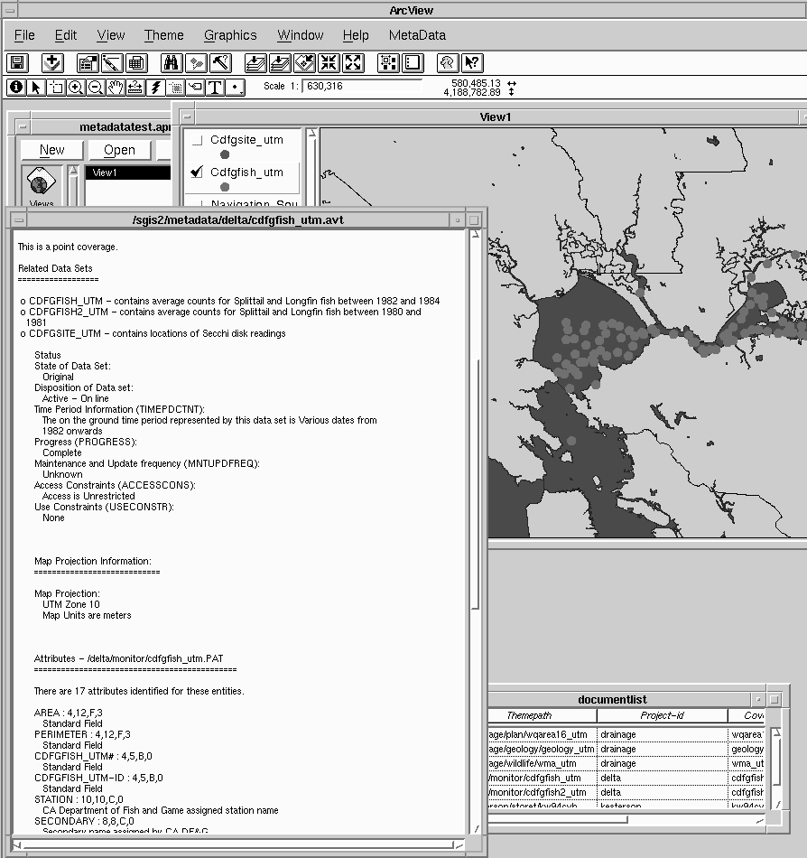
A smaller set of these metadata elements is also produced to meet the needs of our ArcView users. This metadata besides identifying the data set and describing attribute information and associated tables, also identify the data set map units and the resolution of features with suggested display scales. Avenue scripts provide access to these descriptions as well as to the project and theme indexes. This permits the user to browse the metadata for other GIS data sets for the same project or by theme with MOSAIC or NETSCAPE.
The metadata in these text files only represents a subset of the information needed for the transfer of GIS data sets. When a data set is ready for transfer, the existing metadata files are reviewed. A file containing lineage information is prepared and updated. This information along with a file describing MPGIS compliance to the standards completes the metadata description. This file on compliance identifies the metadata elements described and the terms used by MPGIS that are not in the standards. Metadata elements that are not addressed in the metadata description are identified and explained.
This paper concerns the implementation of the Content Standards for Digital Geospatial MetaData for the use and benefit of the organization. The costs in preparing and maintaining metadata have usually not been considered in the development of data sets including geospatial data sets. These costs include delays in providing requested information while the required metadata is prepared and reviewed. There are also benefits to the organization. The Content Standards identify reduced cost in avoiding the duplication of existing digital data sets. The E.S.R.I. White Paper on Metadata Management in GIS identifies benefits accruing to the full integration of metadata into the information base of the organization. It is clear that the development of metadata in any organization will always be a problem where the benefits of full access and use of metadata within the organization do not clearly exceed the costs in developing and maintaining metadata.
Metadata should be viewed as a component of the GIS data set that provides information supporting the use and application of the data set. As a dynamic component, it can be used internally by the organization as well as support the transfer of the spatial data to others. To illustrate this, the integration of metadata into our organization, MPGIS, will be described.
This paper represents the further development of concepts presented in a paper by Hansen and Sebhat at the 1995 E.S.R.I. User Conference. This previous paper focused on sections of the standards and the incoporation of that information into text file format. This paper focuses on the development of metadata to meet the needs of our organization for use as:
A secondary unit of organization used by MPGIS is the data base theme. Data base theme is used as a cross index to similar data sets that are under separate project accounts. It assists in identifying similar GIS data sets that may have additional information or improved spatial resolution that cross project boundaries. A review of themes also provide users the opportunity to browse similar data sets that may be useful for their applications. It assists in maintaining consistency in the structure and description of data sets of the same theme.
The project identifier and the theme act as the key items for accessing MPGIS data sets and metadata. They cross reference the MPGIS text files of metadata. These text files provide the following information about the data sets.
The text file provides information for setting the map units of the view. Minimum and maximum display scales for individual themes are also suggested. It provides an estimate of resolution of features which can be useful in developing the view. Avenue scripts provide an opportunity for automatically setting view map units, maximum, and minimum display scales based on the themes that are loaded.
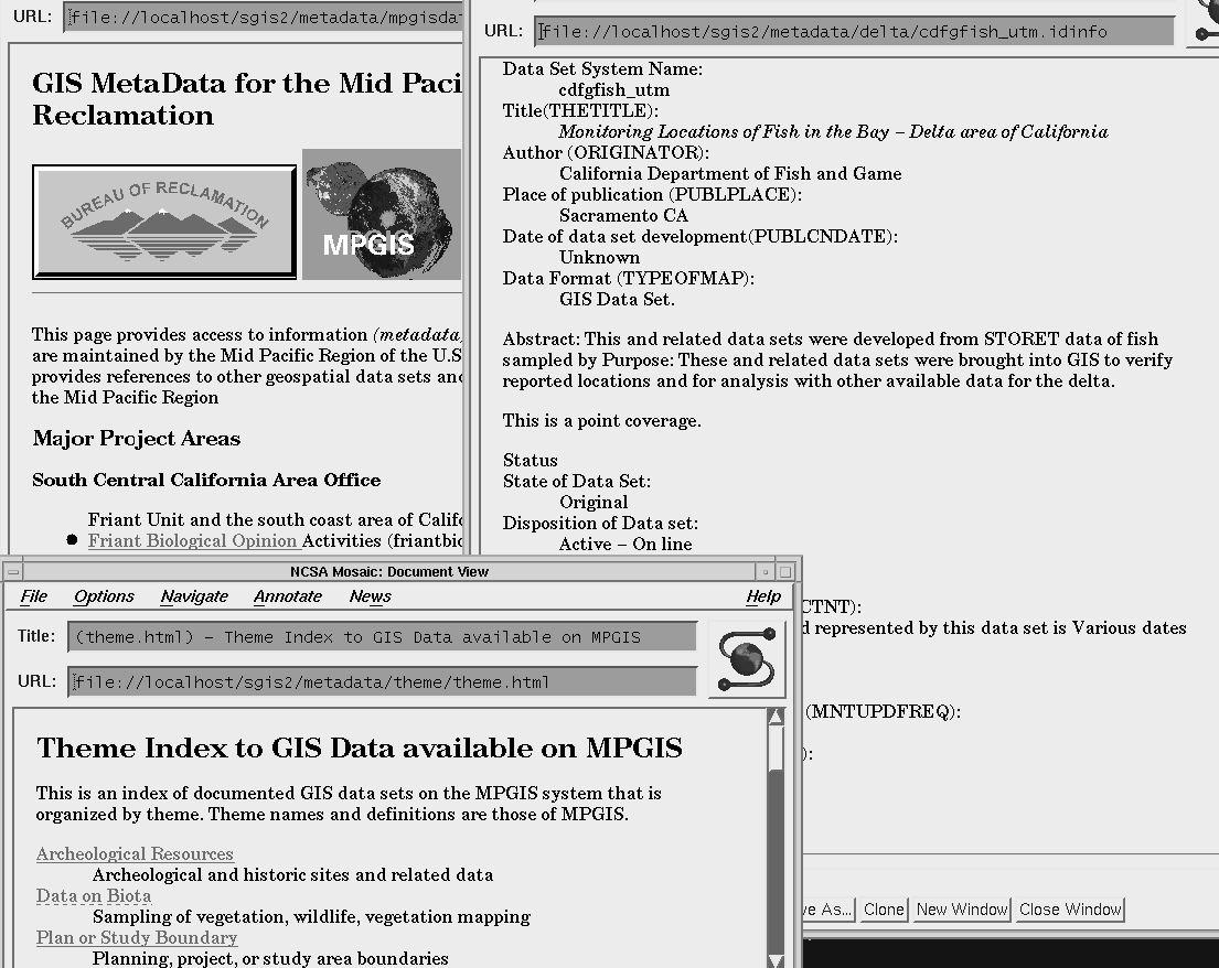
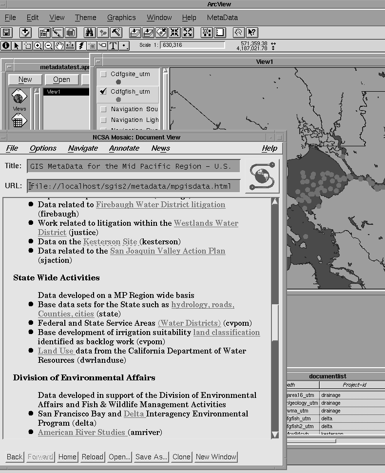
Menu options provide the opportunity for searching the online catalog of other GIS data based on project or theme. Scripts start up the HTML viewer to access the project index or the theme index.
Some data sets are inherently more complex. Some require extensive coordinate or feature adjustment to match the project base data set. Some have been updated because of changes in the spatial or attribute components or both. More accurate coordinate information may have become available. Changes may have occurred in the representation of the spatial features such as boundary changes, construction of a road, or addition of sampling locations, etc. The attributes may represent periodic reporting of sampling data. All represent changes over time with the development of a complex history. This history represents the data set lineage. Data set lineage provides the basis for assessing the quality of a data set for an application.
The lineage describes the sources used in modifying a spatial data set and should identify the features that were modified. The initial step is identifying the initial source data set, coordinate transformations, and adjustments. As the data set is further modified, the lineage report needs to be reviewed and updated. Part of this information is available in ArcInfo or in the system log files. MPGIS describes the lineage of a data set in a separate file which is stored with the other metadata files.
A complete metadata description is not prepared at one time but only as appropriate. The first major components are those prepared for the on-line data catalog. Major sets of elements in the Content Standards covered in these files are the following:
Metadata required in data transfer is more comprehensive than that developed by MPGIS for on-line catalogs or for data management. Some of this information is required for a successful data transfer where the transfer involves other software or hardware systems. Some is required to document the terms used and the authorities for those terms. Much of this and other information is the same for all data sets held by an organization. Duplicating this information in the metadata for a data set can add substantially to the size of the data set without providing much additional useful information.
For MPGIS, this is handled by an overall file of the FGDC metadata elements. Elements which are addressed in the MPGIS metadata are identified. Their location in the prepared files, type, and domain are given. Elements which are system dependent or which are common to all MPGIS data sets are described in this file. Elements which are not addressed by MPGIS are identified and explained. Terms which are not contained as elements in the FGDC standards but which are used in MPGIS metadata are identified and defined. This file acts as a statement of compliance with the Content Standards for Digital Geospatial Metadata . It can also serve as a lookup table for use when data transfer occurs or when the standards are modified.
Metadata for the GIS data sets are prepared as HTML documents for use with an HTML viewer or as text files for use in ArcView with Avenue scripts. Indexes are set up based on MPGIS projects and data set themes. The indexes link the HTML metadata documents for use both on the system and for access via INTERNET. These interim metadata files serve as the basis for preparing metadata for GIS data transfer. Metadata for a GIS data set is only considered to be complete when the data set lineage has been prepared and reviewed and the data set is ready for transfer.
The Content Standards for Digital Geospatial Metadata is used as a guide in the development of these data set descriptions. It provides the names and definitions for most elements used. The metadata prepared by MPGIS is based on:
E.S.R.I. besides providing DOCUMENT.AML as a metadata managment tool is also in the conceptual stage of developing a metadata manager. This manager would share metadata between ArcInfo and ArcView. The manager is briefly outlined in the white paper Metadata Managment in GIS .
A Dublin CORE group is in the process of identifying key elements for indexing of digital documents including geospatial data. Such an index would act as a bibliographic listing. It would assist in performing queries against data bases constructed with the core elements. An ISO (International Standards Organization) is beginning to prepare standards on metadata. The current FGDC standards are under review for modification and further extension.
E.S.R.I. Metadata Management in GIS .:Esri White Paper Series. Redlands, CA, August, 1995.
FGDC. Content Standards for Digital Geospatial Metadata . Washington, D.C. June 8, 1994.
Hansen, David and Michael Sebhat. Compilation of Spatial Metadata for Access in ArcView and Mosaic . Paper presented at the 1995 E.S.R.I. User Conference. Palm Springs, CA May, 1995