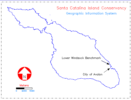
Location of the City of Avalon and the Lower Windsock USGS benchmark.
Both these sites are on the island's channel side and have partially
obstructed horizons to the west due to the island's main ridge.
Location of the City of Avalon and the Lower Windsock USGS benchmark.
Both these sites are on the island's channel side and have partially
obstructed horizons to the west due to the island's main ridge.
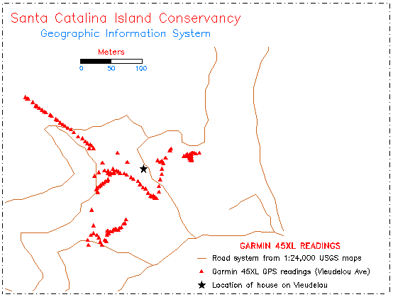
Readings taken with Garmin 45XL (red triangles) at post outside house (black
star) on Vieudelou Avenue, City of Avalon, January 21, 1997.
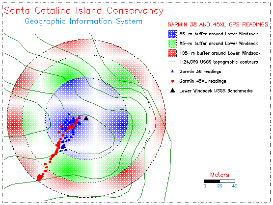
Coincident readings taken with Garmin 45XL and Garmin 38 GPS receivers
at the Lower Windsock USGS benchmark on March 1, 1997. The three
concentric circles indicate a 55- (blue), 85- (green) and 105-m (red)
radius from the actual USGS benchmark location. Note the tighter
clustering of the readings from the less expensive Garmin 38 unit.
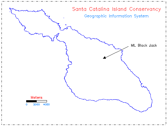
Location of Mt. Black Jack, second tallest (612 m) peak on the island
with a nearly unobstructed horizon allowing acquisition of all
available satellites and optimal satellite geometry for tests
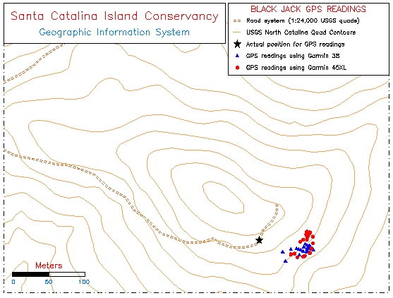
Coincident readings taken with Garmin 45XL and Garmin 38 GPS receivers
near the summit of Mt. Black Jack on March 22, 1997. These readings
exhibit a tighter and more consistent series from both models.
 Return to main text