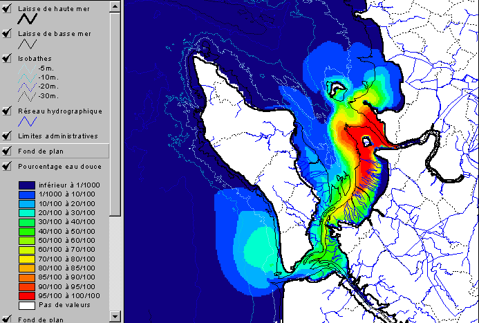
figure 10b : river flood modeling
Data sources : Ifremer Mars2D model, IGN and SHOM GIS data
Data processed by Ifremer
This figure results from crossing information derived from Mars 2D hydrodynamic model with GIS data : simulation of the extension of the Charente river plume within the Marennes-Oléron basin.
for more information about the Mars2D model see http://ifremer.fr/delao
Contact : Marguerite.Breton@ifremer.fr