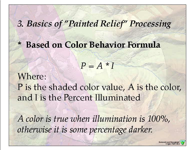
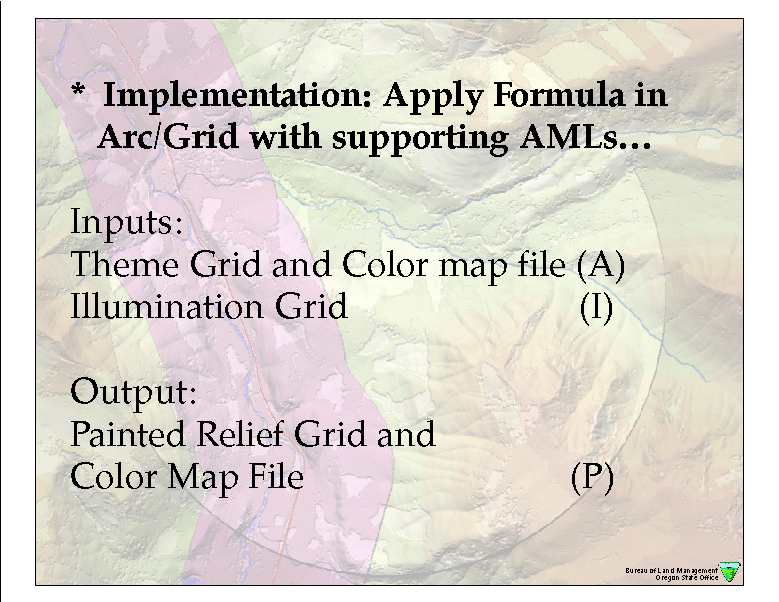
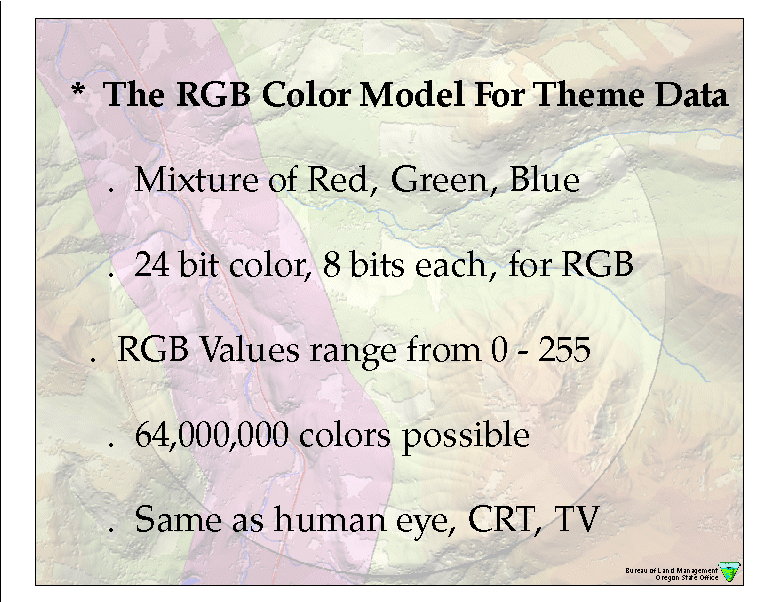
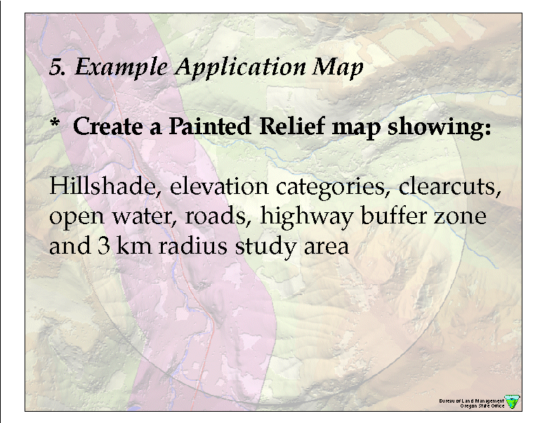
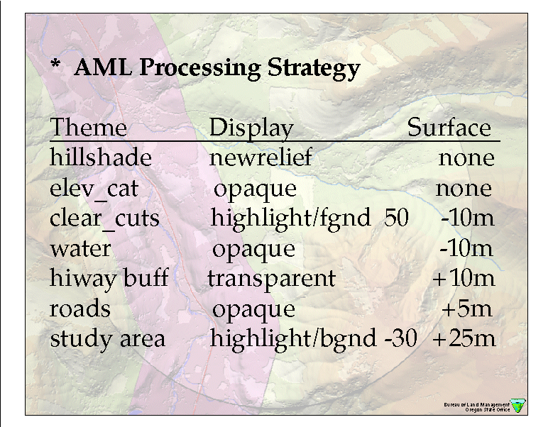
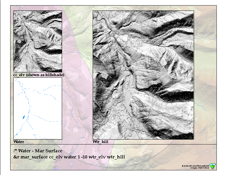
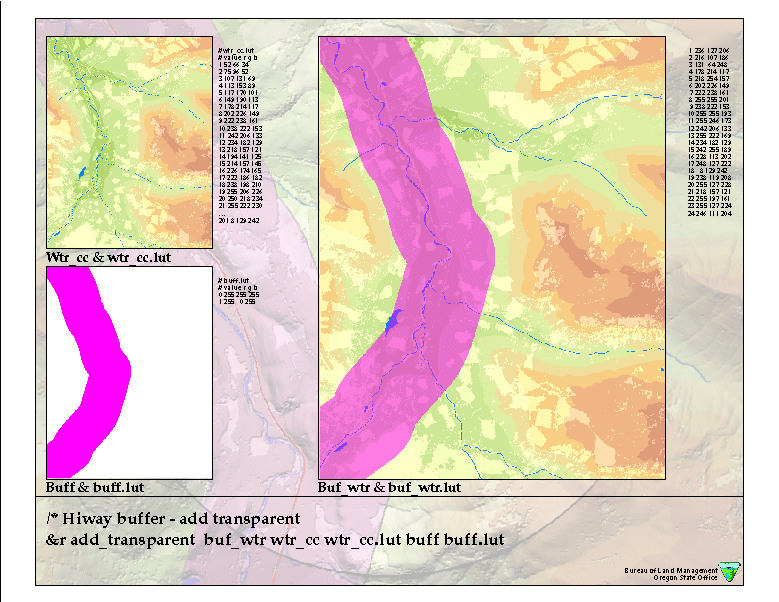
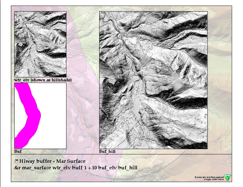
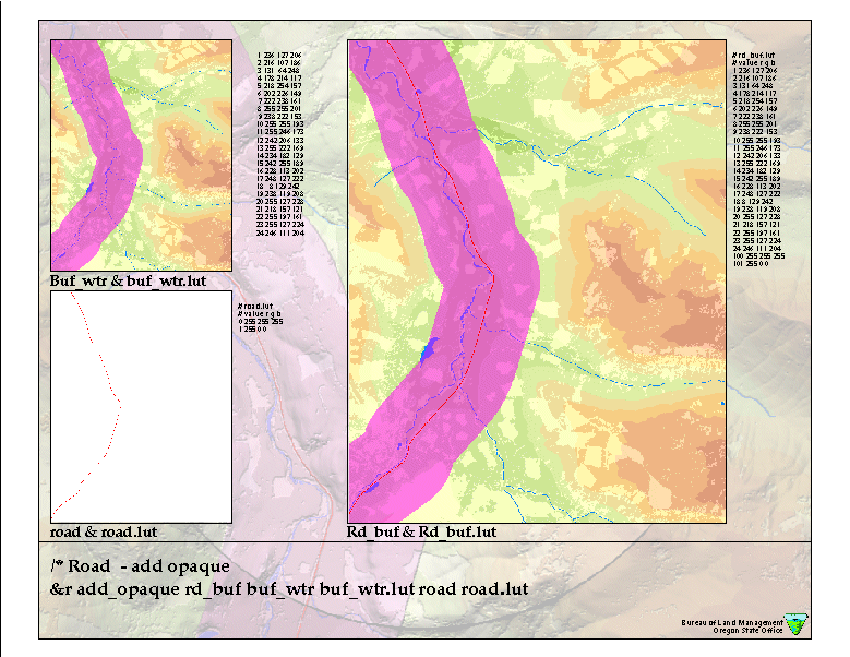
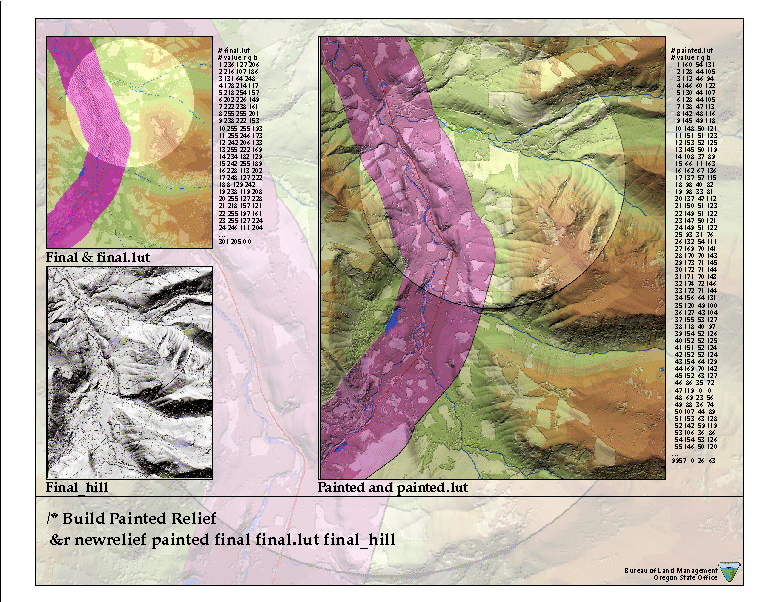
One of the most effective ways to communicate the lay of the land is through a beautiful "painted" relief map. When the geography of an area is presented in this fashion, map users can gain a deeper understanding of the makeup of a region at a single glance. Beautiful "colorized" relief maps are also more interesting and thought provoking than traditional maps and are a necessity for presenting the complex situations that arise when providing maps used for Natural Resources and Land Management projects and research. However, there has been reluctance to require or ask for relief maps because of the perception that they are difficult or expensive to produce. Even today, the methods for creation of colorized relief backdrops for maps is not readily apparent in many "out of the box" geographic information systems (GIS), even ArcInfo!
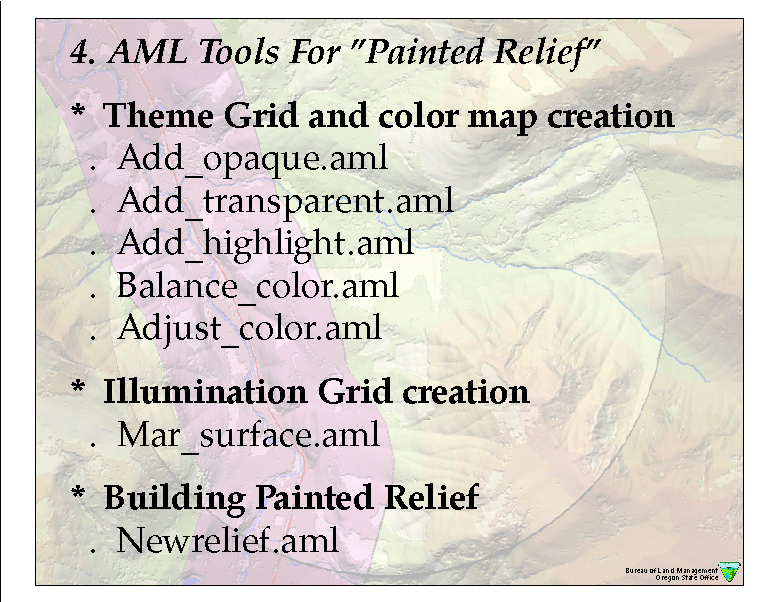
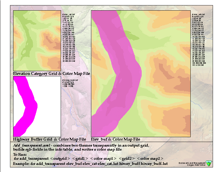
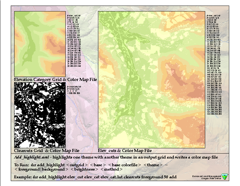
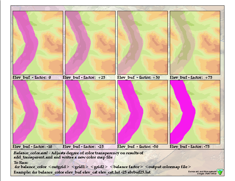
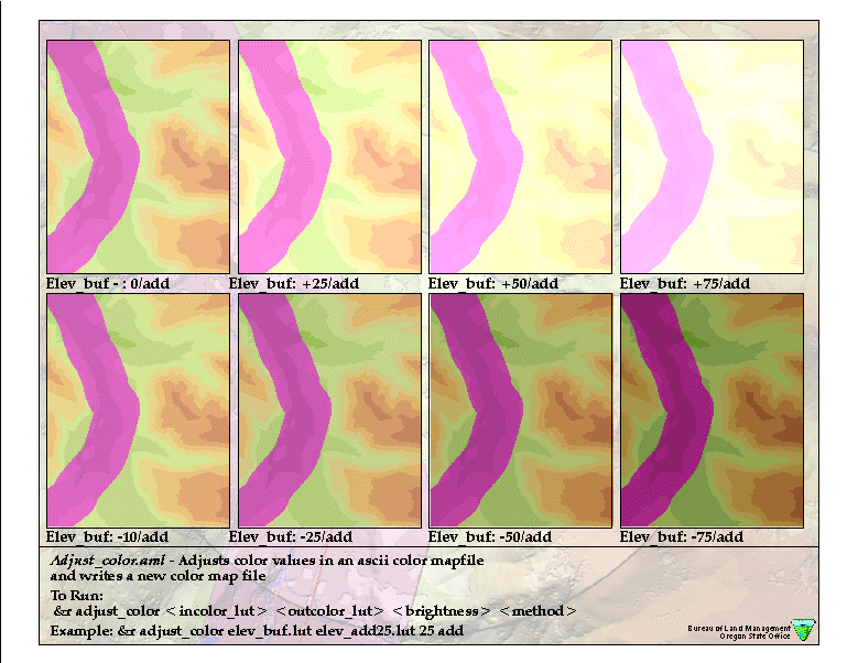
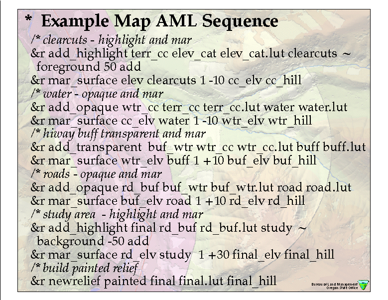
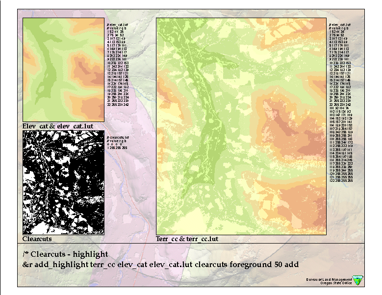
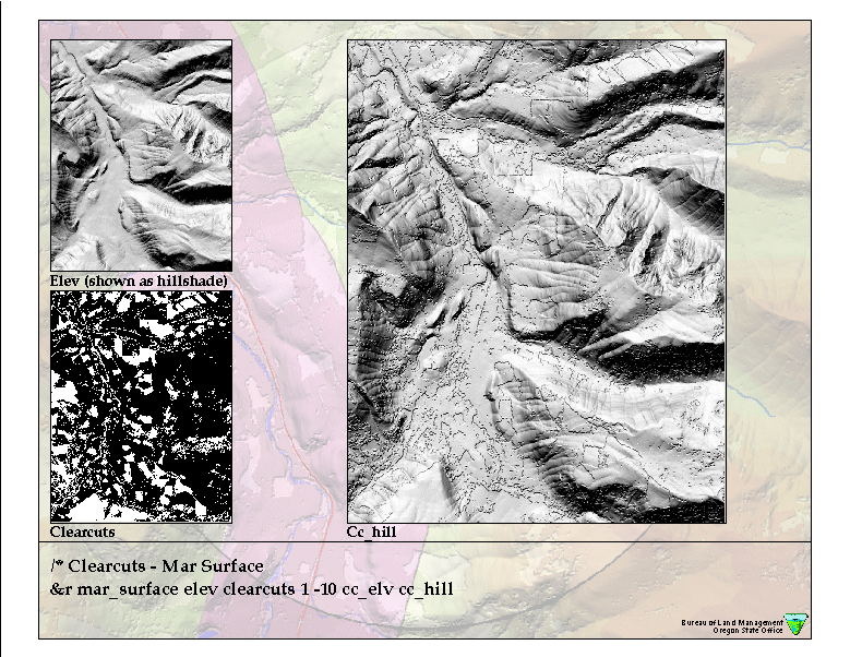
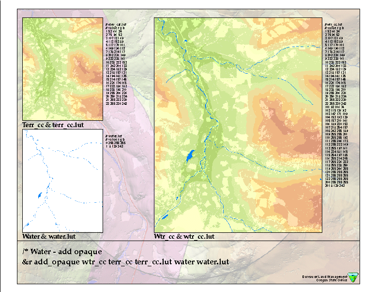
This presentation discussed how beautiful and interesting painted relief maps are created at the Bureau of Land Management offices in Washington and Oregon using a variety of Arc Macro Language (AML) programs. These programs have made colorized terrain maps cheap, quick and easy to create. The images below are the slides from the 1999 user conference presentation. A detailed paper on Creating Beautiful "Painted Relief " Using Arc/Info may be accessed on the World-Wide-Web at www.or.blm.gov/gis. You may also contact the author for advice and copies of new programs by email: jnighber@or.blm.gov.


Jeffery S. Nighbert
Bureau of Land Management
Oregon State Office 955.2
1515 SW 5th Avenue Portland, Oregon 97201
Phone:(503) 952-6399 Fax: (503) 952-6419
Email: jnighber@or.blm.gov
Jeffery S. Nighbert has been a geographer with the Bureau of Land Management for over 15 years and is currently the Senior Technical Specialist for Geographic Information Systems (GIS) at the Oregon State Office, located in Portland, Oregon. He has extensive experience in GIS and holds a M.A. in Geography from University of New Mexico.