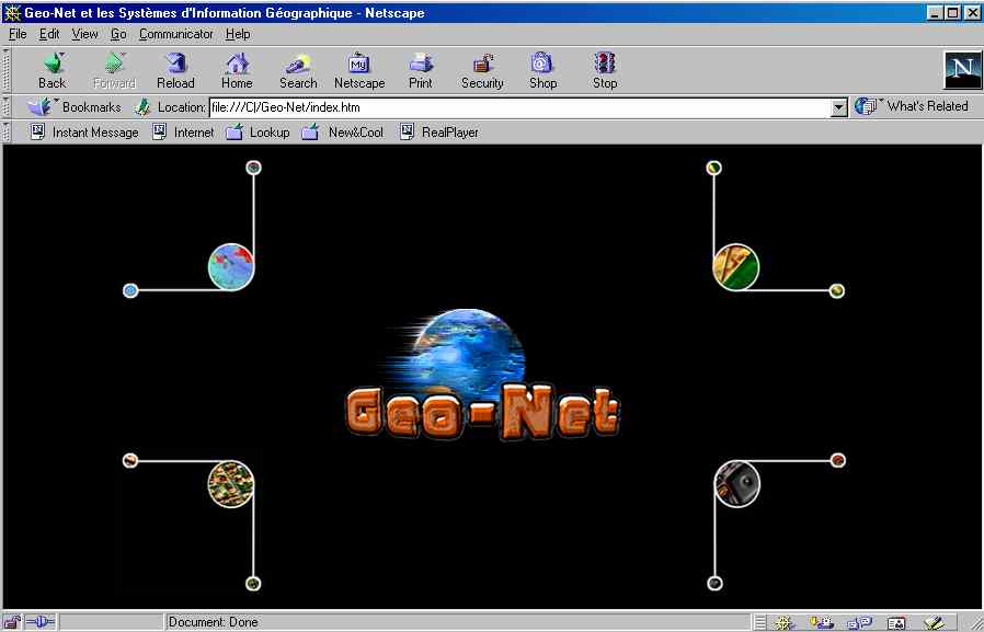
Figure 1 - Geonet website.
Since 1999, the University of Nice-Sophia Antipolis (France) has opened a web site (http://www.unice.fr/geonet) dedicated to the GIS technology. Geo-Net has been created to explain the GIS concepts to the a large public which gathers the students from the university of Nice in different departments as geography, geology, medicine, biology, � , for some other universities and also municipalities, public services. The web site, mad by students with the support of teachers, gives some information on the GIS technology with different applications and explains, in a practical section, how to use ArcView step by step (from several examples and screen prints). Geo-Net is now largely used by people looking for basic knowledge on GIS and ArcView. A new version of Geo-Net based on ArcIMS (http://geonet.unice.fr) is now in progress. This new version will allow a real interactive participation and improve the learning process.
Since 1999, the University of Nice-Sophia Antipolis (France) has opened a web site (http://www.unice.fr/geonet) dedicated to the GIS technology. Geo-Net has been created to present and explain the concepts of the GIS technology. This Website has defined to provide an initiation for the students of the department of Geography and also to all the people interest by the GIS. At the University of Nice Sophia Antipolis, Geonet is widely used by several disciplines as geography, geology, medicine, biology, sociology, �Geonet is not limited to the students of the university but also open to other university, public services, municipalities. The access is completely free.

Figure 1 - Geonet website.
Since 1997, GIS technology is developed in several post-graduate programs as Hydroprotech dedicated to the management of hydro-technological projects (http://www.unice.fr/hydroprotech). Every year, about 150 students follow a training course on ArcView during 30 hours. Due to the interest of the students for the GIS and also of the professionals, the necessity was to support these activities with a free access Website. The interest of a Website is clear because this basic technology, people can easily access to the information.
Geonet is not a simple copy of a traditional course but an environment where the key concepts of the GIS are presented. The creation and the development of the Website is a team work: every year a team of students (3 to 4) specialised in new technologies and communication realised the development of Geonet with the active support of several teachers of the department of geography. Clearly, in this approach, the iniative is taken by the team of students which is fully responsible of the content, the design and the ergonomic tasks of the Website. The main task, during the first year of the project, was the choice of the graphical chart and the definition of the contents of Geonet. The general idea was to explain the basic concepts through examples and applications realised in the same geographical area. To achieve this objective, the National Geographical Institute (IGN - France) has provided a set of numerical data located on the city of Mulhouse, France. All the applications are realised with this set of data. Another sensitive point was to define the technology used for the Website development to assure portability in all browsers. To reach this objective, simple solutions - htm and GIF format - have been retained.
In a second step, Geonet has been completed with a Flash version which simulate the use of ArcView.
The Website Geonet is organised around 4 chapters which can be reach from the introduction page:
In all the pages, the concepts of the GIS, the application in ArcView, the definition of the basic terms and the use in several projects are resented. Each chapter is presented in details in the following paragraphs.
The chapter In theory allows to present the fundamental elements to understand the concepts of the GIS. The chapter is divided in 4 main rubrics:
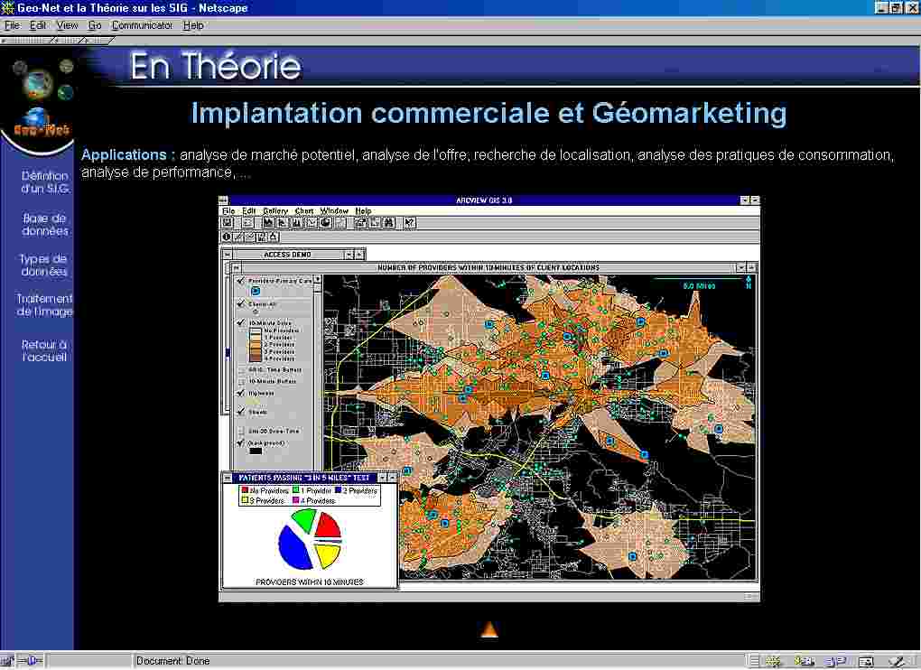
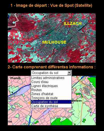
Figure 3 - Geographical data base
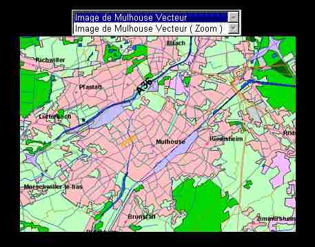
Figure 4 - Vector presentation
This chapter is most documented part of Geonet. In this section, a set of exercises allows to understand the use of ArcView with several simulations. The basic concept is to discover the main functions of the GIS applied on the same geographical area. The application is realised with the data provided by the National Geographical Institute (IGN). In the first version of Geonet, the approach with screen captures - GIF format - has been chosen to promote an efficient pedagogic approach and compatibly with all the web browsers. The text is completed with several pictures which can be selected in a menu. The chapter gathers 8 exercises which allow the user to discover and learn the all the basic commands and procedures with ArcView. Due to the widely diffusion of the Flash technology, a second version of the exercises has been produced. The user have now the choice between the 2 technologies. This development has been realised and implemented 2 years. The practice of all the exercises allows to the student to know enough to start a project with ArcView. All these elements are used during the courses on the GIS technology and also as a tutorial during the practical exercices.
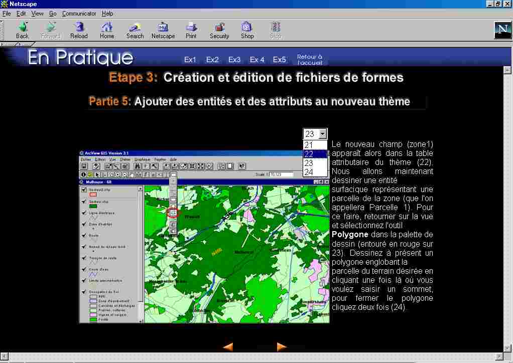
Figure 5 - Exercice sample
The glossary gathers a set of definitions for the basic terms used in the GIS technology. Several links allow to reach different parts of the Website.
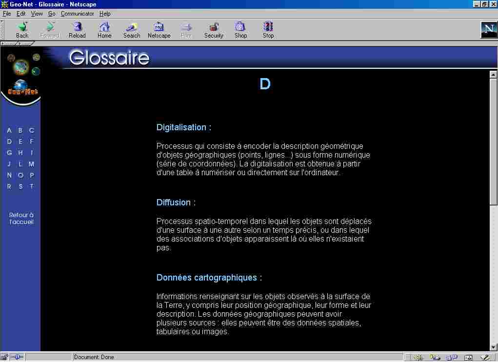
Figure 6 - Glossary
This chapter presents specific applications realised with ArcView and with different thematic projects as environmental management, geology, biology and geomarketing. In the applications, the interest of specific tasks as the production of digital elevation models, the use of grids and the 3D visualisation.
Since 2001, the production of a new version of Geonet has been
started with the support of Esri. The idea was to modify the In practice chapter
with the use of the ArcIMS. In fact, ArcIMS allows more interactivity with the
user who is able to formulate queries, zoom, analysis, �commands. The new Website
has been designed during the last 10 months. The ergonomic design has been completely
redefined - specially the ArcIMS interface - and organised around 4 chapters
similar to the first version of Geonet. The use of ArcIMS is developed in the
practice rubric. To be really interesting for the user, numerical data were
needed .
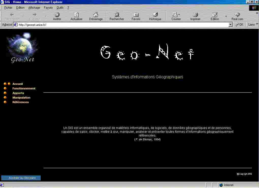
Figure 7 - New Geonet
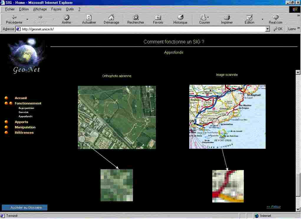
Figure 8 - Definitions in Geonet
A partnership has been defined with the City of Nice which has provided a part of the municipal database: parcels of all the city. The user can now use ArcIMS and apply all the commands available in the new ArcIMS interface. This new development is of course still in progress and will be soon completed with more data on the area of Nice. Several partnerships will be concluded with regional partners and the National Geographic Institute (IGN).
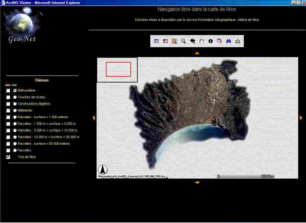
Figure 9 - ArcIMS application
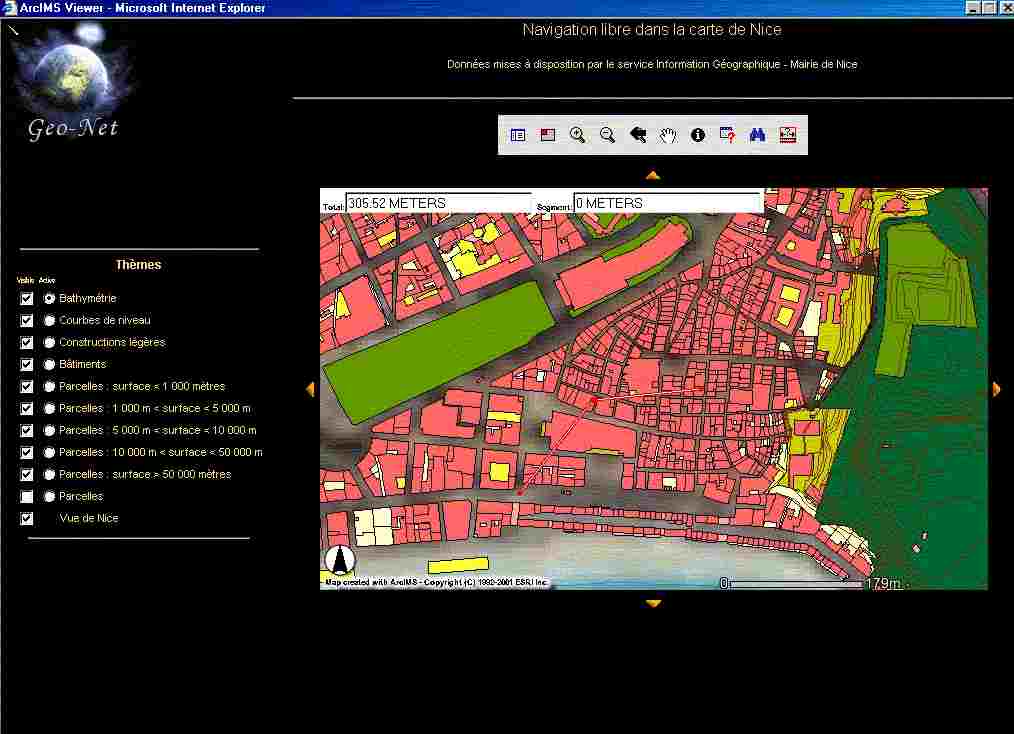
Figure 10 - ArcIMS application on downtown area
The Geonet experience demonstrates the interest of the GIS technology. The most significant result is the interest of the students and of the professionals - universities, municipalities, public services, consultants, � - and the widely use of the free access Website. Another important point is the pedagogic approach of the project. The successive student teams have been fully in charge of the project. This strategy is largely appreciated by the members of the team and allows to obtain a very high motivation. The use of Geonet is the courses is now regular since more 4 years in the university of Nice - Sophia Antipolis. The Website is used to compete the traditional courses and to develop interactivity with the students. Finally, the experience demonstrates the high potential of a web base approach to promote the GIS technology.