James Sadd & Melissa Sanderson
GIS for a Small Urban Campus: Occidental College, Los Angeles
Since 1996, we have been developing a campus GIS to enhance coursework and student research projects, as well to integrate GIS into campus facilities management for analysis of resource use and to develop tools for a more cost-effective operation. With no legacy geographic resources available except for many generations of paper maps, students generated the GIS database using a variety of data automation tools, and used spatial analysis to evaluate a variety of campus resource issues in courses and in independent research projects with the goal of developing recommendations for improved campus operation. The presentation will discuss lessons and pitfalls of (a) database development �from scratch�; (b) working with students to create a campus GIS; (c) integration with campus operations.
A Campus GIS Database
In 1995, the Andrew W. Mellon Foundation awarded a grant of $300,000 over three years, to Occidental College to develop and execute the Mellon Resource Reclamation Program at Occidental College. This Program was to allow the College to transform its Environmental Science and Policy Program from a traditional global perspective to a focus on the conservation of campus resources and the reduction of energy and utility costs. Grant funds were specifically intended to support curriculum development, implementation of a reclaimed water program for landscape irrigation, computer hardware and software for Geographic Information Systems, salaries, and summer internships. Occidental set out to develop a campus GIS database to use digital mapping and spatial analysis techniques: (1) to analyze and develop options for more efficient use of resources in campus operations, and make appropriate changes to achieve cost-savings; (2) to integrate this process into the curriculum of an interdisciplinary Environmental Science and Studies program to help students both understand environmental issues, and learn skills needed to address environmental problems by combining a foundation of fundamental understanding of environmental issues with analytical and problem-solving skills.
We developed and completed campus projects related to resource use and GIS analysis, including a solid waste audit and plan, surface water runoff and flooding analysis, improvements to Campus Lighting Plan for exterior campus lighting. We succeeded in building our campus GIS database and enabled people to use this data analytically, put our technology and information tools to work in quantitative analysis of landscape water use on campus and other projects, integrated this process into student learning by enhancing existing courses and creating new ones, providing opportunities for independent student research and problem-solving projects, and created a working environment in which students, faculty and Facilities Management staff work together to toward common, pragmatic goals for improvement of the campus and the College. This investment by Mellon Foundation into cost effectiveness and improved student learning has achieved for Occidental precisely what it was intended to do: stimulate creative, collaborative, fiscally-sound approaches to areas in need of organizational change.
Over 50 layers were created for the campus. The most important ones are listed below.
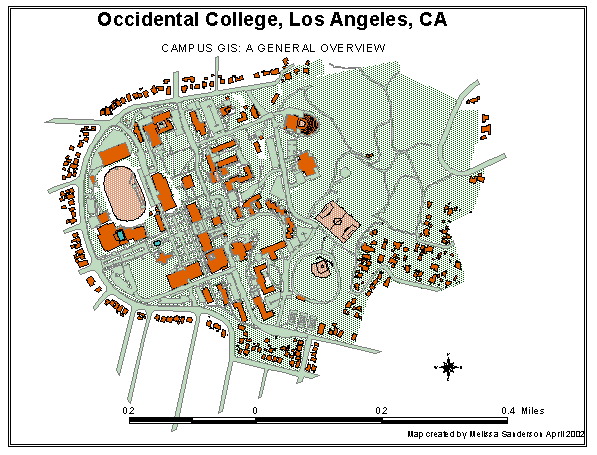
CAMPUS GIS DATABASE � SUMMARY
Numerous attribute data files are part of this database, and which like to spatial features
GENERAL
Surveyed Boundaries of campus owned land
Building footprints (exterior walls; rooflines) � includes off-campus buildings
Paved areas
Parking areas on campus (aerial polygons and point-based by parking type)
Topography (isolines, DEM grid, DTM; 1 ft. resolution)
Landscape vegetation installed/planned
Vegetation census transect areas in undeveloped upper campus
Urban forest pathway
Walls and fences (with types)
Subwatersheds and drainage vectors
Source/Sink point locations (surface runoff)
Linefiles of campus features (roads, pedestrian walkways, tree cover, partial tree inventory, etc.)
CRITICAL CAMPUS FACILITIES
Natural gas distribution lines and valves (meters, shutoff valves)
Wastewater/sewage lines and access points (manholes and cleanouts)
Water distribution lines (outside buildings only; includes chilled water system)
Water points (meters, valves, backflows, fire hydrants)
Underground tunnel network location
Exterior lights (buildings and pole lights)
Virtual Inventory: Footprints of rooms in academic buildings linked to attribute data
FRAMEWORK MASTER PLAN
Pedestrian pathways
Roads by vehicle type
Open space plan
Land use with projections
Visual axes
Building sites for future development projects
IMAGERY
Georegistered black and white aerial photos of campus (1996)
Georegistered color aerial photo of campus (2001)
Photo set of all exterior lights
Photo set of all buildings
CAD drawings of new and recent building projects (georegistered scans)
As-built drawings, old maps and blueprints (Buildings only at present) (georegistered scans)
ALL THEMES AUTOMATED FOR USE IN 3D VISUALIZATION AND ANALYSIS.
Problems Encountered & Lessons Learned
Some problems we encountered limited progress and are discussed in some detail here to both document them and to guide others who may pursue a similar project or wish to replicate aspects of this one. All of these problems were unanticipated at the start of the grant, and not all are unique to Occidental College.
Database Development from �Scratch�
The first was our underestimation of the time and experience required to develop a GIS database that was appropriate for analysis and problem solving of the type we set out to do. At present, our GIS database is quite detailed and precise, but this task proved to be much more time consuming than originally anticipated. Faculty had to obtain sufficient training to use the software, and enough experience to understand critical data concepts necessary for accurate results. Students required significant training time and experience before they could work productively and accurately in database automation. We periodically lost valuable students to graduation, while a few others withdrew from the project, for various reasons, before training and efforts could be applied to maximum effect on the Program. We found that some of the Facilities Management employees who were selected to work with us were lacking in computer skills to the degree that significant additional training and experience was needed before they could use the GIS training effectively and become productive. Creating the database �from scratch� (no previous digital records; all information automated from hard copy, GPS and eventually air photos) was fascinating and richly educational, but required much more time and error checking than we anticipated. As it turns out, this underestimation is not entirely due to our inexperience or poor planning. Over the past decade, GIS industry standard estimates of GIS costs have seen an increase of the costs attributed to the acquisition, translation, conversion and maintenance of geospatial data from about 60 percent to nearly 80 percent of the total GIS investment. One would expect an even greater percentage in a case like ours, in that we began with no fully trained or highly experienced people, some of our best people left the project when they were most productive (students who graduated), and did all of our work with people working on the project part-time.
In the database building process, we also discovered that we required a much higher locational precision than we originally anticipated. We had planned to use the same coordinate system as used in previous conventional surveys of the campus performed by professional surveyors. These surveys used arbitrary geographic coordinate systems (usually based on the State Plane system referenced to an obsolete datum NAD 27); measurement error that varied from survey to survey, and irregularly across the campus, and lacking a relationship to a real-world coordinate system there was no way to use this data with new data that we were adding using GPS (Global Positioning Systems). Our GIS database has been constructed using real-world projections selected to maximize accuracy for a give application, and referenced to a modern datum (WGS84); we are able to obtain decimeter-scale agreement with our GPS (differentially corrected) when adding new data or corrections are needed. Registering old data to a useful coordinate system and introducing a greater level of accuracy was time-consuming and training intensive, but we now have an comprehensive, high accuracy database which is much more useful and flexible than we originally thought it could be, and which has eliminated many of the problems and errors inherent to the generations of historic campus surveys upon which early mapping efforts were based. These are the types of problems inherent to the use of any complex technology, but recent rapid advances in GIS software and GPS hardware during the Program period actually increased our workload by increasing our data requirements. We have been rewarded, however, with an excellent database and with the skills and experience that result from completing a complex project. We have also reached a transition point where the value and utility of the database is yielding increasingly useful benefits.
Working with Students
Occidental students comprised the work force behind the creation of the database. This was a definite benefit to the project. They gained experience in GIS and we gained a database. We found that they learn the software and technology more quickly than the faculty and staff and that they are more comfortable with the technology and often are motivated by an interest in new technology. Students also naturally train each other, cutting overall labor costs. Because they are often academically invested in the project and are receiving extra training, they will work for less money than outside GIS technicians. Also beneficial was their knowledge of the campus; which would have been impossible for an outside technician to know coming into the project. The only real downfall to employing students to create the GIS was retention. We often lost our most efficient and well-trained students to graduation. Occasionally, they also took all the metadata knowledge with them, leaving without documenting the data. Students were often pulled from the GIS classes on campus, but some of our best had no formal GIS training, but were interested in learning through an independent study. We did find that it was well worth the expense to hire some of our more productive students as full time GIS technicians/project managers after they graduated. These students not only managed the database and created new themes, but they were able to trouble-shoot some of the other independent projects underway.
Independent Study Courses and Summer Research
The use of GIS in classes was augmented, and in a few cases piloted, by the students who use GIS and the campus database for independent research projects. At Occidental, we have a large and active independent research program for motivated and talented students, both during the regular academic year (independent study courses) and during a special ten-week summer research program. GIS and the campus database have also played an integral role in a number of independent student research projects, many addressing campus resource problems and design. Twenty two students have worked on the Mellon Resource Reclamation Program or, used the GIS tools and data, through independent research projects or in the summer research program. Some projects were the developed by more than one student, and a few students worked in more than one project. Those most directly linked the to the Mellon Resource Reclamation Program include:
-Four different audits of campus water use, costs, and landscaping
-Electricity price and use audit (pilot project only � data too limited)
-Quantitative evaluation campus outdoor lighting effectiveness, and of proposed changes to the campus lighting plan
-Quantitative study of rainwater infiltration, runoff and flooding on the campus with an evaluation of the effectiveness of the campus flood control
-Campus vegetation mapping including occurrence of native plant species
-Plant census and distribution in the undeveloped part of the campus for planning.
Analysis of plant species for the purpose of developing an �urban forest� walking path
-Spatial distribution and feeding behavior of bird species on the campus
Pilot project analysis of the spatial distribution of ant colonies for a portion of campus to examine correlation of spatial location with landscape irrigation system leaks
-Integration of high precision GPS mapping with GIS data to bring our database to decimeter scale accuracy and precision.
-Creation of a three-dimensional dataset to integrate with the Campus GIS data collection for use in 3D analysis and visualization
-Automation/image analysis of two generations of campus aerial photography (1995, 2001) to aid in further database automation, to allow more flexible error correction and database expansion and updating, and to provide valuable context when exploring vector geographic layers.
As GIS has enhanced the curriculum and learning environment, it has also produced a campus GIS database that is of significant value to the College for the more practical concerns of operating efficiency, cost savings, and improved planning and decision-making. Many of the student projects mentioned above represent components of our overall effort to assess resource use, and to improve institutional planning and operations so that cost savings can be identified and realized.
Integration with Campus Operations
The original Mellon Resource Reclamation Program set as one of its goals development of an environmental master plan of the campus related to resource use, consisting of basic data that was to be organized and analyzed using GIS. In accomplishing this goal, it was envisioned that the work of students, in courses and individual projects, would be integrated with the people and function of the College Facilities Management Department. In addition to our successes with the curriculum and student involvement, we also accomplished this integration - benefiting the institutional mission of FM by addressing their specific requests and priorities, while at the same time strengthening the academic program in a way that best helps students meet their post-College goals. There was, in fact, a symbiosis in operation that made this integration work. Much of the information needed to construct the GIS campus database and evaluate the questions that those in the academic program wished to engage either resides in, or is generated by, FM as part of its operations. The faculty and students working on the Mellon Resource Reclamation Program regularly obtained data provided by Facilities Management and worked with them to ensure that the GIS database contained the type of information, and was constructed in a manner, that FM could use to make better decisions and operate more effectively.
We experienced many problems related to continuity of Program personnel. Several people involved early in the project found themselves unable to continue. Four Facilities Management employees who were involved with the Program all left the College at various times to take other positions, requiring that we restart with new Facilities Management partners more than once. The most recent of these interruptions took place early in the final year of the Program, when Craig Pals, the former Energy Manager in the Facilities Management Department left the College, necessitating a significant reorganization in arranging for completion of the proposed work for the final year. Craig was instrumental in designing those goals specific to FM operations which were outlined in the proposal for the final year and had worked well with the academic GIS team of faculty and students during his tenure at Occidental, using our data for his own work and supervising a student who worked on GIS database data for his purposes. Our plan was for Craig to take on the primary responsibility, and workload, of integrating the Program into Facilities Management planning and operations during the final year, and we had worked with the Facilities Management Director to arrange for and fund this partial hiatus from his regular duties. Once Craig left the College, we again regrouped and developed a way to complete the proposed tasks successfully. We worked with three Facilities Management staff members who were assigned to the Program. None of these staff had any prior experience with the Program or with GIS, and all began working within the Program mid-year. They first required training, provided as a combination of formal GIS training, and later follow-up �workshops� designed and run by the GIS Project Manager to define and execute projects of their own design. For this reason they worked less intensively with the Program than originally proposed, which required faculty and students to take over much of the Facilities Management database building and analysis workload, with monitoring and input from our FM partners. This resulted in adjustments to the proposed budget, with funds originally earmarked to pay Facilities Management staff going instead to compensate the students and faculty who took on the extra work; because some of these students had already graduated and were no longer attached to the College, we engaged their services as consultants.
In addition, one of the supervising faculty members from the original Program required extended medical leave during the critical first year and never reengaged with the Program. Fortunately, in spite of our challenges with people moving out of the Program for various reasons, we have always found others to step in to work with us to complete our proposed tasks. This indicates both that the elements of this Program are sufficiently flexible and powerful to attract new collaborators within an institution, but also that any attempt to replicate this Program or similar academic/institutional collaboration be examined carefully for evidence of a clear commitment among stakeholders.
While working with facilities management was beneficial and necessary to meet our goals, we did run into some major problems. The changes in participants, as previously mentioned, was a large deterrent to productivity. We also were missing the necessary support of the administration; they were excited about the benefits but weren�t willing to commit the resources. Instead of making the GIS project a few people�s primary responsibility, it was tacked on as something they could work on when everything else was complete. The administration has also ignored a lot of the analysis work done by the students who utilized the campus database. Through the students� independent projects, there have been many recommendations for the campus to adjust resource use to be more efficient and cost effective. The only analysis they have truly adapted is the one that allowed them an immediate reimbursement of funds from a local utility.
Endnote
This is a very brief overview of over five years of work to create an integrative, flexible, digital database for our campus. If you have questions or would like more details, please feel free to contact either of us at the e-mail addresses listed below.
REFERENCES
Wilson, J.D., �GeoBusiness Watch� Geoworld, January, 2002, Adams Business Media Publishing.
James Sadd
Associate Professor, Geology and Environmental Science
Occidental College, Los Angeles, CA 90041
jsadd@oxy.edu
Melissa Sanderson
GIS Project Manager
Occidental College, Los Angeles, CA 90041
sanderso@oxy.edu