Damian C. Green
In the UK more than 90% of municipal waste is disposed of by landfilling( 1), indicating that its managed disposal is of extreme importance. Numerous EC directives and UK legislation, together with other environmental concerns, have put pressure upon contractors to get the maximum capacity out of the given volume of their landfill site with the minimum cost and minimal environmental impact. Landfilling practice, and therefore capacity, can be improved with proper monitoring using a Geographic Information System. Analysis of waste composition, degree of compaction and resulting density along with volumetric changes during landfilling, will ensure that the most efficient placement method is used and maximum capacity is achieved. A GIS can also play an important role in the long term environmental monitoring of closed landfill sites.
Waste disposal in the UK has changed dramatically over the last two decades, both with respect to its legislation and its public perception. For a long time it was considered as 'out of sight, out of mind' and somebody else's problem. The majority of the public knew that if they put their waste bin at the end of the drive it would be taken away weekly, but paid little attention to where it was going to be disposed. Only those directly affected by a landfill's location or vehicles entering or leaving waste disposal facilities knew or cared of their existence. In recent years waste disposal has had a higher public profile as the perception of pollution and the environment has grown.
Waste disposal facilities, commonly called landfill sites (which will be explained in section 2.0), were originally located on the outskirts of centres of population, due to the lack of large scale transport to carry the waste away. They were normally found in hollows or depressions in land where people could easily tip their waste and where it would not be seen. As the centres of population have grown, the old landfill sites have been incorporated into the expansion plans of the towns. These sites are normally left as areas of wasteland or developed as car or leisure parks. These areas of wasteland rise in value as the land around them becomes developed. There normally comes a point in time when it becomes economical to develop these sites, and so the nature of the landfill site and surrounding environment may have to be investigated. Landfill sites are now located away from centres of population as large scale transport is available to carry the waste away, and so the surrounding environment is less of an immediate consideration.
Using a GIS the location of landfill sites can be mapped alongside other factors found in their surrounding environment. These factors, to be discussed later, may influence the stability of the waste mass, both chemically and physically. The landfill gas explosion in Loscoe, Derbyshire in 1986, is an example where landfill gas travelled up geological strata to become concentrated in the basement of a nearby house. The concentration built up to a level where it became high enough to ignite, and did so destroying the house, fortunately not injuring anyone. This incident highlights the need for a database of information of the immediate surroundings of a landfill site to highlight any potential dangers.
The development of any landfill is an expensive business, where the only return is on how much waste can be stored in the landfill void. The most economical landfill requires that the void is filled to its maximum capacity, i.e. the highest density for the composition of waste deposited. There is a legal requirement to manage the waste with all environmental concerns taken into consideration, called a Duty of Care. The storage and management of the waste has to be carried out with the minimal environmental effect, in both the long and the short term. This requires a huge overview of many factors over a long period of time - ideal for a GIS.
The site investigation stage, development, and post closure care of landfill sites are ideal opportunities to record all influences and parameters of the landfill and its surrounding environment. On a GIS this would allow an accurate historical three dimensional record of the site to be created, so any potential problems of the development can be identified and investigated.
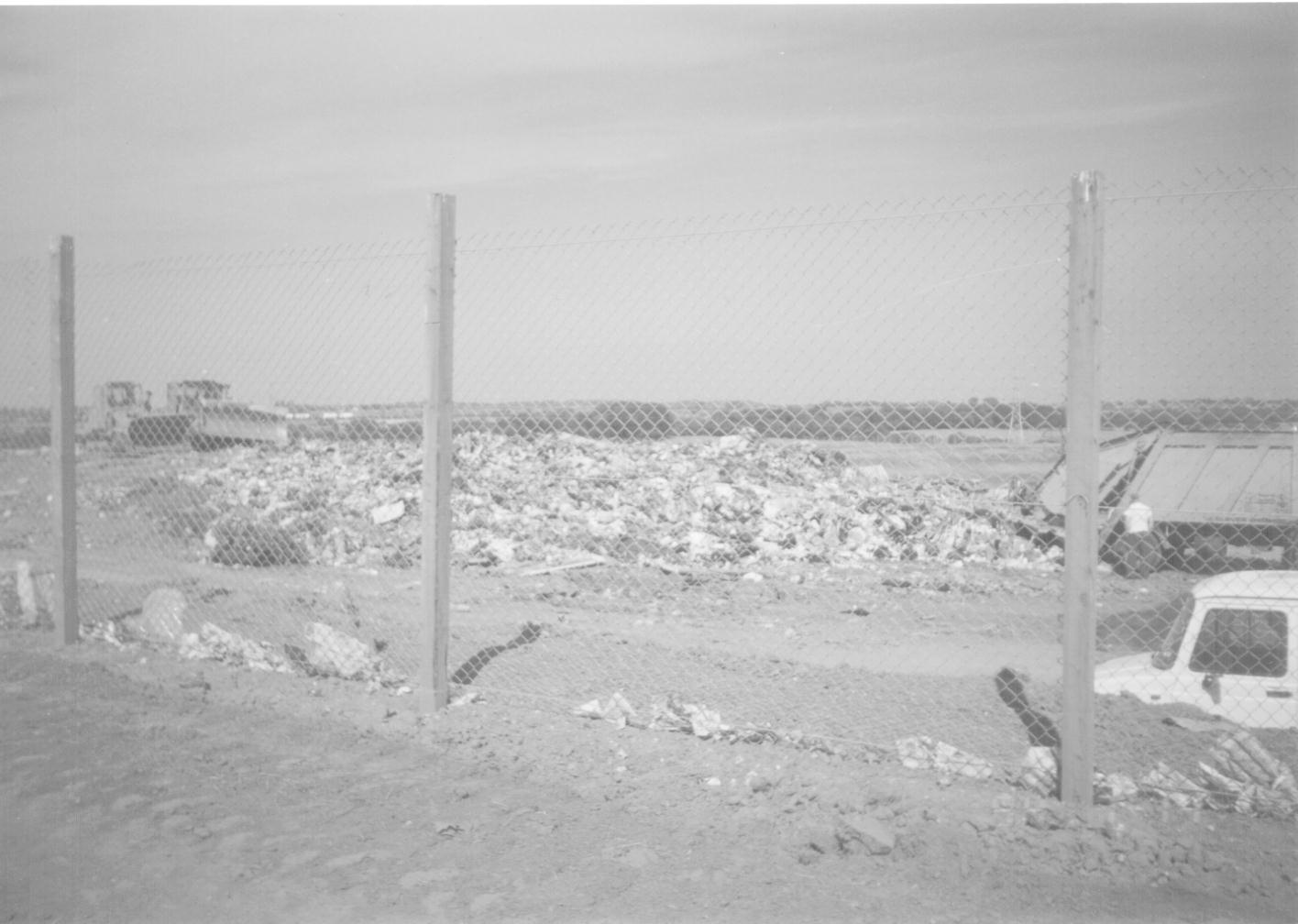
Landfilling is the waste disposal method where waste is placed in hollows or voids in the land, typically former clay pits or opencast coalmines (this is applicable in the UK, as other countries prefer to store waste above ground level, e.g. USA, Germany). These voids are lined, either with natural materials such as clay or artificially with a synthetic liner, this is done in order to prevent pollutants from entering the surrounding environment. The lined void is then divided up into engineered cells where the waste can be deposited. The waste is deposited by truck at a dumping location and compacted using machinery (sheep-foot rollers, JCBs, etc.) that spreads the waste into even layers, between 1-2m thick(1) (See Plate 1). The waste is covered daily with a thin layer, of not less than 0.15m(2), of inert waste, normally clay. This layer prevents water from entering the waste, birds scavenging at the waste and waste from blowing away. The waste layers are built up until the cell is full, and the cells are built up until the void is full. Then the cells are finally capped with a contoured thicker clay layer (around 1m), this layer prevents water from saturating the waste and creating leachate (liquid which comes from landfills and is potentially contaminating). The surface of the landfill is then planted with vegetation to blend it in with the surrounding area.
After the site has been filled and restored to the levels agreed with at the planning stage, it is then left, possibly for redevelopment. Developments come as either hard or soft uses. The majority of closed landfill sites are developed for soft uses. These are where no hard structures are built upon the site, most common uses are recreation or agriculture. Landfill sites have been known to be restored as golf courses and open air paint balling sites, any hard structures were either light enough to be supported by the waste mass or located just off the waste mass. To restore a closed landfill site for agricultural use involves ensuring that there is a thick enough clay layer to deal with the potential ploughing of the soil and the depth of vegetation roots. Many sites are restored initially for grazing until settlement has taken place and the waste has become more stable.
A number of former landfill sites have been redeveloped for hard uses, i.e. ones with structures upon them, for example housing, business parks, etc. However, these uses have previously been unpopular due to the differential settlement that is likely to occur under heavy structures, and the cost required to stabilise the waste mass. There is also the problem with the formation of landfill gases, from the biodegradation of the organic component of the waste. Special gas extraction equipment would have to be installed to prevent the build up of gases and so increasing the cost of any development. This has lead to more typical hard uses being open air, i.e. car parks or open air drive in movies, where the build up of gases is less of a problem.
The landfilling process allows many opportunities for using a GIS, from displaying the outline of the void, to calculating areas of geomembrane liners required, volumes of clay for the lining, volumes of cells to be filled, locations of leachate pipes and gas wells, etc..
A GIS can be used to keep a record of filling and volume parameters. As waste comes into the site it is weighed on a weighbridge at the gatehouse, the weight of the waste is recorded alongside a description of the waste type. As the waste is deposited and the cells of the site are filled, then an average composition of the waste in the cells can be calculated. From field and laboratory based experiments the optimum density for a particular waste composition likely to be obtained in the field can be calculated. From the weight and volume data recorded on site a GIS can calculate the density of the cell for its composition. As discussed before, in the modern business and environmental competitive and demanding world the optimum density would allow the landfill to store more waste, and so reduce the need for more landfill sites and increase the revenue for the site. To bring the density of the cell to the optimum density for the composition then more waste may have to be added to the cell or the compacting equipment may have to make more passes over the area to increase its density.
If an area of the landfill site has a lower density than its surrounding areas it is likely to settle more than its surrounding area. This may lead to problems when the landfill site has closed. The area of lower density may settle to form a depression in the surface of the finished landfill, or be an area where differential settlement is likely to occur. A GIS could keep a record of densities across the site, allowing areas of lower density than its surrounding densities to be located and dealt with. So when the landfill closes and becomes ready for redevelopment, developers would know where to avoid in case differential settlement is an important consideration in their plans.
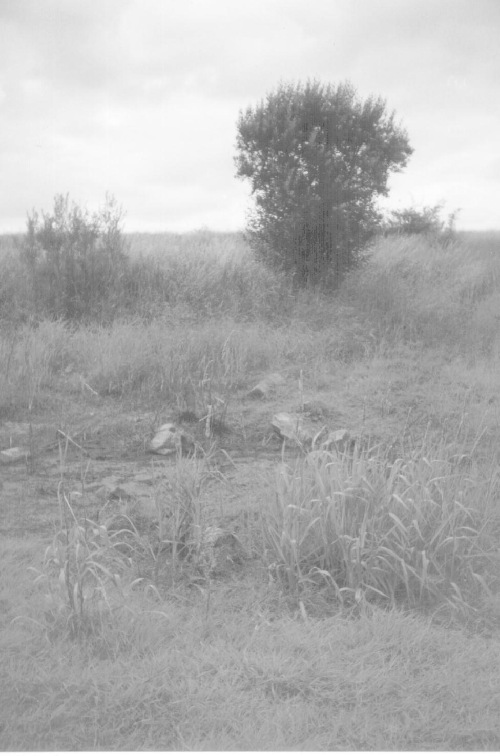
A GIS can be used after the closure of the landfill site to monitor the post closure settlement. This is an important factor as excessive settlement of closed landfill sites can cause ponding, as mentioned above (See Plate 2). This affects the surface in two ways, one, by having a body of water on the surface and so increasing the load on the surface and so causing even more differential settlement, and secondly by the higher moisture content on the surface allowing water to infiltrate the body of the landfill site, allowing the formation of more leachate.
Differential settlement, over areas of high and low density, will cause stress in the covering layer and the integrity of the covering layer may become damaged. If the covering layer is damaged then this may allow uncontrolled gas escapes or water to enter the waste mass and create more quantities of leachate, either may cause further environmental damage. Gas extraction wells or leachate pipes may become damaged and so allow the build up of potentially combustible gases, or polluting contaminants, possibly causing further environmental damage. Any structures on the site that settle with excessive differential settlement may become unstable and dangerous.
The post closure settlement of a landfill site depends upon a variety of factors including age and depth of the waste, composition, moisture content, rate of filling of the waste, level of leachate in the waste, presence of gas, temperature of the landfill site, placement method, etc. All these factors can be put into a model of the site in a GIS allowing their influence to be seen upon the settlement of a landfill site. For example, if a site has been started at one end of the void and progressive filling occurs towards the other end in a number of phases, then the first phase may have undergone a substantial amount of its predicted settlement before the landfilling in the site has finished. And so there will be minimal settlement to allow for in the post closure contoured plans. There may also be a case for filling in more waste if enough settlement has taken place to make it economical to do so.
The economics of landfilling require that the maximum amount of waste enters the landfill site with the minimum of volume. To gain extra volume it may become economical in larger sites to leave waste to settle, either loaded with extra weight on top, say rubble or rockfill, or unloaded. These large scale field experiments of waste settlement will help in using the GIS for possible settlement scenarios, so the maximum pre-settlement levels can be planned for and the maximum amount of waste enters the landfill site
The composition of waste recorded at the gatehouse can be used in other ways other than analysing the composition of the wastefill. If the site has a high organic content, i.e. garden wastes, sewage sludge, putrescible household waste, etc., then it may become economical to install a composting factory. This would only occur if there was a high enough organic input to the site and there was a market for the compost that will be created. This benefits the landfillers in two ways, firstly by minimising the waste going to landfill and secondly increasing the revenue for the site through the selling of the compost. The composition of a landfill site may be looked at to see if other components of the waste could be reused or recycled, i.e. brick and rubble for hard-core, etc.
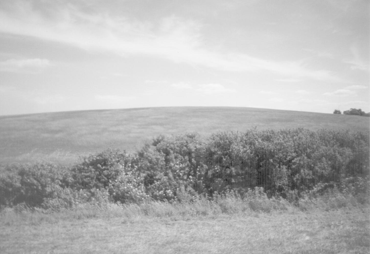
The purpose of proper landfill site management is to dispose of waste efficiently, safely and economically, with minimal environmental impact to the surrounding area, in both the long and short term (See Plate 3). Thus, allowing the landfiller to hand the site to a developer, with an accurate record, and confidence in the ability of the site to support his development.
Research being carried out involves the use of a GIS to record, store and display a wide range of information of the physical data related to landfilling. With huge amounts of a variety of data the emphasis is on being able to manipulate it to display the results quickly and easily. The final results need to be simply displayed to allow a novice see the results without too much background knowledge. This information regarding landfilling can be shown on a GIS, and the results can be used to improve landfill site management.
A GIS is an important tool in the planning and development of a landfill site and has many purposes from capacity calculation to monitoring of settlement and methane levels. As a huge database and display mechanism it can be used to simply and easily display and manipulate a variety of data to increase the confidence of landfill sites as a means of the safe disposal of waste.
Many landfill sites come into problems later in their closed life or as developments around them change. Then there becomes need to explore possible scenarios on how the development will effect the site. Best and worst case scenarios can be worked out for leachate contamination or surface settlement simply and easily on a GIS.
As legal and public concern in the disposal of waste and its possible after effects increase, it is the important to show that every up to date technology has been used during the landfilling process to protect the surrounding environment from potential contamination, either from leachate or gas migration. This is the Duty of Care that ensures waste disposers can guarantee their site's integrity. Pollutants such as leachate can contaminate local water courses causing contamination of public water sources, or death to local ecology. Gas can enter strata and travel away from the site to build up in dangerous concentrations, as was seen in Loscoe, Derbyshire in 1986. The gas may also starve nearby vegetation of oxygen, and so effect local wildlife as vegetation becomes sparse.
The use of a GIS in waste management starting from the site investigation stage of a landfill site, through the site's development and filling, and then during its post closure care, will allow the many different parameters of the complex life of a landfill to be recorded, displayed, and analysed. This will ensure that the maximum capacity of a landfill has been achieved with the minimal environmental impact on the surrounding environment.
(1) Barron, J. (1995). An Introduction to Wastes Management . Second Edition 1995. The Chartered Institution of Water and Environmental Management.
(2) Department of the Environment. Landfilling Wastes: a technical memorandum for the disposal of wastes on landfilling sites. Waste Management Paper Number 26. London, HMSO, 1986.
Damian C. Green
Researcher
University of Sunderland.
School of the Environment,
Benedict Building,
St. George's Way,
Sunderland,
Tyne and Wear,
SR2 7BW.
UK
Telephone: +44 (0)191 515 2715
Fax: +44 (0)191 515 2741
e-mail: damian.green@sunderland.ac.uk