AM/FM Utilities
| TITLE: | GeoMap TELECOM, Using GIS to manage the telecommunications network system |
| DEFINING ISSUES | The structure of telecommunications network between central stations and users, with all necessary technical details. Finding the place of intervention in any case of malfunction. How this network coexist within other local networks water sewerage, electricity cables , gas distribution system, etc.). |
| GIS SOLUTION: | GEOTER Proiect S.R.L. has developed an client/server based application in co-operation with ROMTELECOM Arges. |
| APPLICATION: | The application helps to renewing, questioning, repairing and deploying the telecommunication network system who exist in a locality |
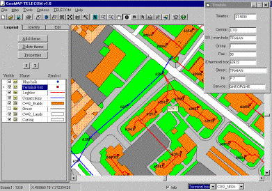
| SOFTWARE: | This is an client/server application and it has developedusing Visual Basic and Map Objects. The application was build so that it permit access of the users just to the functions that the local application administrator agreed to.GeoMAP TELECOM is a GIS application meant to manage the telecommunication network systems. The application helps maintaining, developing and designing the telecommunication network systems. |
Technical department
Design department
Accounting department
Network department
Technical supervision / check-up department
Commercial department
Manager
The application administrator establishes for each unique user a work domain,user possibility to modify geographical or numeric data, user access to certain fields of the databases, printing reports, etc.
Information System Environment Requirements
The application was developed using Map Object 1.1 and Visual Basic, under Windows 95 or Windows NT and requires a minimum of 16 MB RAM. Geographic layers can be as follows: shapefile, ArcInfo coverage, SDE layers.
At the same time the application can import data (and transform them in shapefile) from .DXF file format or from .TXT file format with elements co-ordinates. Shapefile layers can be created and edited in the same manner to ArcView.
Databases can be in .DBF (Dbase) format, .MDB (Access) format for small networks or RDBMS as SQL SERVER, ORACLE or INFORMIX for medium and large networks (the application uses the client-server technology).
Necessary data
Specific data (TELECOM)
External data (specific to other institutions)
External data (general layers)
GeoMAP TELECOM main functions
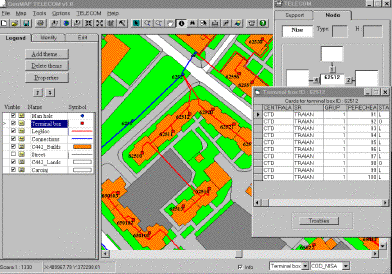
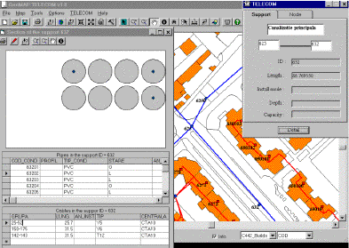
Troubleshooting: locating the terminal box, the card group, corresponding pair and the subscriber's name and address which declared the malfunction (map locating of the damage)
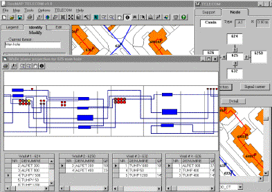
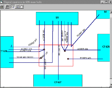
Route's generation for a pair from the subscriber to the telephone exchange.- choosing the available route between two man holes.- displaying the free pairs and the damaged pairs in a selected area.- cables report for a selected area.- finding the best route between two network nodes.- dispersions of the requests for new subscribers.This application is already running at ROMTELECOM Arges.
Authors Information: