Law Enforcement, MapObjects and Recovering Missing Children
Geraldine P. Kochan
The National Center for Missing and Exploited Childrenâ (NCMEC) assists law enforcement agencies in locating missing and abducted children by distributing the child’s photograph. Former and/or current addresses of the abductor are gathered from searching the public record databases. Using MapObjects, an interactive mapping program has been created which allows NCMEC staff the added capability to assess leads based on chronological and geographical proximity to reported addresses of suspect and/or missing child. This ability to view leads, both by location and by time, will add a new dimension to how analysts determine the value of information reported to the Center.
Introduction
The National Center for Missing & Exploited Children, located in Alexandria, Virginia, is a non-profit organization congressionally mandated under the Missing Children’s Assistance Act of 1984. NCMEC’s mission is to assist law enforcement, families, and social-service professionals in finding missing children and help prevent child sexual exploitation. In our goal to recover children, NCMEC has recently developed an interactive mapping application that connects NCMEC’s data to geographical or spatial data and visually represents NCMEC’s attributes on a map. The application assists case managers and case assistants by allowing them to visualize all the location information related to each case and then focus poster distribution to specific areas for valid leads. The mapping application will assist staff analysts by "spatially" scoring leads based on the sighting location and its relationship to address information that the analyst has recently incorporated into NCMEC’s database.
This presentation focuses on two uses of the mapping application that is being developed using Environmental Systems Research Institute, Inc.’s (Esri) MapObjects software. Case managers and assistants are in the process of learning how to use the applications. Staff analysts have recently begun to input historical address information of abductors into NCMEC’s database, but this portion of the application has not yet been completely developed.
Since the mapping application is relatively new, we are not yet able to fully appreciate how well it is aiding in our efforts to recover missing children. However, based on the response from the users so far, our future plans call for allowing law enforcement access to specific fields in our database so that they, too, will have the ability to geographically search for missing children.
Background
NCMEC works towards recovering missing children in several ways. We have a 24-hour, toll-free Hotline/CyberTipline and a web site to collect information on missing children or sexual exploitation activities involving children. In addition, acting as a national clearinghouse, NCMEC disseminates information on child safety and exploitation through brochures, booklets, and training materials. We also offer on-site training to law enforcement and staff from state clearinghouses on how best to handle these unique cases.
NCMEC’s goal is to make each child’s case "media ready" so that a poster on the child is distributed to the public. 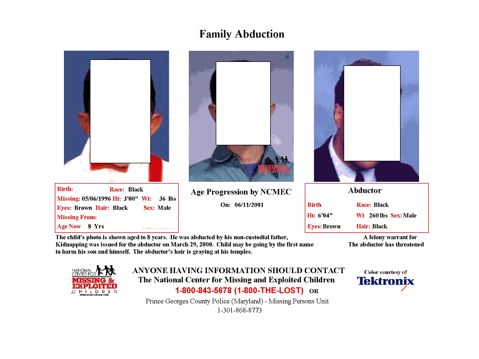 Poster distribution is one of the ways that NCMEC draws attention to the plight of missing children. Posters of missing children are distributed on our web site, on television shows, and through retail businesses as well as direct marketing mailers to homes. All posters list NCMEC’s toll free number, 1-800-THE-LOST (1-800-843-5678), and the number for the investigating agency. If people believe they have seen a missing child, they can refer to either number and report their sighting information. The leads generated by this "Picture Them Homeâ " photo distribution program may result directly in the child’s location and return of a child or set in motion the sequence of events that lead to a child’s recovery.
Before a missing child’s case is "intaked" by NCMEC’s Hotline, the case must meet NCMEC’s missing child protocol requirements. The caller must be either a custodial parent/guardian or law enforcement officer. In addition, the child must be younger than 18 years of age, and be entered into the Federal Bureau of Investigation’s National Crime Information Computer database.
Within NCMEC headquarters, the noted below process is followed subsequent to the intake. The case is reviewed and assigned to one of four missing-children categories that have been defined by the U.S. Department of Justice. These categories include Endangered Runaways, Family Abductions, NonFamily Abductions, and Lost/Injured/Otherwise Missing. A case manager from the Missing Children’s Division is assigned and provides technical assistance to the searching parents and law-enforcement agency investigating the case. Staff analysts in the Case Analysis and Support Division support case managers and law enforcement by providing information on former residential addresses of abductors gained from searches of public databases and prioritize sightings based on information reported by the public. To get a child’s case media ready for the poster distribution, a custodial parent must sign a release form and provide NCMEC with pictures before poster preparation begins.
Once a case has been certified media ready, the Public Affairs Division distributes a missing child’s poster through a network of photo partners. For children who have been missing an extended period of time, their image can be age progressed to show how they may look now at their current age. These posters elicit assistance from the public to call in any sightings of a missing child.
NCMEC’s Recovery Record
Since it was established, NCMEC has had an impressive recovery record. Through March 2001, NCMEC has assisted with recoveries of more than 58,300 missing children and the Hotline staff has handled more than 1.5 million telephone calls through its national, toll-free Hotline. Of these calls, more than 93,700 were sightings in response to our poster distribution program. Poster distributions have been instrumental in the recovery of over 500 children who may otherwise not have been located. This recovery rate is extraordinary, but not only does NCMEC want to do better, it also wants to be able to use new technology more efficiently to recover children. Presently, the technology enables us to get the posters out to the public, but now we need it’s help in analyzing this multitude of information that is returned to us. The new interactive mapping program is one way we are doing this.
Partnerships and Outside Support
NCMEC does not and cannot do all of this alone. We rely on the extraordinary support and assistance from the outside—from corporate partners to the public. Working with corporate partners promotes a synergistic attempt to recover children and has helped enable NCMEC to attain its stellar recovery record. A variety of services and/or partnerships are used to disseminate the poster information about the missing child or abductor. Each partner plays a unique and important role in the recovery of children.
Corporate partners donate their time, software, hardware, technology, and money. As an example, some of our technology partnerships and support pertinent to this presentation are Sun Microsystemsâ , Computer Associatesâ International, Inc., ChoicePointä , AutoTrack XPâ , and Esri. Sun Microsystems has helped build and enhance NCMEC’s technology infrastructure by donating software and hardware using Solarisä . Computer Associates developed our Ingres IIä relational database system and is our Internet provider. For many years, ChoicePoint and AutoTrack XP, have made their public record databases available to us. Our largest photo partners are companies who distribute our posters nationwide. These are ADVOâ and Wal-Martâ . A more recent addition to our organization support list is Esri. Approximately two years ago, Esri began providing NCMEC with software and technical assistance for mapping our data. Thanks to Esri we are embarking on new ways to recover missing children. Finally, of course, we would not be able to accomplish many of these recoveries without the input of people from all walks of life who, for the past 17 years, have provided us with lead information about missing children.
ADVO and Wal-Mart
Each of our photo partners distributes the posters in different ways. ADVO uses direct mail coupons and distributes the poster across six different zones of the United States over a 6-week period, moving from the east to west coasts. 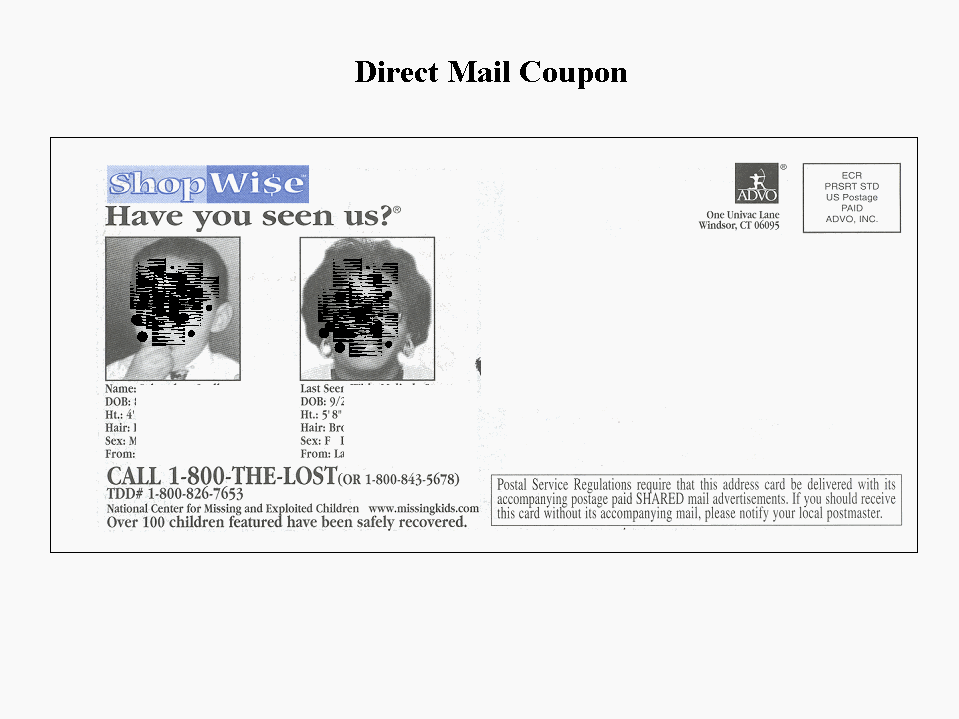 Wal-Mart, on the other hand, displays the posters of missing children at the entrance to their stores within six specific regions nationwide. These posters are viewed by millions of people each week. With the ADVO mailer, 75 to 80 million households receive a child’s poster during a six-week period.
Because of the wide distribution of each poster, a large number of sightings for each case are received at NCMEC. As an example, in one case, over 700 sightings were called into the Hotline during a 6-week time frame with the sightings having varying degrees of usefulness. A staff analyst will read each lead, and all leads received will be sent to law enforcement. In addition, case managers may be assigned as many as 1,000 active cases at any one time. If a case manager/staff analyst has up to four missing children on ADVO at one time, the number of sightings can be phenomenal. For this reason, an interactive mapping application was developed that combines fields or variables from NCMEC’s database with geographical software to spatially display location information. Technology has been helping us distribute the posters, and it is now assisting us in dealing with the maze of information that is being returned.
NCMEC’s Relational Database System
We began using our present database and management system, designed by our information technology officer, in February 1999. Our Ingres II relational database is accessed using Microsoft Accessä software and Visual Basicä programming. Some of NCMEC’s relational tables are a Child’s Table, an Abductor Table, Vehicle Table, Law-Enforcement Table, Narrative Table, Parent Table, Call-Information Table, and two small International tables. Unique child identification numbers and caller identification numbers connect these relational, non-hierarchical tables with each other.
Customized user interfaces for querying the database have been designed for each department according to its needs. Communications receives all the calls and so uses an interface that allows them to gather information to fill in the all the fields of all the tables. The Case Analysis and Support Division, on the other hand, uses an interface that allows them to search for children based on information such as date of birth and physical description, or for information in order to make statistical analyses. 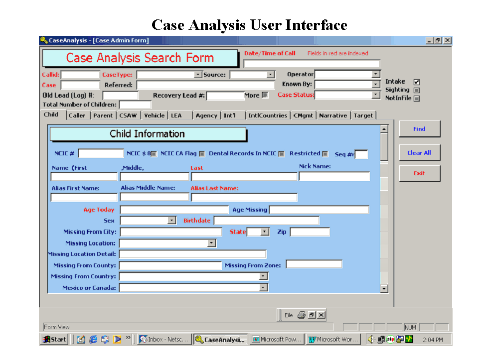 The user interface for the Missing Children’s Division is tailored to its specific requirements.
Longitude/latitude and zip-code tables were purchased from a vendor and are updated quarterly. A programming task integrated these tables into the database management system to identify missing, sighting, and recovery locations. Now our system has the capability of immediately integrating the new table information into the NCMEC database. As soon as information is entered into the city/state or zip-code fields, coordinate information for longitude and latitude is immediately and automatically assigned and appear in their own fields. These are the fields that are instrumental to the interactive mapping application, and now the data is suitable for mapping.
Esri MapObjects - Interactive Mapping Application
Esri’s MapObjects, a server-based application, enables NCMEC to add dynamic, data-driven maps and geographic information system (GIS) capabilities to its users. The application visually represents all location information reported to NCMEC and combines it with a background that consists of a series of specially chosen Esri thematic layers that come with the MapObjects package. The GIS integrates spatial data with our data sources using Visual Basic programming language, and MapObjects transposes the data into a format suitable for mapping analysis.
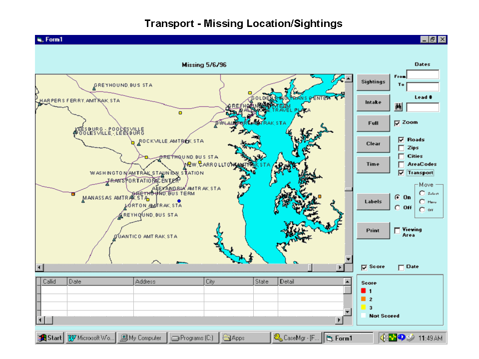
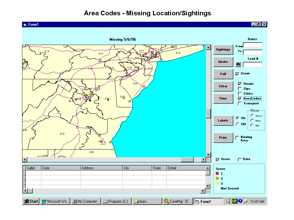
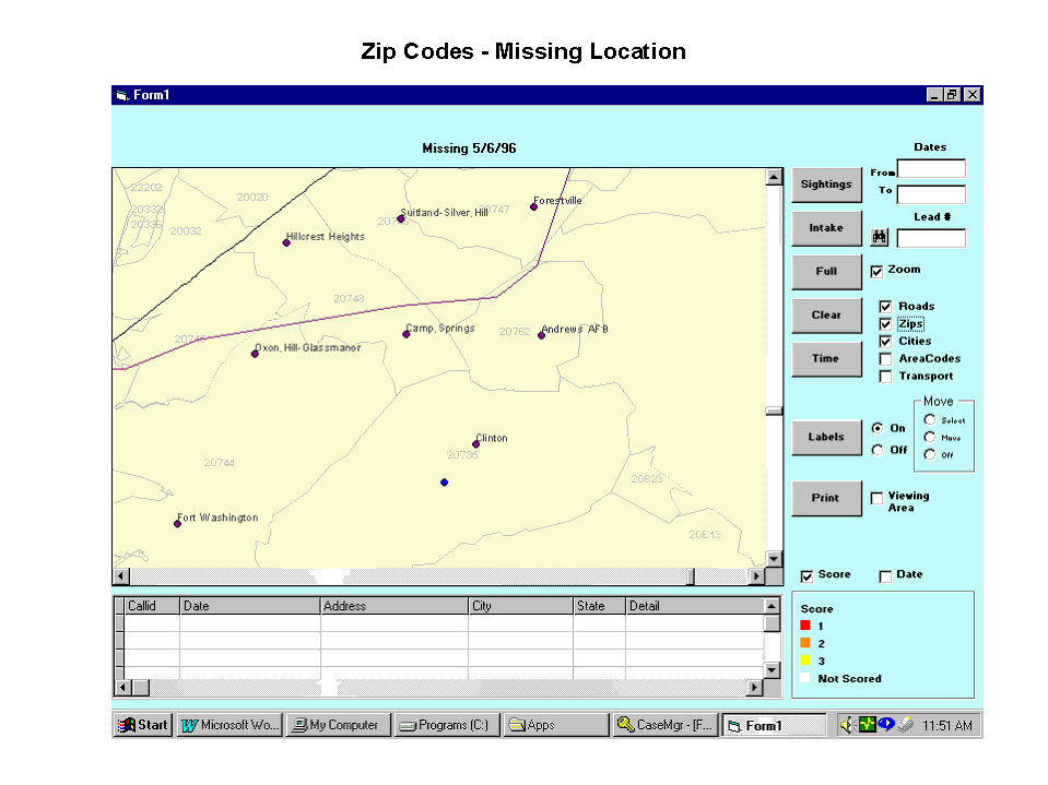
The layers chosen for our purposes include states, cities, roads, zip codes, telephone area codes, and transportation stations such as bus and train stations. A tool bar manages the data and we can zoom in, track data and print a map. A tool-bar button can toggle the labels of a sighting back and forth between a score and date, or the sightings can be viewed within a specified time frame. A sighting can even be highlighted or called up by its specific NCMEC number. As each symbol appears on the map view, a table appears beneath the map. This table contains detailed information on the missing child’s location or sighting that is displayed.
Geographic Representation and Analysis
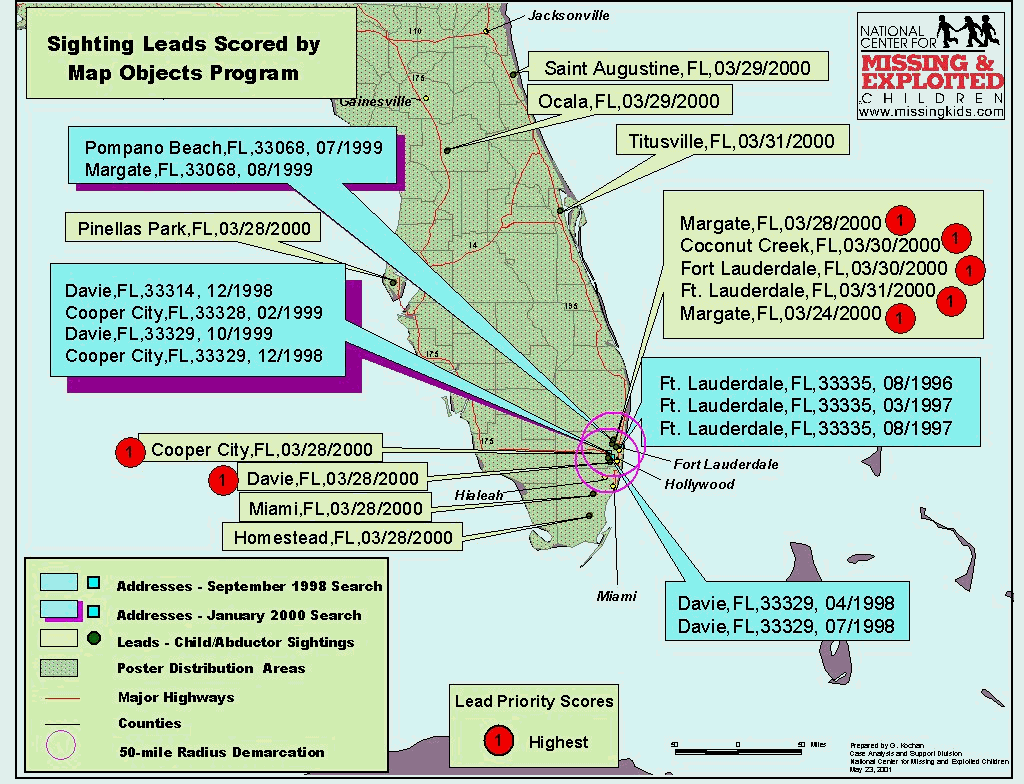
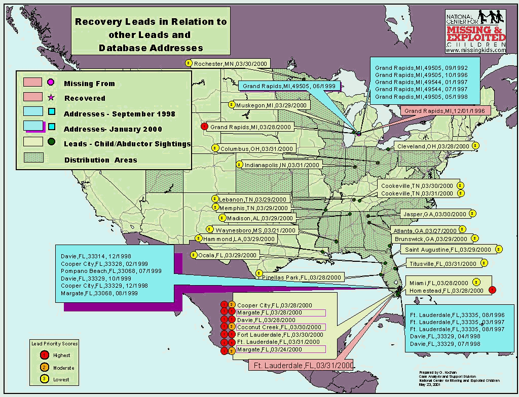
In the interactive mapping application, information from NCMEC’s database is spatially displayed with the associated layers chosen from Esri MapObjects for their thematic content. By viewing a case as a geographical distribution of missing locations and sightings with the appropriate associated layers, we hope to uncover patterns of movement that might otherwise remain undetected as well as enhance the value of leads. We are doing this in two ways. The first interactive application discussed assists the case manager with focusing poster distribution to neighborhoods and localities specific to each case, while the second interactive application discussed assists the staff analyst in scoring the multitude of sightings for their validity. 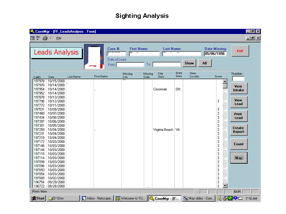
First, by viewing NCMEC’s data with a background of various other layers, a smaller but more logical poster distribution can be done. When a sighting is determined to be a "1," the highest assessment of a lead, the case manager has the option of viewing this sighting using any one of the other layers. There is direct information on the map to help the case manager identify the locale for broadcast fax of the poster to the area surrounding the high-priority sighting to gain additional sighting information. The fax distribution can be sent to an area based either on the zip code or an area code. In the case of an Endangered Runaway, who might be traveling by bus or train, knowing the location of the stations in an area is of utmost importance. 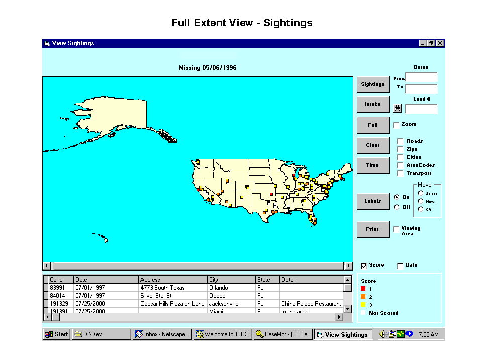
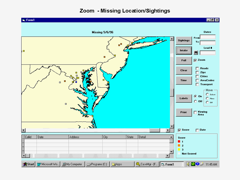
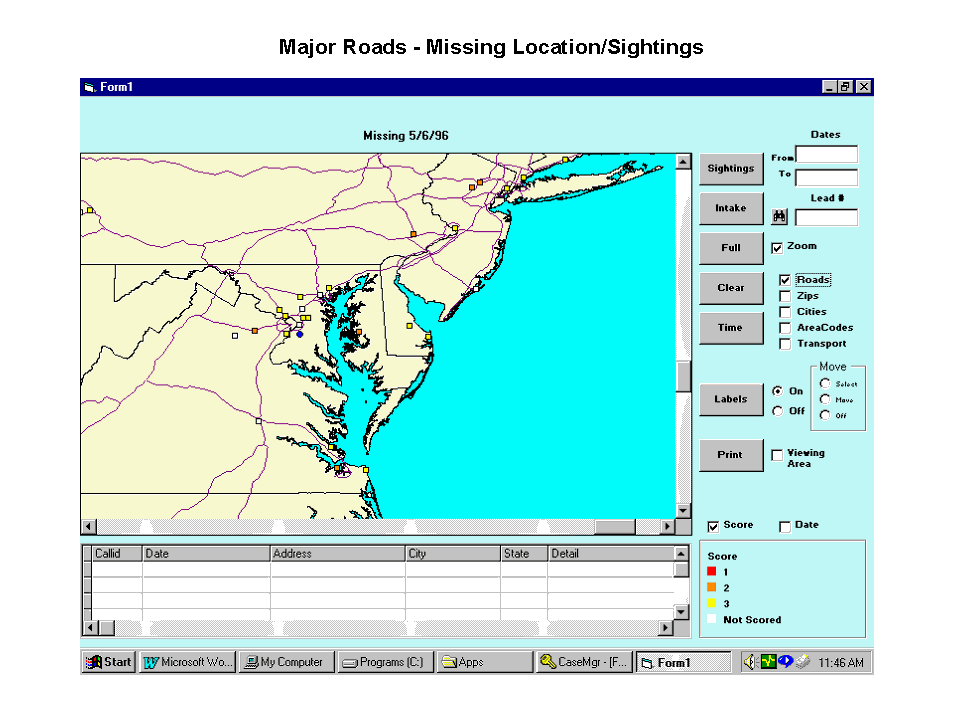
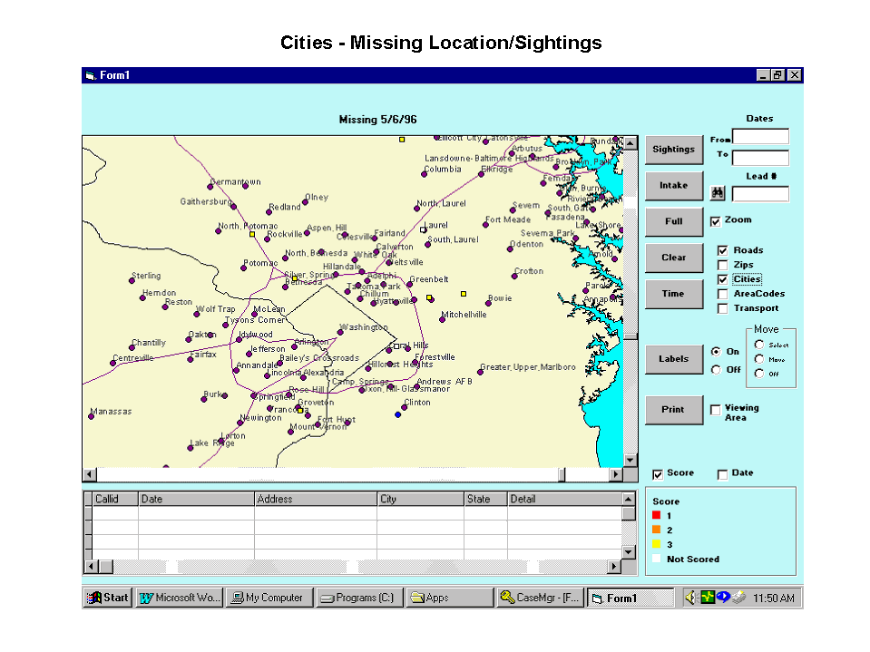
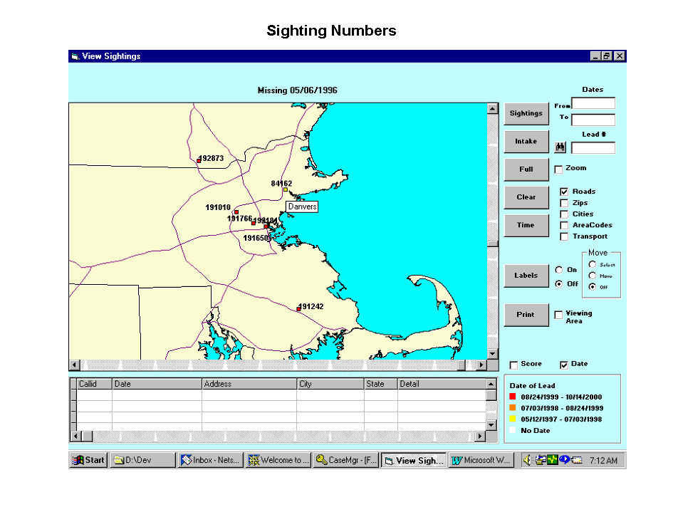
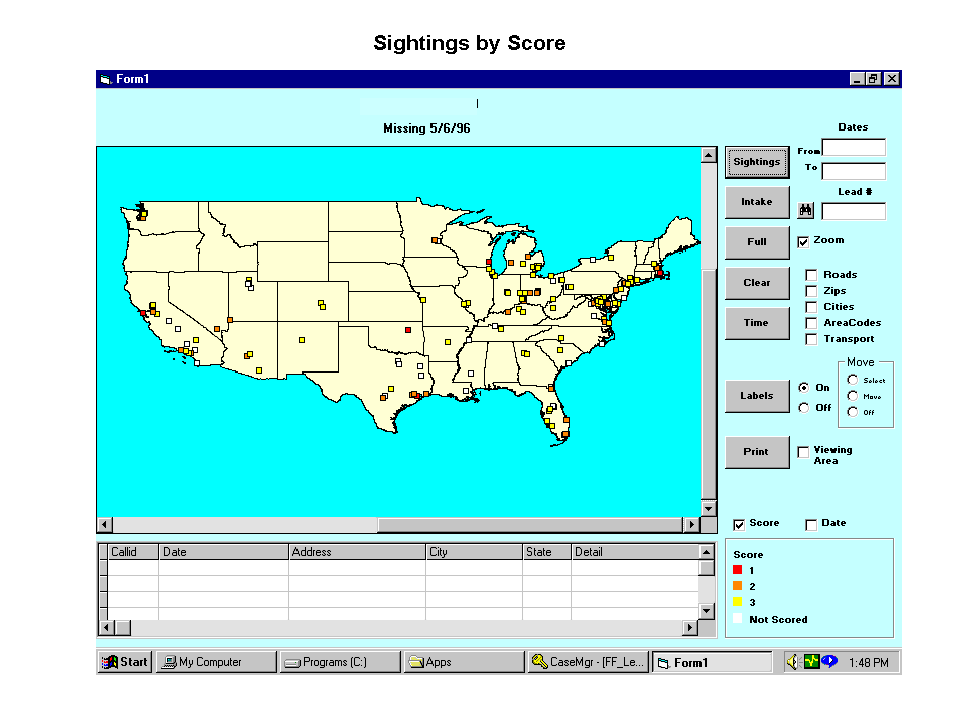
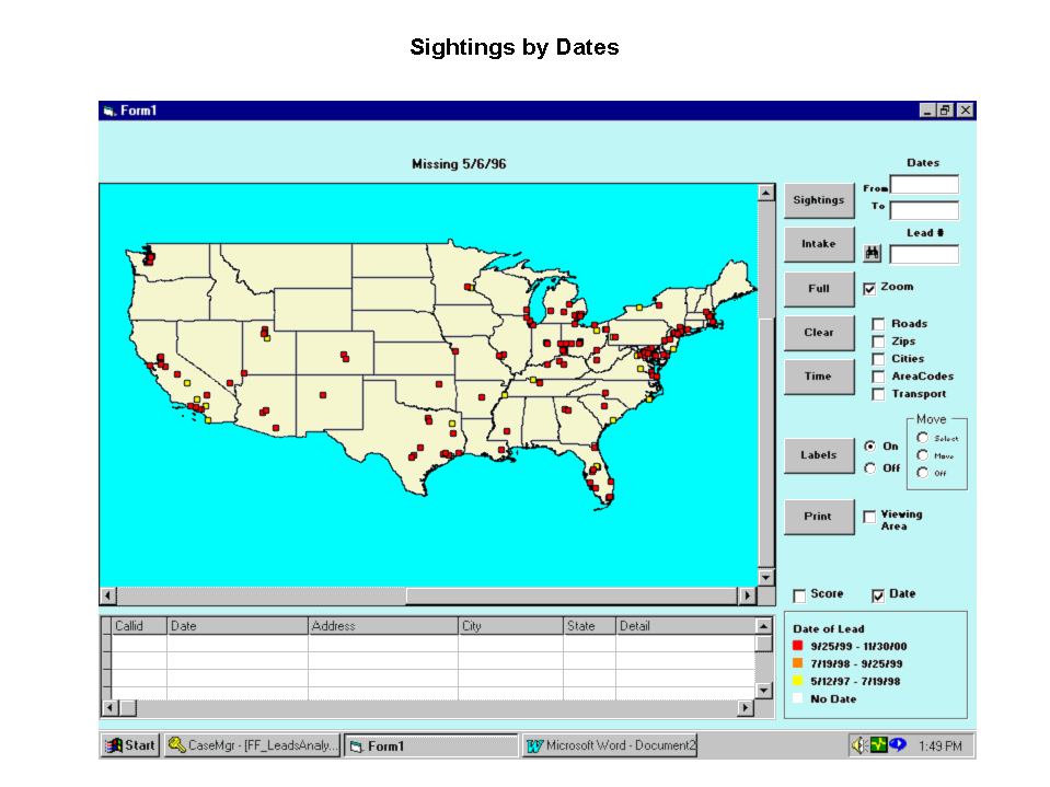
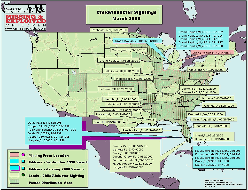
Second, the mapping application will be able to identify sightings based on the reported location and its relationship to a known residence or former residence of the abductor. We expect this procedure to help staff analysts prioritize and thus focus their attention on sightings that have greater potential to recover the child. When a Family Abduction case is intaked and a case manager is assigned, one of the first tasks of the staff analyst is to search the public databases for previous addresses or a current address of an abductor. Any sightings that come in and are located within a specified radius of any of the residential addresses (say a 20-mile radius) will automatically receive an initial score of "1," the highest priority score because of its relative location. The staff analyst can then first go directly to these sightings to validate the information and give the lead a subsequent score based on all known information. If, later on, a new address is uncovered, the staff analyst can then revisit any sightings that fall within the radius of the new address. 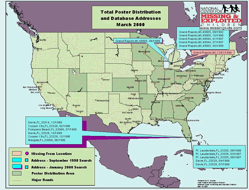

Summary
By being able to visualize the locations of addresses and high-priority leads, we hope to recover more children in less time. A visual representation of a case will enable us to create or modify strategies for additional poster distribution to generate more valid sightings. We hope to be able to predict routes of the abductor/child based on earlier sightings, and poster distribution can be focused on a localized area where the child/abductor may be headed. Finally, otherwise undetected patterns may be seen when the case is viewed geographically.
Geraldine P. Kochan
Research Analyst
National Center for Missing & Exploited Children
699 Prince Street
Alexandria, VA 22314
Telephone: 703-837-6325
Fax: 703-274-2110
gkochan@ncmec.org
 Poster distribution is one of the ways that NCMEC draws attention to the plight of missing children. Posters of missing children are distributed on our web site, on television shows, and through retail businesses as well as direct marketing mailers to homes. All posters list NCMEC’s toll free number, 1-800-THE-LOST (1-800-843-5678), and the number for the investigating agency. If people believe they have seen a missing child, they can refer to either number and report their sighting information. The leads generated by this "Picture Them Homeâ " photo distribution program may result directly in the child’s location and return of a child or set in motion the sequence of events that lead to a child’s recovery.
  Wal-Mart, on the other hand, displays the posters of missing children at the entrance to their stores within six specific regions nationwide. These posters are viewed by millions of people each week. With the ADVO mailer, 75 to 80 million households receive a child’s poster during a six-week period.
  The user interface for the Missing Children’s Division is tailored to its specific requirements.


