GapServ Today Page

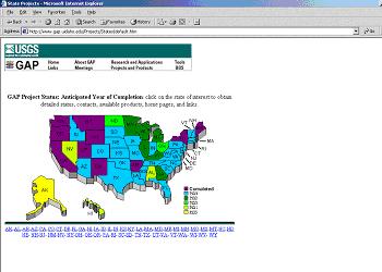
GAP Project Status
This paper will discuss ongoing efforts by the USGS to make biological data it already holds more available via Internet technologies. As steward for the GAP program, USGS BRD has been in the process of assembling these data for more than a decade. GAP data are coverages at nominally, 1:100,000 scale, that were assembled for each state (11 completed, some nearing completion and some now in second iteration) as part of the GAP Program for the identification of gaps in Bio-Reserve location. It includes Arc Grid-Coverage layers on vegetation, land ownership, and others that may have broader application, in planning and management. Many potential user communities are still unaware of its existence and possible utility. The state-by-state distribution of GAP data on CD has been uneven and the USGS BRD is investigating technologies to make it more available. The current prototyping focuses on ArcIMS 3.0.
The United States Geological Survey's Center for Biological Informatics (USGS/CBI) is charged, as part of its mission, with developing and disseminating several biological characterization data sets, fulfilling an inherent component of the USGS Biologic Discipline's functions of inventory, monitoring, research, and information transfer.
The earth's biological resources play a crucial role in human society. To better understand how they function, how humans affect these resources and systems, and how we might manage them to improve future environmental quality, we must first understand their composition and functions. The USGS Center for Biological Informatics manages programs that provide critical data and information on living resources to land stewards and policy makers. This information is used in support of resource management programs and as the basis for making informed policy decisions.
All of the following CBI programs and information systems provide biological characterization information:
These resources are also made available through the National Biological Information Infrastructure (NBII, www.nib.org) which is the major information systems project of USGS CBI.
The first of these is the GAP Analysis Program (GAP). The mission of GAP is to provide regional assessments of the conservation status of native vertebrate species and natural land cover types and to facilitate the application of this information to land management activities. This is accomplished through the following five objectives:
GAP is conducted as state-level projects and is coordinated by the USGS's Biological Resources Discipline. It is a cooperative effort among regional, state, federal agencies, and private groups.
Gap analysis is a data-intensive application of scientific research in remote sensing, geographic information systems, habitat analysis, and species range modeling. datasets are compiled and integrated from a variety of sources.
These data are developed to help the decision making process of biologists and others. All of these data are in various phases of their collection, evaluation and use.
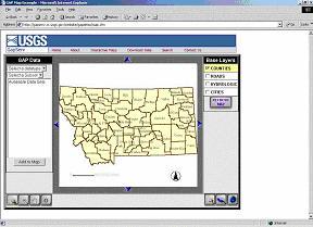
The current project described here, is the development of the a prototype spatial data base and internet map service for the GAP data set developed with the intention of making it more visible and accessible to, perhaps, a wider user community.This is a prototype and its functionality will grow in large part from feedback received after it's initial deployment.
A "gap" is the lack of representation or under-representation of an element of biodiversity (plant community or animal species) in an area intended for its long-term maintenance.
It is a process to keep common species common by filling in the gaps in our network of lands managed for biodiversity.
The gap analysis process was conceived in the 1980s. J. Michael Scott initiated the program with a project involving Hawaiian bird conservation.
Later he and other researchers at the University of Idaho Cooperative Fish and Wildlife Research Unit launched Idaho GAP as the first pilot under the U.S. Fish and Wildlife Service. In 1995, it became part of the USGS's Biological Discipline.In FY 2000, changes were made in the GAP internal administrative structure which resulted in the creation of an oversight committee. The committee has moved towards an increased focus on technology and outreach. In conjunction with advancements in Internet map services, like Esri, the decision was taken to investigate the initiation of a more centralized Internet based access point to GAP's wealth of information. FY2001 saw these decisions implemented in the GAPserv project.
The GAPServ project was developed at CBI with contractual help from Esri (Boulder, CO) in the implementation of both ArcIMS and ArcSDE.
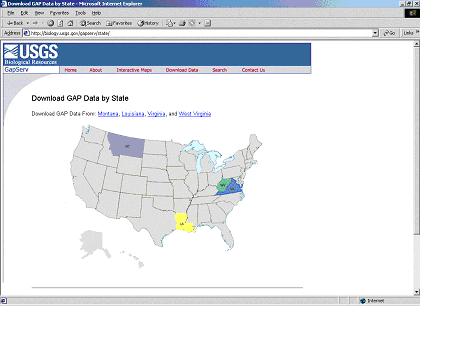
In addition to GAP data sets from the States of Montana, Louisiana, Virginia, and West Virginia, Ancillary data sets thought to be of navigational use to potential users were coordinated and included for each state (generally transportation, hydrology, and county political boundaries).


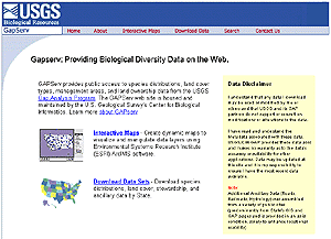
In its prototype phase GAPserv was designed to provide wider centralized access to GAP data sets.
One State's Data sets are currently made available via this prototype: Montana, with Virginia*, West Virginia* and Louisiana soon to follow
More states' data sets will be made available as soon as they are completed or in some older data's cases made compliant with underlying GAPserv infrastructure.
*Virginia, and West Virginia were specifically so that the project could examine the effects of independently developed data sets that share a common border, since all GAP data were developed originally on a state-by-state process.
For the moment, GAPServ is focused towards three audience tiers.
At the current time, GAPserv will provide the ability to visualize and manipulate, to some degree, the major GAP data layers. This functionality is implemented via Macromedia's 'Cold Fusion' visual application programming interface with the GAP information housed in an ArcSDE governed Microsoft SQL Server database. Cold Fusion was chosen as an ArcIMS supported platform that alleviates the burden on the client side, putting most of the load on the server. The expected size of the spatial data sets GAPserv must handle prompted this decision.
Additionally, This prototype plans to include implementation of the ArcIMS 'Extraction Service', a service that will enable interactive users to select an area of interest and have the feature data from the underlying vector display zipped and e-mailed to them.
GAPserv is housed at CBI and Denver, and uses the following hardware resources:
| ArcIMS server | dual Pentium III 500Mhz processors 1Gb ram |
| Arc SDE/SQL server | dual Pentium III 1Ghz processors 1Gb ram (upgrading soon to 4Gb) |
Esri collaborators arrived in May and utilized 'jump start' procedures for both the ArcIMS and ArcSDE components. Work on the Cold Fusion application interface commenced in tandem with loading of the data into the MS-SQL-ArcSDE database.

Historically GAP uses a state-by-state approach developing products for several very good reasons:
However, a decade long evolution of the data does create more challenges when preparing the disparate states for a semi-unified Map Service display and manipulation. Historical project artifacts, multiple collaborators over time and move to still developing standards, all created issues the Gapserv team had to, and is dealing with. the desire to offer 'Extraction service' from the interactive interface combined with ArcIMS 3.1's needs and limitations with respect to vector and grid support discovered a host of unforeseen data transform needs.
Currently the process follows these steps:
For the state of Montana, which has a total of 526 species maps, conversion times ballooned, and even then, produced some very large shape files. The size of the shape files encumbered use of the extraction service, and resulted in a need for an 100K indexing scheme.
The volume of data for all four originally planned states is thus quite large. The size of the database for all 49 states, with active GAP projects, may eventually reach terabyte size.These and other issues will be addressed as the project evolves.

GAPserv is a prototype of the of the kinds of applications that the USGS continues to develop with the intent of putting the science it conducts and facilitates into the reach of the public it serves. It is hoped that it will evolve into a useful data access point for one source of national biological characterization data.
| USGS | Esri |
|---|---|
| Rob Dietz | Emily Powell |
| Ray Carlino | Jeff Garland |
| Julie Brewer | David Fosdeck |
| Janice Little | Nicole Gale |
| John Clark | |
| Mike Frame | |
| Bruce Powell | |
| Ree Brannon |
Scott, J.M., and M.D. Jennings. 1998. Annals of the Missouri Botanical Garden 85:34-47.
Scott, J. M. and M. D. Jennings. 1997. "A Description of the National Gap Analysis Program". - The official description of the National Gap Analysis Program.
Scott, J. M., et al. 1993. "Gap Analysis: A Geographic Approach to Protection of Biological Diversity". Wildlife Monographs. - The first all inclusive overview of Gap Analysis. It was published in early 1993 through a joint effort by key members of the Gap Analysis team.
Edwards, T.; M. Scott, and C. Homer. c1990. "Introduction to Gap Analysis in Biodiversity". - A very good quick look, contains lots of neat pictures of the process.
Biggs, B., A. Singh, and D. VanderZee, c1990. "Gap Analysis in Biodiversity". - Short. Written at UNEP/GRID. It's actually a flyer that was produced to spread the idea around the world. (It has pictures too.)