
Development Planning Process
|
| Abstract | The Long Road to a Home | Many Steps in the Journey | A Bright Future for GIS | Author Information |
Presented by: Gene Hsieh, Gordon Robinson and Scott Armsworth
FORMA Systems

In a high octane real estate market condition, the private sector has
discovered GIS as a way to gain an edge in today's competitive environment.
Land owners, developers, and builders have embraced the versatility of GIS.
FORMA Systems utilizes Esri's full suite of products from ArcInfo to
ArcExplorer to manage and design the planning process within the
development community.
A new home is still the number one dream and represents the largest investment for most
Americans. The Development of New Communities and Homes is a long and complex
process that involves numerous approvals from multi-layers of jurisdictions. In addition to
the jurisdictional approvals needed, public support is a key aspect of development projects,
and require presentations and interaction with Community Groups, Special Interest
Groups, Homeowner Groups, and the local citizens.
As part of the project, data and studies from a diverse group of multi-disciplined teams is
required to provide for a comprehensive development package to assure successful
completion. Success is driven by the market to be financially viable, while responding to
public benefits, open space, habitat and amenities to further enhance the quality of life for
its future residents and surrounding communities.
Esri's GIS software provides a suite of powerful tools that can assist in the development
process. These tools allow the development team to manage data, provide analysis for
response to issues and questions, visualize the data in a user-friendly format, and assist
in defining financial parameters and limits. The GIS tools provide the ability to
communicate legal, environmental, and financial issues in a spatial context, that permits
a greater understanding of the issues and their interrelationships. The tools together
provide for increased credibility in the public and private interest by depicting complex
issues in a format that makes the data more understandable.
The road to development of New Communities and Homes is a long one that requires the
successful completion of many tasks along the way. The first step is Land Management.
The objectives are to document what are the existing conditions, and how will these
conditions respond to future growth or expansion. Appropriate land uses need to be
researched to avoid conflicts with adjacent land uses, and any existing on-site uses that
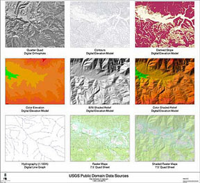
will continue. GIS can be instrumental in this Land Management phase in Base Mapping,
Habitat Monitoring and Preservation, Slope Analysis, and Conceptual Master Plan and
Phasing Analysis. Using Esri's GIS software, inexpensive and useful base mapping data
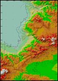
can be captured and processed to be used throughout the planning process. USGS is an
excellent source for creating 3D landform topography, and conceptual plan views to
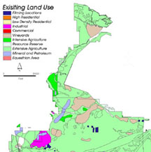
visualize the land. Land use data is constructed from vegetation and habitat data and
constraints using attributes to classify various land use types. The growth potential of the
preliminary site can be determined visually from the results of the topography and land use
studies.
Step Two is Site Selection and Project Definition. This step entails identifying the key
constraints, selecting the specific areas for development, and identifying the necessary
entitlements required for project completion. GIS applications that assist in the Site
Selection phase include aerial imagery to analyze potential sites, topological overlays with
land use, existing entitlements, constraints, and socio-economic analysis using spatial and
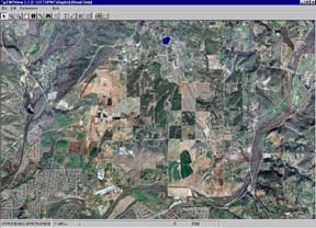
demographic data. Aerial imagery plays an important part of this step as it provides a real
world view of the land to define and select potential development sites. Using Lizardtech's
MrSID Geospatial Encoder, the aerial imagery can be compressed from several Gigabytes
to Megabytes making it more useful and manageable within Esri's GIS software.
Producing topological overlays with existing land use, general plan land use, zoning
information, and constraints is necessary for analyzing composite results and identifying
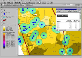
potential sites. Esri's Business Analyst software is used with spatial and demographic
data to create socio-economic analysis models. The Meyers Group and DataQuick
companies provide detailed demographic data including real estate market information that
proves to be a valuable asset for the socio-economic analysis within the site selection step.

Project Management in the development of New Communities and Homes is a major part
of the development process. Successful management of data and coordination throughout
the project team is essential for a successful project. GIS tools provide valuable
assistance in data management and coordination and provide for coordinated project
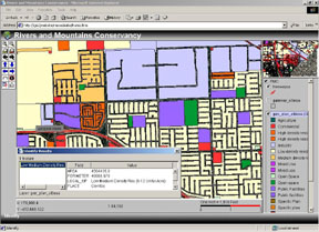
management. Esri's ArcIMS software provides the client and community with GIS
Internet mapping tools to view, edit, query, and print spatial and tabular data. In addition
to the GIS functions, other documents such as project schedules, progress, and team
contact information can be posted and accessed within the ArcIMS Internet web site.
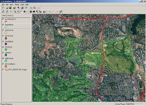
Esri's ArcExplorer is a free application that gives the non-GIS user a tool for accessing
the project GIS data, aerial imagery, and other CAD related files such as engineering
drawings. This application and project data can be loaded onto a team member's laptop
for quick access to data and aerial imagery.
The fourth step for development of New Communities and Homes is Entitlement
Assessment. The objectives of this step are to identify existing layers of entitlement,
determine planning implication for each layer, and summarize the amount of development
permitted. GIS applications in entitlement assessment include documenting current
entitlements (General Plan, Zoning Ordinances), calculating amount of development
permitted, and summarizing results. GIS acts a tool combining the current entitlement data
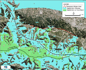
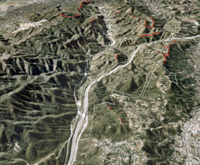
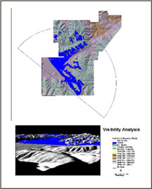
to calculate the number of units allowed within each entitlement. Using Esri's 3D and
Spatial Analyst extensions, models including slope, line-of-sight, and visibility analysis can
be created to assess the limits of development. These GIS analyses provide the results
needed for entitlement assessment.
Encumbrance mapping is also required on the path of creating New Communities.
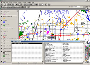
Encumbrances, such as road and utility easements must be identified, mapped and
analyzed to determine their impact on the project. GIS allows the user to map these
encumbrances from a variety of sources and analyze the impact to the project and link this
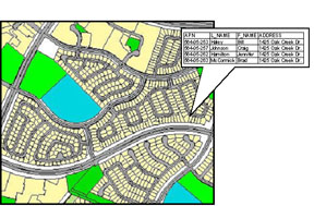
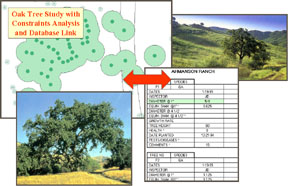
spatial data to parcel library documents. Esri's ArcView software is used to dynamically
link the tabular parcel library with spatial data including parcels and land use. This process
gives the client an interactive ability to view and analyze the extensive parcel library
information with other spatial data within the GIS system.
Baseline information documentation is the sixth step in the development of New
Communities and Homes. This includes the mapping of existing data, such as tree
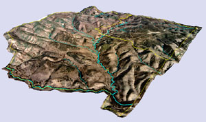
locations and sizes, drainage courses, and topography. Using Esri's ArcInfo TIN module
or ArcView 3D Analyst, the baseline data can be constructed into 3D models displaying the
landscape, trees, drainage, and topography in a real world scene. This information can
then be analyzed in GIS to review impacts on various land use proposals, through the use
of topological overlays and relational databases. Esri's ArcView software provides the
relational database link needed to connect the baseline data and analyze environmental
impacts. Environmental suitability can then be determined with this baseline information.
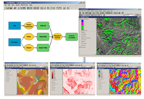
Resources are analyzed to determine the most valuable, and areas are analyzed to
determine the most developable. Weight factors can be applied to this data to determine
the results. Spatial analysis can be used to make these determinations, and GIS mapping
tools can be used to graphically represent this analysis in a coherent manner.
Once the baseline data and environmental suitability studies are completed, Alternative
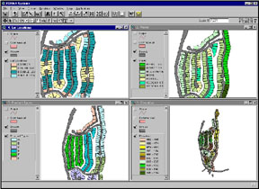
Development scenarios can be created and tested. GIS tools within Esri's ArcView
software and extensions permit spatial analysis for alternative development programs, 3D
Modeling, and Valuation Analyses to determine fiscal implications. These implications
include calculating amenity levels, number of units based on slope, elevation, product type,
view, and lot location of alternative development sites. Within Esri's ArcView software,
these results are linked to spreadsheets and other applications to provide data for further
analysis. This relational database linking brings the power of GIS to the client as it creates
a superior querying environment for getting the answers needed during this alternative
development step.
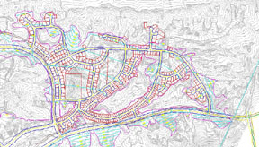
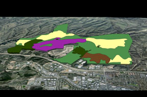
After analyzing the various alternatives, the next step is the development of the Preferred
Plan. This step involves coordinating and converting data from the other team consultants
and additional 3D modeling. GIS applications can be used for data conversion and 3D
modeling and simulations, including terrain modeling, image draping, and view shed
analysis. Esri's ArcInfo software provides the translation tools necessary to convert 3D
CAD files into GIS coverages and shape files for use within the GIS system. This is a vital
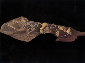
process for the development of the 3D models. Esri's ArcView 3D Analyst extension
provides tools to create 3D models using draping techniques with aerial photography,
conceptual plans, and illustrative drawings over the elevated topographic layers. ArcView
3D Analyst can also be used to create real world photo simulations to analyze the planned
development using building structures within the 3D model.
A project proforma is then necessary to determine costs and to quantify costs reflective of
plan changes and refinements. Applications are needed to create these cost analyses,
dynamically link the spatial data with the tabular data, and produce spatial queries and
reports. These applications are built using Esri's ArcView software. ArcView is a
powerful tool that gives the developer a user-friendly GIS interface and strong linking
capabilities to effectively manage costs related to plan changes.
Upon completion of the project proforma, an issues inventory of the issues is created along
with solution alternatives. GIS applications can be used for slope analysis, 3D modeling,
and creating presentation-quality maps and graphics. These tools can be used in a
Community Outreach Program to provide community education, and solicit community
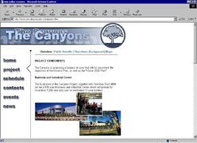
input and support. As part of the Community Outreach Program, a website can be created
utilizing the GIS graphics and data to provide another source of community education and
input.
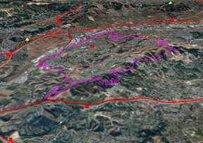
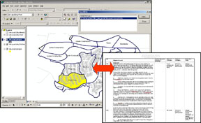
Entitlement Processing and Mitigation Monitoring both require tools to track requirements
and link spatial and tabular data. Esri's ArcMap or ArcView software products are used
to dynamically link the mitigation monitoring schedule to the planned development areas
within the GIS data to provide a complete monitoring document containing mapping and
reporting functionality. Within the GIS software, the GIS data can be linked to a web site
for Internet publishing, spreadsheet, or images to be accessed from the entire project
team. These tools are fundamental for cost effective and time responsive completion of
the requirements necessary for development and construction of New Communities and
Homes.
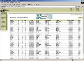
Upon completion of the Entitlement Processing and Mitigation Monitoring processes, a
Sales Tracking Analysis and Reporting mechanism can be used to provide sales
information during the build-out portion of the project. A database querying and reporting
system can be customized on the developers computer system to allow for easy input and
the quick generation of sales reports. This customized system can be created using
Esri's MapObjects technology with Microsoft's Visual Basic programming environment to
provide the developer with the tools needed to analyze the sales information using GIS
tools and print the required reports. This combination of using GIS functions within a
customized user interface gives the developer exceptional analyzing and sales reporting
tools.

GIS has a proven track record in the Development Community which has become more
knowledgeable of and receptive of GIS. The economy and community concerns are
requiring the development industry to be more efficient and resourceful for the successful
completion of new communities. The public and private sectors must work together to
address each others concerns to create these new communities. Esri software is
developing and evolving to meet development industry needs and provide GIS tools that
can be used for more in-depth analysis and create exhibits that depict the analysis in a
easy to understand format. GIS has become the "Nitro" fuel to power the Development
Data Engine of the 21st Century and create a successful journey to the creation of New
Communities.