North Carolina
Julia B. Conley
Abstract: Winston-Salem, North Carolina, was the first community to develop a Community Safety Information System (CSIS) as part of the Department of Justice (DOJ) sponsored Strategic Approaches to Community Safety Initiative (SACSI). The successful focus of the Winston-Salem Initiative has been on the implementation of research-based strategies to reduce and prevent juvenile violence. CSIS , an Internet Map Server application that integrates diverse community data from multiple agencies, was developed as an analytical tool to assist the local SACSI efforts. CSIS has been enhanced to expand its functionality. SACSI has been awarded a $1.8 million grant from a local charitable trust to establish a Center for Community Safety at the Winston-Salem State University campus. Our work to reduce juvenile violence and improve community safety continues.
INTRODUCTION
Winston-Salem, NC was one of the first five communities across the country to participate in the Department of Justice (DOJ) implemented Strategic Approaches to Community Safety Initiative (SACSI). This initiative, which initially began as a two year pilot project in March, 1998, was designed as a way to assist communities combat local crime problems in partnership with federal, state and local agencies. SACSI components have included developing an inter-agency working group, enhancing the local research and technology infrastructure, using a defined set of problem-solving process steps and transferring lessons learned from the project. Other cities participating in the pilot project included: Indianapolis, IN; Memphis, TN; New Haven, CT; and Portland, OR. (Concept paper, NIJ, 1997).
Previous research in Boston, Minneapolis and other jurisdictions has illustrated the importance of a multi-agency, collaborative approach to problem solving (Kennedy, 1998). SACSI uses an inter-agency working group comprised of local law enforcement, community, government and university members, who work together to identify a specific crime-related problem, develop creative methods for addressing the problem, and evaluate the initiative’s effectiveness and progress. A unique characteristic of SACSI has been its emphasis on including non-law enforcement agencies in both the identification of problems and in the formulation of strategies to address those problems. Key members of the “core group” include the US Attorney, the project coordinator, and the research partner. Core team members utilize a seven step approach to problem solving: 1) identify the problem; 2) analyze the problem; 3) identify trends, patterns, opportunities for intervention; 4) design the strategy; 5) implement the intervention; 6) evaluate intervention; and 7) adjust the intervention. Each of these steps requires both access to accurate and timely data and the ability to analyze those data. (Conley, Groff, "Using GIS to Support Community Safety: Strategic Approaches to Community Safety (SACS) Initiative in Winston-Salem, NC", 1999, http://proceedings.Esri.com/library/userconf/proc99/proceed/papers/pap523/p523.htm)
SACSI PROCESS IN WINSTON-SALEM
The focus of the Strategic Approaches to Community Safety Initiative in Winston-Salem has been the issue of juvenile violence. The SACSI juvenile age criteria has also included 16 and 17 year-olds, even though they are considered adults under North Carolina law. The Winston-Salem Initiative has relied on DOJ, local agencies, and researchers to provide and integrate diverse community data sources for the implementation of research-based strategies to reduce and prevent juvenile violence. In addition to NIJ, CMRC, and the US Attorney's Office, SACSI has been supported by a growing collaboration of local partners including the Winston-Salem Police Department (WSPD), Winston-Salem/Forsyth County Schools (WSFCS), Office of Juvenile Justice (OJJ), Forsyth County (FC) Sheriff’s Department, CenterPoint Human Services, Family Services Inc., FC Juvenile Justice Council, FC Department of Social Services (DSS), FC Health Department, Department of Community Corrections, State Bureau of Investigation (SBI), Federal Bureau of Investigation (FBI), Bureau of Alcohol, Tobacco, and Firearms (ATF), FC Youth Detention Center, Forsyth Futures, WS Recreation & Parks Department, ministers from area churches, Alcohol and Drug Coalition, Salvation Army Boys & Girls Club, local hospitals and medical center, WS Urban League, VisionsWork Youth Services, Housing Authority of Winston-Salem (HAWS), Forsyth District Attorney’s Office and researchers from Wake Forest University (WFU), Winston-Salem State University (WSSU), and University of North Carolina Greensboro (UNCG). )
One of goals of SACSI has been to enhance the research and technology infrastructure in the communities. In order to make informed decisions about strategy, direct access to a wide variety of data has been needed. In order to provide analytic capacity that includes spatial analysis, the integration of Geographic Information Systems (GIS) was required. Through SACSI funding, a web-based Community Safety Information System (CSIS) has been developed in Winston-Salem, which uses Geographic Information System technology to assist with SACSI’s strategic, data driven focus. The development of CSIS was directed by the National Institute of Justice’s (NIJ) Crime Mapping Research Center (CMRC). This paper focuses on the continued efforts of SACSI to reduce juvenile violence and tackle other safety issues in our community through the establishment of a Community Safety Center and the use of GIS technology with a Community Safety Information System as an ongoing analysis tool in Winston-Salem.
After a needs assessment and parallel to the development of the GIS technical component, the core team of SACSI and front line workers from local law enforcement, local elementary, middle and high schools, social service, mental health and non-profit agencies serving our community’s youth were meeting with local researchers to analyze data on juvenile and young adult violent crimes and the local nature of juvenile violence within three different age groups, 16-17 year-olds, 12-15 year-olds, and 11 years and under. Agency data from WSPD, FC Sheriff’s Office, OJJ, DSS, CenterPoint, and WSFCS were analyzed during this process. One of the ongoing strengths of SACSI has been the data driven local knowledge and the input from those with first-hand experience working with juveniles. We have minimized making subjective assumptions with this approach. Prior to implementation of the GIS application component of the project, the researchers and front line workers defined and focused on areas of the city with high juvenile crime rates.
To provide the accurate data to assist in these efforts, numerous reporting analysis were generated from WSPD data for juveniles involved in drug violations, violent crimes - homicide, rape, robbery, aggravated assault, weapons violation, kidnaping, and the early pathways - simple assault and communicating threats in younger cohorts 11 years and under. The local juvenile crime involvement has been analyzed by cohort age ranges, by Fire Demand Zones (FDZs), FDZ groupings to define neighborhoods, police beats, sectors, by frequency of perpetrator involvement, etc. This has also entailed address matching the home addresses of all juveniles with involvement in these crime categories. The emphasis on reducing juvenile violence has led to ongoing biweekly violent incident reviews for any violent incidents involving juveniles. The focus was initially on four initial geographic areas with the highest concentrations of crime. We also looked at adult criminal influence by age ranges in these neighborhoods. The Violent Incident Review Team (VIRT) initially included beat officers, probation officers, FC School Resource Officers (SROs) and officers from WSPD Juvenile Repeat Offender Unit. VIRT continues to grow in agency representation, and now may include ministers, HAWS, Kernersville PD, the local District Attorney's office, VisonsWork, the cross-agency team and streetworkers, among others.
The computer software used at the WSPD to support the data analysis requests from SACSI has included Seagate Crystal Reports 7.0, MS Visual FoxPro 6.0 and COBOL 74 , which have been used for data extraction and reporting. Visual FoxPro was used for home address corrections and standardizations, and ArcView 3.1 and ARC INFO 7.2.1 were used to geocode and create thematic maps by sectors and of specific areas of the city with higher crime concentrations, by time of day, during school year, by juvenile home addresses, etc. This mapping and reporting has assisted the local efforts of SACSI to understand the nature of our juvenile crime and design strategies to combat the problems identified. It also raised the awareness about the functionality and types of ongoing reporting and analysis capability that would be needed from the Community Safety Information System.
Another tool developed in our community to support SACSI efforts to prevent juvenile violence is the Jason Network. This Visual FoxPro client-server based application provides for building a case management database around the most serious, chronic juvenile offenders and sharing the appropriate information among the agencies that are focused on monitoring and providing intervention strategies to redirect these serious juvenile offenders. This tool is being used to coordinate tracking the chronic, as well as the emerging violent juvenile offenders in our community. It was developed by Open Software Systems, Inc. using WSPD, OJJ and SACSI data sources. Access is limited to some of the same partners participating in the SACS Initiative, counselors in WSFC School system, Juvenile Repeat Offender Unit at WSPD, DSS, OJJ, and CenterPoint Human Services. JasonNet supports confidential case management information sharing across agencies and gives each agency update capability to only their own department’s case information. This system allows a more complete picture of patterns of individual juvenile violence to be identified early enough to assist with successful intervention strategies. Last year, a JasonNet project coordinator was hired through grant funding. Since then, additional enhancements have been made to the application. There has been some resistance on the partner agencies to use the system, but with these enhancements, hopefully this will be resolved.
The technology portion of SACSI in Winston-Salem involved the development of a GIS Application to meet our local research needs. For the development of CSIS, the initial needs assessment phase involved interviews with 53 individuals representing 19 organizations. This resulted in a summary of possible data sources and attributes, as well as a wish list of potential GIS applications that those interviewed would like to implement in Winston-Salem and Forsyth County. In some cases the initial interviews yielded somewhat inaccurate information concerning what was actually available electronically and the actual data sources. We also encountered different definitions of certain layers, such as neighborhood, which varies depending on the agency. (The FC Assessor’s Office neighborhood is very different from the definitions of the City/County Planning Department, Police Neighborhood Watch, and Housing Neighborhood Development.) Additionally, quite a few of the application suggestions were not realistic for the original scope of the Initiative.
Data contributors from the City of Winston-Salem and Forsyth County departments include: FC Housing Code Enforcement, WS Housing Services, WS Department Of Transportation,WS Revenue Department, Winston-Salem Police Department, WS Fire Department, City/County Planning Department, WS IS Department, FC Assessor's Office, FC School System IS. Other contributors include Housing Authority of Winston-Salem, NC Alcohol Beverage Control (ABC) Commission and ABC Law Enforcement.
A technical lead role was established locally in the WSPD to be a contact with INDUS and NIJ, as well as to work with local data resources on the CSIS development. Individual departments and agencies were contacted as the original list of data and sources was evaluated. The initial CSIS design required over 30 layers of GIS data, many of which were newly developed. We were fortunate to have a well-established GIS infrastructure in our community with existing coverages for the Cadastral (Parcels), Schools, FC municipalities, Fire Demand Zones (FDZs) , Hydrography, Police Beats, Police Sectors, and a newly developed intelligent Street Centerline for address matching. Some of the challenges related to the application and database development have included: identification, acquisition, integration and standardization of data from multiple agencies, the maintenance of confidentiality and security, and geocoding. The new data layers to be developed for CSIS included abandoned and unfit housing, ABC permit holders and violation locations, arrests, businesses, crime incidents and person involvement, WSPD nuisance violation locations, demographics by beat, demographics by school districts, public subsidized housing locations, student demographics and home locations and school districts. The existing school coverage was updated to add additional information from WSFC Schools. (See Appendix A)
Confidentiality issues were also encountered, which initially delayed and has limited the data available for analysis. WSFC Schools made the decision not to release names of students or individual discipline and attendance records due to concerns about student record confidentiality. These school data confidentiality issues resulted in no school information identifiable by student. We were finally able to acquire the aggregated discipline and attendance information by school, which has been integrated into the application. Although, the Housing Authority of Winston-Salem (HAWS) was initially hesitant to share addresses of Section 8 housing, this has been resolved and these locations are now provided to the CSIS application.
The data repository for CSIS is collected from the contributing city county agencies and departments. Oracle 7.3.3 was chosen for the relational database because of the existing expertise and preference locally for this RDBMS. CSIS contains both spatial and relational data that require periodic updates with varying frequency, depending on the nature of the data. INDUS developed generic data migration tools and automated the geocoding process for CSIS. Each dataset source must be collected, cleaned with preprocessing, if necessary, then converted to a comma delimited ASCII file with quotes that is then imported into a file (dbf) to be geocoded in order to create the spatial data layers. Migration scripts have been developed to then load the appropriate Oracle tables with data that will support the querying capability of the CSIS.
Since SACSI is a multi-agency collaborative effort, the Community Safety Information System (CSIS) was designed to provide access to both crime and non-crime data across agencies. CSIS was also designed to be easy-to-use so that all members of the team could conduct their own data analyses and use the tremendous capability of geographic information systems (GIS) to enable the visualization and analysis of spatial data and relationships, such as drug violations and unfit housing. (Conley, Groff, Using GIS to Support Community Safety: Strategic Approaches to Community Safety (SACS) Initiative in Winston-Salem, NC, 1999, http://proceedings.Esri.com/library/userconf/proc99/proceed/papers/pap523/p523.htm)
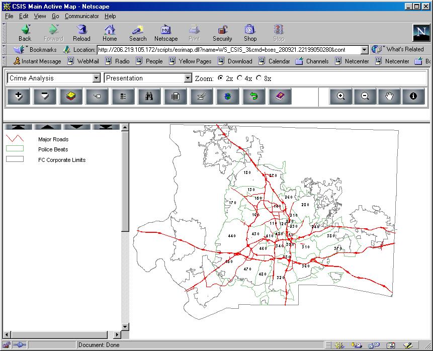
INDUS Corporation developed the generic web-based Community Safety Information System with Winston-Salem as the pilot site. CSIS was developed using MicroSoft Visual Basic 5.0 and 6.0, Seagate Crystal Reports 7.0, MapObjects 1.2, Internet Map Server (IMS) 2.0, (Environmental Systems Research Institute, Inc., Esri) and JavaScript 1.2 software. CSIS was developed using the Esri MapObjects and Internet Map Server products with Oracle 7.33 Relational Data Base Management System (RDBMS) for the data repository. This application runs on a dedicated server, Dell dual processor, 450 Mhz, 2 - 18 GB drives, 500 MB RAM, which is housed at the WSPD. CSIS is password protected to limit access to only those privileged to see the sensitive juvenile data that it contains. Access is also available using the default guest login, which limits the functionality. Queries are submitted via html forms and converted by java script into SQL queries to Oracle tables. The results are passed to the web server where the map is created and sent as a graphics image to the client’s browser.
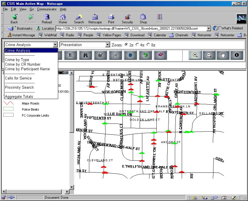
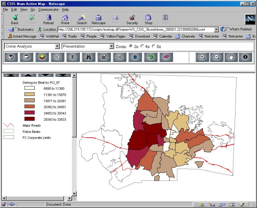
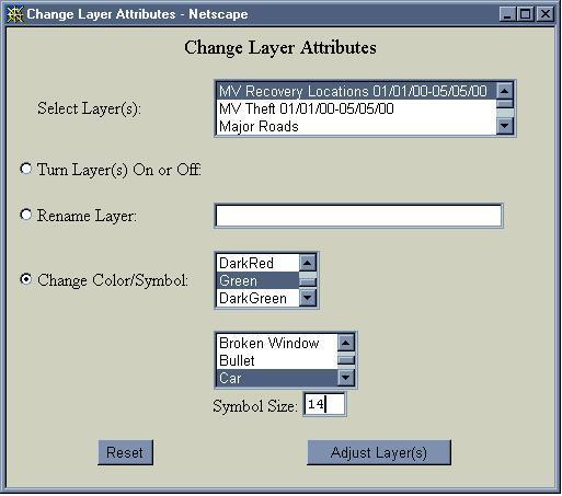
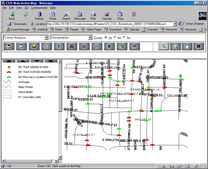
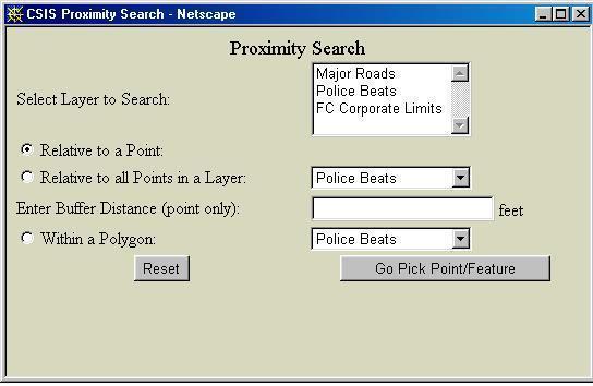
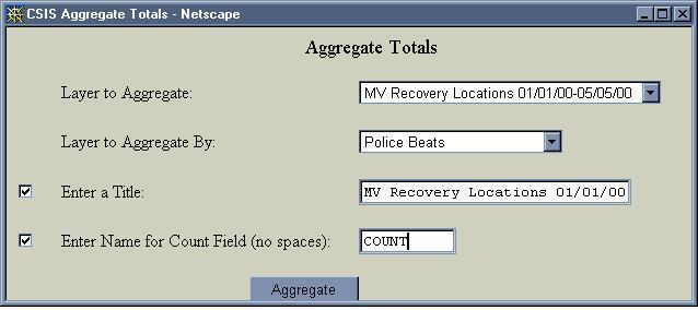
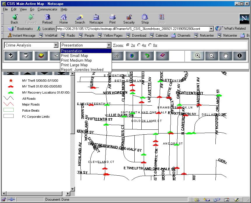
CSIS has been designed to simplify the integration of additional GIS layers. This allows the application to continue to evolve as shifts in crime focus or emphasis occurs. New layers are easily added to CSIS by copying the layer to the spatial directory and defining it in the initialization (.ini) file used by the application. For example, when the SACSI multi agency Violent Incident Review Team reviewed juvenile crime incidents last year, a shift in juvenile crime activity to motor vehicle thefts and attempted larcenies was detected. New GIS layers for vehicle theft incident and vehicle recovery locations were created from WSPD data and added to CSIS to allow viewing of these locations. In the near future we will be adding registered Sex Offenders by home address and Probation and parole data to CSIS
NOTE: Due to the sensitive information in CSIS concerning juvenile crimes, this application is not available to the general public. The application is password protected. The URL shown on the screenshot is an Intranet address with limited access.
CSIS features including most recent enhancements:
Our challenge to complete the development of CSIS and to enhance this application to successfully meet the the needs of SACSI analysis in Winston-Salem has continued with some additional support and funding from DOJ and Indus Corporation, the developer, as well as through our local efforts. Some of the initial challenges were due to Winston-Salem being the first site for CSIS implementation. The initial implementation encountered delays and the application developed was different than our expectations. The implementation for the second SACSI site, New Haven,CN, was a much quicker process. However, the funding was gone. Thanks to the continued support from Debra Stoe, CMRC, and NIJ, additional funding was found to allow INDUS Corporation to update CSIS in 2000, to correct some of our issues with data migration and query functionality and to add enhancements developed during the New Haven customization.
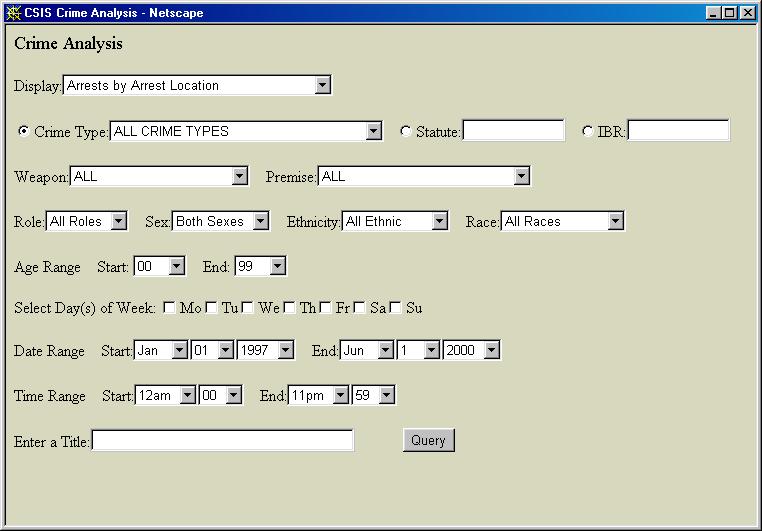
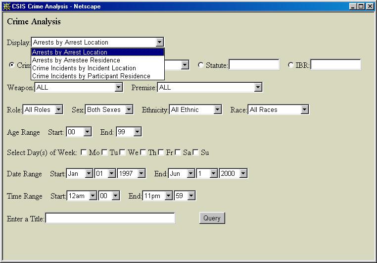
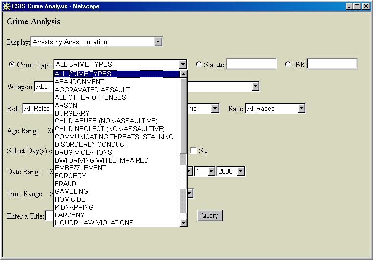
Additional parameters were added to queries, such as weapon type, DOW, and Modus Operandi (MO). CSIS was enhanced to integrate calls for service and to support arrest queries by arrestee home or arrest location. Also, the home addresses of offense participants were added as another GIS layer that can be accessed by this application. An additional flag was added to the names table to indicate those offenders who have been notified by SACSI agencies of the intervention resources available and the consequences of continued violent behavior. Some of the enhancements to the basic application developed for New Haven have now been added to the Winston-Salem CSIS. For example, the presentation options now have map output available (i.e. printing no longer requires screen print capture and pasting into Windows paint accessory.) Additional edits have been added to prevent users from submitting queries and other requests that are not supported. Since Winston-Salem was the first CSIS site to be developed, and the only one using Oracle for a repository, we have had more technical difficulties with the VB/MO IMS solution technology. We still have additional work ahead of us to fully utilize the potential of CSIS.
For the continued success of the CSIS application, the spatial and attribute accuracy of this information must be maintained. Providing analytical tools to researchers and allowing extraction of data for further manipulation is one goal. Maintaining data quality is another responsibility that will continue to take local time and resources and can not be compromised. The street centerline network continues to require ongoing development and maintenance, as do the new layers developed for SACSI. One important functionality we initially lacked was a way to identify specific types of businesses. i.e. show all of the hotels/motels, restaurants, car dealerships, bars, churches, etc. This was resolved by creating separate coverages by business. Business layers continue to be investigated and corrected, as we consolidate valid businesses from the WSFD, WSDOT, and WS business license data and receive feedback from officers on the street. As land use codes are collected and coded in the cadastral coverage by the FC Assessor’s Office in the near future, we will have another cross reference of the business location data that can be used as a cross check of our business coverages being enhanced. In order to improve the analytical functionality of CSIS, this data must continue to be reviewed and updated. Crime related information is still not available electronically from the FC Sheriff's proprietary Records Management System. When and if this is received, a process to load this into CSIS and ensure that the existing queries work with this additional data will be needed. The WSPD historical crime data used in SACSI was converted from Uniform Crime Reporting (UCR) to Incident Based Reporting (IBR) coding in 1999. The demographic and discipline and attendance data aggregated by schools is loaded into CSIS, as well as the unfit and to be demolished houses. New GIS layers being developed, such as the home addresses of habitual felons and repeat offenders can also be integrated into CSIS. One issue we still have not addressed is redesigning the Oracle tables and updating the Javascripts, Crystal Reports and SQL queries to convert dates from character type attributes to date type. The migration process is unwieldy with the complete replacement of large files of police data each time. Our goal is to add the option to append, rather than requiring a complete replacement for each file migrated.
According to the "SACSI Implementation Action Plan Initial Draft", June, 1999 , the initial key findings from the SACSI research analysis indicated that juvenile violence was clustered in four specific neighborhoods in Winston-Salem, with hot spots around certain blocks, dead-end streets and convenience stores. Older offenders often tutor younger ones, especially in drug violations. A small number of perpetrators were responsible for most serious crimes. The research pointed out the need for after school and mentoring programs. The fundamental strategy recommendations from the SACSI Strategic Core team were that enforcement, intervention, and prevention activities were needed. The continued focus of SACSI enforcement strategies has been on repeat offenders and cleaning up problem locations. SACSI intervention strategies have involved early identification and providing intervention for chronic juvenile offenders with priority treatment and services. Operation Reach, an ongoing effort organized by SACSI, has taken teams of ministers, street workers, truancy team members, social workers, probation officers and sheriff and police into neighborhoods to talk with troubled youth and their families. The prevention component of SACSI recommended a family-focused case management approach, with in-school and after-school activities in SACSI identified neighborhoods. Conflict resolution and anger management skill development with cultural sensitivity was also recommended by the initial research.
Through the SACSI efforts and the partnerships developed, Winston-Salem and Forsyth County is receiving approximately $6 million in federal funding from the Safe Schools Healthy Students Initiative. This funding, over a three year period, supports truancy teams of School Resource Officers (SROs) and social workers, training in violence prevention, parent education and after school programs in SACSI identified high juvenile crime neighborhoods. A SACSI cross-agency team with staff from OJJ, WSFCS, and DSS has been established to implement case management focusing on SACSI identified youth and their families. VisionsWork Youth Services has received funding from the Governor's Crime Commission to establish a SACSI Streetworker Program, which is modeled after the successful Boston street-level outreach program. This funding enables four Streetworkers to network with at risk juveniles on our streets. Special mentoring and training programs have been set up at VisionsWork and Urban League. With the awareness that job skill training and access to jobs is a key factor in turning our youth from drugs and other crime, job skill development and networking with potential employers has been part of SACSI efforts. Another issue identified by the initial SACSI analysis was that offenders 16 and 17 years-old had aged out of the WSPD juvenile repeat offender unit and had "fallen through the cracks", because they were not automatically passed on to the adult repeat offender unit. This has been remedied through new procedures within WSPD.
SACSI has been awarded a $1.8 million grant from a local charitable trust to establish a
Center for Community Safety at the Winston-Salem State University campus. Funding for staff, including a full time
project coordinator
and program manager, is provided. The Center will expand its focus beyond just juvenile violence and will tackle
other community violence and safety issues.
Management of SACSI day to day operations has transitioned from the US Attorney's Office to the new Center for
Community Safety. The Federal Weed & Seed program sites have been expanded to include those neighborhoods with a high
concentration of juvenile violence, as identified by SACSI research. The Weed & Seed program, which brings extra resources
to troubled neighborhoods to "weed" out the criminal activities and "seed" to revitalize these neighborhoods,
is now partnering with SACSI
to operate from the new Community Safety Center. The SACSI working group has taken over responsibility
for notifications and Operation Reach activities, with a WSPD police officer assigned as a full-time liaison to assist
SACSI efforts.
to assist.
A local minister now works part-time out of the Community Safety Center to engage more members of
the faith community in SACSI efforts. With clergy, law enforcement, and community resources working together, we are
providing alternatives for our youth that can enable them to make positive changes and say no to a life of
violence and crime.
Most recently, with NIJ grant funding, the Winston-Salem/Police Foundation Safe
Schools Partnership began building upon the groundwork of SACSI efforts and partnerships to develop a Safe Schools
mapping application. Our first meeting
was very appropriately held in the new Center for Community Safety. Our work to reduce juvenile violence and
improve community safety continues. We are well under way in our community to deal with the critical issues
concerning juvenile violence and to implement intervention strategies to redirect the lives of our children.
The work being done in Winston-Salem will not only
help our community, but also serve in developing a model for other cities that can assist in crime reduction.
We have a responsibility
with both the technology and the intervention roles to continue this process and make a more
proactive response to issues of juvenile
violent crime in our community. The first SACSI intervention strategies began implementation in September, 1999. WSPD arrest data
comparing 9/1/1999-3/31/2000 with the prior two years indicated a
decrease in juvenile arrests
(-28.5% decrease from last year compared to the current year) for the violent crimes targeted by SACSI.
Although the citywide
offense rate has increased citywide in the current year for the violent crimes tracked by SACSI,
it has decreased in the SACSI
neighborhoods. Conley,Julia; Groff,Elizabeth. "Using GIS to Support Community Safety: Strategic Approaches
to Community Safety (SACS) Initiative in Winston-Salem, NC", 1999 Esri User's Conference,
http://proceedings.Esri.com/library/userconf/proc99/proceed/papers/pap523/p523.htm) Kennedy, David M. "Pulling Levers: Getting Deterrence Right." NIJ Journal: July, 1998. Oberle, Sylvia. SACSI NEWS, Volume I, Issue 1 May 10, 2000. Soloman, Amy 1997. "Strategic Approaches to Community Safety Initiative:
A Concept Paper." Internal document National Institute of Justice. Indicators of Effectiveness
REFERENCES
Appendix A
Data and Sources for the Initial Applications
| Abandoned Housing |
FC - Housing Code Enforcement |
|
Abandoned Housing | WS - Housing Services |
| ABC Permit Holders |
Alcohol Beverage Control (ABC) Commission |
|
Accidents | WSPD |
| Adult establishments | WS Business License |
| Arrests | WSPD PISTOL 2000 Arrest Module |
| Car dealerships | WS Business License |
| Convenience stores | WS Business License |
| Crime Incidents | WSPD PISTOL 2000 Incident/Investigation module |
| City Boundary | City/County Planning Department |
| Crime victims | WSPD |
| Demographic characteristics | WS Housing Neighborhood Development |
| *Drug markets - unavailable | ABC Violation Locations |
| ABC Violation Locations | ABC Law Enforcement |
| WS Abatement Letters | WSPD |
| Fire Demand Zones | WS IS Department |
| Hotels/motels | WS Business License |
| Nuisance Violations | WS - Housing Code Enforcement |
| Liquor houses | ABC Violation Locations |
| Neighborhood Association Areas | City/County Planning Department |
| Nightclubs | WS Business License |
| Property (Parcels) | FC Assessor's Office |
| Police Beats | WS IS Department |
| Public/Subsidized Housing | HAWS Housing Authority of Winston-Salem |
| Housing Authority Project locations and Units | HAWS Housing Authority of Winston-Salem |
| Restaurants | WS Business License |
| School Districts | City/County Planning Department |
| Schools | FC School System IS |
| Sectors | WS IS |
|
Street Centerline | WSPD initially, then FC Assessor's Office |
| Street Lights |
WS DOT |
|
Students | FC School System IS |
| School Attendance |
FC School System IS |
|
School Discipline | FC School System IS |
| Person Data |
WSPD PISTOL 2000 Name Module |
|
Youthful offenders | WSPD PISTOL 2000 Name Module |
| Banks | WS Business License |
| Churches | WS Business License |
| Railroads | FC Assessor's Office |
| Hydrology | FC Assessor's Office |
| County/City | Esri - County.shp. For US |
| FC Corporate Limits | City/County Planning Department |
| Major roads | Centerline attribute 'Road_Class' |
| Arrestees | WSPD PISTOL 2000 Arrest Module |
Julia B. Conley
Senior Information Systems Analyst
Winston Salem Police Department
Information Systems Division
City of Winston-Salem
725 N Cherry St
Winston-Salem, NC 27102
(336) 773-7864 FAX (336) 773-7996