1. Improving Access to Environmental Information - The CEROI Programme
 Agenda
21, adopted at the 1992 UNCDE Earth Summit conference in Rio de Janeiro,
Brazil, specifically calls for improved environmental information for decision-making,
environmental education and awareness rising. At the Summit, world leaders
signed a global environment and development action plan involving citizens
in cooperation with their local government to develop a sustainable strategy
at local level, its own Local Agenda 21.
Agenda
21, adopted at the 1992 UNCDE Earth Summit conference in Rio de Janeiro,
Brazil, specifically calls for improved environmental information for decision-making,
environmental education and awareness rising. At the Summit, world leaders
signed a global environment and development action plan involving citizens
in cooperation with their local government to develop a sustainable strategy
at local level, its own Local Agenda 21. Furthermore, the Århus Convention of 1997 leads in a similar direction by aiming to guarantee the rights of public access to environmental information and public participation in decision-making. It also affirms the need to ensure sustainable and environmentally sound devlopment.
1.1 Putting environmental information to work
The reports can be easily accessed on the CEROI gateway, where members can store or mirror their SoE reports on a central server at the GRID-Arendal office. The site functions as a global gateway to urban SoE reports. It also provides a meeting place for discussion, exchange of experience and information as well as it offers extensive help on how to produce SoE reports and utilise urban environmental indicators. The gateway provides a database for comparison of key issues and core indicators of all published CEROI reports. This makes it possible to monitor global trends and read about local responses to urban environmental problems.
1.2 The pilot phase
2. The template and the software
 Together
the Publikit®
software and the CEROI template are a unique combination and simple
to use and do not require any special technical knowledge or experience.
The software and its template system transform complex environmental information
into comprehensible and accessible SoE reports.
Together
the Publikit®
software and the CEROI template are a unique combination and simple
to use and do not require any special technical knowledge or experience.
The software and its template system transform complex environmental information
into comprehensible and accessible SoE reports.2.1 The CEROI template
Regardless of the issues and indicators the city chooses to use, the template will accommodate them. Many of the issues are already included in the template together with basic elements needed on the report pages. There is also room in the template for highlighting important items, including news, frequently asked questions, links to other resources, contacts, and other complementary information. The template offers environmental, design and programming help on how to complete each individual page.
The CEROI template also includes core indicators and proposed indicators for use within individual themes. Indicators in the context of a state of the environment report are representative, concise and easy-to-interpret parameters, which are used to illustrate main features of city environment and their development over time and space. The indicators are based on UNCHS (Habitat) indicators and the OECD core set of environmental indicators. The selection of indicators and pilot cities were closely co-ordinated with the Cities 21® of ICLEI. These indicators will be accessible and comparable both through individual city reports and through the CEROI server.
2.2 The software
Initially, the software
Publikit® was developed for environmental reporting on the Internet.
The software allows anyone to create, publish and maintain information
on the Internet. Publikit® utilizes an easy-to-follow navigation system,
a comprehensive help system with easy- to-follow steps for creating standardized
web sites and web reports from concept through to completion. It offers
features for comparing data with one server set-up for multiple sites
and a data fast link to the Internet. Additionally, Publikit® can
be used for all web-publishing purposes and enables users to quickly custom-create,
disseminate and maintain their own reports and information structures
for their specific needs. It can also be combined with other software
programmes for user-friendly handling.
The HTML Editor is the central unit for creating content and layout of
web pages. The editor is based on Microsoft technology to ensure full
control over the layout as well as to obtain the level of functionality
expected of a modern word processor and design tool. Additionally, the
software offers editing possibilities in the HTML source code of each
web page for more experienced web publishers. Creating a complete web-based
report requires a lot of repetitive work, such as inserting headers and
footers on every page of the project. Publikit® carries out therefore
routine tasks by using reusable objects, i.e. changing a piece of information
will automatically update all relevant pages.
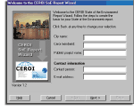 As
applicable for the CEROI template, Publikit® contains wizards that
guide the user through fairly advanced processes, such as publishing to
the Internet, in straightforward steps. The extensive Help system serves
as an on-line handbook by providing technical, thematic and design guidance
for create web pages and Internet reports.
As
applicable for the CEROI template, Publikit® contains wizards that
guide the user through fairly advanced processes, such as publishing to
the Internet, in straightforward steps. The extensive Help system serves
as an on-line handbook by providing technical, thematic and design guidance
for create web pages and Internet reports.
It was decided to use the advantage of GIS as an effective visualization
tool to present environmental data on the Internet. Using GIS on the web
opens up easy access to environmental information. Maps indicate clearly
where environmental problems are located, such as contaminated sites and
their pollution level.
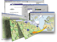 Maps
also graphically identify where environmental work needs to be carried
out. Publikit® offers powerful
GIS functions for handling vector and raster maps on the Internet.
The map module provides an easy way to publish dynamic, interactive maps
on the Internet. The raster map engine displays raster maps and supports
a layer of interactive graphical symbols. When inserted into a web page,
the Publikit® map engine makes the map come "alive" on the
Internet. This includes panning the map and dynamically investigating
graphical information. Useful map explanations and hyperlinks can be added
for in-depth information. The symbols can be grouped into categories and
themes as well as each symbol can be linked to an Internet page containing
additional information. Even more significant is the usage of ArcIMSTM
in conjunction with Publikit® for publishing complex vector maps to
achieve optimal mapping interactivity. The Publikit® software includes
its own module for connecting to existing ArcIMSTM service
to individual web sites. A wizard guides users through the process of
connecting to existing ArcIMSTM, select map services, and tools
to be activated in the Internet map presentation, such as zooming, panning,
layering. Therefore, the Publikit® software provides easy entry into
the complex GIS world for users with little as well as advanced mapping
background.
Maps
also graphically identify where environmental work needs to be carried
out. Publikit® offers powerful
GIS functions for handling vector and raster maps on the Internet.
The map module provides an easy way to publish dynamic, interactive maps
on the Internet. The raster map engine displays raster maps and supports
a layer of interactive graphical symbols. When inserted into a web page,
the Publikit® map engine makes the map come "alive" on the
Internet. This includes panning the map and dynamically investigating
graphical information. Useful map explanations and hyperlinks can be added
for in-depth information. The symbols can be grouped into categories and
themes as well as each symbol can be linked to an Internet page containing
additional information. Even more significant is the usage of ArcIMSTM
in conjunction with Publikit® for publishing complex vector maps to
achieve optimal mapping interactivity. The Publikit® software includes
its own module for connecting to existing ArcIMSTM service
to individual web sites. A wizard guides users through the process of
connecting to existing ArcIMSTM, select map services, and tools
to be activated in the Internet map presentation, such as zooming, panning,
layering. Therefore, the Publikit® software provides easy entry into
the complex GIS world for users with little as well as advanced mapping
background.
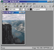 The
graphics module of Publikit® includes image-editing functions, handles
importing, converting and manipulation of graphics and images, and automatically
prepares images for Internet browsers. The software also facilitates the
creation of tables, charts and graphs by connecting to existing data source
or by entering new data.
The
graphics module of Publikit® includes image-editing functions, handles
importing, converting and manipulation of graphics and images, and automatically
prepares images for Internet browsers. The software also facilitates the
creation of tables, charts and graphs by connecting to existing data source
or by entering new data.
When the report has been completed, the Internet publisher module connects
and transfers each file to an Internet server in a simple process. Additionally,
the software allows updating of individual pages and folders without having
to publish the complete project again.
3. Choice of communication channel
The CEROI Programme decided to utilize the Internet. The Internet is a rapidly growing information medium that is easily accessible globally. Published information is easily updated, thus reducing the risks of presenting old and invalid information. Publishing a SoE report on the Internet is a quality control itself, since stakeholder will react if the information presented is not correct.
4. The implementation
The implementation of the CEROI Programme was started early 2000 in co-operation with regional and international institutions and networks such as ICLEI, EEA, Habitat/Global Urban Observatory, Medcities and others. The CEROI secretariat has been set up to promote, develop and facilitate the CEROI network, publish a regular CEROI newsletter and organise sponsors support to cities with constrained economic resources.
5. Summary
The CEROI Programme with the software Publikit® emerged as an Internet publishing system for simply handling complex environmental information structures. It fills in a gap in the global work of improving public access to environmental information as stated in the Agenda 21, adopted at UNCDE Earth Summit conference in 1992. The CEROI network gathers people from around the world to share information on urban environmental data, their experience and efforts. Members can signpost good environmental practice in their local community and promote their achievements globally.