AREALIS is a national initiative on establishing a nation-wide Geographical Information System (GIS) making environmental data and land use information available. The Norwegian Mapping Authority is leading the project.
It is a unique co-operation where governmental agencies, together with all counties and municipalities, 435 in all, are to develop and deliver a variety of environmental data sets.
The information is shared by the parties, and are also spread for external use. AREALIS data presents the value and interest of different sectors. Such information is essential for land users if we are to move towards a sustainable land use. A joint effort is very cost-effective. Other important aspects of AREALIS are very focused spesifications, high diversity of topics, broad diversity in partners and users, joint management and the use of the National Spatial Database infrastructure (NSDI). AREALIS uses Esri products in data mangament (SDE), web map presentations and among users (e.g. ArcView).

1. Overall objective of the project
AREALIS is a national programme initiated by the Norwegian Ministry of Environment. It is a nation-wide project aimed at making environmental data and land use information available at local and regional administrative levels (counties and municipalities).
This project has run since 1997. All counties are to develop a variety of environmental data sets. The aim is to develop relatively detailed data sets for all the 435 municipalities, but the project will only cover about 1/ 10 of this number by the end of the project period. Many data sets are drawn from different national mapping, management and planning agencies. Data are simplified, standardised and processed in order be accepted and used by the administration in the municipalities. Distribution of the variety of geographic data sets are handled by one agency - the Norwegian Mapping Authority, making information easily available. The Norwegian Mapping Authority is co-ordinating the project on behalf of the Norwegian Ministry of Environment. See www.statkart.no/arealis
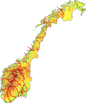
Figure 1: Norway has a varied environment and topography. Many environmental values need to be reflected in the planning processes at the local level.
2. Background
Land use planning and other kinds of planning effecting the environment are carried out at both national, regional and local levels. The central government works out overall objectives for a sustainable development, and uses different means to direct the development. These include legislative measures such as the Planning Act, other kinds of regulations, detailed planning, major environmental impact assessments etc. Despite these measures we find many examples of land allocation and development which not can be labelled environmentally sound, irreversible land use changes, severe land use conflicts, severe pollution affection neighbourhoods etc. The existing measures alone are inappropriate to cope with the problems regional and local planners are facing.
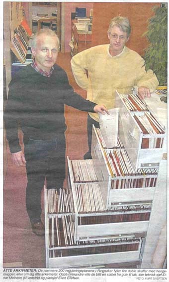
Figure 2: Information is difficult to get hold of. Land use plans are currently stored in drawers and shelves.
At the same time we find a vast spectrum of environmental information in different institutions, commonly scientific information with high accuracy, but too detailed to be informative and of value for planners. Often planners get hold of information late in a planning sequence resulting in reduced ability to adjust plans, making planning long-lasting and expensive, producing severe land use conflicts and result in-proper land use. By making existing environmental data and land use information from different sectors available at local and regional administrative levels (counties and municipalities) we hope to stimulate the work for environmentally sound land use, sustainable development and rational planning, minimising land use conflicts and resulting in shorter planning time and economic use of the planning force.
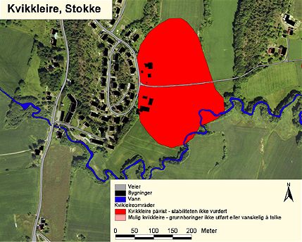
Figure 3: Land areas suceptable to land slides (clay) marked in one of the databases in AREALIS. It is essential information for planners. Combined with data sets on existing and planned houses planners can take action and avoid areas prone to slides.
AREALIS is a very important project designed to solve some of these vast areas work, and make planners and politicians able to cope with their day to day work on sustainable development planning together with their aim to carry out predictable planning operations. AREALIS is as such user-oriented, giving weight to the needs of local and regional planners and decision-makers.
3. Organisation and co-operation
Some of the most important elements of AREALIS can be summarised as follows:
4. Important elements of AREALIS - standardised data - easy access
Concerning data capture, data storage and distribution the following elements are important for a well-functioning system were environmental information is actively being utilised;
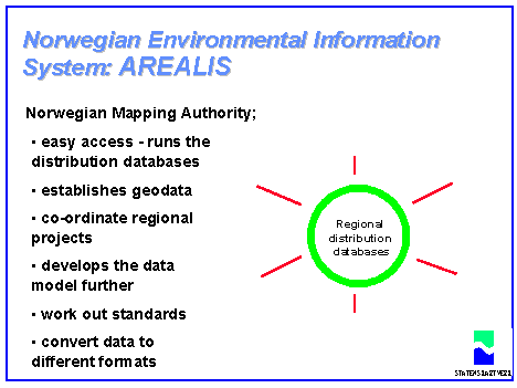
Figure 4: The Norwegian mapping authority runs distribution databases. Data from different owners are collected and sent to users. If users need the broad package of thematic data they can contact one focal point instead of getting in contact with many partner. Distribution is by sending CD's. This is the technology that currently is operating.
5. The thematic information in AREALIS
These are geographical data sets (digital maps linked with matrix information) of many kinds. About 150 data sets have been defined, grouped into several main topics.
The topics included in AREALIS are based on the needs on local and regional planning levels.
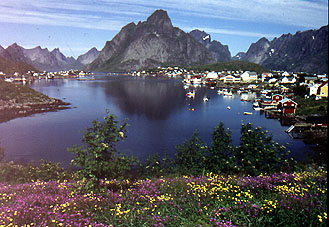
Figure 5: It is essential for AREALIS present and distribute information about different environmental values and sector interests. Landscape map data devided into regions is one of the datasets presenting landscape values. Here Lofoten, Northern Norway.
6. Utilizing new technology in distribution - high speed communication
AREALIS uses internet for presentation of the project and for distribution of messages and reports about both the project and the data. A specific reference service is being offered, where coverage and regulation attached to the data sets are presented.
We are now carrying out tests for data delivery through internet, by using internet map servers. This is a joint project ("High Communication Project") between the Norwegian Mapping Authority and other national agencies
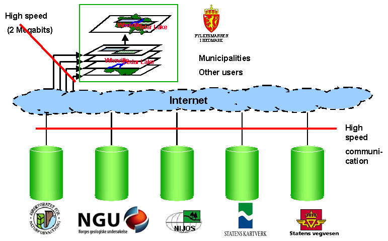
Figure 6: National users/ agencies in Norway now are trying out different high speed communication solutions. National bodies both use and deliver data, and make data available also to municipalities. The national agencies include environment, roads, maps, geology, agriculture and forestry.
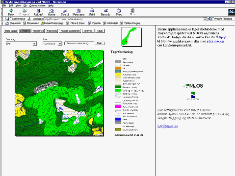
Figure 7: A view that is a combination of data from different servers made available through high speed communication network. The ones connected use ARCims-technology.
Author information:
Mr. Arvid Lillethun, Senior engineer