Brandt Melick and Doug Smith
Leveraging Success Though Partnerships and Process
With a tight budget and limited staff the City of Springfield took a creative
approach to their 2000 Re-mapping Project. Every aspect of the project was confined
to stringent time frames, and most staff support became voluntary. Only through
forging strong partnerships were the project able to succeed. Presenting perspectives
from both the City and their contractor, David Smith and Associates, the presentation
focuses on how to build partnerships that lead to success.
Springfield is a relatively small city, (approximately 14 square miles) with
a population of about 50,000. The City of Springfield sits in the middle of
the Willamette Valley, in the center of the state of Oregon, USA. It abuts the
City of Eugene along the West side, surrounded by rivers and mountains to the
East.
David Smith and Associates Inc. (DSA) is a photogrammetric mapping company
that has been in business since 1965. Portland, Oregon based DSA specializes
in photogrammetric mapping and overall project management of photogrammetric
projects.
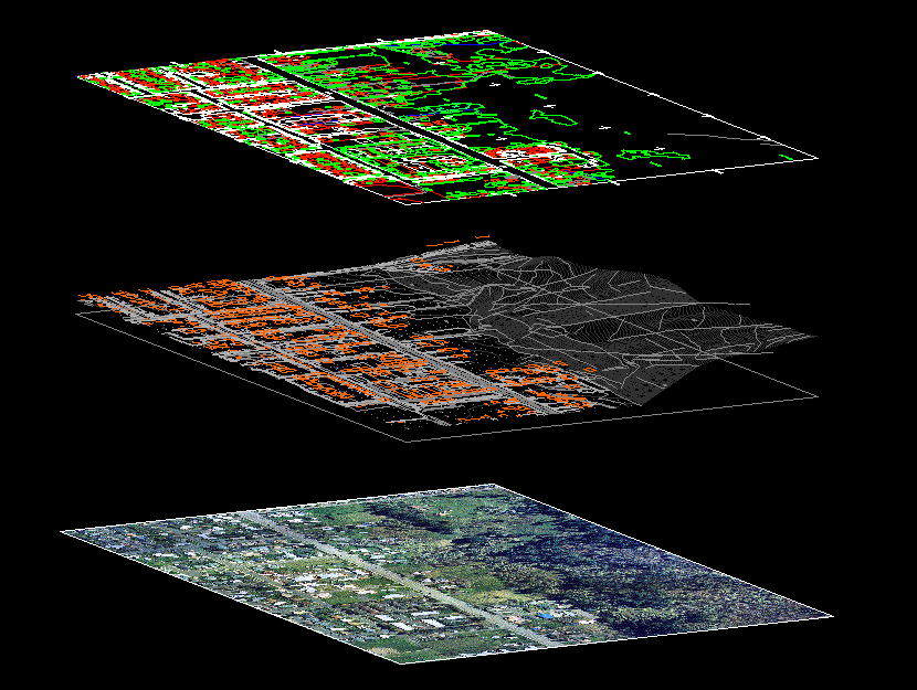
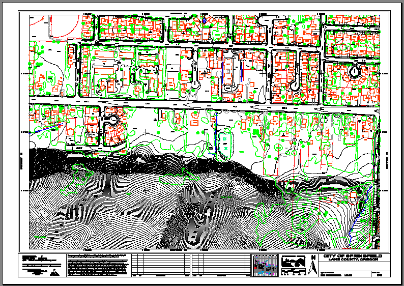
2000 Aerial Project Description
In March of 2000, the City's Public Works Department contracted with DSA for
digital mapping services to support AM/FM/GIS activities.
Project scope encompassed full planimetry (base maps), precise digital terrain
models (DTM) and high-resolution color orthophotography. These products replaced
digital topographic mapping from1990 and dated low-resolution digital photography
acquired over the years.
These products meet daily needs to perform site plan review, design and construct
new public infrastructure, maintain and operate city facilities, support crime
analysis/crime prevention studies and much more. Deliverables for this project
replaced our old base mapping information and went into use immediately upon
arrival.
Mapping Extents
The project boundaries extend slightly past the west side of Interstate 5 on
the West, 79th Street on the East, the outer banks of the McKenzie River on
the North and the Coast fork of the Willamette River on the South. This boundary
includes areas not previously mapped: the newly incorporated Glenwood area,
the area North of a new children's sports complex and the Thurston area between
Cedar Creek and the McKenzie River. For a detailed map of Springfield see the
City's Standard
Maps Web page.
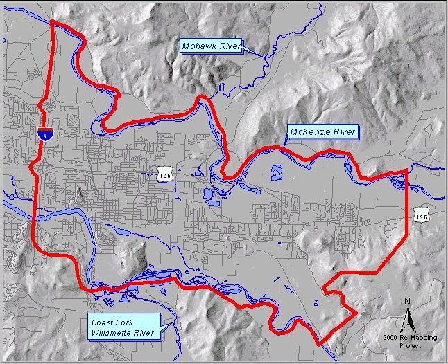
The 2000 project boundary (in red above)
significantly extends beyond the previous mapping area to include both rivers
for enhanced flood and habitat analysis along the riverbanks.
Schedule
DEC 1999 Received internal authorization to proceed
JAN 2000 Developed Request for Proposals (RFP)
FEB 2000 Selected proposal
MAR 2000 Completed pre-marking, ground control, aerial photography
APR 2000 Performed aeriotriangulation
MAY 2000 City reviewed first map sheet to finalize data collection
specifications
MAY-DEC 2000 Drafted planimetric maps, DTM and contours and submitted
draft data to City for review
JUNE -DEC 2000 On-going City review of map products to verify road
names, house numbers and other information
JUNE-DEC 2000 Create orthophotos as map sheets are completed
SEPT-DEC 2000 Incorporate City comments/changes into final map products
SEPT-DEC 2000 City review of final map products for final formatting
and product design
JAN 2001 Delivery of all final map products
Optimizing Success
Although this paper covers the essential elements of a comprehensive re-mapping
project (like project planning and design, mapping standards, data integration,
and the implementation of project deliverables) these elements are presented
within the context of our methodology and approach to building teams and establishing
partnerships. From the initial phases of building an RFP through the meticulous
tasks of Quality Control/Quality Assurance (QA/QC), cohesiveness and cooperation,
above all resulted in a win-win situation for both the City and the contractor.
To benefit the reader, information has been formatted to serve as useful tools
for embarking on similar projects. Throughout the paper essential factors (process,
guidelines and things to remember) will be highlighted as discussed and then
summarized at the end. By sharing this experience, the City hopes to increase
the chance of success for others. As is common in our industry, we all have
much to do in little time, so optimizing success is essential.
This paper develops four major themes in management: understanding roles, building
and maintaining teams, sharing the right information, and preparing and scheduling
resources. In the sections that follow, these critical elements are explored
from two points of view. First a framework is established for developing successful
internal teams. Then building on this framework, the critique extends to external
teams and describes in context (of the mapping project) successful dynamics
between the City and DSA.
Internal Teams
Building successful relationships starts at home. Internal animosity and communication
break down, however well masked, surface in these types of projects. Internal
teams need focus, support and confidence to succeed. They must trust you as
their leader. Be cautious not to engage in vague discussions about perceived
feeling or attitudes. Focus on actions, the environment and progress toward
achieving project objectives. As a team leader, establish self-confidence in
others and take time to maintain healthy relationships. Reward good behavior
and deal with problematic behavior before it escalates.
Do little things to raise spirits and keep a positive attitude. By setting
a good example and not dipping down into the lower levels (of hear-say and gossip),
a team leader or project manager can save a lot of energy, keep things on track
and achieve much more. Be liberal with compliments and be sure to recognize
achievements. Even though it may not appear to be a major breakthrough or project
benchmark to you, it very well could have been a major obstacle to your teammate.
When in doubt, don't hold back; results justify the time.
Pro-Actively lead the team. A critical aspect of effective leadership is knowing
your teammates. Each person reacts differently to different management styles.
Be flexible and adjust your style appropriately. Address inexperience with increased
direction and structure. Back off the discipline, provide moral support and
vision to more experienced staff. When appropriate, empower your staff by encouraging
ownership and respecting individual expertise. Think of your staff as a team,
and coach them with integrity and honesty. A well-inspired team will lead you
to success.
The city has found framework and process structure to be another critical component
to successful project management. When looking at projects such as this one,
break it down into several major steps, a few may include:
1. Project planning and initiation
Quantify and secure available resources (money and people) as this drives
scope and assists in formulating obtainable objectives
Document business needs behind project outputs and specify how mapping products
serve business needs
Identify map projections, map units, project control, and accuracy requirements
with engineers and surveyors
Identify content (mapping extent, layers, features, etc.) with potential
users like engineers, planners, and public safety staff
Review formats (layers, feature definitions, symbology, software formats,
etc.) with key users and data custodians
Keep your head above ground and identify future integration plans, new regulations,
mandates, asset inventory projects, habitat restoration projects, and the
like as they come to you upon project completion
2. Request for Proposals (RFP) and selection process
Clarify business needs and how mapping products meet needs
Define products and develop examples that illustrate desired content and
format
Pro-actively seek expert approval of RFP content and structure
Develop evaluative criteria with internal and (as appropriate) external experts
Develop standardized evaluation forms that focus on evaluative criteria
Require on-site presentations
Check references
3. Quality Control/Quality Assurance (QA/QC)
Review preliminary data
Develop standard forms to process feedback
Check accuracy, content and format
Test how well data meets key business needs
Keep project sponsor well informed (on how products meet expectations)
Test sample data in production (as appropriate in a controlled environment)
4. Project closure
Explain products to users
Educate users on proper use, product limitations and timeframe(s) for delivery
Post products
Showcase the value of your teams' contributions to the project
These steps can come from a work plan, action plan or other guiding document,
but they need to reflect clear divisions that the whole team can understand
and appreciate once completed. The list above (1-4) reflects a few that were
used on our project.
Do your homework in the early stages of project initiation. Define roles and
carefully pick staff to fill the roles. Pick people who have a vested interest
in the project outcomes, when possible. Define the necessary commitments and
discuss these commitments up-front with potential staff and their supervisors.
Recruit staff and explain why they were chosen. Be sure to explain value to
your candidates, project value to them, value to the organization, and why you
value their participation on the team.
Project initiation should include a kick-off meeting. Get the team together
with their supervisors, the project sponsor (director or department head who
is funding the project) and layout the commitments, discuss schedules, layout
project objectives and clearly define the goals/project outputs. Make sure everyone
knows what he or she is getting into and why he or she is there. Time spent
in the early stages of any project will pay off in the long run.
For our project the RFP and the selection process were key pieces. Great care
was taken to explain the evaluative criteria, integrate the team's feedback,
and discuss why these criteria had been chosen and the logic behind how to insure
project outputs. Forms and other instruments were developed to focus the team
on these criteria, standardize the evaluation and save time. Everyone sees things
a little bit differently so do not assume they think the same as you. During
the selection process apply some structure and assist others in following the
rules.
Throughout the project several teams were formed. The QA/QC team had different
folks than the RFP team. In addition to the team-building and leadership points
mentioned above, remember the following:
- Focus on clear project objectives
- Organize new teams as required
- Frequently communicate with team members
- Pro-Actively track progress
- Recognize achievements
Lastly, regarding internal teams, be sure to acknowledge project closure. Even
if it's an un-successful completion, list the problems, develop solutions and
be sure to recognize accomplishments.
Upon successful completion, celebrate. Your team has been through a lot, and
they deserve credit for their efforts and hard work. If it's been a good team,
you may need them again in the future. I have found that food, especially pizza,
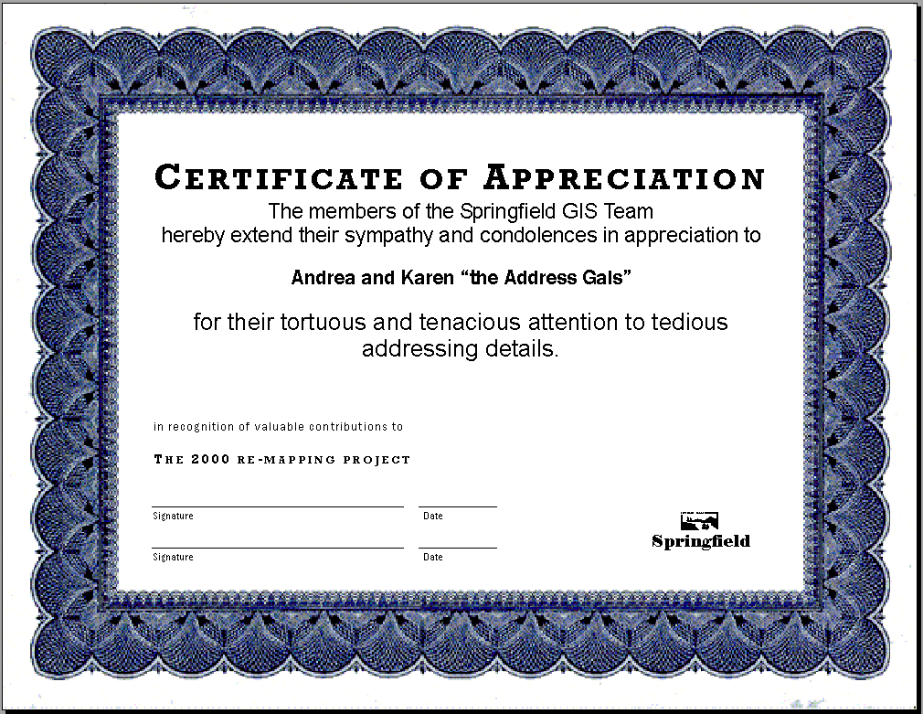
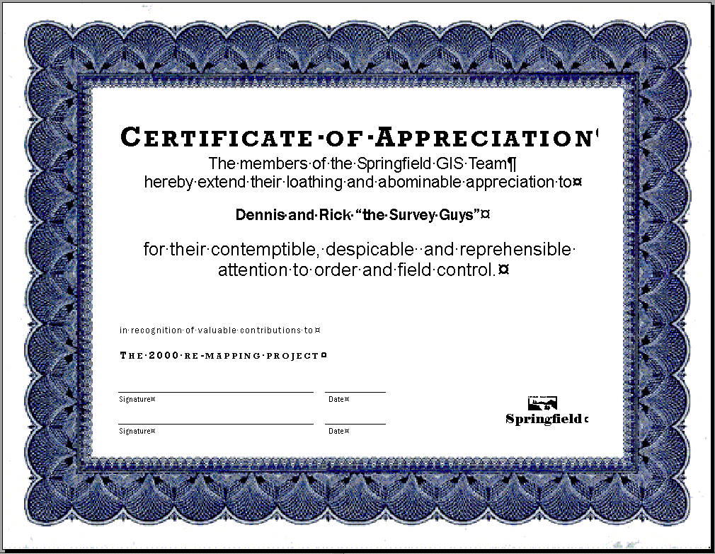
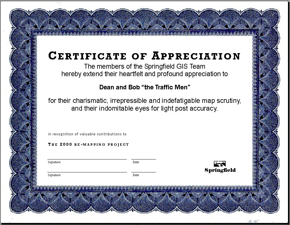
and some awards can make the event a lot of fun. See Address
Gals, Survey Guys, Swale
Guy, and Traffic Guys for sample awards.
External Teams
Just as a successful project requires careful structuring of the internal teams
in order to get a clear definition of the project goals, equally careful structuring
of the external teams make sure that technical aspects of the project implementation
meet the goals.
Optimal success comes from fostering a relationship with the consultant that
allows this "external team" to function as an extension of your internal
team. You have selected the consultants that make up your "external teams"
because you feel these people can provide the level of expertise and quality
you require for the best overall value to the project. By forging a relationship
that allows the external team to act as an extension of your own internal team
capabilities (rather than as a completely independent entity), you can take
better advantage of the expertise and value the consultant can lend to your
project.
Developing this kind of relationship with the external team requires thinking
of your consultants not as just data providers, but as a professionals with
unique capabilities and experience that can benefit your project. From that
standpoint, you can take several pro-active steps to get the most out of the
services provided by the consultant and their external teams.
In defining roles, recognize that more interaction with the consultant equates
to more value
Projects that require more expertise from the "external team" also
require a different level of interaction with the consultants. Purchasing "off
the shelf" imagery, or data layers derived from existing maps, is a different
process than planning and designing a project to create new base mapping. When
purchasing existing data or contracting for conversion of data from existing
sources, there are somewhat limited options with regards to accuracy and formatting
and there is a limited amount of input that you can provide that will affect
the quality of the final product. When designing a project to create new base
mapping data, there is almost unlimited potential to customize accuracy, formatting
and overall data design. Consequently, by working closely with the consultant
and through on-going communication with the external teams, you can create the
opportunity to insure the project achieves its full potential to meet the goals
and needs defined by your internal teams.
In the case of Springfield's re-mapping project, the data products created
not only needed to support GIS and planning applications, they also needed to
support critical City engineering and surveying activities as well. The updated
data needed to maintain compatibility with existing activities and uses, but
also allow the City to take advantage of new technologies to expand their ability
to use this information for new applications. The diverse needs for a project
of this scope added considerable complexity to issues such as accuracy, data
formats and overall project design and structure. The City could not meet their
goals without on-going communication with DSA throughout all project phases.
Recognize that the Consultant does have specialized expertise and don't
be afraid to ask for changes or recommendations
Photogrammetric mapping, as well as many other specialized consulting fields,
is a highly technical process and very few GIS Coordinators have the day-to-day
experience with this technology that is needed to fully understand all the complex
issues that affect the project. As such, do not be afraid to ask the consultant
what would be involved in revising a project specification or in changing a
specific element of the project if it would better suit your needs. When it
comes to aerial mapping for City GIS programs, every project differs as each
City puts their own twist on the end uses and has specialized applications for
the data. Just because one process worked best for another project does not
mean that it is the best approach for your project. Many times a change in the
approach will not have any affect on the consultant's cost or level of effort,
but it could result in significant savings in time and money for the final specific
application.
When it comes to technical processes like photogrammetric mapping, your consultant's
expertise is a key element of success.
Timing is everything: allow for several stages of review, from an initial
"Pilot Project" through final approval
Interaction through the intermediate review process is critical. In any complex
project, opportunities to improve the project occur when you actually see and
use the products. Without a well integrated review process you may miss opportunities
to refine products and make changes that can save you cost down the road.
Success hinges not only on your initial approach and specifications, but also
on your ability to identify and incorporate improvements at key phases in the
project. While it is important to resolve as many issues up front as possible,
it is equally important to include a benchmark for review of an initial "Pilot
Project" or "First Sheet Review," before the consultant has committed
to a final approach. This will allow you the opportunity to ensure that the
project is meeting all goals and needs prior to full production and will also
provide the opportunity to potentially identify additional value that could
be added to the project.
For Springfield's re-mapping, the City had the advantage of working with photogrammetric
mapping data over the past ten years. Many of the enhancements to the data were
based on those years of experience. However, the City also conducted a careful
review of the initial data. This allowed them to further assess how well the
data met their goals. Several additional enhancements were added based on the
City's review of the initial sheet. Since these issues were addressed before
full production of the data collection, the changes were easily incorporated
into the process without affecting the overall cost.
On-going review by the internal teams of data provided by the external teams
is also critical. The City may have access to information that the consultant
does not have. In the case of photogrammetric mapping, on-going review typically
includes road name verification, verification of utility features and other
issues.
Final approval will be a smooth process with no surprises if the initial review
phases were implemented. It is much easier to catch problems and avoid delays
if issues are raised up-front, instead of at the end of a project.
Net Results: More Value for Less Cost
Through active project management and teaming, the City was able able to move
beyond the RFP specifications and the minimum base mapping requirements typical
for City mapping. By implementing the management and teaming practices presented
in this paper, the City was able to incorporate many changes in the technical
processes that will allow them to save significant cost when developing the
applications that are being built on top of the base mapping data. Many of these
applications may not be unique (impervious surface studies, 3D modeling, maintaining
compatibility with existing hardcopy map needs, maintaining compatibility with
existing engineering CAD uses, etc.). Unique though, is the fact that the City
will be able to implement these applications quickly and with significantly
less cost than if they had not implemented the aggressive up-front planning,
timely review and team oriented effort that formed the cornerstone of this project.
Here are a few examples of some of the added value the City was able to achieve
through its efforts and process:
- Impervious surface polygons
- Building outline extrusions
- Dual datum support
- Hard copy uses
- CAD and GIS Functionality
Impervious surface polygons
Typically, photogrammetric data represents visible features as vector line
work. There is no database link that identifies lines as belonging to a specific
polygon. Polygon coverages then have to be built later using GIS software. This
can be automated to some extent, but this requires significant manual effort
to resolve ambiguities.
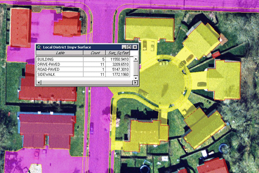
For Springfield's project, the City and DSA were able to develop a strategy
that would allow a specific ID tag to be digitized during data collection. DSA
also implemented a "double-pass" check of the end point snaps for
key line work. This ID tag and clean-up procedure eliminated nearly all-ambiguous
polygons and allowed for a nearly completely automated polygon build. This strategy
was developed during the City's review of the First Sheet sample data. By implementing
it up-front, before full production, there was no impact on the project cost.
Had this task been required after the initial data collection was completed,
it would have been very costly.
This approach will not work in every situation. In this case it was successful
only as a result of careful review and assessment of initial data by the City
and good communication between the City and DSA to determine what possible modifications
to the technical processes could be implemented to best accommodate the City's
in-house capabilities and goals.
Building outline extrusions
The City knew from its experience with the existing 1990 mapping data that
building elevations would be very useful for 3D modeling and extrusions. Typically,
buildings are collected as 2D entities with an elevation attribute at the gutter.
Requiring true 3D to pick up all elevation changes on the building is costly.
The final strategy was a compromise: Buildings were digitized as 2D polylines
at gutter elevation, and then moved in height so that the elevation attribute
represents the peak.
Dual datum support
Existing City data is at NAD `27 datum. Future plans are to convert to NAD
`83. Typically, a base mapping project is tied to control at a single datum.
Often, "out of the box" regional datum conversions are then used for
GIS purposed to work in multiple datums. These regional conversions would not
meet the City's accuracy needs for many of the engineering uses that were also
driving this project.
DSA and the City worked out a strategy to develop a robust datum conversion
which incorporates the existing NAD `27 control points and ties the existing
data to the new NAD `83 control network. Separate sets of the final map files
and orthophotography were delivered in each datum, but more importantly DSA
was able to provide the City with the final conversion data and automated scripts
which would allow the City to perform an identical conversion on other data
layers. It was essential that the details of the datum issues be worked out
up front, during the premarking and control stage. It would have been very costly
to develop as accurate a conversion later in the project.
Hard copy uses
Even in a digital world, many of the City's users rely on hard copy maps to
make decisions. The existing hard copy maps met cartographic standards that
are easy to obtain with current photogrammetric software, but that are sometimes
difficult to duplicate using typical CAD and GIS packages. The City and DSA
developed a detailed strategy for the final data formats that will allow the
City to use their in-house resources to duplicate the quality of hardcopy plot
that users are used to seeing.
Through review and communication with the Consultant, the final digital map
file formatting and structure not only allow the data to be easily pulled into
the GIS, but also allow the City flexibility to maintain its hardcopy map file.
CAD and GIS functionality
While GIS uses and ARC-INFO/ArcView applications were a major driving force
for this base mapping project, a portion of the City's engineering staff also
relies heavily on CAD for many of its activities. DSA and the City worked closely
to develop layer standards and formatting standards that would facilitate both
ARC-INFO and ArcView GIS uses, but also support an engineering staff which is
used to working in a CAD environment. By getting feedback from users in all
areas early in the project, the City and DSA were able to develop base mapping
data that can be easily integrated into both environments. To convert the data
between environments after the project was complete would have entailed considerably
more effort.
Conclusion
Building and maintaining the critical relationships described above is no simple
task. It requires insight, flexibility, persistent interaction and dedication
to achieving healthy communication between all team members. The key to optimizing
success is a collaborative work environment.
If the City of Springfield's project success is any indication, then the time
and effort spent building solid project teams throughout the project will be
rewarded many times over with quality products and added value upon project
completion.
Acknowledgments
Internal project teams from the Public Works Department and Development Services
Department at City of Springfield: External project teams from David C. Smith
& Associates, Inc.: City of Springfield Leadership Program 2001, The Mardac
Justis Group
Brandt Melick
GIS Coordinator, City of Springfield
Springfield, OR USA
Doug Smith, P.E., C.P.
Vice President, David C. Smith & Associates, Inc.
Portland, OR USA