LandGIS from Tobin International is a tool for the creation, editing and maintenance of linked spatial cadastral records. Created originally in ArcView, and currently being migrated to Arc 8 technology, it specializes in the creation of polygonal spatial objects from textual information, i.e.; Jeffersonian, metes and bounds, survey/abstract and many other types of legal descriptions. Linked also at a database level, including ArcSDE, this technique allows cadastral end users, land/lease records administrators and other mapping experts create polygonal, line and point objects and store them in a spatial environment, such as Esri Geodatabases. As part of the migration to Arc 8 technology, it moves away from an "Avenue" language environment to a Visual Basic, Com, Nth Tiered architecture better suited for the world of the web based intra/internets.
A comprehensive ArcView based Tool that allows the Land professional to graphically integrate a company’s enterprise wide textual and spatial land, lease and ownership data
Full utilization of the GIS capabilities provided with ArcView® GIS and Spatial Data Engine (SDE®) tools from Esri · Bi-directional queries between LandGIS® and other TOBIN land and ownership systems · Ability to query the entire TOBIN system database from LandGIS® · Ability to perform spatial selection of cross reference data within TOBIN systems
Generates color-coded maps based on data attributes in any TOBIN application (i.e., expiration date, calendar events, etc.) · Direct export of LandGIS® projects to Tobin Tools for Land® projects · Creation of custom reports with third party products such as Crystal Reports®
Automatic creation of textual cross references based on the spatial relationships created within LandGIS · Overlapping polygon intelligence · Rapid access and timely analysis of data for very large databases (tens of thousands of leases, contracts and division orders)
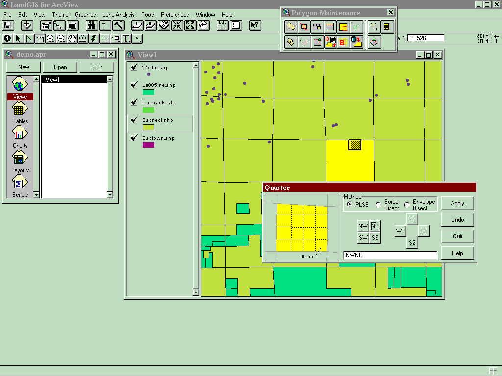
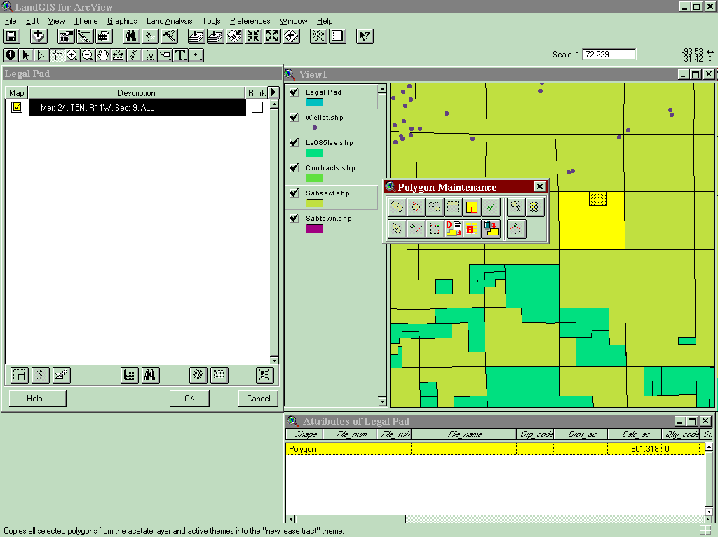
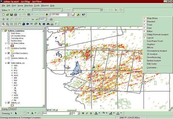
Pan and zoom function, scale-dependent map displays · On-line map displays and hard copy mapping functions with capability to spatially relate any graphical lease, contract and division order data to base map data such as wells, pipelines, seismic lines, units, or other related mapping data. · Generation of polygons at the lease and division order tract levels resulting in map displays of tracts with related attribute data.
Field capture of lease boundaries from broker or field workstations · Roll up of ownership in overlapping leases (without costly restructuring of lease records) · Enables viewing of overlapping leases due to depth severance or multiple undivided interests. · On-screen (heads up) digitizing of lease, contract and division order boundaries
Coordinated maintenance of lease, contract and division order boundaries and associated textual data · Well unit planning, well spotting via footage calls and offsets, work-over analysis, shut-in/shutdown well lease jeopardy analysis · Combined textual and graphical query functions (e.g., all producing wells within one mile of a lease) · Well production query and analysis.
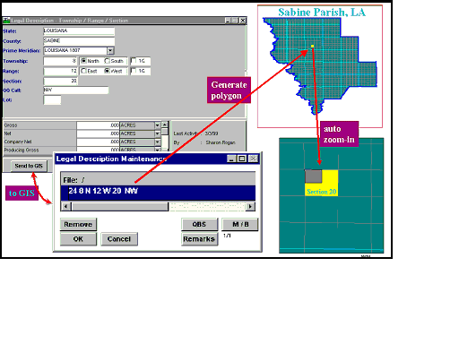
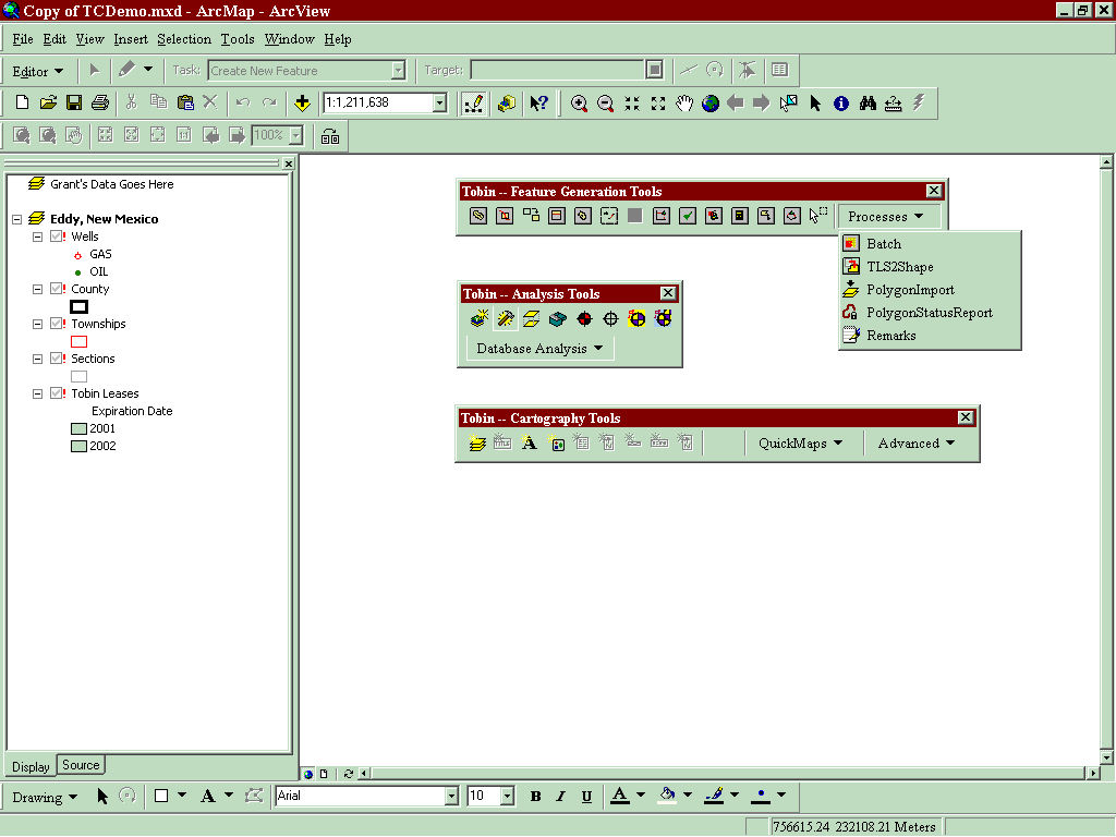
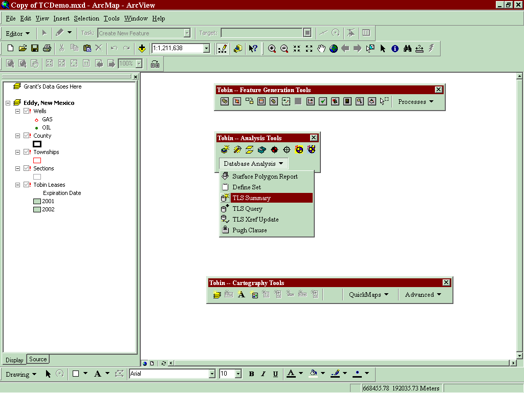
Creating Legal Descriptions Quarter Quarter Calls Textual input Graphical Input Metes and Bounds Abstract/Block/Survey—League/Labor Offshore Area/Block Lot Descriptions
Single extension with multiple dependencies, landgis.avx Can load and work with other extensions in one environment. Works directly against Tobin Land Suite database for legal description generation and maintenance.
Single extension, harder to add enhancements. Must “play” nicely with other extensions. Not very “extensible or scalable”. Avenue language somewhat limited. Does NOT work against other tabular databases.
Written in ArcGis\VB, (visual basic technology). Built as components (based on COM architecture). Built in 3 tier architecture. Opens access to multiple database schema’s, especially GeoDatabases.
Can make changes to business/application tier without effecting database or UI tiers. Rapid development enabling technology. Gives Tobin the ability to create it’s own objects. Allows the creation and inclusion of MetaData information.
Certainly the best tool for “Next Generation” mapping and analysis. Fully scaleable and extensible. Allows Tobin to create “plug and play” applications for other vertical markets, outside Oil and Gas land administration.