2001 Esri User Conference
Technical Paper
Paper Number: 811
Michelle Palmer
Evacuation Traffic Information System
(ETIS)
Hurricane Floyd brought forth the largest evacuation in U.S. history affecting four states and more than three million people. The problems encountered during the evacuation gave concern over the safety of the population that was evacuating.
The Federal Emergency Management Agency (FEMA), United States Department of Transportation (USDOT), and the U.S. Army Corps of Engineers to assist in “fixing the problem” contracted PBS&J.
Several tasks were completed as part of the Southeast U.S. Hurricane Evacuation Study and a new concept was born from the study - the Evacuation Liaison Team (ELT). The ELT’s main focus is to facilitate communications between states during a multi-state hurricane event. A major function of the ELT is to let inform states as to how much traffic is anticipated to arrive in their state from another state.
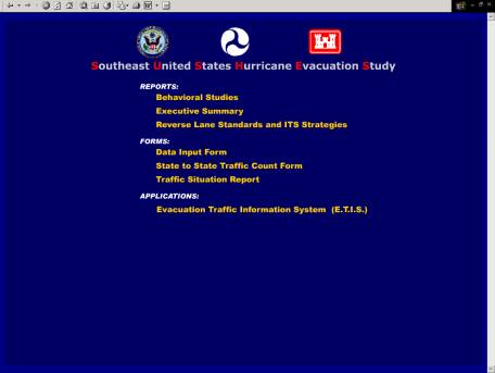
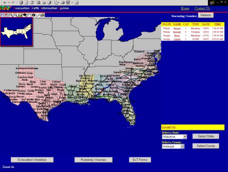
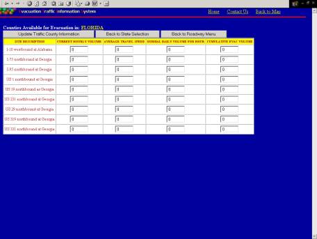
To assist the ELT and help forecast where emergency transportation situations may arise the Evacuation Traffic Information System (ETIS), Formerly Travel Demand Forecast Model (TDFM), was created. ETIS shows the traffic flows within and between states, as well as information on shelter locations, road closures, hotel/motel availability, traffic count stations, etc., during an evacuation. The ETIS also incorporates data from previous hurricane evacuation studies and produces from these studies, estimations about probable roadway congestion.
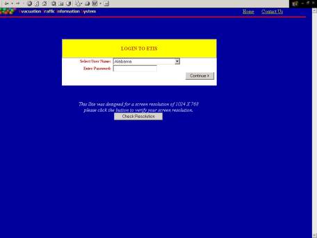
When navigating to the web site users have the capability of viewing study documents, printing standard evacuation forms, or entering the ETIS system. Users entering ETIS must login in with a valid username and password. Security code or login information is used to track users on the system and set security clearances and permissions to utilize different program features, access map layers and manipulate data.
The system provides a graphical interface with button and menu selections that function with the point and click of a mouse. The base covered by the program includes Texas, Louisiana, Mississippi, Alabama, Florida, Georgia, South Carolina, North Carolina, Virginia, Maryland, and Delaware.
ETIS system includes the following features:
Other general program:
Select the Evacuation Traffic Information System (E.T.I.S)
On the left hand side of the screen is the map display and on the right is a list of current counties under evacuation.
Below the evacuating counties is a feature that will allow you to query a specific state and county then zoom you to it on the map.
Along the bottom of the screen are buttons that allow you to edit county and route information.
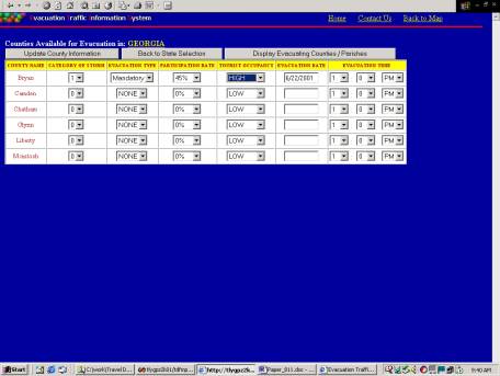
Users select:
-Category of Storm (1-5)
-Evacuation Type (Mandatory or Voluntary)
-Participation Rate (0% - 100%)
-Tourist Occupancy (LOW, MEDUIM, or HIGH)
-Enter and Evacuation Date and Time
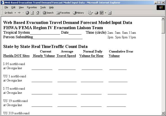
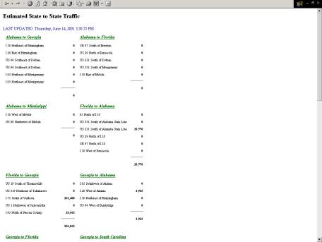
State-to-State Traffic Count Forms
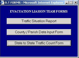
The ELT forms include:
-Traffic Situation Report
-County Input Form
-State-to-State Traffic Count Form