Dr Gordon Pagan
The field data collection software Penmap provides a field GIS data collection capability along with a complete survey measurement information system about how points were collected. This can now be transferred to ArcView using the Penmap/ArcView transfer tool. All GIS themes and relevant survey structures and data can simultaneously be transferred, making ArcView the ultimate home for completed surveys and the means whereby they were accomplished.
Introduction
The intention of this paper is to demonstrate the means, capability and function whereby survey measurement data can accompany GIS information and be transferred into the Esri range of products. Survey measurements and metadata have not by tradition been associated with, or included in, GIS information. There now appears to be a trend towards including all the raw survey data measurements along with the finished product to the customer. This appears to be the case for Cadasteral users and more frequently now for other smaller organizations as well. This is important for accountability, proof of procedure and justifying how the data was created in the first place. The software for doing this is a well established graphical field data collection application called Penmap (or Map500 in some parts of Europe). Recent modifications and developments of this products over the past year has enhanced this capability and dialog with Esri products. Our aim in this paper is to indicate the power of this functionally rich survey tool and demonstrate how data may be transferred and archived into Esri products. We will concentrate on 3 aspects to illustrate the spectrum of surveying methodologies available:-
Collecting and transferring survey measurement data to Esri products
Editing topographical data from Arcview 3.* products - the sandwich method
Creating 3D surveys using reflectorless instrumentation
The last item will involve surveying the lecture room in the course of the presentation illustrating the possibilities of 'intelligent surveying' where boundaries and edges can be calculated rather than be input directly.
Fields surveying - basic requirements
Collecting and transferring survey measurement data to Esri products
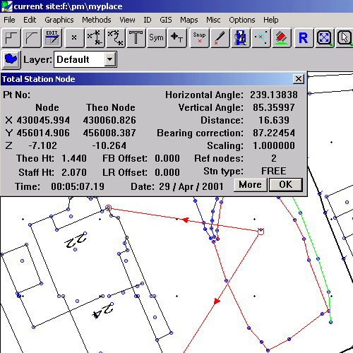
The raw ingredients of map detail can be taken from a number of sources. In this paper we concentrate on on-site real time surveying techniques which will include instrumentation, gps and other surveying methodologies. Penmap is a graphical field data collection tool which can interface directly to instrumentation, GPS and use a raft of other methods to generate coordinates on which GIS data is harnessed. Like GIS, the coordinates are database supported giving a complete history and profile of how the coordinate was collected and calculated. The following example (Fig 1) shows the identity and characteristics of a sample point in the survey. This shows it was collected by an instrument and the way the instrument was set up and orientated with respect to local detail. Note the arrowed lines indicating the reference observations for stationing the instrument.
(Fig 1)
Once detail information has been collected, GIS attributes can be added (see Fig 2)
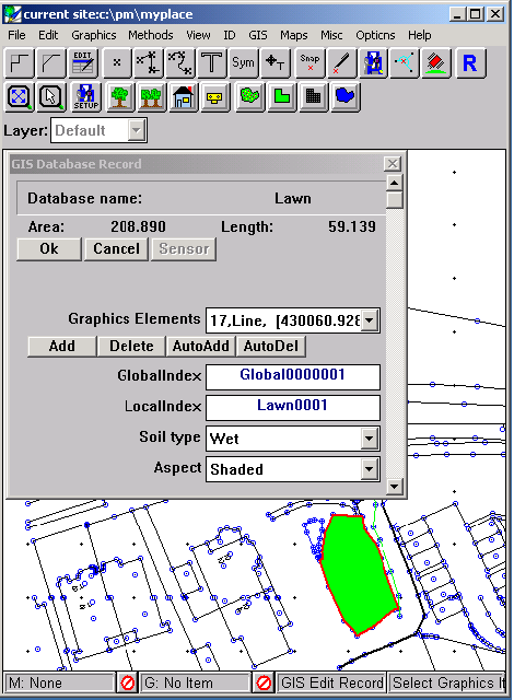
(Fig 2)
Transfer to Arcview
Selecting File:Export:Esri Shapfiles gets the following dialog (Fig 3)
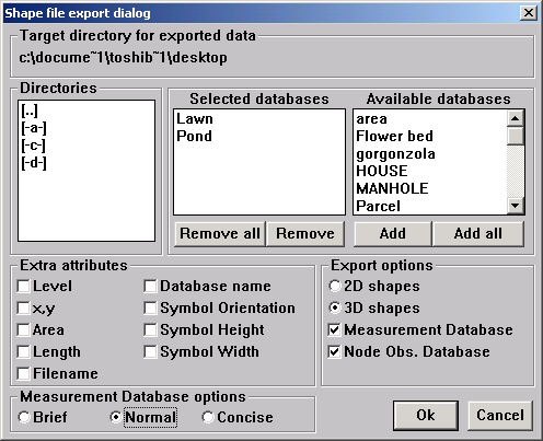
(Fig 3)
where the Measurement Database and Node Observation Database checkboxes have been checked. This allows for all the metadata and survey information to be housed in a shapefile format alongside all the GIS data. Picking up these shape files in a new Arcview project gives the following picture:-
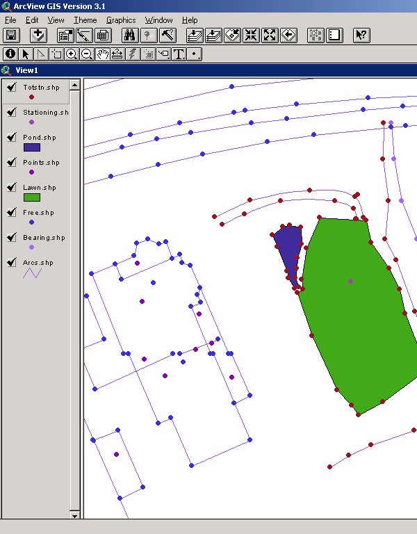
(Fig 4)
If you query a total station node you get the following information:-
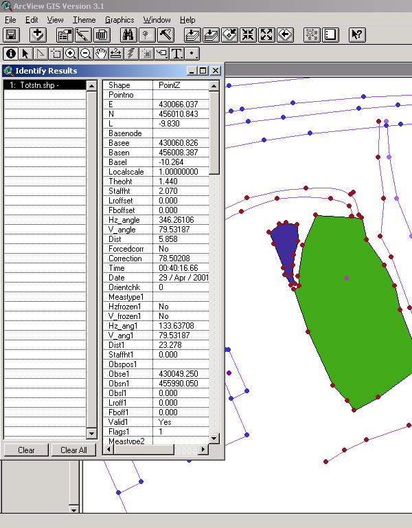
(Fig 5)
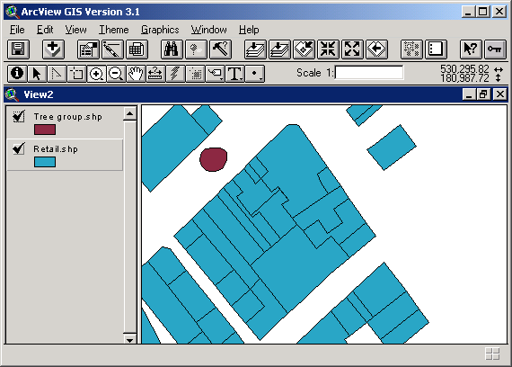
Editing topographical data from Arcview 3.* products - the sandwich method
Penmap can happily serve as the filling in an Arcview Sandwich. This allows the spatial data elements to be easily edited and added to from survey information. The following diagram shows a screen shot of Arcview (3.1) with the Penmap extension enabled and a sample GIS showing a retail area (Fig 6). Please note the ![]()
button on the speedbar line which will invoke the Penmap editor.
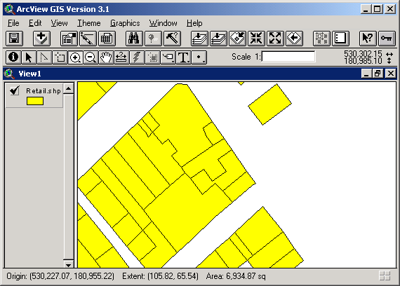
(Fig 6)
When this button is pressed, all shapes in the current Arcview window will be ported to the Penmap editor. Fig 7 shows how this appears
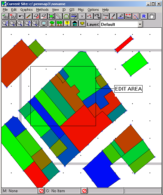
(Fig 7)
After zooming in on the edit area and doing some editing we get:-
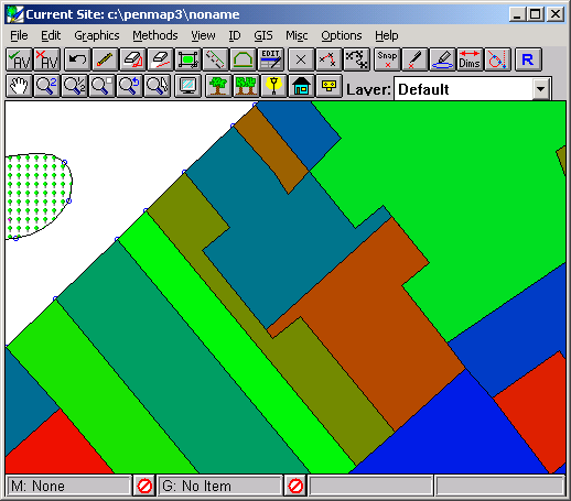
(Fig 8)
In this edit we have
Using the 'Return to Arcview' menu item in Penmap ports these modifications back into Arcview:-
{
Fig 9)Please note the extra theme and parcel modifications and splits as performed by Penmap.
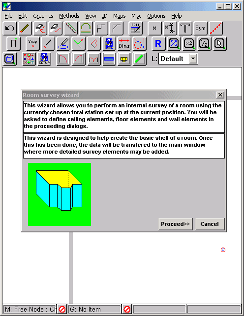
Creating 3D surveys using reflectorless instrumentation
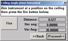
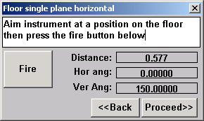
Penmap allows you to very quickly create internal floor plans using reflectorless instrumentation. The surveying technique is quick and involves fixing planes rather than individual points within the room. A series of dialogs (wizard) guides you through the process resulting in a rotating 3D p0977 of the room. You can then choose to accept the whole 3D plan into your survey or just the floor plan. The plan can then be modified by other tools available to add windows, doors annotation etc.
(fig 10)
The wizard gives a list of dialogs allowing you to fire the instrument at the ceiling, floor and walls in a clockwise order.
(fig 11) (fig 12)
Walls are assumed to be vertical and are contiguous to the previous wall:
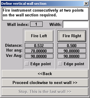
(fig13)
Sometimes wall sections are hidden from the instrument view. These walls are calculated automatically provided that the 'edge point' check box is checked and the instrument is pointing at the left or right edge of an adjacent and visible wall. After the last wall has been surveyed in, the 3D frame view is displayed:-
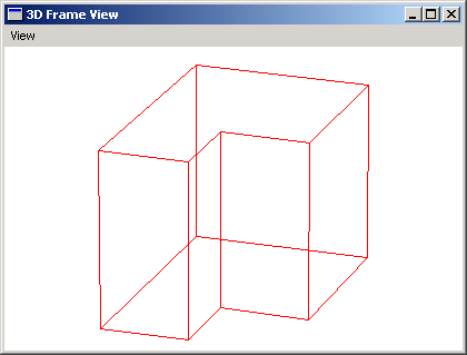
(fig14)
Accepting this will transfer the shape to the main survey in either full 3D or just a 2D plan view.:-
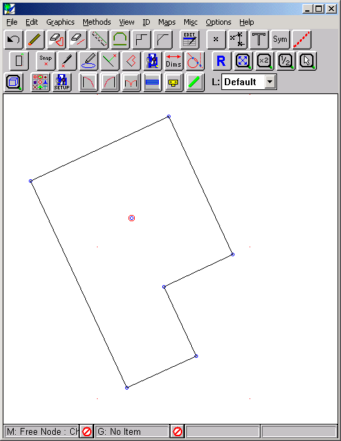
(fig 15)
The shape can then be attributed up or fleshed out to include windows, doors and furniture using any of the Penmap on-board tools and symbols
As shown in fig 16 below.
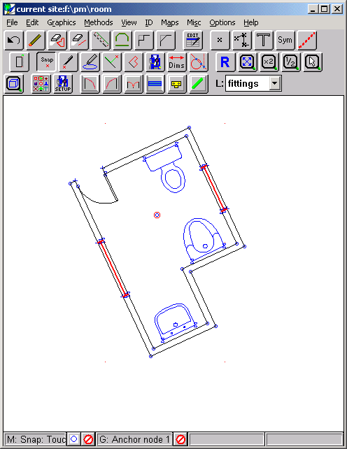
(fig 16)
Summary
A small flavor of the surveying techniques available have been presented here. The results of which can easily be ported via shape file format to any Esri host system. End customers can now be given one Esri project file containing a complete database of parcels, points and attributes along with all the measurement database items too. He can inspect these raw measurements and get the confidence to know that the data collection quality meets his chosen requirements.
Contact Points
For further information please refer to the following web sites and email addresses
For North America and the Caribbean
For everywhere else in the world
For North America and the Caribbean
For everywhere else in the world