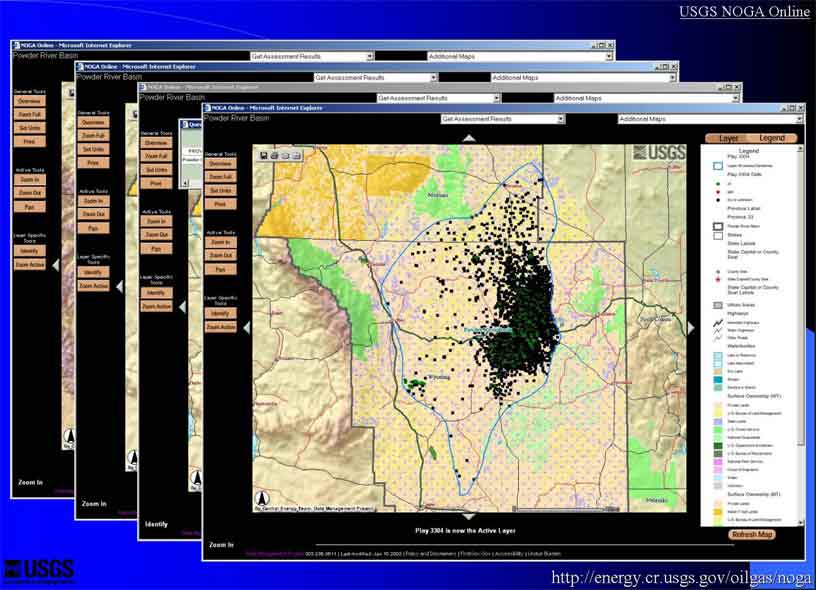
Figure 11. The Interactive Map Application using ArcIMS. These maps demonstrate choosing layers and zooming in on the Upper Minnelusa Sandstone play boundary and the cells within that play in the Powder River Basin Province, Wyoming and Montana. Also shown are base cartographic layers including surface ownership.