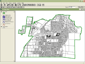
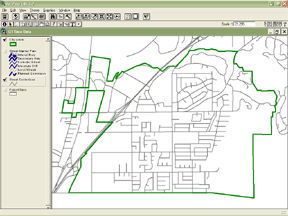
City of Grand Terrace, California
Dragos Barbu and Steve Cumblidge
The paper will relate the experiences of the City of City of Grand Terrace (population 11,626), from development of the GIS in 1998 to its current status, with all of the pitfalls and challenges, such as budgeting, staffing, data sources and maintenance, and user issues. The paper will present basic issues applicable to development of a functioning GIS in a small local government setting. This paper is intended for relative beginners in GIS. The Grand Terrace experience may prove helpful for other small jurisdictions in development of their GIS programs.
Dragos Barbu, MIS Specialist, has a Master of Science degree, an Associate degree in electronics and a certificate in GIS. He facilitated the creation of the GIS for the City of Grand Terrace. He is now in charge of the City's MIS program, responsible for operation and maintenance of the City's computer network infrastructure.
Steve Cumblidge, Assistant Planner, has a B.S. in Urban Planning, a Certificate in Graphic Design, and is nearing completion of the GIS Certificate from University of California Riverside Extension. He is using the City's GIS for planning and economic development program support and is actively creating and maintaining GIS data.
In 1998, the City of Grand Terrace received a grant to develop its Geographic Information System. Initial data sets were acquired from the San Bernardino County Geographic Information Management System (GIMS). The City used paid and unpaid interns to create and manipulate initial data sets.


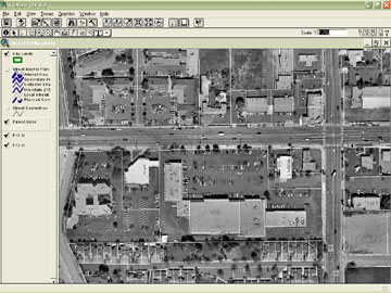
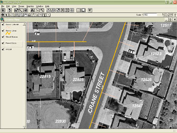
The City acquired digital aerial ortho-photos in 1998, which are a principal component of the City's GIS. The City cooperated with the adjacent City of Colton to get digital orho-photos with a six inch pixel resolution. The digital aerials are used to underlay the map layers and help greatly to understand the relationships between the digital map information and the actual built environment. A number of houses and buildings have been constructed since 1998, as well as numerous room additions, patio covers, etc., which are not represented by the aerial photos. Because the aerial photos are so important to the GIS, the City should begin to budget for new digital aerial ortho-photos within the next two budget years and work closely with the City of Colton on ordering the next set of aerials.
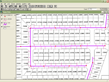
In the last year, a sewer line data mapping project has been undertaken, with all sewer lines having been mapped and made viewable as a data layer in the GIS. All sewer plans have been scanned and can be viewed in electronic format as well. A desired goal is to have data available in the field for use in emergencies, as well as for regular maintenance.
The GIS is actively being used by the Assistant City Manager for various public improvements and budgeting for street maintenance. It is used by the Planning Department for both current and advance planning, as well as for public information and research. Also, the GIS is also used for code enforcement activities.
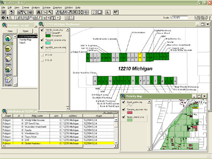
The GIS is being used extensively in the Planning Department for querying land availability and producing maps and displays to facilitate the City's Economic Development Program (See attachments B-1 through B-5). Dragos Barbu has been maintaining the GIS data on the City's network and has used the GIS to illustrate the City's Capital Improvement Program.
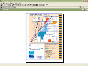
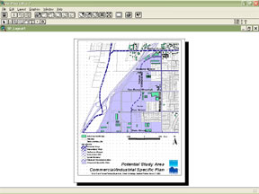
GIS has proven to be an indispensable tool for conducting City business. Initially, it was used for high level analysis of infrastructure, and for generating maps and displays illustrating various aspects of the City. Over the last two years, GIS has been further implemented on the public counter in City Hall; used as a daily tool to provide information to City Staff and citizens.
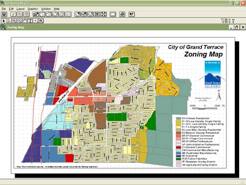
The following information (data layers) is available at the public counter for free at this time:
1. Property data - acreage, zoning, ownership, building square footage and year built
2. Sewer lines, sewer laterals, sewer easements, and manhole covers as well as digital scans of all sewer as-built drawings
3. Aerial photos for any property in the City of Grand Terrace
4. Streets centerlines, street right-of-ways, railroads and rail spurs
5. Core commercial buildings with images hot-linked
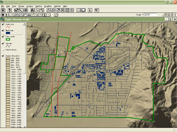
6. Elevation data per USGS digital elevation model
As a small city, Grand Terrace has to keep its staff levels to a minimum. The City does not have the luxury of having a full-time GIS position. Currently, the GIS is being maintained and enhanced on a part-time basis by Steve Cumblidge, Assistant Planner with network support by Dragos Barbu, MIS Specialist.
GIS has become an indispensable tool for Grand Terrace, but it needs continued update and maintenance. The initial set of GIS information (data) was developed in 1998 and remains largely the same today. The City has subscribed with the San Bernardino County Geographic Information Management Systems (GIMS) for updates to various data layers, principally the parcel data layer. However, GIMS is behind in producing updated data for the county as a whole. The City has not received an update from San Bernardino County GIMS since 1999.
Fortunately, Grand Terrace has not changed greatly since 1999, and staff is managing to cope with the change that has occurred. The City subscribes with a private company for parcel ownership data (Property Pro) for use until the County gets its act together. The purchased data is linked with the City's parcel data to provide more accurate ownership data. Staff has also been updating data, cleaning up existing data layers, and developing new data layers where and when possible.
The initial software acquisition (ArcView, ArcInfo and ArcIMS) was covered by a generous grant from Esri secured by Dragos Barbu in 1998. Annual maintenance has been paid for by the City in order to keep technical support and to receive periodic upgrades and technical fixes to existing software. However, as with all technology, GIS software is constantly evolving and changing, and Esri has extensively redesigned their software (ArcGIS) to include more tools and more features. The City is upgrading to current software in order to keep up with latest advances in GIS technology. Staff is working with Esri to identify the most cost effective way to keep the City's GIS software current. Fortunately, past expenditures for maintenance means upgrades will not cost full price.
Year 2000 Census data will be acquired to illustrate the population and income characteristics for Grand Terrace and surrounding areas. This data is needed to show the economic development potential of Grand Terrace to potential businesses and developers.
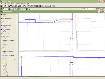
The City's water provider, the Riverside Highland Water Company, provided the water system data in CAD (Computer Aided Drafting) format. Staff is converting water system data so it will be viewable as an additional data layer in the GIS.
Staff is also developing a digital terrain model so that the City can be modeled in three dimensions for drainage and view-shed analyses.
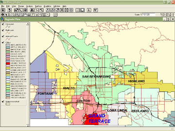
Grand Terrace is cooperating with the local council of governments (San Bernardino Association of Governments - SANBAG) on GIS data sharing and maintenance, and has received valuable regional data sets.
Staff is considering where to deploy GIS within the City when time and computer/software assets become available, as well as for uses that will make a positive impact. The GIS will be expanded to the Building Department Public Counter and add building permit activity tracking to help expedite development processing. Another added use will be to develop a Code Enforcement data layer used to identify any geographic patterns to code violations and develop enforcement focus areas. A further project in development is to use GIS in conjunction with the Finance Department for business license tracking. A business license data layer is being developed to assure that business license registration fees have been paid, and to determine that the City is receiving all retail sales taxes it is due.
A key goal for the next year will be to establish GIS for intra-net use in City Hall in order to make the City's geographic information available to all City Staff as a regular tool. The City will utilize ArcIMS with third party software to expand the GIS (intranet) to more computers and users in a cost effective manner with little need for extensive staff training on complicated software. A key challenge will be to integrate all geographic data into one comprehensive geodatabase.
Following the intranet deployment of enterprise GIS, the City will have the opportunity to make the GIS available to the general public on the City's web site. City staff is watching key advancements in GIS-on-the-Web technology. ArcIMS is not easily implemented out-of-the-box, and currently only larger cities with big information technology departments/budgets with programming capabilities have been able to put GIS on the web. Grand Terrace would like to be one of the first small cities to implement GIS on the web.
This paper shows the progress the City has made with its GIS program, in spite of having a small staff with many diverging demands on their available time. Seeking grants for software and cooperating with adjacent jurisdictions and regional agencies is very beneficial to development of GIS in a small city. This report spells out some ambitious goals the GIS program is evolving towards. These goals are in line with the City Council's goal of improved communications with the community, by providing widely available geographic and related information to enable staff to do their job more efficiently and effectively, as well as providing similar types of information to the citizens of Grand Terrace via the Internet.
Dragos Barbu, MIS Manager
City of Grand Terrace
22795 Barton Road
Grand Terrace, CA 92313
(909) 430-2231
dragos@cityofgrandterrace.org
Steven Cumblidge, Assistant Planner
City of Grand Terrace
22795 Barton Road
Grand Terrace, CA 92313
(909) 430-2247
stevenc@cityofgrandterrace.org