Rob Garcia
The introduction of ArcView 2.0 represents tremendous new opportunities for school district planning. While ArcView 1.0 was an interesting first effort, it failed to provide many of the capabilities that school districts were searching for. ArcView 2.0 is such a major improvement over the previous release, that it has literally revolutionized the way school districts can use geographic information. This paper focuses on 2 key areas of using ArcView 2.0 in school district planning: 1) School District Planning Tasks; and 2) Using ArcView 2.0 with other Windows applications.
Even though ArcView 2.0 is relatively new, it has already revolutionized the way school districts can use geographic information. The objective of this paper is to show how we use ArcView 2.0 in the school district planning process. We see ArcView as a tool which school districts can use to complete a wide range of tasks. Clients come to us with needs and we respond by training them how to use ArcView to meet those needs. Consequently, training and technical support are important parts of our consulting services. Section 1 lists many common planning requests or tasks that we have received from our clients and the solutions we provided. Section 2 follows with a discussion about using ArcView with other Windows applications to complete more complex tasks.
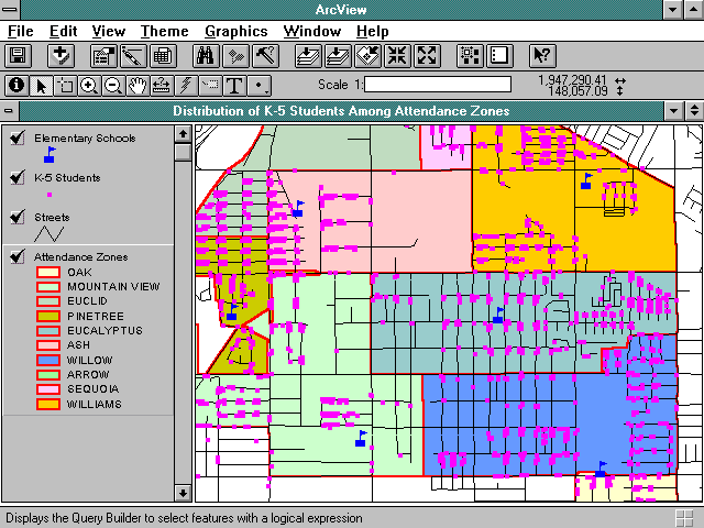
Solution: Create a View showing the distribution of students by school and attendance zone.
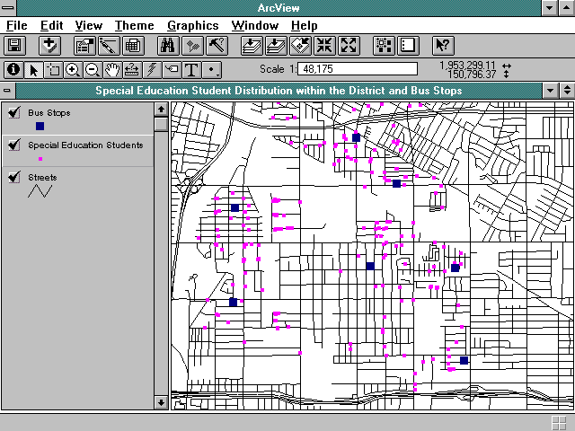
Task: The bus dispatcher needs to see where special education students live because handicap students must be picked-up at home.
Solution: Create a map showing the distribution of special education students coded by the school they attend. Prepare a list of students including name, address, school and handicap type. The maps can be used to plan handicapped bus routes.
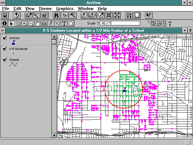
Task: Principal of School A needs to create a list students who are eligible for transportation.
Solution: Display School A attendance zone, all students and 1/2 mile radius circle. Select appropriate records and create list.
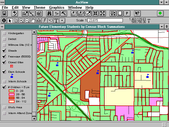
Task: Planners want to look at the potential number of incoming Kindergarten students for the next four years.
Solution: Access Census data to see the number of households with children under the age of five.
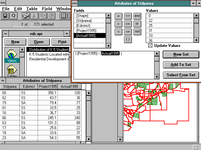
Task: Principal over estimated enrollment and wants to see which study areas were over estimated.
Solution: Display study area table with estimated vs. actual students.
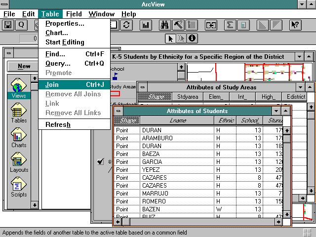
Task: Superintendent wants to evaluate ethnicity of student enrollment district wide for potential boundary changes.
Solution: Spatially join students theme and study area theme. Calculate total ethnicity.
Task: Prepare district wide attendance zone maps with major street annotation.
Solution: Display streets, annotation, study area theme, shaded and classified by school code.
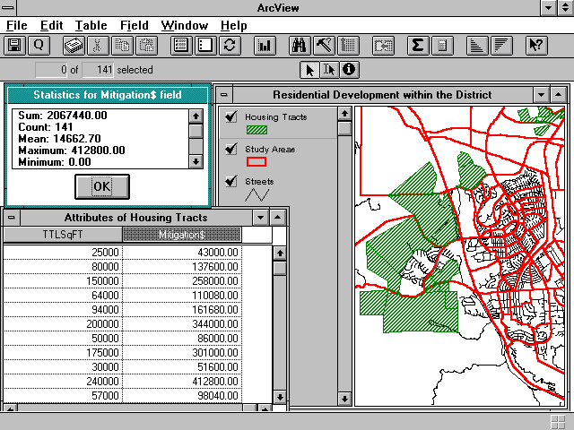
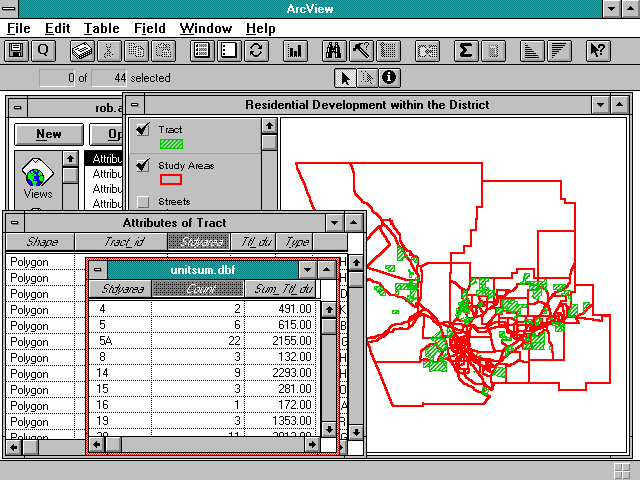
Task: Facility Manager wants to estimate potential mitigation fees from residential development in a particular area of the district.
Solution: Display subject area, open table and calculate fees and summarize.
Task: Facility Manager wants to familiarize himself with development activity prior to meeting with developers.
Solution: Spatially join tract theme with study area theme and calculate number of proposed units per study area and school attendance zone.
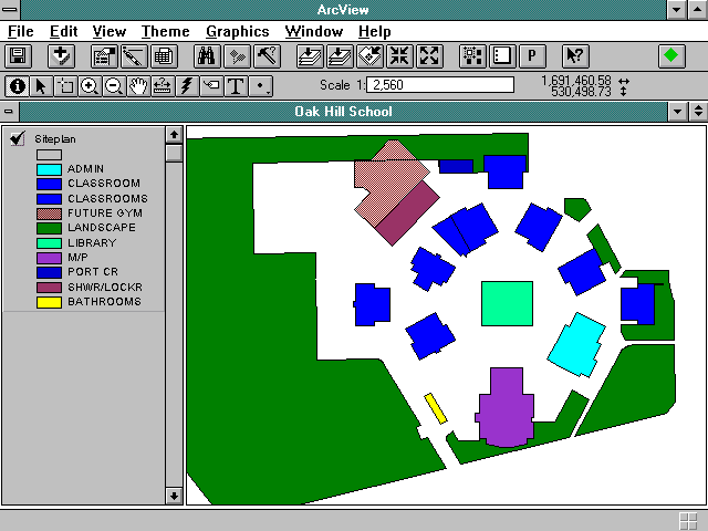
Task: Facility Manager wants to see school layout to plan new carpet installation.
Solution: Access CAD drawing of school site, and calculate square footage and costs for each class room expected to get new carpet.
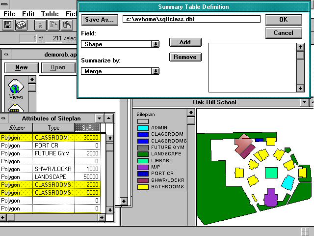
Task: Principal needs to evaluate classroom space for planning next year's teaching assignments.
Solution: Access CAD drawing of school site, evaluate pupil space per room, assign teachers and print maps for distribution.
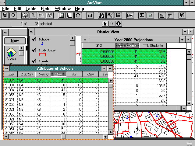
Task: Facility Planner wants to use student enrollment projections to see when selected schools will reach capacity.
Solution: Link projections table to school theme by school code.
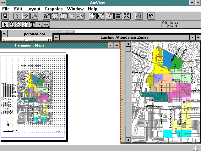
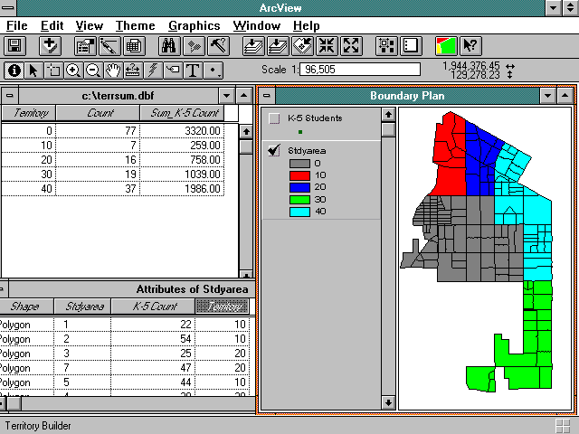
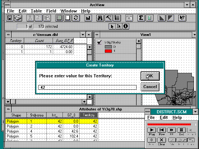
Task: A new elementary school is opening next fall. The Superintendent wants to create a new attendance zone and realign existing attendance zones.
Solution: Using Territory Builder, create and balance new attendance zones.
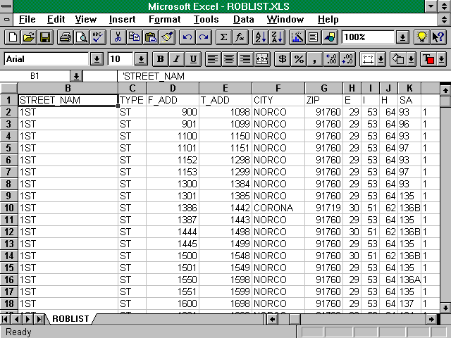
Task: Central registration department needs a street directory to assign new students to the appropriate school.
Solution: Modify Streets Table to show the following items, then export for use in EXCEL:
STREET NAME
STREET TYPE
FROM ADDRESS
TO ADDRESS
STUDY AREA CODE
SCHOOL CODE.
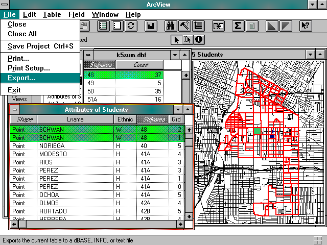
Task: Prepare student enrollment projections.
Solution: Join students with study area themes and calculate the total number of students for each study area by grade. Export .DBF file to EXCEL.
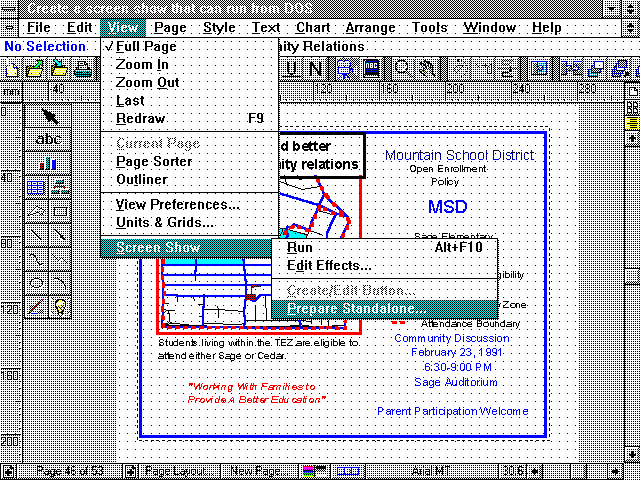
Task: Attendance Boundary Committee needs to make a presentation to the School Board regarding proposed attendance boundary changes.
Solution: Import ArcView graphics file (.WMF) into Freelance Graphics and create slide show presenting boundary alternatives.
Task: Facility Manager wants staff trained on the use of ArcView redistricting tool.
Solution: Use Freelance Graphics Screen Cam to create movie of going through the steps of using the redistricting tool.
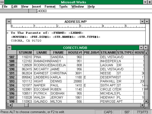
Task: School Board wants to invite all parents living within a particular attendance zone to attend a public forum regarding proposed boundary change.
Solution: Using ArcView, select students living the attendance zone. Export name and address to .DBF file for use in WORKS to create mailing labels and form letters.
Task: Facility Manager needs an attendance matrix showing the enrollment of each school including students attending a school outside their attendance zone, and transfers into the district.
Solution: Spatially join students and study area theme. Create summary tables based on school of residence versus school of attendance. Export tables to Microsoft WORKS.
