Steven Stichter
State-Level Support of Local Land Use Planning
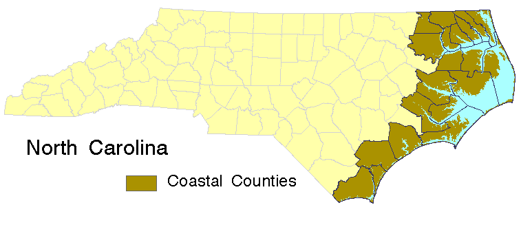
Since 1974, the State of North Carolina has required the
creation of land use and natural resource protection plans
in each of the 20 counties that border ocean or estuarine
waters. Since 1978, the State has provided funds and
technical assistance to support the local planning process
through the activities of the North Carolina Coastal
Resources Commission and its staff, the Division of Coastal
Management (DCM).
Encouraged by internal research projects and supported by
increased use of geographic information systems in other
state agencies, DCM initiated the development of a GIS in
1992. Beginning in the summer of 1995, the data collection
efforts to support land use planning
will be put to the test--in addition to funds and
continued technical support, DCM will provide a standard
package of information to all jurisdictions scheduled to
update their existing land use plan.
This paper will explore the issues related to selection,
presentation and transfer of information to local
governments. Accuracy, scale, classification and precision
are critical aspects of determining which state data are
appropriate for local planning. The challenge lies in
achieving a balance that results in worthwhile products for
the Coastal Management program and local jurisdictions.
Planning in Coastal North Carolina
The North Carolina Coastal Area Management Act (CAMA)
established the first (and to date only) requirement for
local planning in the state. Each of the 20 counties within
the defined coastal zone are required to develop
land use plans and update those plans at least every five
years. Municipalities in the coastal zone have the option of
developing their own plans or remaining under their county's
plan. To aid in the development of these plans, the Division of Coastal Management
provides financial assistance through
planning grants and technical assistance through its
planning staff. The final
land use plans must comply with minimum technical and
procedural standards developed by the Division and
officially approved by the NC Coastal Resources Commission.
As of winter 1995, all 20
counties and 71 municipalities (out of 89 total) in coastal NC have locally-adopted
and DCM-approved plans for their future growth and
development.
Information Support
In the past few years a number of boards and committees have called for
another kind of support for coastal land use planning,
namely a standard package of information to serve as a
base for the planning process. This idea was first
promoted in 1993 by the Coastal Resources Advisory
Council, the citizen advisory board to the Coastal Resources
Commission. In the fall of 1994, the Coastal Futures
Committee (CFC), a blue-ribbon panel appointed by the
governor to study the future of coastal management in North
Carolina, reiterated this proposal. The committee's final
report included the following recommendation under the
heading Improving the Quality of the Planning
Program:
The Division of Coastal Management should
provide a standard package of background data, preferably on
a GIS, to all local governments at the outset of a land use
plan update. This could include information available from
all relevant state and federal agencies, including
population projections, economic and demographic trends,
water quality information, land use, land cover, soils,
wetland and hazard areas. (Coastal Futures Committee 1994)
In July 1995, DCM will respond to these calls by providing base of planning
information to all jurisdictions scheduled to
update their existing land use plans at that time.
Six counties and nine municipalities
are scheduled to begin the planning process this summer.
These initial packets will contain all of the major types of
information that state guidelines require to be addressed in the land use plans, with
the exception of those
data that reside wholly at the county or local level, such
as building or septic tank permit information. A list of
information categories for the standard information packets is given below.
- Economic: Industry mix by SIC, Labor force size, largest employers
- Demographic: Population projections, Income, Census variables
- Surface Water Resources: Water quality use classifications, Use
support, Fishery nursery areas, Shellfish waters
- Land Resources: Forests, Wetlands, Groundwater recharge zones,
Watershed boundaries
- Infrastructure: Roads, Landfills and waste disposal sites, Point
source discharges, Surface water intakes
- Other: Potential hazards, Military airspace, Marinas
Information Base for Land Use Planning
A solid information base is of critical importance to
planning. It provides the context and substance for
discussions of problems and issues facing a community or
county. This information base is composed of both the formal
maps, databases and statistics which describe a planning
jurisdiction and the more informal knowledge and conceptions
brought to the process by the participants. For the formal
information to be useful, it must be accepted by all
participants as accurate and appropriate (Gruber 1994).
Where all participants agree that a given problem and
an agreeable solution exist, extra
documentation of the issue may be superfluous. In instances
where controversy remains, however, agreement on a common
description of the problem can greatly facilitate
discussions about the severity of the problem and help to
focus more quickly on viable solutions.
Much of the work of this project will focus on ensuring
that the information that is collected and provided will be
useful and acceptable to the participants in land use
planning in Coastal North Carolina. These participants range
from the governments that must ultimately adopt the plan and
the consultants who typically prepare them to the citizens,
land owners and land developers who are most directly
affected by the final plan.
Another role for the formal planning information is to
make accessible expert knowledge that is critical to understanding and resolving a
local problem but otherwise unavailable locally. For example, few jurisdictions have
staff expertise in the areas of surface water quality or delimiting animal
habitats. Data sets developed by other researchers may offer sufficient guidance on these issues during plan
development. Assessments of water quality condition conducted
bi-annually by the North Carolina Division of Environmental
Management, for instance, summarize a great deal of
information on surface water quality, including identification of
degraded waters, probable sources of degradation,
and waters with high resource or habitat values.
State Government as Information Source
There are many factors which support the provision of state-level information to local
jurisdictions for use in land use
planning, but the objective of each is the same:
a more effective land use planning process and better plans. A ready source of information available at the outset of the land
use planning process will enable more substantive discussions from the very first public
meeting. For the majority of coastal jurisdictions that do not have map generation
capabilities, the maps provided with these packets may be a resource that has not
been available during the development of previous plans. These common sources
of information can potentially facilitate discussions of shared problems between
neighboring jurisdictions. As the provider of information, DCM can also combine and
extend primary information to identify relationships between or implications of
changes
within an area. For example, impact coefficients may be applied to population growth
projections to estimate the impact of new residents on local water consumption or
wastewater treatment.
A number of developments make this project possible at this
time. The first is the rapidly increasing number and breadth
of digital information sources (both GIS-based and otherwise)
developed and shared by state agencies. The State of North Carolina,
through its Center for Geographic Information and Analysis (CGIA) has assembled
an impressive array of map base information and natural resource inventories. Major
funding for the development of comprehensive regional datasets came in the late
1980's with the Albemarle-Pamlico Estuarine Study, co-funded by the Environmental
Protection Agency (EPA) and the State of North Carolina under EPA's National
Estuary Program. Many of these regional GIS layers have since been extended
state-wide, resulting in creation of the state's Corporate GIS Database.
In 1994, North Carolina adopted a strategic plan for geographic information, which
defines funding and custodial roles for the individual components of the corporate
database to ensure the continued maintenance and currency of its components.
These data comprise the bulk of information to be distributed for
land use planning support; only a few critical, but presently unavailable,
components must be created by DCM. Within DCM, recently expanded GIS
capabilities (hardware, software and expertise) make this project both technically and
financially feasible. These capabilities were developed to support other DCM
initiatives that rely upon the GIS. A wetlands mapping and functional assessment
project and a watershed database of demographic and natural resource information
are two GIS-based projects, the results of which will be incorporated into the land use
planning information packets.
Secondary benefits to this project accrue at the state
level. By enabling the use of a broader variety of
geographic data and encouraging the sharing of data, the
probability increases that higher quality and finer detail local
databases will be made available to DCM as they are created.
Municipally- or county-maintained building and
septic tank permit records, for example, could be of great
assistance to DCM in both its land use planning and
development permitting functions. Widespread use of
geographic data developed by state agencies should expand
the already significant sharing of information between state
agencies, broaden the support for further GIS development
within NC state government and help identify and resolve
gaps and errors within the state GIS database.
Finally, to complete and distribute the first set of
information packets in time for the approaching summer deadline, DCM
will necessarily become a more efficient provider of general
information about coastal North Carolina, especially for
GIS-generated information and map products.
Limits of State-level Information
Contrasting the many advantages to the state serving as a primary source for land
use planning information are some significant existing limitations to that role. These
include accuracy, scale and completeness limitations to the state GIS database; the
practical necessity of delivering, this year, a standard, 'one size fits all' package;
development and implementation costs to DCM; and the difficulty in providing
information across the broad spectrum of technical capabilities among coastal
planning jurisdictions. Preliminary reviews indicate, however, that the advantages
gained by local governments by easy access to a broader variety of information will
outweigh the costs of data assembly, formatting and redistribution, even accounting
for the use limits associated with those data.
Database Concerns
Because the majority of the data which comprise the state's corporate database were
developed by state agencies to support regional studies and mapping, the source scale
for much of this data is 1:100,000 (1":8,333'). This scale corresponds to standard
scales for
regional planning, which range between 1":1,000' and 1":10,000'; typical scales for
local planning, however, fall between 1":400' and 1":2,000' (American Society of Civil
Engineers 1983).
Although 1:100,000 scale data are too coarse for parcel-specific planning and review,
they are adequate to demonstrate the distribution and extent of factors critical to
coastal land use planning. Such indicator information may have previously been
unavailable or sufficiently cumbersome to use so as to render them inaccessible to the
planning process.
Data in the state's corporate database were collected by many different agencies with
diverse
quality control standards. Differing feature definitions, methods of data capture and
capture dates all affect the compatibility and reliability of the GIS database
components. Many of these accuracy concerns will be resolved as GIS layers come
into everyday use and information is updated with greater frequency. Within the
context of the transfer of information to local governments, metadata
(source scale, agency and date) will be provided for each piece of information to
enable data users to determine which elements are appropriate for their uses.
Finally, a number of components which are high on local
government wish lists, such as wetlands information and floodplain and jurisdictional
boundaries, are presently missing from the state's corporate database. In some cases,
a comprehensive
data source does not exist. This is true of wetlands and DCM, as noted above, is
developing wetland maps for coastal North Carolina to fill this gap. For other
information, such as
floodplain boundaries and water quality use support ratings, the challenge lies in
getting existing information into digital map form.
Packet Development Costs
The development of land use planning information packets and the transfer of this
information to local governments is not without cost to DCM and to local
governments. Costs associated with the packet development include GIS hardware
and software purchase and maintenance; data acquisition; staff time to assemble and
reformat information and compose maps; and printing and copying supplies.
For this year's project, many of the costs listed above are covered by a one-year
federal grant or under other ongoing projects. Although substantial emphasis is
placed on developing methods and procedures which will reduce the amount of effort
required for updates, significant costs will remain in future years. Excess in-house
GIS capacity which existed this year will most likely be absorbed by expanding GIS
use within the Division. Staffing support, provided this year through the one-year
grant, must come from DCM in the future and the Governor has proposed an extra
position to support coastal land use planning in this year's state budget. Future data
acquisition needs will become clearer with final assembly and distribution of this
year's information packets, although the majority of these needs will potentially
continue to be met primarily through information developed by the appropriate
agency or jurisdiction. To encourage continued cooperation, DCM will have to play a
larger role in the expansion of the state GIS database through development of new
data layers of use to other agencies and users.
Packet Use Costs
Successful transfer of information to the local level depends upon substantial work
on the receiving end, in addition to the effort expended in developing the basic
packages. The geographic information used for this project is complex; interaction
between data layers on a map increase this complexity. Training on the uses and
limits of the information for both DCM and local government staff will be critical to
productive and appropriate application of this information to the land use planning
process. Guidance documents which link these new data sources with existing and
familiar sources and with the pertinent sections of the land use planning guidelines
will facilitate information adoption and use.
Packet Distribution Costs
Once packet development is complete, the practical issue of information dissemination
and distribution remains. For those jurisdictions without any GIS capabilities this is
straightforward--paper maps of the geographic data will be distributed along with
paper and electronic versions of all tabular and text materials. Spreadsheet and
word-processing formats must be attended to, but the small number of standard
products and the increasing ability of these programs to read foreign formats eases
this problem. For distribution of GIS data, the technical issues are much more
difficult. The variety of potential hardware platforms, GIS software, and tape and
disk media exponentially increases transfer difficulties. The number of jurisdictions
with GIS capabilities is presently limited (10 coastal counties and 9 municipalities
have some type of GIS), but the role of technical transfer issues is sure to grow with
the number of geographic information systems in local governments in the coastal
area.
Conclusions
There are clear interests, benefits and uses for higher quality and a broader variety
of information to support local land use planning in coastal North Carolina. For many
types of data, especially GIS data, DCM is a logical source for local planning
jurisdictions. Although there are costs associated with data assembly and
redistribution, these will be overridden by benefits to the planning process,
such as greater understanding of land and environmental conflicts and interactions,
expanded cooperation between neighboring jurisdictions and enhanced public
awareness and participation. Close cooperation between state agencies in data
development and sharing, especially with GIS data, made this project possible, which
is a promising development. How these packets actually affect the planning process
will become apparent, however, only after the first year of their distribution and
use.
Acknowledgements
Funding for this work was provided by the Office of Ocean and Coastal Resources
Management, NOAA, US Dept of Commerce, under the Project
of Special Merit grant program. I would like to thank Trish
McGuire for her insight and assistance with development and fulfillment of
this project.
References
American Society of Civil Engineers, Committee on Cartographic Surveying (1983).
Map Uses, Scales, and Accuracies for Engineering and Associated
Purposes, New York.
Gruber, Judith, 1994. Coordinating Growth Management
through Consensus-Building. University of California,
Berkeley: Institute of Urban and Regional Development.
North Carolina Coastal Futures Commission, 1994. Charting a Course for Our
Coast: A Report to the Governor.
State of North Carolina, Department of Environment, Health
and Natural Resources.
Steven Stichter
Environmental Planner
North Carolina Division of Coastal Management
PO Box 27687
Raleigh NC 27611
Tel: 919 733 2293
Fax: 919 733 1495
stichter@cama.ehnr.state.nc.us