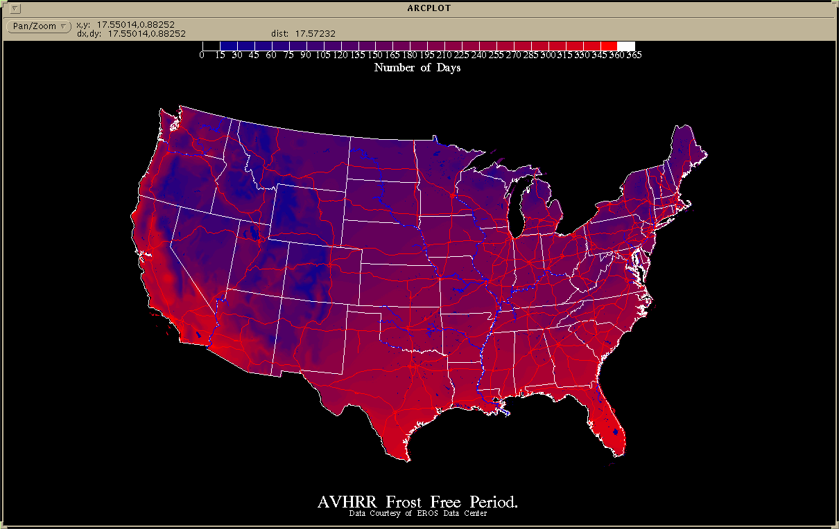
 Figure 1
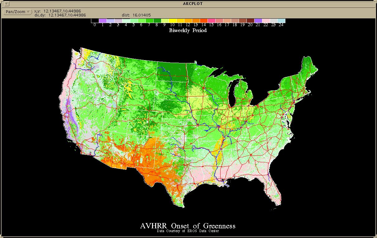 Figure 2
Ecosystems function across many scales. However, resource managers must often use data at whatever scale is available. To provide the resource manager with data that can be used to evaluate these systems at various scales and to place local information in a regional context, a database has been generated at Utah State University, Department of Geography and Earth Resources. The database can be used to address environmental management problems at multiple scales. It brings together information gathered by the U.S. Geologic Survey, the National Biological Service, and the Utah National Guard to place ground based information in a local, regional, state, and national context. A graphical user interface has been developed using Arc Macro Language (AML) that allows a user to display and query landcover and landuse, historic and current climatic conditions, topography, plant phenological temporal profiles, critical wildlife habitat, land ownership, field data, and remotely sensed data from 1km AVHRR, to 30 meter Landsat TM, to 1m airborne videography and scanned aerial photos.
Scale Considerations:
The importance of spatial scale in ecological studies, and the effect scale
has on the phenomenon being observed has been widely discussed (Allen, et.al.
1982, O'Neill et.al. 1986, Meentemyer 1989). Multiple scales may be necessary
for observing a complete system over time and space.
Also, scale has become a questionable item with the advent of GIS, since layers
can be zoomed in or out, so it is extremely important to keep data of
similar scale grouped apart from data of lessor or greater scale. Otherwise,
a person with little understanding of GIS may overlay and analyze data of
non-common scale, and obtain completely erroneous results without recognizing
any inconsistency. The grouping of compatible data reduces this possibility.
The database provides data in four separate spatial scale groups. The data is amassed and depending upon its scale is placed in one of four data sets of similar scale: national, ecoregion, state, local. The scale range for each category is the following:
National	1:1,000,000 - 1:2,000,000
Ecoregion	1:250,000   - 1:500,000
State		1:100,000
Local		1:24,000    - 1:50,000
Populating the database is done by obtaining the most accurate, quality controlled data from throughout the nation. Much of the data collected for this paper was obtained from four data sources: 1)ArcUSA(tm), 2)USGS Conterminous Land Cover Characteristics Database, 3)NBS Gap Analysis, and 4)the Camp W. G. Williams ecosystem management project. Each of these data sets has been created by peer-reviewed scientists, and has been quality tested to ensure defensibility. The four data sets are also consistent with the four scales mentioned previously, and are selected for their variety of information ranging from anthropogenic to geological to biological. The database is continually changing as higher quality data is created and becomes available.
National Level
ArcUSA(tm), the USGS Conterminous U.S. Land Cover Characteristics Database, and
data from the National Climatic Data Center were used for the national level
database. The ArcUSA(tm) data was produced at a scale of 1:2,000,000, consistent with
the national level, and contains a broad range of data including cartographic
features (state and county boundaries, roads, railroads, rivers, lakes,
federal land areas, county seats); indexes (latitude/longitude grids, USGS
topographic maps, Landsat scenes); and statistical attributes for states and
counties (population by age and race, income, hospitals and doctor, local
government spending, major soil types, agricultural products raised and sold).
The ArcUSA data is dated circa 1992. (Esri, 1992)
The U.S. Geological Survey's EROS Data Center, as part of the U.S. Global Change Research Program, has developed prototype 1-km spatial data sets for global environmental research. The data set relies heavily upon information gathered from Advanced Very High Resolution Radiometer (AVHRR) satellite images. The data set contains a prototype land cover characteristics database for the conterminous United States, bi-weekly NDVI data, ecoregion boundaries as defined by Omernik (Omernik, 1987), 1km DEM derived from the Defense Mapping Agency's 30-arc second data, USGS Land Use Land Cover data, frost-free data, and various derived data sets (Simple Biosphere Model, Biosphere-Atmosphere Transfer Scheme, Onset of Greenness, Peak of Greenness, and Duration of Greenness). The scale of this data is consistent with the national and ecoregion level. These data are circa 1990 (Loveland et.al., 1991). Refer to Figures 1 and 2 bellow for examples of these data.
Data from the National Climatic Data Center was collected from a Unidata system located at Utah State University. Point data were collected and interpolated over a national 10km grid. The result is a database consisting of monthly 30 average minimum, mean, and maximum temperatures and precipitation. In addition, Arc Macro Language code was written to collect current Unidata climate information and produce daily maps of the above variables and project climatic conditions 48 hours into the future. This weather machine is currently in operation at USU and provides 10km historic, current, and future condition maps for inclusion to the national database. Figures 3 and 4 show examples of these grids.
State Level:
The National Biological Service is conducting a nationwide mapping effort on
a state by state basis named Gap Analysis. The Gap Analysis program is an effort
to map vegetation, predicted vertebrate distribution, and land ownership at
a scale of 1:100,000, with a minimum mapping unit of 100 hectares. Utah State
University has been a leader in the program, producing the first complete Gap
Analysis data set at this scale, and includes a vegetation map consisting of 38 classes,
a predicted vertebrate distribution map with 535 species, and a detailed map
of land ownership attributed with biodiversity management status. Gap Analysis
data is derived from recent Landsat Thematic Mapper imagery, DEM, and ancillary data.
The data is usable at the state level scale, and more states can be incorporated as
they become available. Utah Gap Analysis data is dated circa 1994
(Edwards et.al., 1995). State level data also includes monthly NOAA-AVHRR NDVI
imagery and climatic information as well (Figure 5).
Local Level:
Where local data sets have been created, they are easily incorporated into the
database. The Camp Williams National Guard Base contracted with Utah State
University to develop multiple data layers at a 1:24,000 scale, consistent with
the local level scale for ecosystem management. The Camp Williams data was created
over a two year period
from 1992 to 1994, and was dervived using a combination of Landsat Thematic
Mapper imagery, aerial photography, aerial videography, and ground surveying.
The data set consists of physiographic data (soils, elevation, aspect);
cartographic data (roads, rivers, buildings); floristic data (vegetation
distribution and trend over time, plot transects); historical data (fires,
land use); faunal data (vertebrate distribution, threatened and endangered
species locations); and remotely sensed data (Landsat TM and MSS, aerial
photography and videography) (Shultz, 1993). Figure 6 shows a soil adjusted
vegetation index image produced from Landsat TM data over the 25,000 acre
National Guard Camp.
Other Data Sets:
Other data sets may be useful in making certain management decisions, and are
easily incorporated into the database at the appropriate scale. Examples of
these data include: digital elevation data from the Defense Mapping Agency at
the 3-arc second and 1-arc second scales, STATSGO soils maps for the nation,
TIGER socioeconomic and political boundary data, and 1:100,000 digital line
graph data from the USGS.
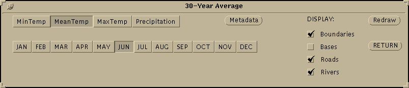 Figure 7
 Figure 8
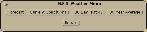 Figure 9
 Figure 10
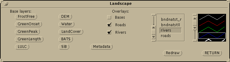 Figure 11
Edwards, Thomas C. Jr., Collin G. Homer, Scott D. Bassett, Allan Falconer, R. Douglas Ramsey, and Doug W. Wight. 1995. Utah Gap Analysis: An Environmental Information System, Report. Utah Cooperative Fish and Wildlife Research Unit, Logan, Utah.
Environmental Systems Research Institute. ArcUSA, edition 1. Esri, Redlands, CA. 1992.
Loveland, T.R., Merchant, J., Ohlen, D.O., and Brown, J., 1991, Development of a land cover characteristics data base for the conterminous United States: Photogrammetric Engineering and Remote Sensing, v. 57, no. 11, p. 1453-1463.
Meentemeyer, Vernon 1989. Geographical Perspectives of Space, Time, and Scale. Landscape Ecology. Vol. 3, No. 314, pp. 163-173.
O'Neill, R.V., D.L. DeAngelis, J.B. Waide, and T.F.H. Allen, 1986. A Hierarchical Concept of Ecosystems. Princeton University Press.
Shultz, L., 1993. The Camp Williams project: Ecosystem based management and research on a military reservation: Report of the collaborative research team: Nonpublished paper, 5 pp.
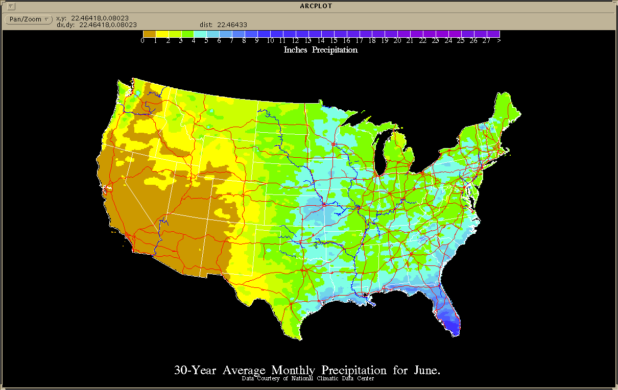 Figure 3
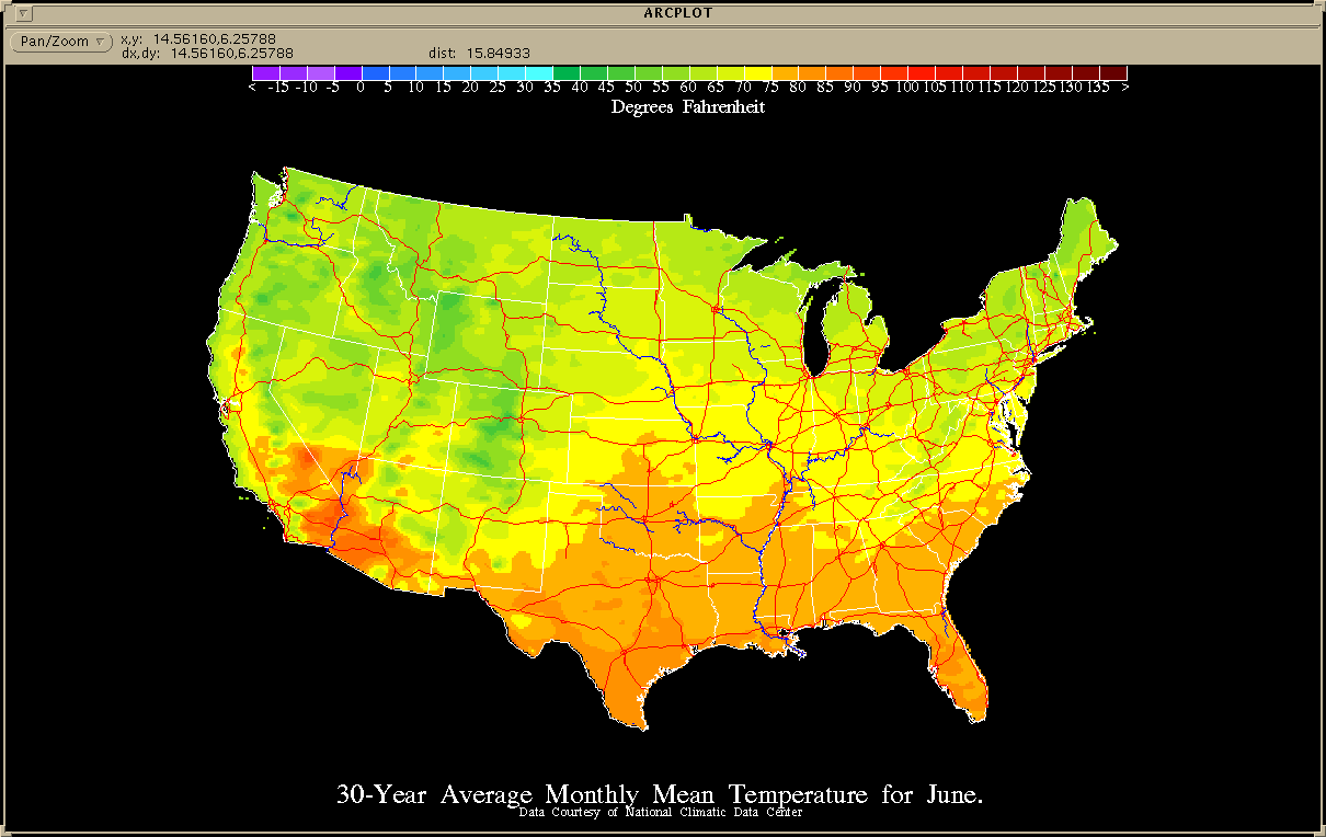 Figure 4
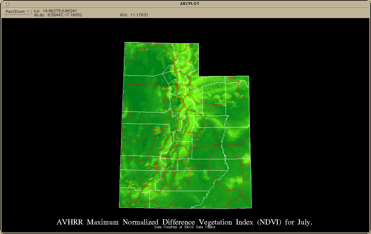 Figure 5
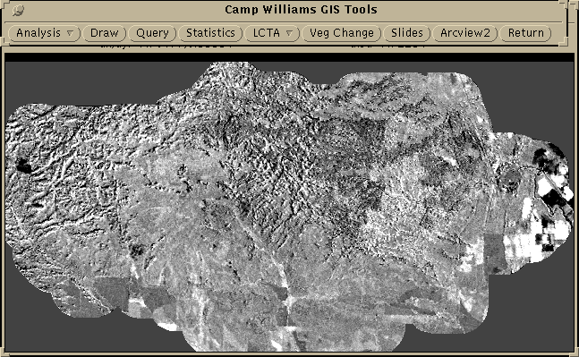 Figure 6