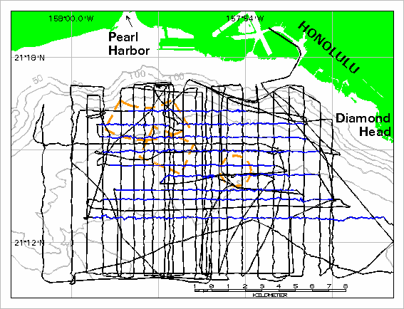
Figure 3. Tracklines surveyed by U.S. Geological Survey in 1994. The full navigation is displayed in black and was built as a single
route
with navigation time as the
measure
. The blue lines are the segments of the survey during which the towed camera was operating. The camera line segments were extracted as
line events
based on start and end times and then converted to a line coverage. Dashed outlines are disposal sites. Bathymetry in meters.