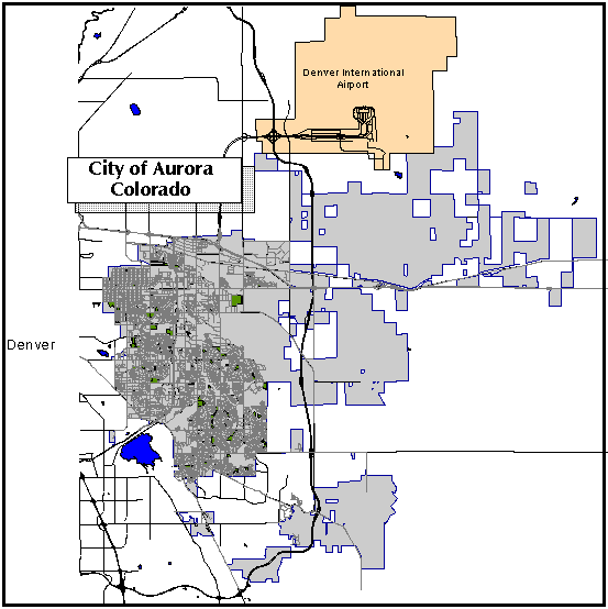
The main project which will use GIS is the Lawn Irrigation Return Flow Project, a potential new source of water supply for the City of Aurora. Under Colorado Water Law, the City has the right to reuse water supplied to its customers, if the water is from another basin. Water from out-of-basin sources can be used and successively reused until extinction. Additional sources of water that can be reused include nontributary groundwater and consumptive use agricultural water. On an average year, the City of Aurora has the potential to reuse 93 percent of its water supply. A percentage of the reusable water delivered to customers is applied on lawns for irrigation purposes. Most of the water that is used for outdoor use is consumed through evapotranspiration by grass, trees, and shrubs. Additional losses occur from runoff and spray loss. The remaining amount percolates through the root zone and returns to the stream. By quantifying the amount of reusable deep percolation water reaching the stream, the City of Aurora can reuse the water for park and greenbelt irrigation, augmentation of wells, and for exchanges (diverting water upstream and replacing the diversion with a like amount from a downstream source). ArcView and its link to the Utility Billing database will assist the Department in determining water usage applied to lawns and irrigated areas.
In addition, the Utilities Department understands that conservation is also important for long range water planning. Since the early 1980's, the City of Aurora has utilized an aggressive water conservation plan. The GIS will assist the Department in analyzing usage, usage patterns, and targeting high water users for a voluntary water audit. The Audit Program is geared toward reducing service disconnects, increase water use efficiency, and for educational purposes.
In 1992, the Department first started using a GIS to analyze water usage within the City. However, this GIS and Utility Billing database setup was less than ideal. Due to software and hardware limitations, a direct link between the Utility Billing database (AS 400) and the GIS database was not possible. The process of acquiring the data was very labor intensive and time consuming. It involved using the results from a GIS address search and inputting them by hand into a AS400 terminal to query water usage information. These results then had to be analyzed statistically using spreadsheet software.
Not until early 1995, with the release of ArcView 2.0, did it became evident that linking the GIS to the Utility Billing database was possible. ArcView was ideal for this task because of its Structured Query Language (SQL) connectivity, Avenue script customization, spatial data analysis, file input and output, and graphical user interface. Knowing the benefits of accessing water usage data through ArcView, the Department proceeded with the development of the GIS and the usage data base.
Two INFORMIX tables are used for the Utility Billing database. The first table is the master reference table, called MASTER_REF. The master reference table contains customer number, GIS number (which can be related to address points in ArcView), meter types, service and mailing address. The second INFORMIX table used in this project is the water usage table, called WATER_USE. The WATER_USE table includes customer number, billing dates, water usage and sewer usage.
Currently there are over 2.78 million records in the WATER_USE table, which contains all water usage information for the years 1992 to 1996. Once a month this table is appended with current billing data from the AS 400 database. The MASTER_REF table is currently about 102,000 records in size. Because of its relatively small size this table is re-built monthly to reflect new billing accounts that come on line.
To assist in querying the water usage table, views were setup in INFORMIX of the master reference table. Views hard code query statements for user convince and faster database queries. For this project, six views were created from the master reference table based on the water schedule type (the type of account). These views are s_rate, i_rate, b_rate, a_rate, t_rate, and r_rate for single family, irrigation, commercial, apartments, townhomes, and raw water irrigation, respectively. In addition, to increase performance SQL statements are written to create a temporary INFORMIX table in memory called TEMP_USE.
The first approach to accessing the water usage database is to select an area of interest or to select individual address points. This method is useful for determining water usage within a drainage basin or water use in parks and other large irrigators. An example of this type of query follows. The ArcView application has a view of the City of Aurora, containing streets and the City boundary. The first step is to select the Global icon to set some global variables for the application. This only has to be done once. The next step is to zoom into the area of interest. Large area queries are time and CPU intensive, so it is better to narrow down the query selection first. Next, the user must set the area of interest for the library themes (e.g. address points) using the area of interest icon. Once this is set and indexing is complete, the user can then select features of the active address theme. After the address points are selected, the Geo Select icon is pressed to start a menu driven SQL query builder. The first menu is the Rate Selection Menu, which allows the user to select the type of account. For example, there is a choice between all types, single family, irrigation, commercial, apartments, townhomes, and raw water irrigation. The next menu is the Time Selection Menu. This menu allows the user query any month, irrigation season, or winter months. The Year Selection Menu follows, allowing any year from 1992 to be selected or all years can be analyzed. Input from these menus builds a SQL statement for an INFORMIX query to the master reference and water usage tables. Once the query is completed, the user is prompted to link the newly created table with the attribute table of the address points. The resulting table can be analyzed for water usage.
The second approach to querying water usage is querying the INFORMIX water usage and master reference databases based on a selection criteria. This query is useful in determining usage information throughout the service area. To optimize table queries, this script does a quick paring down of the water usage table based on month, year and usage criteria selected by the investigator. Then the full SQL statement is compared to the pared down table to produce the final usage report. This query starts with the user selecting the Usage Select icon while the view window is active. A rate menu pops up for selecting the type of account (e.g. single family, irrigation). Next, the time selection menu asks for which month, followed by the year selection menu. Here the user can pick any year for analysis. Next, the meter size menu pops up, allowing the user to select a particular meter size or all meter sizes. The final menu is for the usage selection. In this menu, the user can input a value of usage (in 1000 gallons) as a criteria, i.e. usage greater than 5000 gallons. With the completion of the query string and search, a usage table is returned.
Once the address points are selected in the Shop Creek Basin, the user will initiate the script. The script starts by defining the view and active theme (address points). A variable, F, is set to the field " tag" in the active theme. The BitMap variable is set to the selected address points. Next, a connection is made to the INFORMIX tables and a temporary table named Scratch is created in memory. Each record from the BitMap (selected address points) is inserted into the temporary table. Dictionaries and lists are defined for rate and time. The remainder of the script builds the SQL statement through the use of menus. The first expression is created using the type of account or rate that the user selects, as shown in Figure 1. For example, if the user selects single family accounts (s_rate), the initial expression would look like this.
1) Select s_rate.gis_no, water_sch, add_units, water_use.* from s_rate, scratch, water_use where s_rate.gis_no = scratch.gis_no and water_use.cust_no = s_rate.cust_no

2) Select s_rate.gis_no, water_sch, add_units, water_use.* from s_rate, scratch, water_use where s_rate.gis_no = scratch.gis_no and water_use.cust_no = s_rate.cust_no and month(bill_date) = 10 and year(bill_date) = 1994


3) Select * from water_use where month(bill_date) = 7 and year(bill_date) = 1992 and water_use >= 1000 into temp temp_use
The second SQL string (String 4) is listed below.
4) Select i_rate.cuto_no, i_rate.gis_no, water_use, sewer_use, water_sch, bill_date from i_rate, temp_use where temp_use.cust_no = i_rate.cust_no
Here the string will return a table listing customer number, GIS number, water use, sewer use, type of account, and billing date, where there is a customer number match between the temporary and i_rate tables.
The Usage Select performance is excellent for specific month and year queries. In the example above a table was generated in 3 seconds showing the 22 irrigation accounts using over 1,000,000 gallons in July, 1992. When the usage query is lower the performance decreases slightly. For example, using a usage greater than or equal to 100,000 gallons the query took about 1 minute and 10 seconds. It should be noted that complex queries, such as multiple months of years will dramatically decrease performance. These complex queries should not be done with this current script.
Modifications to the application for future analysis will include adding statistical and graphing tools. Other future development may include down loading real-time weather station data for evapotranspiration analysis, and integrating park coverages and databases into the application.
INFORMIX is a trademark of Informix Software, Inc.
AS400 is a trademark of IBM.
_theView = av.GetActiveDoc
theTheme = _theView.GetActiveThemes.Get(0)
theFTab = theTheme.GetFTab
F = theFTab.FindField("
tag")
if (F = Nil) then
  MsgBox.warning("Theme has NO GISTAG field, please select another theme", "OOPS!!!")
  return -1
end
theBitMap = theFTab.GetSelection
if (theBitMap.Count < 1) then
  MsgBox.warning("No Features selected in Address Points theme, please select
  feature(s)","OOPS!")
  return -1
end

aSQLCon = SQLCon.Find("Informix Version 7")
if(aSQLCon.IsLogin.not) then
  aSQLCon.Login("billing@dilbert_tcp")
end
aSQLCon.ExecuteSQL("create temp table scratch (gis_no Integer) with no log")
expr = "insert into scratch values ("
for each r in theBitMap
  gis = theFTab.ReturnValue(F,r).SetFormat("dd")
  aSQLCon.ExecuteSQL(expr + gis.AsString + ")")
end

RateDict = Dictionary.Make(15)
RateDict.Add("All Types","master_ref")
RateDict.Add("Single Family","s_rate")
RateDict.Add("Irrigation","i_rate")
RateDict.Add("Commercial","b_rate")
RateDict.Add("Apartments","a_rate")
RateDict.Add("Townhomes","t_rate")
RateDict.Add("Raw Water Irrigation","p_rate")

TimeDict = Dictionary.Make(22)
TimeDict.Add("January","= 1")
TimeDict.Add("Febuary","= 2")
TimeDict.Add("March","= 3")
TimeDict.Add("April","= 4")
TimeDict.Add("May","= 5")
TimeDict.Add("June","= 6")
TimeDict.Add("July","= 7")
TimeDict.Add("August","= 8")
TimeDict.Add("September","= 9")
TimeDict.Add("October","= 10")
TimeDict.Add("November","= 11")
TimeDict.Add("December","= 12")
TimeDict.Add("Winter","in (1,2,12)")
TimeDict.Add("Irrigation Season","in (4,5,6,7,8,9,10)")

PickList = {"All Types","Single Family","Irrigation","Commercial","Apartments",
"Townhomes","Raw Water Irrigation"}
TimeList = {"January","Febuary","March","April","May","June","July","August",
"September","October","November","December","Winter","Irrigation Season"}
YearList = {"1992","1993","1994","1995","1996"}

theTemp = "/tmp/temp2.sql".AsFileName
LF = LineFile.Make(theTemp,#FILE_PERM_CLEARMODIFY)

RATE = MsgBox.ChoiceAsString(PickList,"Select Rate Type to Search","Rate Selection Menu")
SQLT = RateDict.Get(RATE)
expr = "select " + SQLT + ".gis_no,water_sch,add_units,water_use.* from " + SQLT +
",scratch,water_use where " + SQLT + ".gis_no = scratch.gis_no and water_use.cust_no =
" + SQLT + ".cust_no"

Time = MsgBox.ChoiceAsString(TimeList,"Select Time Frame" + nl + "Choose Cancel
for all Months","Time Selection Menu")
if (Time <> nil) then
   expr = expr + " and month(bill_date) " + TimeDict.Get(Time)
end

Year = MsgBox.ChoiceAsString(YearList,"Select Year Frame" + nl + "Choose Cancel
for all Years","Year Selection Menu")
if (Year <> nil) then
   expr = expr + " and year(bill_date) = " + Year
end

LF.WriteElt(expr)
LF.Close

aVTab = VTab.MakeSQL(aSQLCon, expr)
  if (aVTab.GetNumRecords < 1) then
    MsgBox.warning ("No " + RATE +  " records!","Error")
    return -1
  end
aTable = Table.Make(aVTab)
aTable.GetWin.Open

answer = MsgBox.YesNo("Do you want to link the Table?","Link Table",false)
if (answer) then
  vtab2 = aTable.GetVtab
  field2 = vtab2.FindField("
_no")
  theFTab.Link( F, vtab2, field2)
  vtab2.Link(field2, theFtab, F)
end
aSQLCon.Logout
Sample Avenue Script (Usage Select):
aSQLCon = SQLCon.Find("Informix Version 7")
if(aSQLCon.IsLogin.not) then
  aSQLCon.Login("billing@dilbert_tcp")
end

RateDict = Dictionary.Make(15)
RateDict.Add("All Types","master_ref")
RateDict.Add("Single Family","s_rate")
RateDict.Add("Irrigation","i_rate")
RateDict.Add("Commercial","b_rate")
RateDict.Add("Apartments","a_rate")
RateDict.Add("Townhomes","t_rate")
RateDict.Add("Raw Water Irrigation","p_rate")

TimeDict = Dictionary.Make(22)
TimeDict.Add("January","= 1")
TimeDict.Add("Febuary","= 2")
TimeDict.Add("March","= 3")
TimeDict.Add("April","= 4")
TimeDict.Add("May","= 5")
TimeDict.Add("June","= 6")
TimeDict.Add("July","= 7")
TimeDict.Add("August","= 8")
TimeDict.Add("September","= 9")
TimeDict.Add("October","= 10")
TimeDict.Add("November","= 11")
TimeDict.Add("December","= 12")
TimeDict.Add("Winter","in (1,2,12)")
TimeDict.Add("Irrigation Season","in (4,5,6,7,8,9,10)")

MeterDict = Dictionary.Make(20)
MeterDict.Add("5/8 inch meter","A")
MeterDict.Add("3/4 inch meter","B")
MeterDict.Add("1 inch meter","C")
MeterDict.Add("1 1/4 inch meter","D")
MeterDict.Add("1 1/2 inch meter","E")
MeterDict.Add("2 inch meter","F")
MeterDict.Add("3 inch meter","G")
MeterDict.Add("4 inch meter","H")
MeterDict.Add("6 inch meter","I")
MeterDict.Add("8 inch meter","J")

PickList = {"All Types","Single Family","Irrigation","Commercial","Apartments",
"Townhomes","Raw Water Irrigation"}
TimeList = {"January","Febuary","March","April","May","June","July","August",
"September","October","November","December","Winter","Irrigation Season"}
YearList = {"1992","1993","1994","1995","1996"}
SizeList = {"5/8 inch meter","3/4 inch meter","1 inch meter","1 1/4 inch meter",
"1 1/2 inch meter","2 inch meter","3 inch meter","4 inch meter","6 inch meter",
"8 inch meter"}

theTemp = "/tmp/temp.sql".AsFileName

LF = LineFile.Make(theTemp,#FILE_PERM_CLEARMODIFY)

RATE = MsgBox.ChoiceAsString(PickList,"Select Rate Type to Search","Rate Selection Menu")
SQLT = RateDict.Get(RATE)
expr = "select * from water_use "
where = "where "

Time = MsgBox.ChoiceAsString(TimeList,"Select Time Frame" + nl + "Choose Cancel for
all Months","Time Selection Menu")
if (Time <> nil) then
   expr = expr + where + "month(bill_date) " + TimeDict.Get(Time)
   where = " and "
end

Year = MsgBox.ChoiceAsString(YearList,"Select Year Frame" + nl + "Choose Cancel for
all Years","Year Selection Menu")
if (Year <> nil) then
   expr = expr + where + "year(bill_date) = " + Year
   where = " and "
end

Size = MsgBox.ChoiceAsString(SizeList,"Select Meter Size" + nl + "Choose Cancel for
all Sizes","Meter Size Selection Menu")

Usage = MsgBox.Input("Select Usage Criteria","Usage Selection Menu","")
if (Usage <> nil) then
   expr = expr + where + "water_use >= " + Usage
   where = " and "
end
expr = expr + " into temp temp_use"

LF.WriteElt(expr)

if(aSQLCon.ExecuteSQL(expr)) then
end

expr = "select " + SQLT + ".cust_no," + SQLT + ".gis_no,water_use,sewer_use,
water_sch,bill_date from " + SQLT + ",temp_use where temp_use.cust_no = " + SQLT +
".cust_no"
if (Size <> nil) then
   expr = expr + " and water_sch[2] = '" + MeterDict.Get(Size) + "'"
end

LF.WriteElt(expr)
LF.Close

aVTab = VTab.MakeSQL(aSQLCon, expr)
  if (aVTab.GetNumRecords < 1) then
    MsgBox.warning ("No " + RATE +  " records!","Error")
    return -1
  end
aTable = Table.Make(aVTab)
aTable.GetWin.Open

aSQLCon.Logout