Title: Applying GIS to resolve issues in County Government
Author Name: Chaula Jain
Defining Issue: How York County Government uses GIS in its various departments like the Tax Assessor's department, the department of Zoning, and most recently the department of Voter Registration and Elections.
GIS Solution:
The GIS Division of York County with the help of L. Robert Kimball and Associates of Ebensberg, PA have developed several need based applications to assist in the working of the above mentioned departments.
Application or Methodology:
The Tax Assessor's Department uses the application to edit and update parcel records for the county. A user can access the data by either the owner name or the tax map-id number and can print the relevant information and parcel map. These print-outs can also be used for sending tax notices.
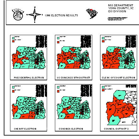
1996 was the year of elections . GIS maps were used for the management of the County elections and GIS tools were used to analyze the results.
The Department of Zoning can access the main GIS server by tax map-id number and view the information. This information is very useful to the public, especially to end users like Realtors and Developers.
Software: The main software used for all the above applications is ArcInfo for UNIX. All the applications are built with AML. The data is obtained from existing Autocad files, Dbase files and from L. Robert Kimball and Associates, Ebensberg, PA.
Today, we are at a juncture where we all know what GIS means -
"An organized collection of computer hardware, software, geographic data and personnel designed to efficiently capture, store, update, manipulate, analyze and display all forms of geographically referenced information" (Understanding GIS, pg. 1-2).
However, most of us seem indecisive about the benefits of implementing the system. It should be realized that it is a program with very few immediate results and immense long term benefits.
GIS has a wide range and variety of applications. Government is one of the primary users of the system. In spite of high implementation costs, the long term benefits have prompted most government agencies to opt for the system. There could be many ways in which the problem of funds could be resolved. It is possible for state and local governments to get grants from the federal government to pay for their GIS system (Shah & Sharoff, pg. 38-41).
One needs to review some full-fledged GIS systems in Government to cast away any doubts; some exemplar systems in the Carolinas are the City of Rock Hill, SC and Lincoln County , NC.
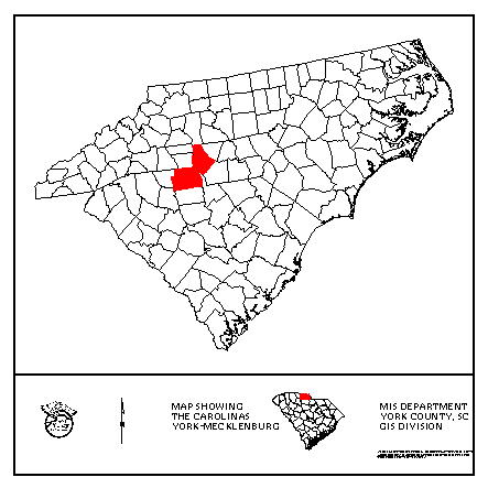
York County, South Carolina, is in the midst of implementing a full fledged GIS.
York County is located in the northern Central portion of South Carolina. It is bordered by a portion of North Carolina to its north, Chester County to the south, Lancaster County to the east and Cherokee and Union Counties to the west. Natural boundaries include the Broad river on the west and Catawaba river on the east. The county is heavily wooded in many areas (Historical Properties of York County, pg. 12)
York county is developing at an exceptionally fast rate. Much of the development pressure, especially in the eastern third of the county is due to Charlotte, North Carolina located in the north.
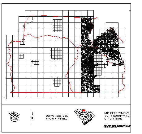
The GIS program in York County started in July of 1994. L. Robert Kimball & Associates of Ebensberg, PA have been contracted by the county to be responsible for the cadastral mapping of the entire county . The county received the first set of six maps from Kimball in July of 1995. Hence July, 1995 could be considered as the official date of beginning of the GIS program in the county.
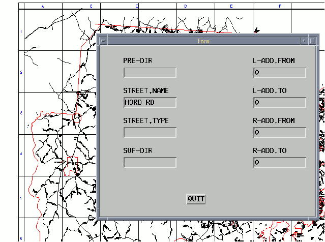
The Tax Assessor's office is responsible for the quality assessment, acceptance and maintenance of the GIS data received from LRK. They use several applications developed with Arc Macro Language .
An AML application package developed by L. R. Kimball and the GIS Division of York County helps the staff to edit maps, split parcels, do changes in the info-files for ownership, addresses, fire-districts and many other necessary alterations to the data.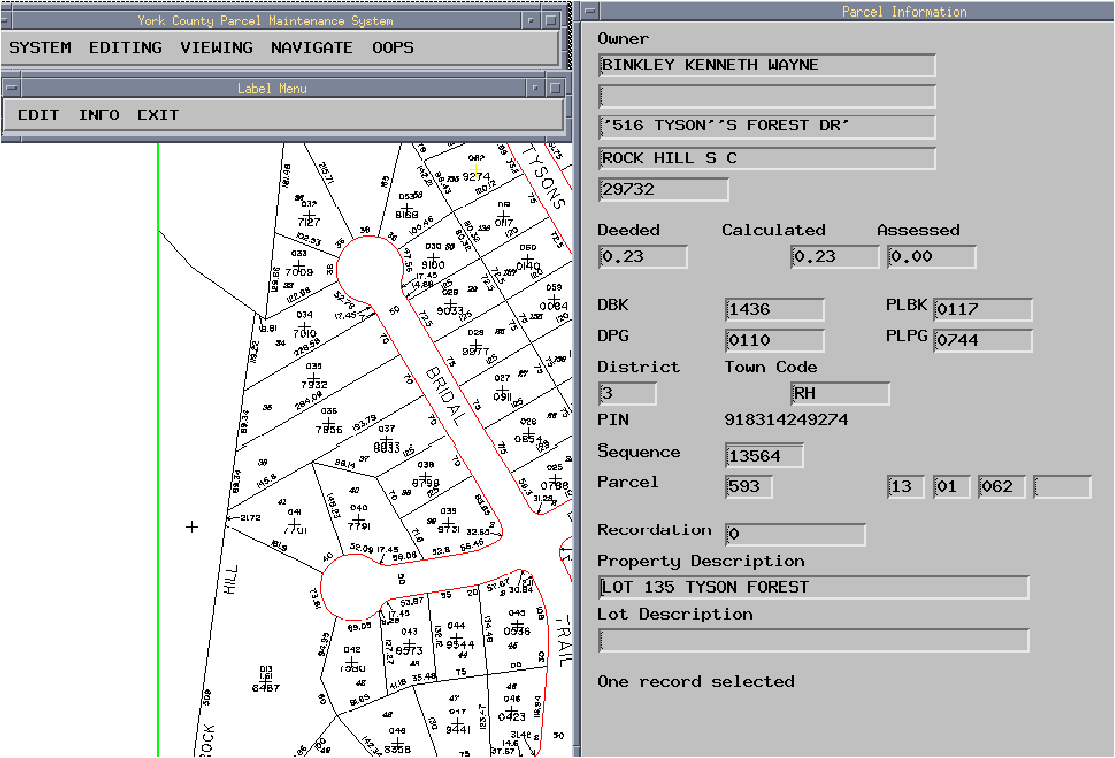
An application is also developed so that a user can view cadastral data by entering either the parcel id or the name of the owner. The information displayed has the parcel map of the property, vicinity map, the picture of the property and other related information like mailing address, zoning, deed-book number, plat-book number, and other necessary information. Once the data is received for the entire county these type of print-outs can be used to issue tax notices, it would also be very useful for Realtors, developers and the general end user. 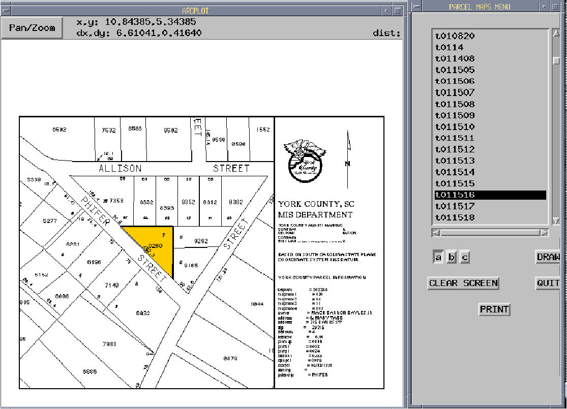
York County Office of Elections & registrations:
During 1996 elections, the Elections & Registration office used the maps produced by the county GIS.
These maps displayed voting precincts and major roads with an overlay of council, school, senate and house districts. These maps were also used to hold mock elections in schools and to better manage the elections within the county.

The final results of the 1996 elections were analyzed & printed in the form of GIS maps. These maps were used to display the results at a quick glance for publication purpose and in future they will prove helpful to the candidates to prepare for the next elections, both at local and national levels.
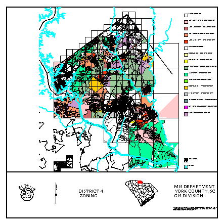
York County Planning & Development Services:
A zoning/landuse coverage was developed for parts of the county for which the county has received cadastral data. A road map with road index was also developed. The information for the road index was existing in Q/A database with the department of Zoning, this was exported in dbase format and was used in ArcInfo as a textfile.
York County MIS/GIS Department:
This is the department which is in charge of the GIS system, they are responsible for loading, maintaining and making data available to end users. They carry out the general system administration and networking, create AMLS and coverages for other departments to use . Most of the above mentioned coverages and applications have been developed by this department.
At present they are working on project for the York School district. The project involves geocoding the roads coverage. The School District will use this information to route their school buses. This would also prove very useful to the county. Data entry is being done by high school students who work under the guidance of the GIS coordinator; these students are also learning some ArcInfo skills. An AML application helps them enter data with ease.
At present the GIS system is managed by the department of Management Information Systems. This Department consists of a MIS Manager, a GIS coordinator and a PC network coordinator.
Ms. Maura Couch, York County and Mr. Cory Tucker, Esri Tech.Support need a special mention since they helped me compile the images for this paper in the right format.
2. Shah Nirav M. and Sharoff Barry, EI Technologies, Aurora, CO, GIS World, August 1996, pg. 38-41.
3. Historical Properties of York County, SC, Prepared by Samuel Thomas Jr., York County Historical Commission, 1995, pg. 12.