 |
Yu Luo
Spatial Analysis Education and GIS Componentware Technology
Abstract
Geographic Information Systems (GIS) industry had been attempting to satisfy rapidly growing needs for GIS by providing intuitive GIS software, immense spatial database, sophisticated custom GIS applications, and enterprise solutions. GIS componentware represents the latest industry effort. This technology provides system integrators, value-added resellers, and common GIS practitioners with rich development tools in GIS and mapping.
Geographers are presented with both challenges and opportunities by this new technology. Their self-perceived prominence in GIS has been diminishing and many geographers feel that they are falling behind in this accelerating technological progression. Some of them are concerned that this trend will further contribute to the ongoing debate about whether GIS has degraded spatial analysis. They argue that GIS componentware technology has not contributed to closing the gap between spatial analysis and GIS capabilities since it is only a tool set with crippled GIS features. Even worse, most application developers are potentially geographic illiterates.
The future of GIS componentware and geographers’ roles in its evolution are promising, however. The market demands will continue to drive the technology. Geographers’ spatial analysis expertise and their traditional strong presence in GIS will prove to be constructive in both conceptual models and specific implementation of this technology.
Table of Contents
I.
Overview of GIS Componentware Technology
II.
The Missing Role of Geography in GIS Componentware Technology
III.
GIS Curriculum and GIS Componentware Technology
IV.Conclusion
Acknowledgements
Appendixes
End Note
References
Author Information
I. Overview of GIS Componentware Technology
I.I What is GIS componentware technology?
GIS componentware technology is based on Microsoft OLE architecture and Dynamic Linking Library (DLL) foundation. Either OLE (or OCX, ActiveX in 32 bit operating systems) or DLL encapsulate rich GIS and mapping functions, and these functions are available to industry standard development environments such as Delphi, Visual Basic, and Visual C++. GIS application can be developed and deployed at industry standards. GIS componentware becomes a part of powerful toolbox of a developer.
Some GIS components also have the Internet extension that enables the GIS application can be deployed and used via the Internet.
I.II Why is GIS componentware technology needed?
GIS diffusion or democratization is the leading factor for GIS componentware technology. It is estimated that more than 80% business data have spatial dimension and increasingly people start to appreciate the power of GIS technology. Many users, however, do not need highly sophisticated and complex GIS software. They only need some simple GIS or mapping functions such as map overlay and buffer zone query. In many applications GIS is only a small supporting role. The big GIS software proves to be too clumsy and less flexible in many occasions.
Distributed computing also drove GIS componentware technology since it demands integrated network (or enterprise) solution. A highly complex proprietary GIS system is not appropriate.
I.III How is GIS componentware technology possible?
GIS componentware technology can trace its roots to proprietary macro language of commercial GIS software. These macros or scripts such as Avenue and AML automate or speed certain repetitive tasks in their software environment. They cannot, however, be called into program without the software in operation.
Recent technological breakthroughs in application development made component technology possible. OOPS development model converts functions into objects, which can be assembled and maintained at relative ease. Another important development is the fast growth of 4GL Rapid Application Development (RAD) environment such as Delphi and Visual Basic. Fully complying with OLE or OCX standards, RAD boasts a fast development cycle and is ideal for GIS components. The intuitive nature of RAD tools empowers many more people with the power developing GIS applications.
I.IV Why are traditional GIS software vendors so enthusiastic about the technology?
The first reason is both depth and scope of GIS componentware markets. It is estimated that Fortune 5000 companies are reaching a saturation stage in terms of complex shrink-wrap GIS software (Reid, 1997). Two market segments, GIS system integrators and Value Added Resellers (VAR) are performing well and continuing to grow. The Internet/Intranet is also showing promising sign in GIS distributed computing.
The second reason is market share consideration. Big GIS software vendors are concerned with the control issue in the aftermath of GIS componentware technology. By offering its own GIS components that strongly promote their own GIS methods such as data format, they are trying to continue to maintain their market share.
I.V What are the major GIS componentwares?
All major GIS software companies have released OCX/DLLs based on their own GIS technology. Currently Esri, MapInfo, Sylvan, Blue Marble, and TIMC Enigma have very active marketing their technologies. Large companies tend to break the functions of their flagship GIS software into components while smaller companies focus on open data format and format conversion.
The market share data is scarce due to the infancy nature of the technology. The overall GIS market balance probably will not change significantly since large companies have controlled the most popular spatial database formats, and GIS components are so far only the natural extension of the current technology. Since the Internet is a new frontier and the standards have yet to be set, it may be where some technological and marketing excitements occur.
II. The Missing Role of Geography in GIS Componentware Technology
II.I Where are geographers?
It seems that GIS componentware technology was driven by the market demand, initiated and implemented by the GIS industry. Geographers have yet to make significant contribution either in terms of conceptual framework or specific implementation. In comparison to the active involvement in the early years of GIS development, geographers have been rather silent. For example, there were fewer than 4 presentations addressing any aspect of GIS components in 1997 Annual Conference of American Association of Geographers at Forth Worth, Texas, while GIS trade conferences were flooded with the development and implementation of GIS componentware.
A simple answer is that geographers’ configurations of expertise are not most appropriate in developing and polishing the technology. Both development and implementation demand strong background in programming, software engineering, interface design, and marketing. One can hope that when both RAD tools and GIS components evolve to a mature stage, geographers will eventually overcome barrier to examine or use the technology.
II.II Are geography and spatial analysis in danger?
The lack of association between geographers and GIS componentware technology is alarming. For years geographers have proclaimed themselves as the champion of GIS conceptual framework (Brown, Sui). It has yet to be determined how much that is true since geography is not the only disciplines that study spatial dimension of the Earth phenomena (Taylor and Overtone).
It is difficult to argue that, however, geography and geographers have had made monumental contributions to the conceptual framework of GIS. Sui suggests that GIS has basically been built upon Berry’s geographic matrix (Berry, 1964). Earlier geographer GISers were much more involved in the technical aspects of GIS development. One reason is that the early GIS was rather primitive and easier to comprehend, and the second reason may be that those pioneering geographers also tended to be very sophisticated technically. Berry’s geographic matrix is a rather philosophical diagram, and its implementation in and with GIS proves to be more complex both in terms of depth and scope.
GIS componentware empowers virtually any developer with tools in developing GIS or mapping applications. Is this a curse or bless to geographers? Geographers often complain about the inappropriate use of GIS by the non-geographer GISers. Now imagine that how many people will use the GIS or mapping applications developed by potentially spatially illiterate developers or programmers?
The dilemma is that most geographers are not technically sophisticated enough to lead the technological development, not deep enough to do GIS right to set a good role model. The gap in technical expertise between geographer-GISers and many non-geographer-GISers such as those in AM/FM has been widening, with the latter enjoying a more advantageous position. In early years of GIS evolution, many GIS technical training were conducted by geographers. They were so concerned with the integrity of spatial analysis, they were worried about "...[G]IS education may become pure technical training to uninformed operators" (Openshaw 1991, Sui 1996). Interestingly, geographers among themselves often argue about what spatial analysis should be and how it can be properly aided or implemented by GIS (Taylor and Overtone). Now non-geographer GISers are able to offer more focused and in-depth GIS training in their own fields. Some of them suggest that it is not difficult to teach a person spatial analysis, basic modeling principles, cartographic standards, and utilization of various GIS software1. Many geographers, therefore, understandably have a sense of frustration and anxiety.
II.III What should geographers concentrate on?
What can geographers do? We should turn to the roles geographers assume in GIS. According to Brown, GIS endeavors can be divided into three groups:
1. Routine-descriptive GIS/mapping
2. Analytical-System design
3. Technical system design
Geographers enjoy comparative advantages in the second group.
| Routine-descriptive GIS/mapping | Routine-descriptive GIS/mapping | Technical system design | |
| What they do | Make maps and diagrams; visual display of spatial data | Integrating GIS with statistics, cartography, information retrieval, and similar tools to answer substantive questions of a scholarly or applied nature | Advancing GIS software and analytical systems |
| Geographers’ Comparative advantage | No | Yes | No |
Table 1. GIS application classifications (modified after Brown)
Clearly GIS componentware technology belongs to "technical system design" group. Should we stay out this category then? Can we afford it either from the view of maintaining my status quo or trying to limit the potentially exploding non-spatially corrects GIS applications?
Geographers still can actively participate in the technical systems design such as GIS components. They probably will not play a role of programmer or software engineer, rather as a visionary in the conceptual framework and also as practitioner of the technology. GIS has never been driven solely by technologies, but rather by the needs for solutions for spatial problems.
III. GIS Curriculum and GIS Componentware Technology
The GIS education in geography departments in the United States has been evolving from geography department centered to cross-disciplinary based. Bigger departments went farther than smaller ones. In a geography department with a strong GIS program, three tracks of GIS concentration can be developed:
Hopefully a new generation of geographer GISers, with solid training in spatial modeling, thorough topical study, and strengthened technical training, they can play the following roles in GIS
How can geographers reach these goals?
1. Faculty development with active industry support
GIS faculties have to try to keep update in a very dynamic field and the industry’s support is vital. Donations of resources such as software, teaching materials, and free technical training are essential.
2. True integration of GIS/Remote Sensing/Quantitative in curriculum development
The integration of GIS and remote sensing has been undertaking for some time and proves to be very fruitful. Students can learn to identify, collect, process the real data to perform real world analysis. But the link between quantitative methods and GIS/Remote Sensing has been weak in most departments. Most students have limit their analysis based on the capabilities of their GIS or remote sensing software. Without solid training in quantitative methods and topical research, the depth and scope of GIS implementations are bounded.
3. Develop alliance with other disciplines such as Computer Science and Marketing in GIS curriculum development. Arrange special programming courses targeting on GIS professional. Double majors or minors cross-disciplines should be strongly encouraged.
While GIS componentware technology gives thousands of potentially spatial illiterate developers the power to develop GIS or mapping applications, geographers are naturally concerned. But since few geographers concentrate and excel on the technical advancement side of GIS, many of them feel powerless to prevent the potential large-scale insult on the integrity of spatial analysis. This paper proposes that geographers should reform their GIS programs to tighten the integration of spatial modeling, GIS, and remote sensing. They should implement and practise GIS more vigorously and improve GIS’s capabilities in conducting spatial analysis. Finally, they also should encourage a smaller group of students to become very technologically competent so they can directly involved in identifying, shaping, and creating the GIS trends.
The author would like to thank Esri� for its generous donation of two MapObjects licenses, which contributed to the GIS curriculum reform at Indiana State University.
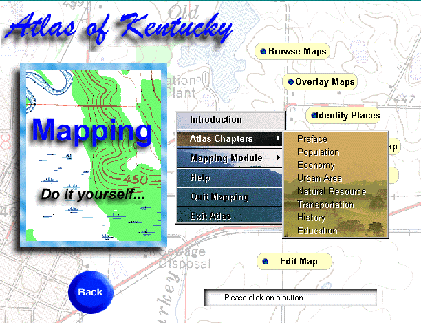
Here are some screen shots of Atlas of Kentucky on CD-ROM being developed by me. All shots come from the mapping module of the CD title. The mapping and GIS functions basically come from Esri's MapObjects. It is very easy to implement MapObjects.
 |
Opening screen of the mapping module. The navigation system is very flexible. You can go anywhere you want by click on right mouse button.
 |
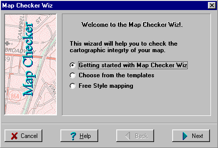
Here is a simple map checker I developed to help improve the cartographic quality in the mapping module.
 |
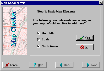
Another shot. I guess anybody can argue what standards should be.
 |
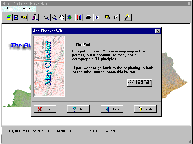
This is the full view of the Map Checker Wiz.
1. John Haaks, K-Mart Corporation, in his discussion at "Business and career skills: a view from the corporate world" panel, Annual Meetings of Association of American Geographer, April 2, 1997, Forth Worth, Texas.
Sui, Daniel. 1995.A pedagogic Framework to Link GIS to the Intellectual Core of Geography. Journal of Geography 95(6): 578-591.
Berry, Brian. 1964. Approaches to regional analysis: A synthesis. Annals of the Association of American Geographers 54(2): 2-11.
__________. 1980. Create future geographies. Annals of the Association of American Geographers 70(4): 449-458.
Openshaw, Stan. 1991. A view on the GIS crisis in geography, or, using GIS to put Humpty-Dumpty together again. Environment and Planning 23(5): 621-629.
Taylor, P., M. Overtone. 1991. Further thoughts on geography and GIS. Environment and Planning 23(6): 1087-1094.
Treadwell, Joann. 1996. Editor’s Note: who cares how it’s done. Business Geographics 4(10): 8.
Reid, Hal. 1997. Are we running out of gas? Business Geographics 5(1): 40.
Rajani, Purvi. 1996. Moving toward the mainstream ---slowly. GIS World 9(9): 86.
Rajani, Purvi. 1996. Simple models reflect GIS market segmentation. GIS World 9(12): 86.
Brown, Lawrence. 1996. President’s column: The G in GIS --- getting it right. AAG Newsletter 31(9): 1-3
Yu Luo, Ph.D.
Assistant Professor of Geography
Director of GIS and Computer Cartography Lab
Department of Geography, Geology & Anthropology
Indiana State University
Terre Haute, IN 47809
Phone: 812-237-2444
Fax: 812-237-8029
Email: geluo@scifac.indstate.edu