Creating a Geographic Information System
for Ocean Planning and Governance in the Southeastern United States
Cindy Fowler, NOAA Coastal Services Center (CSC)
Joelle Gore, NOAA Office of Ocean and Coastal Resource Management (OCRM)
Key Words: ocean GIS,
ocean planning, ocean governance, ocean policy, shoreline, bathymetry
Abstract: GIS has traditionally
been used for terrestrial applications. Some data sets are problematic
when working in the ocean. Sorting through the available shorelines
to find the "official" shoreline is an issue. The dynamic nature of the
shoreline due to erosion and tidal range is difficult to capture in a GIS. Finding
and combining multiple resolution survey data from various sources
to create reliable bathymetric data usable on the PC is also a
challenge. NOAA is working to create PC-based data sets and tools
in ArcView that can be used for the Ocean Governance and Planning
community. Key data sets for ocean planning are being created
for the southeastern United States. A high-resolution shoreline
will be created for this area by vectorizing the scanned byproducts
of the original tide-controlled photography used for NOAA nautical
charting. Bathymetric survey data will be combined to create bathymetric
contours from the shoreline out to the Exclusive Economic Zone
(EEZ), or 200-mile international boundary. These key data sets
will be combined with other cadastral and natural resources data
layers to create a GIS suitable for the ocean planning and governance
community. Esri's ArcInfo will be used for data development with
ArcView 3.0 as the final software that will serve the ocean planning
community.
Introduction: Resources
and uses of U.S. ocean areas are governed under a regime that
is fragmented among federal and state authorities, based on jurisdictional
boundaries and single-purpose statutes, and not integrated by
one coherent set of national goals and guidance. The result is
often inefficiency, jurisdictional confusion, and contentious
decision making that often fails to address impacts on ocean resources.
An important part of the comprehensive ocean planning process
is the creation of a geographic information system (GIS). A GIS
can be used as an aid to decision making, to identify conflict
areas, and to assist in bringing together a broad user community
interested in ocean resources.
Although resource managers and policy makers at all
levels of government have called for changes in the U.S. ocean
governance regime to redress these inefficiencies, it has been
increasingly difficult to develop a comprehensive ocean resource
strategy. In the absence of a national framework, the National
Oceanic and Atmospheric Administration's (NOAA) Office of Ocean
and Coastal Resource Management (OCRM) has encouraged states to
consider developing comprehensive ocean policies and state and
regional management plans. OCRM has teamed with the NOAA Coastal
Services Center (CSC) and Strategic Environmental Assessment (SEA)
Division to assist in this first regional ocean GIS effort. This
paper outlines the process of designing and creating an ocean
GIS, which serves as a unifying and non-contentious platform for
regional ocean planning and policy dialogue in the southeastern
U.S.
GIS has primarily been used for terrestrial-based
applications. Finding supporting standards, data, and applications
become problematic when working off shore. Because of difficulties
with data acquisition, ocean data tend to be more sparse than
their associated terrestrial-based data. For example, sorting
through the available shorelines to identify an "official"
shoreline is an issue. Finding and combining multiple resolution
survey data from various sources to create reliable bathymetric
data usable on the desktop is also a challenge. There is the critical
issue of resolving the vertical datum when combing bathymetric
and elevation data. In addition, the cadastral element of an ocean
GIS quickly becomes a quagmire. Generally, the low-water line
or baseline is used to calculate state and federal boundaries,
where the mean high-water line is generally considered the shoreline.
Setting database priorities: In
an effort to create a regional ocean GIS, state, federal, and
regional partners worked through a process that outlined the priority
issues and identified the data sets necessary for addressing these
issues (See table 1). A high-resolution
shoreline, bathymetry, and cadastral data layers were found to
be fundamental to the broad spectrum of issues. In addition to
the data sets required, a recent CSC survey revealed that the
majority of the coastal community (including those in the Southeast)
are using Environmental Systems Research Institute's (Esri)
ArcView® desktop mapping software. This project
is committed to provide data that are structured to be readily
used by those customers.

 Shoreline: CSC has begun
the process of collecting the key layers for inclusion in the
ocean planning GIS. The high-resolution vector shoreline is being
acquired from a combination of byproducts (T-sheets) of the NOAA
nautical chart production process. The photography that was used
to create the charts is the only universal, tide-controlled product
that exists for the entire U.S. The most recent data (post 1990)
have a digital CAD-like format that can be extracted and processed
to produce a topologically structured vector shoreline. Pre-1990
products only exist in a raster scan of the photo separate from
the chart. These raster scans are being vectorized using Esri's
ArcScan® using labor from the AmeriCorps National
Civilian Community Corps. The final product will be a high-resolution
shoreline (scales ranging from 1:5,000 to 1:20,000) for the Southeast
with associated Federal Geographic Data Committee (FGDC)-compliant
metadata.
Shoreline: CSC has begun
the process of collecting the key layers for inclusion in the
ocean planning GIS. The high-resolution vector shoreline is being
acquired from a combination of byproducts (T-sheets) of the NOAA
nautical chart production process. The photography that was used
to create the charts is the only universal, tide-controlled product
that exists for the entire U.S. The most recent data (post 1990)
have a digital CAD-like format that can be extracted and processed
to produce a topologically structured vector shoreline. Pre-1990
products only exist in a raster scan of the photo separate from
the chart. These raster scans are being vectorized using Esri's
ArcScan® using labor from the AmeriCorps National
Civilian Community Corps. The final product will be a high-resolution
shoreline (scales ranging from 1:5,000 to 1:20,000) for the Southeast
with associated Federal Geographic Data Committee (FGDC)-compliant
metadata.
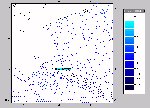 Bathymetry: Creating a
useable bathymetry data layer for a desktop mapping system requires
discovering, inventorying, and combining multiple bathymetric
sources and processing them into a simpler data structure that
can be reasonably viewed by ArcView®. A single
clearinghouse does not exist for all bathymetric data. To create
a regional bathymetric data set requires discovering and combining
multiple sources of hydrographic survey, marine track-line, and
research data. The NOAA National Geophysical Data Center (NGDC)
is the largest archive of bathymetric data, with U.S. Geological Survey (USGS),
the U.S. Army Corps of Engineers,
and the individual states providing a small amount of supplemental
data. These data range greatly in accuracy, date, and density.
Any areas that have been recently surveyed, including major harbors
and some parts of the Exclusive Economic Zone (EEZ), have highly
accurate and dense coverage. Estuarine and near-shore areas, as
well as those with few navigational hazards (i.e., deep-water
areas) have older and sparser data. Because very little attention
has been paid to the off-shore areas by FGDC and commercial vendors,
non-navigational related standards and procedures for bathymetry
are either not well documented or do not exist. CSC has begun
inventorying available data and developing a methodology for combining
these data, and will provide a complete bathymetric data layer
for use by the southeastern ocean planning community.
Bathymetry: Creating a
useable bathymetry data layer for a desktop mapping system requires
discovering, inventorying, and combining multiple bathymetric
sources and processing them into a simpler data structure that
can be reasonably viewed by ArcView®. A single
clearinghouse does not exist for all bathymetric data. To create
a regional bathymetric data set requires discovering and combining
multiple sources of hydrographic survey, marine track-line, and
research data. The NOAA National Geophysical Data Center (NGDC)
is the largest archive of bathymetric data, with U.S. Geological Survey (USGS),
the U.S. Army Corps of Engineers,
and the individual states providing a small amount of supplemental
data. These data range greatly in accuracy, date, and density.
Any areas that have been recently surveyed, including major harbors
and some parts of the Exclusive Economic Zone (EEZ), have highly
accurate and dense coverage. Estuarine and near-shore areas, as
well as those with few navigational hazards (i.e., deep-water
areas) have older and sparser data. Because very little attention
has been paid to the off-shore areas by FGDC and commercial vendors,
non-navigational related standards and procedures for bathymetry
are either not well documented or do not exist. CSC has begun
inventorying available data and developing a methodology for combining
these data, and will provide a complete bathymetric data layer
for use by the southeastern ocean planning community.
Boundary: A cadastral
data layer is just as necessary in mapping the ocean realm as
it is on the land. Ocean boundaries and the rights associated
with ownership have become even more critical to define as the
ocean resources increase in value. Because ocean survey markers
are virtually non-existent, it becomes even more important that
all parties understand the boundaries of features of state, federal,
and international interest. The baseline is a line of reference
that is used to calculate the outer limits of the state and federal
waters (i.e., Territorial sea, Contiguous Zone, EEZ). Generally,
the low-water line is used, but deciding on this line can be an
item of contention. Because the baseline is used to project a
boundary of 3 miles, 9 miles, 12 miles, or 200 miles, a small
shift in the baseline can shift the ownership boundary and result
in large amounts of lost revenue. The U.S. Department of the Interior,
Minerals Management Service,
in conjunction with NOAA, the individual states, and the U.S.
Department of State Ad Hoc Interagency Baseline Committee, work
to resolve and map the baseline. In the Southeast, only South
Carolina has a resolved baseline. In the process of mapping ocean
boundaries, this project will gather the best available information
for the baseline. Hopefully, in the process, a dialogue between
the responsible agencies will be stimulated that will help to
resolve the boundary issue.
Building an ocean planning GIS provides an excellent
opportunity to build partnerships between the federal and state
sectors in support of ocean resource management. In addition,
this project aids in leveraging and coordinating institutional
resources and applying them to specific coastal issues, such as
habitat protection and coastal hazards, as well as ocean planning
and governance.
Cindy Fowler
National Oceanic and Atmospheric Administration
Coastal Services Center
2234 South Hobson Ave.
Charleston, SC 29405-2413
Ph: (803) 974-6249
FAX: (803) 974-6315
cfowler@csc.noaa.gov
Joelle Gore
National Oceanic and Atmospheric Administration
Office of Ocean and Coastal Resource Management
1305 East-West Highway, SSMC4, 11th Floor
Silver Spring, MD 20910
Ph: (301) 713-3117 x177
FAX: (301) 713-4367
jgore@coasts.nos.noaa.gov

 Shoreline: CSC has begun
the process of collecting the key layers for inclusion in the
ocean planning GIS. The high-resolution vector shoreline is being
acquired from a combination of byproducts (T-sheets) of the NOAA
nautical chart production process. The photography that was used
to create the charts is the only universal, tide-controlled product
that exists for the entire U.S. The most recent data (post 1990)
have a digital CAD-like format that can be extracted and processed
to produce a topologically structured vector shoreline. Pre-1990
products only exist in a raster scan of the photo separate from
the chart. These raster scans are being vectorized using Esri's
ArcScan® using labor from the AmeriCorps National
Civilian Community Corps. The final product will be a high-resolution
shoreline (scales ranging from 1:5,000 to 1:20,000) for the Southeast
with associated Federal Geographic Data Committee (FGDC)-compliant
metadata.
Shoreline: CSC has begun
the process of collecting the key layers for inclusion in the
ocean planning GIS. The high-resolution vector shoreline is being
acquired from a combination of byproducts (T-sheets) of the NOAA
nautical chart production process. The photography that was used
to create the charts is the only universal, tide-controlled product
that exists for the entire U.S. The most recent data (post 1990)
have a digital CAD-like format that can be extracted and processed
to produce a topologically structured vector shoreline. Pre-1990
products only exist in a raster scan of the photo separate from
the chart. These raster scans are being vectorized using Esri's
ArcScan® using labor from the AmeriCorps National
Civilian Community Corps. The final product will be a high-resolution
shoreline (scales ranging from 1:5,000 to 1:20,000) for the Southeast
with associated Federal Geographic Data Committee (FGDC)-compliant
metadata.