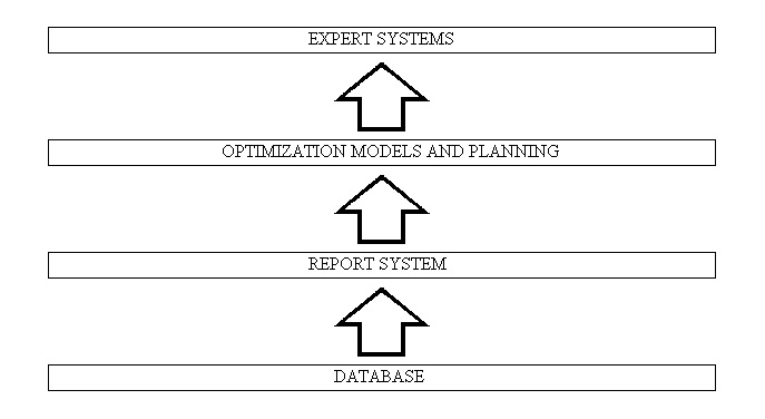
For successful management, each company needs the internal flow of data and information, and this demands many resources. This continuos supply of data can be realized with the aid of computer technologies that are already in the market and should significantly increase the efficiency and competitive advantages of the company. Multiple entering of data would be abolished. Data will be collected only once for all purposes: not only for studies and projects, but also for the realization and regular maintenance of the system. The railways system is a group of various constructions and for its functioning. It demands a co-operation of many different experts. By means of computer technologies, it is possible to unite these experts in one professional team, which is not treating one structure partially but which is treating the system as a unit. Because of the fact that computers are relatively efficient, more different solutions of a problem can be analyzed and realized in a shorter period of time, considering different parameters at the same time. This decision support system is designed to aid human decision-making and provide productivity tools for knowledge experts. In this way, decision making becomes the most efficient. Analyses at the end of the thesis show that the investments in geographic information system, which is some kind of decision support system, will pay back very soon and savings will be relatively large.
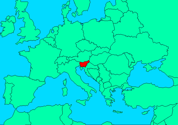
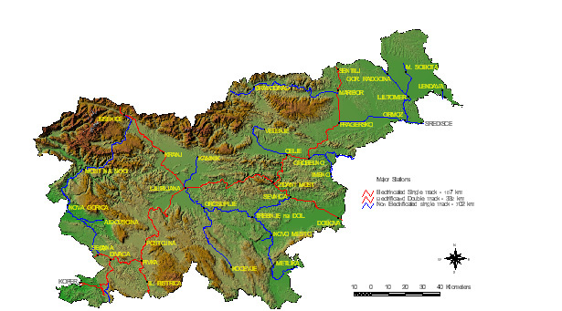
The company Slovenske zeleznice d.d. is now owned by the state of Slovenia and it has about 1,200km of railway lines. The company employs about 10,000 people. At the moment, the priorities are modernization of railway lines and construction of international railway connection with Hungary.
The basic tasks of every economical subject (including Slovenske zeleznice d.d.) is tendency to the rationalization of consumption, raising of productivity and using the inner resources. For that kind of tasks it is necessary to control the standing of the system in the first place. On the railway, the main reasons for changing the state are traffic and atmospherically influences. Because of the safety, the railway parameters must satisfy certain standards. For reasonable planning of interventions, we need to ensure data of dynamical changes and data about mutual dependence between specific parameters of railway.
Because of a large amount of data, it is reasonable to use computer supported information system, which properly and quickly processes data and presents the results. We chose a geographical information system. At the same time, the system enables data exchange with other external spatial and non-spatial databases.
The aim of introducing the GIS on Slovenske zeleznice d.d. is to achieve correct data processing about the state of railway infrastructure, as the basis for planning, projecting and maintaining the railway lines. At the same time it ensures on-line access to data and information for users. It enables several kinds of analyses as support to decisional and planning functions, which depend from knowing the area location, content and economically-technical state of rail elements and of geographical conditions and administrative-legal rules.
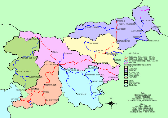
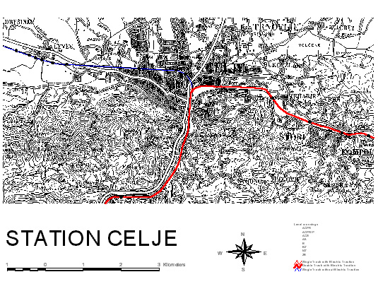
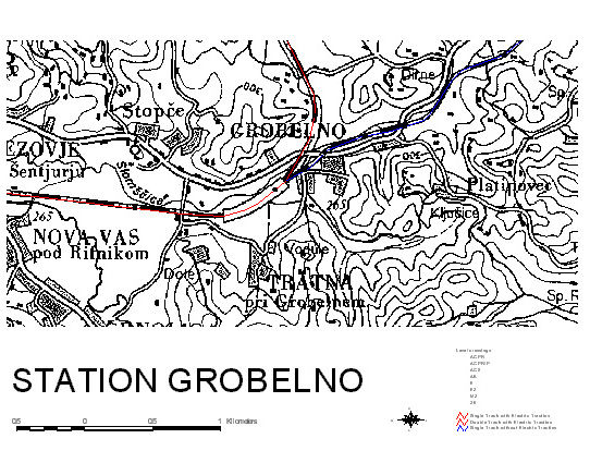
Database is filed and renewed in different ways. The data is mostly gathered at the particular sections (Ljubljana, Maribor, Celje, Postojna, Pivka, Novo mesto in Nova Gorica), that is on the place of their formation. So we get unitary dislocated database.
According to the profession the database is divided to civil engineering, electro technical and real estate part. Every part has its characteristics and specifics. Since the planning, construction and maintenance of the railway are wholeness, it is necessary that the experts from all fields are working together.
For each layer there is a standard, which includes the way of measuring of position (geographical data) and structure as well as content of attributive data (alphanumerical part).
At the end of introduction, there will be about 200 layers. At the setting of standards, there are most of the leading personnel co-operating; during the work, they can find the necessity of certain layer of data. It is our tendency that a certain standard is in use for several years, because on that way we can observe the condition of certain sort of objects during that period.
Because of demands for immediate results of GIS, the system is divided into two levels: operative-detail level and strategic level, which are the specialty of that information system. In both levels have the attributive part the same, because of the later mosaic changing.
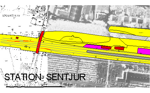
Organization on the detail level is more complex. It demands creation of land surveying traverses (base lines) and detail survey recording of objects.
The data is gathered on the field of sections for maintenance of the railways and they are by contents the same as data in the detail level. On the ground of standards for certain objects and elements of the railway infrastructure, there are special menus for entering data created (by Microsoft FoxPro) but we will replace those menus created in Microsoft Access very soon. The system enables independent processing of the alphanumeric part of the database, without necessary installing software ArcInfo. There are also specially included code lists, which ensure unitary data entered on different locations. With that list, we ensured relatively fast improvement of information system and the results of the work combined with it. At the same time, we ensured time as well as resources for expanding and capturing detail geographical data with survey recording on field.
Even when the detail level will be full, we may not expect total release of the strategic level. Data from external alphanumerical databases will still be dynamically segmented to the axis of railway on the same or similar way but with the difference that the railway will be more precisely located in space. We expect to dynamically segment to the axis of the railway the certain forecasts of consequences by choosing the right decision, because of presenting the results as well as continuing the crossing with other data and information in this area.
To insure the unity of database we have to modify organization on the field of Infrastructure in the company of Slovenske Zeleznice d.d.
We have to establish group for GIS, which will take care of control technical database unity, collecting data at the central point and for upgrading the system.
Within civil engineering maintaining sections (Celje, Ljubljana, Maribor, Postojna, Nova Gorica, and Novo mesto) we have to establish independent land surveying groups. Their work will include: building and maintaining transverses (baselines), the necessities of civil engineering maintenance section and electrotechnical section, taking over surveying of new and reconstructed railways and processing spatial data for both professional services.
Land surveying groups are equipped with appropriate surveying and other equipment for successful work on field as well as in office. During this year, the equipment will be complemented.
All decision-makers and referents competent for entering and updating the data have to have access to computer graphic workstations connected to computer network of the company.
For successful work, there is the setting up of the local area networks on the management center and maintaining sections in progress. They will be connected with the new telecommunication network (1998) in to one network. That way all on-line users will be connected to unique LAN-WAN and will have access to updated data.
For successful operation of such system, it is necessary to be connected to other external geographic information databases. Some of them the company Slovenske zeleznice d.d. is bound to present certain data or information about the railway infrastructure. On the other hand, it gets data necessary for continued work from others.
Project organizations working for Slovenske zeleznice d.d. department of Infrastructure are bound to create projects to be compatible to ArcInfo. That of course takes some extra work. We are planning to design the demands and standards as well as the process of later control by the end of the year of 1997.
When the data about the certain object is available in the system, it is possible that projecting organizations for the basis in their projects uses it. That counts for scanned maps as well as for vector part of the database, measured on field with origin accuracy.
GIS of Slovenske zeleznice d.d. is an opened system. There are capturing and exchanging of data enabled in all formats, supported by software.
Because of faster implementing and expected results the information system is divided to strategic and detail level, which is unusual but it leads to the final goal (more optimal decisions) faster.
Described information system combines technological abilities of information technology and the new discoveries in the field of planning, civil engineering and maintaining the railways. It is designed as dynamic and adaptive information system to the certain leading engineer as well as to several geopolitical conditions. With that kind of geographic information system, the maintenance of railway infrastructure in highest quality will be enabled as well as optimal planning and leading of investments and more optimal construction of new sections or entire railways. The concept also gives the ability to upgrade the contents as well as the information equipment. We are expecting the system to work several years with of course certain modifications of equipment, personnel and organization. Through GIS or through experiences of other railway management it is possible to upgrade the system with new discoveries from fields of planning, projecting, executing and maintaining of the railway infrastructure. From the financial analysis we can see, that the goal of more rational consumption of infrastructure financial sources with such information system can be reached. The analysis includes the final saving of 5 %. We think that with that analysis the hypothesis of excuse of implementing the system is confirmed.
2. David Kroenke: MANAGEMENT INFORMATION SYSTEMS, MITCHELL PUBLISHING, INC./ SANTA CRUZ CALIFORNIA 1989
3. Michael F. Goodchild, Karen K. Kemp: INTRODUCTION TO GIS, National Center for Geographic Information and Analysis University of California, Santa Barbara 1990
4. Michael F. Goodchild, Karen K. Kemp: TECHICAL ISSUES IN GIS, National Center for Geographic Information and Analysis University of California, Santa Barbara 1990
5. Michael F. Goodchild, Karen K. Kemp: APPLICATION ISSUES IN GIS, National Center for Geographic Information and Analysis University of California, Santa Barbara 1990
6. UNDERSTANDING GIS, Environmental System Research Institute Redlands 1990
7. UPRAVLJANJE INFORMACIJSKIH RESURSOV V 90 LETIH: 6. posvetovanje, Drustvo ekonomistov Maribor / sekcija za informatiko 1990
8. Janez Sturm, Dusan Fajfar, Bogdan Zgonc: GEOGRAFSKI INFORMACIJSKI SISTEM SLOVENSKIH ZELEZNIC, GRADBENI VESTNIK št.: 11-12/1993
9. Janez Sturm: TEHNICNA IN ORGANIZACIJSKA ZASNOVA GEOGRAFSKEGA INFORMACIJSKEGA SISTEMA NA SISTEMU SLOVENSKIH ZELEZNIC, Magistrsko delo, Univerza v Ljubljani, FAGG 1994
10. Janez Sturm, ZASNOVA GEOGRAFSKEGA INFORMACIJSKEGA SISTEMA PODJETJA SLOVENSKE ZELEZNICE d.d., Mednarodni znanstveni kolokvij: UPRAVLJANJE PROMETA, 5.4.95, UNIVERZA V MARIBORU
11. Janez Sturm, ZASNOVA GEOGRAFSKEGA INFORMACIJSKEGA SISTEMA PODJETJA SLOVENSKE ZELEZNICE d.d., 5. Mednarodni simpozij o elektrotehniki v prometu 96, Ljubljana - Gospodarsko razstavisce, 10.-11.10.96, Zbornik referatov - Proceedings