Note: This paper was presented in 1997. The Land Use Planning Education Project (LUPEP) has more current project information on their Web site at www.riveredgenc.com/html/landuse.html; they also have a Yahoo Group site for e-mail lists: http://groups.yahoo.com/group/lupep.
Terrie Cooper, Project Director
Eric Fowler, GIS Consultant
Tosca Hoffmann, Graduate Student
Gary Korb, Project Assistant
I. Project Abstract
Riveredge, in working for its mission of providing leadership
in Environmental Education has stepped forward to accept this
challenge. Terrie Cooper and Tosca Hoffmann, Riveredge staff,
Gary Korb from Southeastern Wisconsin Regional Planning Commission
(SEWRPC/UW-Extension), and Eric Fowler, GIS specialist, have forged
a partnership to develop a curriculum for High School students
that focuses on land use planning issues in southeastern Wisconsin,
utilizing GIS as a classroom tool. As an educational tool, GIS
has been shown to encourage critical and creative thinking, and
develop problem solving skills for its users. This tool can also
be used to help students practice the process of scientific investigation
and resolve environmental issues.
During a two-day teacher in-service in February 1997, the curriculum,
first of its kind, was introduced to 11 teachers from the Milwaukee
River Watershed in Wisconsin. Participating Year One schools include
the following Milwaukee Public High Schools: Riverside University,
Rufus King, Vincent and Washington and the following area high
schools: Cedarburg, Grafton, West Bend East, University School
of Milwaukee, Marquette and Nicolet.
The two week long Land Use Planning curriculum for High School
students encompasses the following topics: Introduction to Planning
Principles, Exploring the Tools Available for Planning, Developing
a Land Use Plan and Implementing the Plan.
Thanks to the generous funding support of The Milwaukee Foundation
and the Wisconsin Coastal Management Program, we have purchased
reference books, topographic and aerial maps, stereoscopes, GIS
software Arc View 3.0 and global positioning units for the participating
schools. Digitized data sets of the Town of Saukville have also
been provided to participating schools by the Southeastern Wisconsin
Regional Planning Commission. This digitized data set includes:
soils, land use, transportation, environmental corridors, natural
areas, vegetation type, wetlands, topography, bedrock, population
figures and urban growth.
As part of the project, students are developing a Land Use Plan
for the Year 2010 for the Town of Saukville. Student Land Use
Plans will be brought together and shared May 20, 1997 with SEWRPC
officials and educators who will critique student plans and evaluate
the Land Use Planning Project for Year One.
"Never doubt that a small group of thoughtful committed
citizens can change the world. Indeed, it's the only thing that
ever has."
-Margaret Mead
A. Project Need
Urban growth is expanding in Southeastern Wisconsin at an unprecedented
rate. Overall, the average annual population growth rate for the
region (Washington, Ozaukee, Milwaukee, Waukesha, Kenosha, Racine,
and Walworth counties) has been about 3% . This small increase
in population cannot begin to account for the changes seen across
the regional landscape, and upon our highways.
Population growth, instead, is reflected in a rapid decentralization
of both people and urban development. A population the equivalent
of the City of Racine, left Milwaukee County between 1970 and
1980. During this time, the suburban counties grew rapidly, particularly
Washington and Waukesha counties. One of every 2 people added
to the Southeastern region were in these counties. Washington
County grew 67.7 % and Waukesha grew 42.1% in the past 25 years.
Washington County is Wisconsin's most rapidly growing county.
This geographic redistribution of people is the most important
cause of the dramatic land use changes and environmental issues
taking place in our region. The Southeastern Wisconsin region
has added only 10% more people to its population since 1963. But
we also:
If these trends continue, our land use problems will only increase.
We need to work towards developing a population who will make
new lifestyle choices that work to protect the quality of our
environment in Southeastern Wisconsin. By understanding and analyzing
the nature of these demographic trends, a community can more intelligently
choose and plan the direction it wishes to take.
According to the Southeastern Wisconsin Regional Planning Commission
(SEWRPC) education is an important key to this process. Research
has shown that the most effective way to begin such change is
through the process of educating our children, the future decision
makers and leaders of tomorrow.
To address the critical need of educating future environmental
decision makers about the important role of developing and implementing
a comprehensive land use plan in Southeastern Wisconsin, Riveredge
Nature Center formed a consortium in 1996 to develop an educational
program for high school students focused on Land Use Planning.
The consortium includes: Riveredge Nature Center (Project Director),
the University of Wisconsin Extension, the Department of Natural
Resources, the Southeastern Wisconsin Regional Planning Commission,
and the UW-Milwaukee Geography Department.
The project will involve students, educators, business and industry
professionals, and government officials in a collaborative effort
to develop student involvement in the process of land use planning
through environmental analysis. Students will develop increased
competencies in problem solving, analysis, communications, ecology,
economics, civics, geography/geology, sociology, and language
arts.
This project will serve 840 high school students over the two
year implementation period. Students participating in the project
attend high schools in the six county area of Milwaukee, Ozaukee,
Racine, Walworth, Washington and Waukesha.
B. Project Goals
The goals of the Land Use Planning Educational project are:
1. To utilize Riveredge Nature Center's existing network of the "Testing the Waters" program, a collaborative endeavor between public, private and educational institutes, to link diverse schools and communities together -- rural, suburban and city -- through the common thread of the Milwaukee River watershed,
2. To develop an awareness in teachers and students about the importance and complex nature of land use planning,
3. To develop teachers and high school students to have competencies in: techniques for gathering environmental, demographic, transportation and economic data; using data to design models for futures land use planning; defending their models at an annual student land use forum with public officials, planners, and environmental groups,
4. To utilize state of the art technologies including: Geographical Information Systems, map-making, Computer Models and the Internet Computer Network; to facilitate data collection, communication and cooperation in land use planning by students,
5. To work cooperatively with public, private and educational institutes to increase student problem solving skills and to encourage an interdisciplinary focus (social, political, economic and ecological) to the complex issue of land use planning in Southeast Wisconsin,
6. To develop a citizenry who are competent to take active and
responsible steps to resolve complex socio-environmental issues.
C. Methodology
Riveredge is the Project Director of the consortium of private
and public leaders offering the "Testing the Waters"
program. Students and teachers work together in monitoring nonpoint
source pollution and sharing this information with community leaders
through the Internet. Testing the Waters has provided hands-on
experience to over 18,000 students from 40 area high schools and
middle schools since 1990 and has become a national model.
The Testing the Waters consortium saw the need to expand the TTW
program into a broader base view of the watershed. Water quality
is a reflection of land use and it is imperative that students
understand the land use planning process to more effectively work
towards resolving water quality issues facing the Milwaukee River
Watershed.
Utilizing the existing network for the "Testing the Waters"
project, Riveredge will implement the Land Use Planning Educational
project over a two year period with a total of 20 High schools
from Milwaukee, Ozaukee, Racine, Walworth, Washington and Waukesha
counties. The project has been piloted with ten schools in the
1996-1997 school year. An additional ten schools will be brought
in for the 1997-1998 school year for a total of twenty participating
schools. All targeted schools currently utilize the "Testing
the Waters" curriculum and are knowledgeable about Riveredge,
the collaborative education method employed, and have successfully
integrated TTW into their classroom curricula.
D. Project Timeline
| Project Task/Work Product | Timetable | Responsible Party |
| Implement curriculum | October 1996 through May 1997 | Project Director, participating schools |
| Conduct training | Oct-96 | Project Director, Steering Committee |
| Organize and conduct Student Congress | May-97 | Project Director, Steering Committee, participating schools |
| Evaluate Year One | Jun-97 | Project Director, Steering Committee, participating schools |
| Obtain agreement from remaining twelve schools from TTW network for 1997/98 school year implementation | Apr-97 | Project Director |
| Refine curriculum based on evaluation | July 1997 through September 1997 | Project Director, teachers from five identified schools |
| Complete Annual Report for distribution | Sep-97 | Project Director, Steering Committee |
E. Year One Accomplishments
· Worked with aforementioned Land Use Planning Steering Committee
members to develop goals, objectives and timeline for Land Use
Planning program.
· Selected ten high schools from "Testing the Waters"
Network to become pilot schools for implementation of land use
planning curriculum during the 1996/97 school year (see Appendix
A).
· Developed with teacher involvement the land use planning
curriculum for high school students. (see Appendix B).
· Scheduled a two day in-service for selected Land Use planning
pilot schools (see Appendix C).
· Purchased computer equipment, Arc View 3.0 GIS software,
stereoscopes, GPS units and curriculum materials for training
and implementation of Land Use planning program.
· Obtained Land Use digitized data sets from Southeastern
Wisconsin Regional Planning Commission (see Appendix D).
· Implemented land use planning curriculum and conducted
training Sat. Feb. 1 and Thurs. Feb 6, 1997, for pilot schools
(see Appendix E).
· Held a teacher feedback session Monday, March 17, 1997,
to evaluate program progress, difficulties, needs (see Appendix
F).
· Will organize and conduct a Land Use Planning Forum on
Tuesday, May 20, 1997, where Regional Planners from SEWRPC and
educators will evaluate student Land Use Plans for the Town of
Saukville.
· Evaluate Year One Land Use Planning Program.
· Refine curriculum based on first year evaluations by teachers,
students and Steering Committee members.
F. Project Goals for Year Two are to:
· Refine the Land Use Planning curriculum, based on the evaluations
by Year One teachers, students, and the Land Use Planning Steering
Committee.
· Invite an additional ten schools into the program for the
1997-98 school year, for a total of twenty participating high
schools.
· Develop and implement a four-day in-service for teachers
for University credit, that will provide teachers with the training,
curriculum and resources needed to implement the Land Use Planning
Project in their schools during the 1997-98 school year.
· Present and publish this project at the Environmental Systems
Research Institute's User Conference, July 8-10, 1997, in California.
· Provide on-going support through monthly newsletters, telephone
calls and classroom visits for the twenty participating schools
in the project.
· Organize and conduct a Land Use Planning Forum where students
and teachers from participating schools will come together with
SEWRPC officials and educators to critique Student Land Use Plans
to land use issues identified in their community.
· Evaluate Year Two Land Use Planning Educational Program;
refine the curriculum as appropriate.
· Publish and sell the curriculum nationally to other educators
interested in teaching about Land Use Planning and the utilization
of GIS as a powerful educational tool.
Appendix A Land Use Planning Project Description
Appendix B Land Use Planning Curriculum
Appendix C Outlines used for Training
Appendix E Summary of Training
Appendix F Summary of Teacher Feedback Meeting
Appendix H Staff Involved in Project
Building on the foundation established with the highly successful
"Testing the Waters" project, a "Land Use Planning
Education" project is being launched for high school students.
The project will involve students, educators, business professionals,
and government officials in a collaborative effort to develop
student involvement in the process of land use planning through
environmental analysis. Students will develop increased competency
in problem solving, analysis, communications, ecology, economics,
civics, geography, geology, sociology and language arts.
By focusing on land use concerns, this project will broaden the
students' perspective of the environment and their responsibilities
to it rather than perpetuating views which are victims of "tunnel
vision." This project is based on the belief that:
· Land use planning is essential to balance
human population expansion and urban growth to ensure a quality
environment for future generations.
· Education is a key element in effective land
use planning.
· It is imperative that citizens be aware of the
relationships between land uses and environmental quality
to make informed decisions. Reliable information and data are
needed to make sound decisions.
· Since many land use planning determinations are
made at the local government level, citizen input into the
planning process is essential: to ensure that land use plans
represent the greatest possible agreement amongst area citizens,
are subsequently supported, and address environmental impacts.
· Land use decisions must be made on a regional
basis, as environmental and other concerns know no political
boundaries.
To address the critical need of educating future environmental
decision makers about the important role of developing and implementing
a comprehensive land use plan in Southeastern Wisconsin, Riveredge
Nature Center, the University of Wisconsin Extension, the Department
of Natural Resources and the Southeastern Wisconsin Regional Planning
Commission have joined forces to develop an educational program
for high school students. Very few schools around the United States
have attempted to develop a land use project like this.
Project Timeline
The Land Use Planning Education Project will begin in January/February
1997 with a 2 day expense paid training and curriculum development
workshop. Teachers involved in the curriculum development and
training will be expected to participate in implementing and evaluating
this two-week curriculum by May 30, 1997.
Pilot schools participating in the project will receive:
·SEWRPC's very comprehensive Land Use Planning Data set for the study area
(A copyright license agreement must be signed by all teachers),
·Loan of the field equipment, maps, curriculum, stereoscopes and resources needed for completing the land use planning project,
·Any bus, training and sub costs associated with the project for Year One,
·Computer software & upgrade costs, training and technical support to work with the ArcView Geographic Information System,
·Guaranteed involvement in the Year Two project.
As a participant in the project teachers agree to:
·Assist in developing, implementing and evaluating, with the project staff, the land use planning curriculum for high school students. The Year One project will focus on developing a Land Use Plan for the Town of Saukville.
·Attend the land use planning forum on a day to be decided in May with SEWRPC staff, county and city planners, GIS specialists and environmental leaders to present, defend and evaluate student land use planning models for the Town of Saukville.
·Evaluate Year One Land Use Planning Program.
I, __________________________________________________(print name)
of _______________________________________________________
High School have read the above Memorandum of understanding between
the Land Use Planning Consortium Members and the participating
schools and agree to meet the responsibilities outlined above.
Signed __________________________________________Date______________________
Why Plan?
Resources
Activities
How Plan?
Resources
Activities
Tools for Planning
Resources
Activities
Implementing a Plan
Resources
Principles to Plan By
Parameters for Planning for Town of Saukville
for Year 2010 (from Saukville Survey)
Tools for Planning
Project Outline:
1. Each School will be assigned an area of the Town
of Saukville to plan for the Year 2010.
2. Given the above parameters, what could your area
accommodate in terms of future development, to meet the Town's
needs by the Year 2010?
3. Plans will be presented by each school team (a
teacher and 6 selected students) reviewed and defended in front
of a panel of SEWRPC planners, UW-Milwaukee Urban Planning professors
and graduate students, UW-Extension staff and GIS specialists,
during one day in May (the weeks of May 12-24).
Questions and considerations to help guide student
planning
1. What are the projected population statistics for
the area in 2010, on what are they based?
2. What is the anticipated industrial and commercial
growth? What planning is being done to provide for this growth?
3. What areas of the community are destined for a
different land use in the future? Why?
4. What will happen to the people and structures
in existing areas that will experience land use changes?
5. Where may new expressways, highways, bridges and
other new roads need to be constructed?
6. Have areas been designated in the town to accommodate
the following? (Or should they occur in nearby villages instead?)
a. New schools
b. Libraries and other cultural sites
c. Parks, open spaces, and recreation areas
d. Industrial development sites
e. Commercial shopping centers
f. Low income housing areas
g. Police, fire, and other municipal service areas
h. Mass transit facilities
i. Preservation of agricultural land and environmental
corridors
7. What are the estimated costs for expanding existing
facilities? Who will pay for these improvements? How much of the
funding will come from the local, state and federal levels?
8. What trends could impact your planning decisions?
For example; cost of gasoline, commuter trends and other demographics.
9. What types of zoning tools are currently available
in the Town that could be used in your planning? What specific
laws are in effect to prevent building in floodplains; to control
land erosion; to prevent unnecessary clearing of trees and other
vegetation, and to control diversion of or tampering with streams
and rivers?
10. Does the zoning law encourage cluster housing?
11. Does the present tax structure penalize owners of open lands (ie. Farmers)? Has consideration been given to tax relief for farmland?
Use the following questions as a guide for considering
some of the environmental impacts your plans may have upon adjacent
land, the community at large, and nearby communities. Consider
both the short-term and long-term impacts.
Air Pollution
Water Quality and Management
Transportation
Noise
Growth
8:30 - 9:00 am
I. Introduction/Overview
9:00 - 9:20 am
II. Introduction to Maps
A. Uses
B. Types
9:20 - 10:00 am
III. Introduction to GIS
A. What is GIS?
B. Purpose
C. Components
10:00 - 10:10 am Break
10:10 - 12:00 am
IV. ArcView Basics
A. Product overview
B. ArcView interface
V. Creating views and themes in ArcView
A. Views and themes
B. Working with shapefiles
12:00 - 12:30 PM Lunch
12:30 - 2:00 PM
VI. Working with Themes in ArcView
A. Modifying symbols with the Legend Editor
B. Managing theme display with theme properties
VII. The power of tables in ArcView
A. Working with tables
B. Building relationships between tables
C. Querying tables
D. Displaying statistical reports
2:00 - 2:15 PM Break
2:15 - 3:30 PM
VIII. Spatial query and analysis
A. Spatial query
B. Spatial Analysis
IX. Creating a map layout
A. Creating a layout
B. Frames
3:30 - 4:00 PM
IX. Close/Review - Assignment
A. Review ArcView concepts and tools
B. Assignment to test ArcView skills (will be reviewed on Feb
6)
8:30 - 9:00 am
I. Introduction to Land Use Planning Education Project
Goals
A. Review Curriculum available for teaching Land Use Planning
B. Developing a Student Directed Plan
1. Challenge to develop a proposal for Town of Saukville future land use plan
2. Best solution to given scenario (population growth, housing needs, industry)
3. Plan reviewed, critiqued by SEWRPC and other planning
officials in May
9:00 am - 11:00 am
II. Introduction to Planning
A. Historical Background (brief)
B. Why plan -- Unplanned growth, what problems it causes
-- The need for managed growth
(Examples of planning issues - look at newspaper clippings in area)
C. Type of communities (interconnectedness between decisions made by one community can have significant impact on another)
1. County
2. City/village/town
D. Impacts of unmanaged growth
1. Sense of place
2. Fiscal
3. Transportation
4. Social
5. Environmental
E. Objectives of planning
1. Sense of place; prevent sprawl
2. Cluster development/mixed use
3. Neotraditional towns
4. Farmland preservation
5. Natural resources/open space/environmental corridors
6. Housing
7. Other (social, economic, public health)
III. How do you develop a plan?
A. Overview of Process (relationship between planning & implementation)
1. Visioning; goals & objectives
2. Describing the community
3. Planning elements
4. Alternative analysis
Look at high/medium/low growth scenarios
Use centralized vs. decentralized plan
5. Citizen input in planning
IV. Implementing a Plan - the Ultimate Challenge of Planning
A. Introduction
1. Zoning
2. Building and Sanitary Codes
3. Fiscal devices
11:00 am - 12:00 pm
V. What you need to plan for Town of Saukville - Tools for Planning
A. Data & Tools - Where/how do you get data - tools?
1. Demographic trends
2. Analyzing fiscal impacts
3. Inventories of resources (Aerial maps, topographic maps, soils, waters)
4. GIS as a mapping/data management tool
5. Communication - data interpretation, community
involvement (surveys)
12:00 - 12:30 Lunch
12:30 - 3:30 pm
VI. Bus trip to Town of Saukville
A. Review map types - what they interpret best
B. Practice using topographic maps, aerial maps w/stereoscopes to locate sites
C. Use GPS units to locate position on map
D. Ground truthing practice
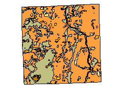
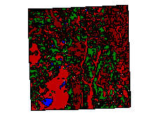
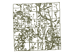
A. The Data
What we chose to have included in the data sets...
We wanted to have a large set of diverse
data available for the teachers and students to utilize (see attached
list of data sets, Table 1) By providing diversity, we offer the
students opportunities to explore the data to solve unanswered
questions about an area. Another important point to consider is
they will have fewer limits placed on them with a narrow data
set. The nature of the data will have bearing on the use of applications.
The majority of the data had to be in digital format. This way,
it is easy to access, manipulate, maintain, and share.
Potential Uses of the data...
| Data Set | Use at Neighborhood Level? | Use Regionally? | Source | Objective |
| Soils | Yes | Yes | SEWRPC | View differences over space. See if surroundings affect soil. |
| Land Use (1990) | Yes | Yes | SEWRPC | Compare changes over years, maybe update current land use. |
| Transportation | Yes | Yes | SEWRPC | See effect on surrounding land use due to transportation network, as well as analyze network's layout. |
| Environmental Corridor | Yes | Yes | SEWRPC | Identify features that affect EC and what are some of the surrounding land uses (river, lakes, rail…). |
| Natural Area | Yes | SEWRPC | Determine if surrounding land use affect Natural Area. | |
| Vegetation Type | Yes | SEWRPC | Determine if surrounding land use affect Vegetation. | |
| Wetlands | Yes | SEWRPC | Determine if surrounding land use affect Wetlands. | |
| Uplands | Yes | SEWRPC | Determine if Uplands affect land use. | |
| Wildlife Habitat | Yes | SEWRPC | Determine if surrounding land use affect Wildlife Habitat. | |
| Depth to Bedrock | Yes | SEWRPC | Determine if Depth to Bedrock affects land use. | |
| Depth to Water Table | Yes | SEWRPC | Determine if Depth to Water Table affects land use. | |
| Well and Surface Points | Yes | SEWRPC | Determine if Well & Surface points affect land use. | |
| Water Elevation | Yes | SEWRPC | Determine if surrounding land use affect Water Elevation. | |
| Estimated Soil Percolation | Yes | SEWRPC | Determine if surrounding land use affect Soil Percolation. | |
| Census Block Groups | Yes | Census | Use for aggregation/analysis of demographic data - detail. | |
| Census Tracts | Yes | Yes | Census | Use for aggregation/analysis of demographic data - general. |
| Aerial Photos | Yes | SEWRPC | Aid in determining land use. | |
| Cadastre | Yes | SEWRPC | See ownership at a broad level, i.e. government (local, state, federal), private, hospitals, schools, etc. | |
| Hydrography | Yes | Yes | SEWRPC | Determine if surrounding land use affect hydrography. |
| City Forestry coverage | Yes | Milwaukee | Determine if Forest coverage affects land use. | |
| Topography | Yes | MCAMLIS | Determine if topography affects land use. |
Table 1
Students will learn what a specific data type could be used for,
and how it relates to other data. The relationships of different
data demonstrates the complexity of an area's characteristics.
This allows them to become aware of what is next to what, or what
is on top of what. For example, what type of soil comprises a
wetland area? Would development of an industrial park generate
pollution, discharge into a local river, affect that wetland area,
and how so? This is a sample of possible questions that students
will investigate. They will become more familiar with how data
is collected, if it is current, and relevant to their needs.
Initially, our goal was to have all of these data types (see Table
1 above) tailored for 9 different schools participating in the
project. The study area would be 1 square mile around each school,
to keep the students physically close to their school for possible
field data collection, and familiarity. Unfortunately, this was
not possible. Due to: 1) the deadline that we required was too
short (discussions with the planning commission took place in
late December, and we required the availability of the data by
early February). 2) The data coverage was not complete in all
parts of the seven-county region. 3) In this first year, we decided
that one data set would be more manageable.
With more investigation, the steering committee decided to have
customized data sets, for each school, as a goal for the future.
This way no one school has a richer data set than another. We
researched the local area and concluded that one area, with all
the data sets available, would be the best choice for the project.
We chose the Town of Saukville.
The Town of Saukville is a geographic area that has a very complete
set of data. The data has been recently collected and formatted,
and covers both urban and rural land use types within a one square
mile area. Each school would use this one site to study the different
types of land use. The students will be able to analyze and interpret
the data, and display their findings. The results should be interesting
since there is an element of urban land use related with rural
land use. Also, students participating in the project live in
a variety of different locations within southeast Wisconsin. Where
they live may influence their perspectives and decisions on how
to develop a suitable land use plan.
We received the data from the Southeast Wisconsin Regional Planning
Commission. The data came with an extensive data dictionary. We
had to convert this data to ArcView 3.0 as shapefiles, as well
as, overlay the attribute data. The origin of the data came with
polygons in DXF format, and the attributes about the polygons
as a point table with a centroid X, Y coordinate for the location
in the polygon.
Currently, the codes for the data still have to be referenced
in the data dictionary. Our goal is to place textual descriptions
of the data set in the table so the students have information
available to them. We have provided activities and suggested different
uses for the data, but it is in the hands of the teachers and
students on how they will utilize it and make informed decisions
from it.
Data in ArcView format:
Urban - Shows
historic urban growth by year.
Soils - Soil
type
Natural Area Evaluation and Classification evaluates the diversity
of plant and animal species. They include:
Habitat
Suitability of soils for Conventional onsite sewage
disposal systems - Unsuitable, Undetermined,
Water, and Suitable
Suitability of soils for mound sewage disposal systems
- Unsuitable, Undetermined, Water, and Suitable

B. Issues with SEWRPC
SEWRPC is the provider of the data. They also
contracted out some of the digitizing, making some of the data
copyrighted. Due to this, we had to receive legal authorization
for all 9 schools to use it, however, the project did get the
data free. Receiving the necessary signatures took several weeks.
SEWRPC was very helpful in explaining the different types of data
available and the some issues to keep in mind, such as, varying
scales across the data sets. For example:
1980's Aerial photos available for some areas
1993 aerial for others (approximately 60% coverage)
Milwaukee County 1"=100' with 2' contours
Outside Milwaukee County 1"=200' with 2' contours
In 1998, the digital cadastre will be available. It is currently
at 50% coverage. Also, some municipalities, such as the City of
Milwaukee, do not line up with SEWRPC data.
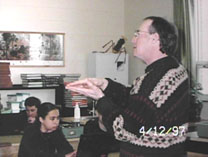
A. ArcView 3.0
During the training session, it was apparent
that it would be unlikely to convey all the information about
ArcView 3.0 in one day. There were several problems. One being,
the use of a different operating system, which slowed the progress
of class. Another, trying to relay the concept of GIS in a short
period of time. As a result, time was limited for questions to
be asked, or answered. Naturally, this led to some teachers feeling
a bit overwhelmed. One teacher made a succinct comment, "
I thought we were learning a software package. It wasn't until
later that I realized that this was just a tool."
The purpose of ArcView 3.0 is to be used as a tool for land use
planning. We did not want the teachers to become expert users
of the software, but he did want them to become acquainted with
its capabilities and potential applications. Being an instructor,
and a proficient user, he felt that many of the students would
approach the software without hesitation. Eric felt that the teachers
wanted to understand the software thoroughly. At the time, it
was neither practical or necessary. During the training session,
a mind set appeared to present, and it was addressed amongst educators
at the 1996 Business Geographics Conference, teachers had to overcome
not knowing as much as the students, as far as, the comfort level
with the software is concerned.
Tosca and Kelly Leigh-Outobed, a graduate student in Urban Planning
at the University of Wisconsin-Milwaukee, assisted Eric in training
the teachers on the ArcView 3.0 software.
The result from this class was that we do not, in the future,
want to solely teach ArcView 3.0. Rather, include that training
with the main purpose of the project, land use. Also, in the future
we will use the actual data sets from SEWRPC in the training.
B. Curriculum
Eric and Tosca provided a more comprehensive list of resources
available, and how they can be used. They included: aerial photos,
soil maps, and topographic maps. It was also suggested to the
teachers to have their students research the area, take photographs
of the sites, scan them in to the computer, and link the photos
to the geographic feature in ArcView 3.0. By doing this, the students
could share their work interactively with students at the other
schools via the web. The result would be an exciting activity
for all the students and teachers involved.
With the capability of geocoding in ArcView 3.0, the students
will be able to take inventories they create and match them to
them to various databases (i.e. an inventory of homes on five
acre lots matched to the street database). Other sources that
can be geocoded were mentioned: street addresses, GPS points,
USGS and other federal data available via the web (The teachers
were provided with a list of relevant web sites).
Alternative ways to collect data, such as local surveys and community
perceptions were addressed. The use of a hand-held GPS unit was
also demonstrated.
A bus tour of the area (Saukville) was taken by the teachers who
attended the training session. They were able to observe the diversity
of the area; natural, farmland, residential, industrial, commercial,
and recreational land uses. After the tour they compared aerial
photos from the past three decades and saw how much change had
taken place. They indicated that the bus tour allowed them to
become acquainted with the area and helped them interpret and
understand the aerial photos better.
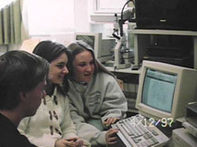
C. Witnessing Progress in the School - March 27, 1997
Gary Korb from the Southeast Wisconsin Regional Planning Commission
was a guest
speaker at Cedarburg High School. The discussion with students
revolved around the
students' perceptions of what it takes to develop a land use plan.
Regarding Saukville, the students' perceived the residents and
business owners to be
conservative, cautious, and of a rural mind set. Their perceptions
are based on a survey
conducted by SEWRPC. The majority of the students found the results
of the survey
conflicted with comments provided in the survey.
What do the students see happening?
-Preserving farmland, open space, environmental corridors.
-A rural area becoming more populated. As a result, there will
be an increase in residential, commercial, and industrial growth.
The question is "How will this affect the area?"
-How do the results of the local survey compare to surveys conducted
at the national level?
-Why do people in Saukville respond to the questions in the survey
the way they do?
-What issues do the respondents support, and why?
-How do these people react when an unfavorable action takes place
that will cause
negative impacts to the area in which they reside and work?
-Would people be willing to change their habits in order to conserve
on resources needed
by people in the community? For example, would people be willing
to carpool to work to
conserve on gas to keep the quality of the air clean in the area.
-Do people really consider how their actions affect land use locally?
-How does volume of traffic affect local or regional land use?
-What are the negative aspects of land use planning?
-Trends-how do they develop?
-Use and compare various sources of data.
-What does a rural atmosphere really mean? Is there a real definition(s)?
-Interests vs. Actions. What are the compromises?
-Think of solutions.
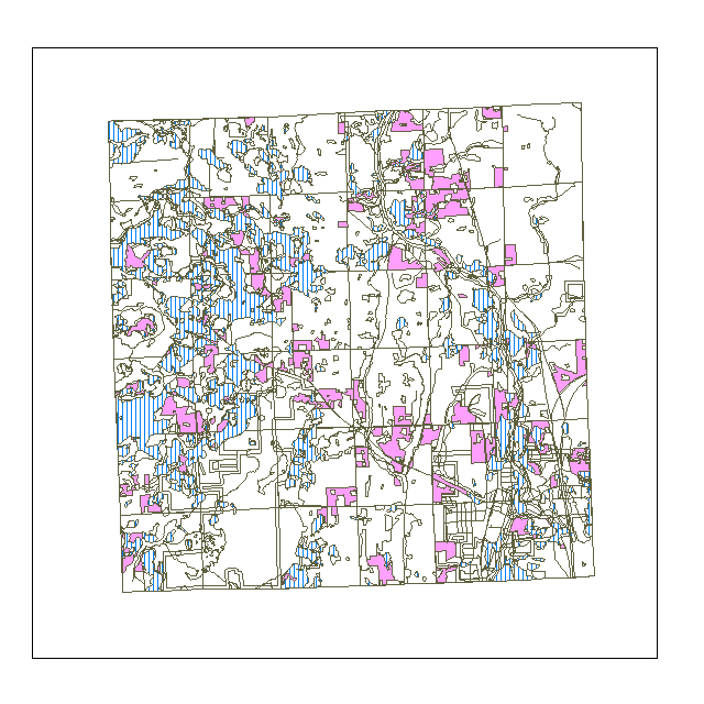
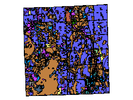
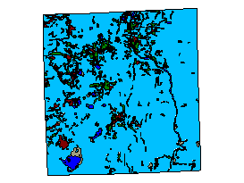
From this map, the students can determine where suitable soil
is located for development in relation to existing cropland. If
a farmer decides to sell his farm, and the cropland is comprised
of suitable soil, should the land be sold to have homes built
on it, or should the land be preserved? This is one example of
a land use planning decision that the students may be confronted
with. Note: The blue area represents suitable soil and the pink
area represents cropland.
A. Basic Reaction
Four of the teachers participating in
the project were present. The overall reaction to the progress
taking place on the project was positive. However, one major issue
concerned the teachers, they did not have enough time to digest
the curriculum and software within the past 6 weeks. The amount
of time they are spending on the material is taking precedence
over everything else they are doing. One teacher commented that
he had become addicted to ArcView 3.0 software, and had to take
himself off the computer because he was neglecting his other teaching
responsibilities. They also commented that they were teaching
the students about the basics of maps and how to use them, in
addition to land use planning. Instruction of the ArcView 3.0
software is an important element, but has become secondary at
this time.
Another concern is they feel uncertain about what the end product
may be. They agreed that this remains to be seen. They did express
their happiness with the progress being made on the project at
the present time.
B. Problems
Lack of time. Again, they have a large amount of literature
to read, learning and utilizing the different types of maps, and
using the ArcView 3.0 software and GPS technology.
C. Successes
Feedback from the students regarding the work that has been
done and readings from the GPS technology.
D. Needs
More time to learn and prepare, and specialized training aimed
at the Saukville data set.
Changes
More emphasis on land use planning concepts and less
on ArcView 3.0. Although, ArcView 3.0 is important and relevant.
-Dennis Boom from Cedarburg High School Cedarburg, WI
Grade level: Juniors and Seniors
Activities-using USGS maps, Topo maps, and aerial photos of Saukville
to teach students
map types and interpretation. He had the students work in groups
to measure the amount of area developed in Saukville. The students
used a grid system to determine the square feet per acre and the
percent of land developed for each year.
The students also had to determine the factors that cause change
to the land. The students responded with an answer, saying that
an increase in human population is the cause.
He had the students examine statistics from the data collected
from a survey conducted by SEWRPC. From this information the students
were able to determine trends about transportation uses, the local
population, and to identify positive and negative opinions about
land use planning in the area.
-Pat Casillo from Riveredge University High School Milwaukee,
WI
Grade level: Freshman
Activities-The students were given maps to look at, from the state
level, county level, and township level. This allowed them to
see the difference in information and detail, not to mention scale.
She decided to introduce the schools participating in the program.
She also covered the sources of information (literature, curriculum,
etc.) she had received from the steering committee. She posed
relevant questions to the students, "why plan?", "how
to develop a good plan?", and "how would they implement
a survey for the Village/town of Saukville?" The students
were interested in conducting their own survey to feel better
connected with the residents in the study area. However, it has
been advised, due to political reasons not to proceed with an
additional survey.
They worked with stereoscopes and the GPS unit. They had success
with collecting readings from the GPS-7 satellite readings.
Doug Glasenapp-Rufus King High School Milwaukee, WI
Grade Level: Juniors and Seniors
Activities-He divided the an area (36 square miles) into 4 sections.
Each group has individuals responsible for different land use
practices-industrial and commercial development, environmental
corridors, transportation network, residential development, etc.
This gives the students the opportunity to learn how professionals
tackle planning issues and how they decide on final decisions
and plans.
He had the students learning about remote sensing, working with
aerial photographs, topographic mapping, land allocation, and
ground truthing.
Karyl Rosenberger-Nicolet High School Glendale, WI
Grade Level: Freshman
She has ArcView 3.0 loaded and is working on the rudiments for
her students. She is interested in distance learning, and is supporting
the idea of having them learn the concepts of land use planning
first, then using the software as a tool.
Comments
At the end of the meeting, it was mentioned that it would
be a good idea to have a Freshman/Sophomore and Junior/Senior
classes. This way the knowledge would be passed onto the following
class. This would make it a comprehensive course, and perhaps
become more advanced for the students in the higher grades.
The overall reaction was outstanding. The teachers said the students
really enjoy looking at them and working with them. They are learning
a great deal from them. Imagine what it will be like when they
actually get the opportunity to create one(s) of their own.
One quote was: "It is hard enough to get land use training
across, let alone AV3 training". We believe that the teachers
should let the students try it before evaluating the level of
difficulty. We need the teachers to understand they do not need
to be the experts of this technology. This was a topic addressed
by the TERC group at the 1996 Esri User Conference, and mentioned
by teachers at the Educational Track at the 1996 Business Geographics
conference.
Vol. 1 No. 2 March 1997 |
|
|

A great sharing session was held at Nicolet High
School, Monday March 15. Thanks to all who participated. We learned
how teachers were implementing the project in their classrooms,
student reaction to the project and problems encountered. I will
summarize our discussion and the teaching outlines and send them
out to you next week.
Briefly, teachers and students enjoyed the mapping activities,
evaluating land use trends from the SEWRPC data and graphs and
using the aerial maps and Saukville Survey for examining the land
use changes over the years. The use of GIS as a tool was still
being explored and will be implemented by some over the next month.
If you couldn't be at the meeting and want to send in your teaching
summary and comments, I will share them with the rest of the group.
May 20 SEWRPC plan review postponed until Year 2
It was decided at our March 15 meeting that instead of having
students design a Land Use Plan for Saukville to present to SEWRPC
officials on May 20th, we instead will have each teacher decide
how they want to handle designing a Saukville plan in their own
teaching units. These plans would be shared with others at our
evaluation session on May 20, 4-6 p.m. They will form the basis
for next year's assignment.
Teacher Year 1 Evaluation and Sharing Session Planned for Tuesday,
May 20, 4-6 P.M.
Folks felt we did not have adequate time this first year to
bring students together with officials to evaluate plans. Instead,
it was recommended that we have another Teacher meeting to evaluate
the project's first year and share teaching outlines and planning
projects. Since we have already blocked May 20 on our calendars,
this will be our date. The purpose of this meeting is to evaluate
the project, make recommendations for next year and share student
Saukville plans from those schools who are able to develop them
for Year 1. I will send out more details on this meeting.
Land Use Planning Training scheduled for June 23-26
I am seeking 1-2 credits from UW-M for the training. Riveredge
will cover your tuition cost with part of the grant. 2 1/2 days
will be focused on Land Use Planning concepts and curriculum,
1 1/2 days will be focused on the GIS training. This is for both
Year 1 and Year 2 teachers. Year 1 teachers may chose not to attend
the GIS training. I will follow up with a more specific training
agenda and credit information.
Saukville Citizen Survey Raw Data enclosed
Gary has provided us the raw data from the Saukville Survey.
You may want to let your students pour over the raw data and decide
if the SEWRPC summary is an accurate representation of what citizens
were saying. Teachers at the March 15 meeting thought this would
be useful information to have.
Land Use Planning Project to be presented at Esri's User Conference
in July
Tosca Hoffmann, Terrie Cooper and Eric Fowler have been selected
to present and publish the Land Use Planning Education
Project at the largest International GIS users conference, Environmental
Systems Research Institute, Inc., July 1997. We will be sharing
with others how this project was conceived, funded, implemented
and we will summarize its effectiveness. Your evaluations, ideas
and input will be a part of the presentation. Anyone interested
in co-presenting with us, our grant may be able to cover a part
of the expenses? Thanks for working as partners with us in developing
this first of its kind project.
Gary Korb available for Classroom Visits
Call Gary at SEWRPC 547-6721 if you would like to have him
visit your class and expand on any of the Land Use Planning concepts
covered in the training.
Funding available to cover a Town of Saukville Bus Tour
Let me know if you are planning a bus trip to the Town, Riveredge
will reimburse you for the bus. If you would like a Land Use steering
committee member to accompany your tour, give me a call. Gary
or I can try and arrange to work with your group.