Figure 1. Location of UC Davis Campus in Davis, California

The University of California, Davis (UC Davis) is one of 9 campuses in the University of California system. The UC Davis, Office of Planning and Budget developed a geographic information system (GIS) to use for physical, environmental, and capital planning (PECP) of the campus. This report outlines the stategy designed to implement the GIS project. Methods used to create the GIS data and applications are described. Recommendations for implementing a GIS project are provided. Examples of ArcView extension applications and GIS data created for the project are shown.
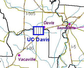
UC Davis is located on the western edge of the City of Davis, California (Figure 1). The university is one of nine campuses of the University of California system. UC Davis is well known for its colleges of agricultural, environmental sciences, and veterinary medicine. U.S. News & World Report, for the third consecutive year, ranked UC Davis among the top 10 public universities nationally. The 3,500 acre main campusincludes a core campus with more than 1400 academic, research, and administrative buildings. Additional campus lands include an arboretum, agricultural fields, undeveloped ranch lands, and nature preserves. More than 24,000 students attend the university greatly expanding the 50,000 resident population of Davis during the school year.
|
Figure 1. Location of UC Davis Campus in Davis, California |
|
|
Like most California universities, the demands for additional space and resources at UC Davis have increased with growing populations in the state. The campus planners and university environmental planners strive to meet the needs of the growing academic population by designing and implementing a Long Range Development Plan (LRDP) for the campus. Although GIS is widely used in academic departments on the campus, GIS was not being used by administrative departments.
The UC Davis Office of Engineering Services developed and maintains a mapping system for managing facilities and infrastructure on the campus. Geographic data for the system were digitized from aerial photographs and converted into a McDonald Douglass Graphic Data System (GDS) format by a contractor. As additional facilities and infrastucture were surveyed on the ground, the geographic features from surveys were added to the mapping system. A primary use of the mapping system was to create a mapped inventory of all utility systems on the campus.
GDS is a computer aided design (CAD) system in which geographic features can be linked to tabular databases. GDS is an older technology that operates on UNIX workstations and it is not considered ‘user friendly' like newer GIS software on personal computers. The vendor that created GDS is no longer in business therefore support of the software is limited. GDS software does not contain GIS tools for spatial analysis and thematic mapping and therefore it does not meet the requirements of the PECP users.
The GDS software was difficult to operate, it was not compatable with other campus GIS efforts, it was no longer being developed, and it did not provide the functions required by the PECP users. The facilities mapping system was also maintained and operated by another department so access to the programs and data were limited to a few trained users. The PECP users need to acquire a relatively easy to use system that could be integrated with other personal computer software such as spread sheets and graphic drawing programs. The Office of Engineering Services would continue to use the GDS system and PECP users would need to obtain updates to the base map features from the GDS system.
The PECP users decided to develop GIS for facilities and environmental planning by acquiring GIS software using an inexpensive campus-wide site license with the Environmental Systems Research Institute (Esri), the vendors of ArcInfo and ArcView GIS programs. ArcInfo and ArcView are widely used for planning and environmental management applications. The academic campus has many users of ArcInfo and ArcView who could potentially benefit from having access to campus facilities and planning data in formats compatible with the software. The campus users could also become a source of technical and financial support for a larger effort to integrate the various departments into a campus-wide GIS.
It was decided that ArcView software would become the primary program to access the GIS data library and that ArcInfo would be used as a tool to maintain the GIS data. Data could be obtained from the GDS system in a Drawing Interchange File (DXF) format compatible with ArcInfo. DXF files are text files and conversion techniques needed to be developed to translate the data into suitable ArcInfo formats.
A Request for Proposals (RFP) was issued to select a consultant to convert the GDS files into ArcInfo coverages and to develop the ArcView and ArcInfo system. The PECP associate environmental planner would administer the contract and the GIS. Jones & Stokes Associates, Inc. was selected as the consultant.
The primary objectives of the GIS project were to provide:
The initial users of the system are the department director, the campus planner, the campus environmental planner, the associate environmental planner, and a student assistant. The director and senior planners use the system to view pre-defined map layers, examine data connected to map objects, generate reports, and prepare maps. More experienced users, such as the associate environmental planner, maintain the GIS data, write automation programs, link GIS data to other databases, perform spatial analysis, generate custom reports, and support the other users.
Initially, the PECP users anticipated loading the GIS data on a server maintained by the Geographic Information Systems Research Laboratoy (GISRL) of the Office of the Vice Chancellor for Research. PECP users would rely on expertise of staff in the GISRL for support and data maintenance rather than develop the expertise within the Office of Planning and Budget. After the RFP was awared, PECP users decided to install the GIS data on a server maintained by the Office of Planning and Budget and to develop a long-term approach for the PECP staff to maintain the data. The decision to house the GIS locally was based on users' desire to have greater control over the system and to reduce recuring maintenance charges.
The implementation project consisted of five broad areas: needs assessment, data conversion, application development, installation, and support. A description of the methods used to implement the project are described in this chapter.
A needs assessment is a study of the economic, functional, and physical requirements necessary to implement a successful system. Interviews and studies conducted in tasks 1-3 comprised the needs assessment. A report and presentation were provided as a result of these tasks. The following sections summarize the conclusions from this study.
The general uses of the system are described along with the objectives in the previous chapter. Interviews were used to obtain more detail on expected uses of the system than were described in the RFP. The results of the interviews were used to recommend changes to the proposed configuration or to describe custom application programs to be used with the GIS software. Functions that were not possible or practical using the data or software were also noted.
The following statements summarize the specific requirements and uses of the system as described by PECP staff:
Although a primary function of the GIS is to facilitate the planning process, designs of graphic and tabular products needed to be described. The PECP staff were using maps created from the GDS mapping system that showed facilities on the campus. Maps of specific areas of the campus were useful, and both wall maps and figures for documents would be needed. The system developed would also need to be flexible enough for users to create maps at various map scales. The map templates created for the system are described in Table 1.
| A Portrait | A Landscape | B | C | D | E | |
|---|---|---|---|---|---|---|
| Academic Core | 1" = 600' | 1" = 700' | 1" = 500' | 1" = 300' | 1" = 250' | 1" = 150' |
| Core Campus | 1" = 1100' | 1" = 1000' | 1" = 700' | 1" = 500' | 1" = 400' | 1" = 200' |
| Main Campus | none | 1" = 2000' | 1" = 1500' | 1" = 1000' | 1" = 700' | 1" = 500' |
| Entire Campus | none | 1" = 5000' | 1" = 2500' | 1" = 2000' | 1" = 1500' | 1" = 1000' |
ArcView is a generic GIS program for viewing GIS data on a computer terminal. The PECP users would need to load the GIS data into an ArcView project and create legend files each time a new view of the data was created. Other tasks such as creating layout maps would also require the user to frequently repeat steps in ArcView. The designers of ArcView created a programming language called Avenue that can be used to extend the functions of ArcView to create custom GIS tools. Application tools were needed to automate certain repetative processes and to add functions in ArcView that do not come with the software.
The application tools created for the project consisted of automation tools designed specifically for use with the PECP GIS data, and spatial tools that could be used with any ArcView GIS data. The tools created for the project are listed in Table 2. A detailed description of each tool is provided in a following section.
| TOOL NAME | APPLICATION | DESCRIPTION |
|---|---|---|
| Standard Map Maker | Automation | Creates layouts of campus districts using standard map templates |
| Custom Map Maker | Automation | Creates custom layouts from user-defined views |
| View Builder | Automation | Adds themes and legends to a view |
| Buffer | Spatial | Creates polygon buffer around selected themes |
| Area Calculator | Spatial | Calculates area and acreage of themes or selected features |
| Zoom to Districts | Automation | Store named views and restore view extents |
| Key Map | Automation | Creates a locator map view and an overview polygon from a primary view |
| Intersect Themes | Spatial | Creates new theme from intersection of two themes |
| Merge Themes | Spatial | Creates a new theme by merging shapes from two themes that contain the database items |
| Clip Themes | Spatial | Creates a new theme by cliping a source theme using the outer extents of a polygon clipping theme |
The base map GIS coverages are stored in secured directories on the server. File security was set to allow users read (copy) access to the coverages but only the GIS administrator was given write access to files on the server. This procedure was established to set a single point of contact to make changes to the library of coverages being shared by all department users, and to reduce the chances of data being lost or inapproriately changed.
Existing digital data was used to create the ArcInfo GIS coverages. All data were acquired from the GDS system maintained by the Office of Engineering Services in DXF format. The following sections describe the techniques used to convert the data.
The GDS system stores the mapped data in tiles or facets to reduce the physical storage size of any data set. This method of storing data is common with CAD systems: map graphics are stored in files or data sets in the same geographic extents as the maps produced from the system. Although this is an efficient technique with CAD systems where the user is more concerned with the product (a map) than the process (analysis and presentation of spatial patterns or geographic attributes), geographic data stored in a GIS should be contiguous across a landscape so that spatial analysis tools and thematic mapping functions can treat the data as a single unit.
Mapped features in the GDS system are further divided into drawings and objects. Drawings are logical groupings of mapped features of common themes. Objects are the individual mapped features. For example, elevation contour lines are considered objects. All topographic features (objects) are stored in a topography map (tiles). There are 24 map tiles for each map.
Not all GDS maps and objects were coverted into the GIS. PECP users selected objects that would be of most use for planning. In general, detailed infrastructure features such as chilled water supply valves or natural gas cathodic anodes were not converted into the GIS.
After a list of GDS maps and objects to be converted were prepared, a staff member from the Office of Engineering Services extracted the objects by tile into DXF files. The files were delivered to Jones & Stokes Associates to be converted into ArcInfo coverages.
Because descriptive attribute data are not attached to the GDS objects, methods to translate object codes to coverage names and tabular attribute data needed to be devised. It was decided that the primary object name would be translated as the name of the coverage. The completed object name string would be used as a tabular attribute linked to each ArcInfo feature.
Each GDS map tile was delivered as a separate DXF file. The objects in the DXF file were contained as AutoCAD "block" entities. A block is a grouping of all objects into a single graphic object. In order to convert each object in the file as a feature in ArcInfo, the block was removed using the EXPLODE command in AutoCAD. An program was written using the AutoLISP language to automate the removal of the blocks from each DXF file. A script file was written to process multiple DXF files as a batched computer process in AutoCAD on a Sun SPARCstation UNIX workstation.
After blocks were removed from the files, objects in each DXF file were converted into ArcInfo coverages using the DXFARC command in ArcInfo. An alternative method to remove the block from the DXF file is to use the BLOCK subcommand in DXFARC during the conversion process. As previously described, the primary object name was used as the coverage name created. The DXFARC command creates point, line, and annotation (text) features in the converted coverage.
The coverages were examined visually using ARCEDIT to determine the objects that were converted. Most of the point features created using this technique were insertion points for annotation features. These point features were deleted from the coverages.
Database attribute tables for each feature were created using the BUILD command. This command creates attribute tables and DXF conversion tables in the INFO database (Table 3).
| TABLE | DESCRIPTION |
|---|---|
| *.AAT | line attribute table |
| *.PAT | point attribute table |
| *.TAT | annotation attribute table |
| *.ACODE | AutoCAD DXF line attributes |
| *.XCODE | AutoCAD DXF point attributes |
The ACODE table was joined to the AAT table for line coverages and the XCODE table was joined to the PAT table for point coverages using the JOINITEM command in ArcInfo. The ACODE and XCODE files contain CAD attribute columns, or items, with information such as object color, thickness, and layer name. The layer name contained the GDS object code names. Once the ACODE and XCODE files were joined to the feature attribute tables, all CAD attribute items except the layer name were deleted from the attribute tables. The process to create the coverages, join the tables, and delete the items was automated in ArcInfo by creating programs using the Arc Macro Language (AML). Because the conversion of the DXF files to ArcInfo coverages required many hours of computer time, the AML programs were run on the Sun SPARCstation as a batch job.
A single contiguous ArcInfo coverage was created from each group of tiled coverages for each primary object code listed in Appendix A. GIS users would not be able to view the maps of the entire campus or use GIS tools for anaysis of spatial patterns unless the features were joined in a single coverage. Because line features were split at the junction of each map tile, the ARCEDIT command UNSPLIT NONE was used to join lines as continuous graphic elements across map facets.
Graphic attributes such as line symbols, colors, hatching patterns, and text fonts are not stored in ArcInfo coverages. Graphic attributes and map legend displays for ArcInfo coverages can be created using the ArcView legend editor. More than one legend can be created for each coverage to display multiple feature types or to provide alternative graphic displays of a coverage. The legends can be stored as a file on the computer and used later to resymbolize the displays in an ArcView View window or ArcView Layout window.
A legend file was created for each primary object in the coverages. The legend files were used in an application program, described in the next section, that allowed GIS users to add map themes to a view using standard graphic symbols and patterns.
A color palette was also created that contained various color combinations based on hue, saturation, and color values. The color palette was saved as a disk file.
ArcView is a GIS viewing program that contains geographic viewing, charting, tabular data management, map making, and programming tools. Users read ArcInfo coverages or other GIS data files such as Shape Files and CAD files as a "theme" into a View. Legends are created in views to add color and symbology to a theme. A theme in a View is a logical name for the features displayed from a physical coverage file.
Tabular data can be added and joined to features in a View using the Tables section of ArcView. The Chart section of ArcView can be used to create various graphic chart formats using data in the tabular files. Maps are create in ArcView using the Layout section.
In order to save work in an ArcView session, the user saves the session as an ArcView Project file. A project file is a text file that contains references to the locations of the various coverages, legends, and other physical disk files used in the session.
An ArcView project file was created with the initial delivery of the GIS data. The ArcView project file contained 4 Views. The Views consisted of existing land uses, the Long Range Development land uses, basic facilities on the core campus, and the facilities on the entire campus.
ArcView is primarily a GIS viewing tool intended to be used by both novice users and expert GIS technical staff. Recent versions of ArcView contain more processing and data management tools that require more time to learn how to effectively use the system. In order to make ArcView easier to use and to automate routine processes, application programs were created as ArcView extensions using the Avenue programming language and the ArcView Dialog Designer graphic user interface (GUI) development tool in the Script section of ArcView. The applications were created as extensions to ArcView to give the user the ability to load the custom applications whenever the application was needed and to unload the tool from ArcView if the user elected not to use it.
The following are examples of the GUI from some extensions created for the GIS project.
|
View Builder. The GIS administrator creates a text file of theme names, path names of the coverages and legend file names for a project or user. The names of the themes appear in the View Builder menu. The user selects the themes to be added to a view by clicking the theme names. The selected theme names appear in the lower box of the menu. The themes are automatically added to the view with the appropriate legend. |

|
|
Standard Map Maker. Users can create maps of standard views using a predesigned template of map layouts. The view window is adjusted to the appropriate extents and the layout is created at the designated map scale. |

|
|
Custom Map Maker. Users can create custom maps of non-standard views using automatic scales, preserved view scales, or user defined scales. A custom template contains the predefined layouts for UC Davis. |

|
|
Map Calculator. Areas and acreages of themes or selected features can be calculated and displayed. |

|
|
Buffer. Graphic buffers or shape file themes can be created around line or polygon themes. The user enters the distance from the features to create the buffer. If a theme has selected features, the buffer is created only around the features selected. |

|
|
Spatial Tools. This set of tools creates a new theme from two themes: an input line or polygon theme, and an overlay polygon theme. The intersect tool creates a new theme that is the intersection of two themes. The attributes from both themes are retained. The clip tool results in a new theme that is the portion of the source theme that is clipped to the extent of the overlay theme. The merge theme creates a new theme that combines two themes with the same database table items. |

|
The system would initially be used by 4 PECP users. The ArcInfo coverages created from the GDS files would form the library of enterprise GIS data. These base map files were stored in a directory, or workspace, on a disk partition of an NT server. The server would form the backbone of the GIS network and act as the file server, print server, and network server. The permissions of the files in the GIS library were altered to allow read access to all users but write access only to the GIS administrator. The remainder of the disk was set up to store project files and other GIS coverages being developed.
Users would archived some files when a project was completed. Other temporary or intermediateGIS coverages could be deleted. Some user's project files would eventially be moved into the partition with the enterprise GIS library if the project files would be maintained for other long-term uses. This organizational method allowed users to develop the GIS library while retaining the flexibility to use the GIS for project applications.
In addition to the NT server, ArcView was loaded on 3 NT workstations and a notebook computer operating Windows 95. The notebook computer, used by the department director, could be connected to the GIS network using a docking station. Finally, ArcInfo was loaded on the workstation used by the associate environmental planner and GIS adminstrator. The final configuration allowed all users to access and share project files and the enterprise GIS library.
Training and support were key elements to the success of the implementation program. A program was designed to provide introductory training on the functions of ArcView and to teach users how to apply GIS to solve problems pertinant to the needs of the PECP users' job responsibilities.
The focus on training was to educate the staff not only on the mechanics of using the software, but to teach staff how to apply the GIS tools to meet the objectives of the project that were outlined during the needs assessment phase. A key concept in this approach is to distinguish between training and teaching. Training classes are often designed to cover a set amount of learning material over a designated time period regardless of the students' abilities to understand and use the information presented in the class. Teaching places emphasis on the students' abilities to learn and apply the tools as indepentent users. To meet both the training and teaching objectives, a series of training sessions and workshops followed by on-site and telephone support were established to help the PECP users immediately apply their knowledge on actual applications. This technique resulted in early acceptance and successful use of the GIS by staff and supervisors.
The training and support program included:
Two other implementation concepts were applied during the project: train the trainer, and use the GIS immediately. Key to the long-term success of any GIS implementation project is to designate a technical laison to provide both administative and technical support to users. The associate environmental planner was designated the key contact for long-term support of other PECP users. He was given additional outside GIS training and was responsibile for most of the design and implementation decisions.
Also, to promote the success of the project, the GIS was immediately used to create maps for on-going planning projects on the campus. Too often, GIS programs get prolonged while data in the system are being refined or application programs are being written and tested. To justify funding and to retain champions of the program, the GIS was being used concurrently while data and applications were being developed.
Documentation was provided to describe the methods used to create the system, to provide a guide for users in the operations of the extension applications, to describe techniques to maintain the system, and to provide metadata that described the structure and content of the ArcInfo coverages.
The implementation project was a success due to good planning, funding appropriate for the level of development, technical competance of staff and contactors, and sufficient support from the champions of the project. The success of any GIS project is usually dependent on these and other factors. As a result of this project, our conclusions for other groups implementing a GIS are:
|
Core Campus Long Range Development Plan |

|
|
Core Campus Existing Land Uses |

|
|
Land Assignments and City of Davis Parcels |

|
|
Buildings and Facilities |

|
|
Utility Systems (water shown here) |

|
Bruce Boyd, GIS Project Manager
Jones & Stokes Associates
Eric S. Rainbolt, Associate Environmental Planner
University of California Davis